
Good morning, East Tennessee!
Happy Friday—grab that cup of coffee (maybe even one of those eastTNweather mugs from the merch shop at etnweather.com) and let’s talk about your forecast. It’s also Football Friday, and yes, I’ve got some orange on today. Tomorrow, the orange suit comes out in full force as Tennessee football season gets rolling.
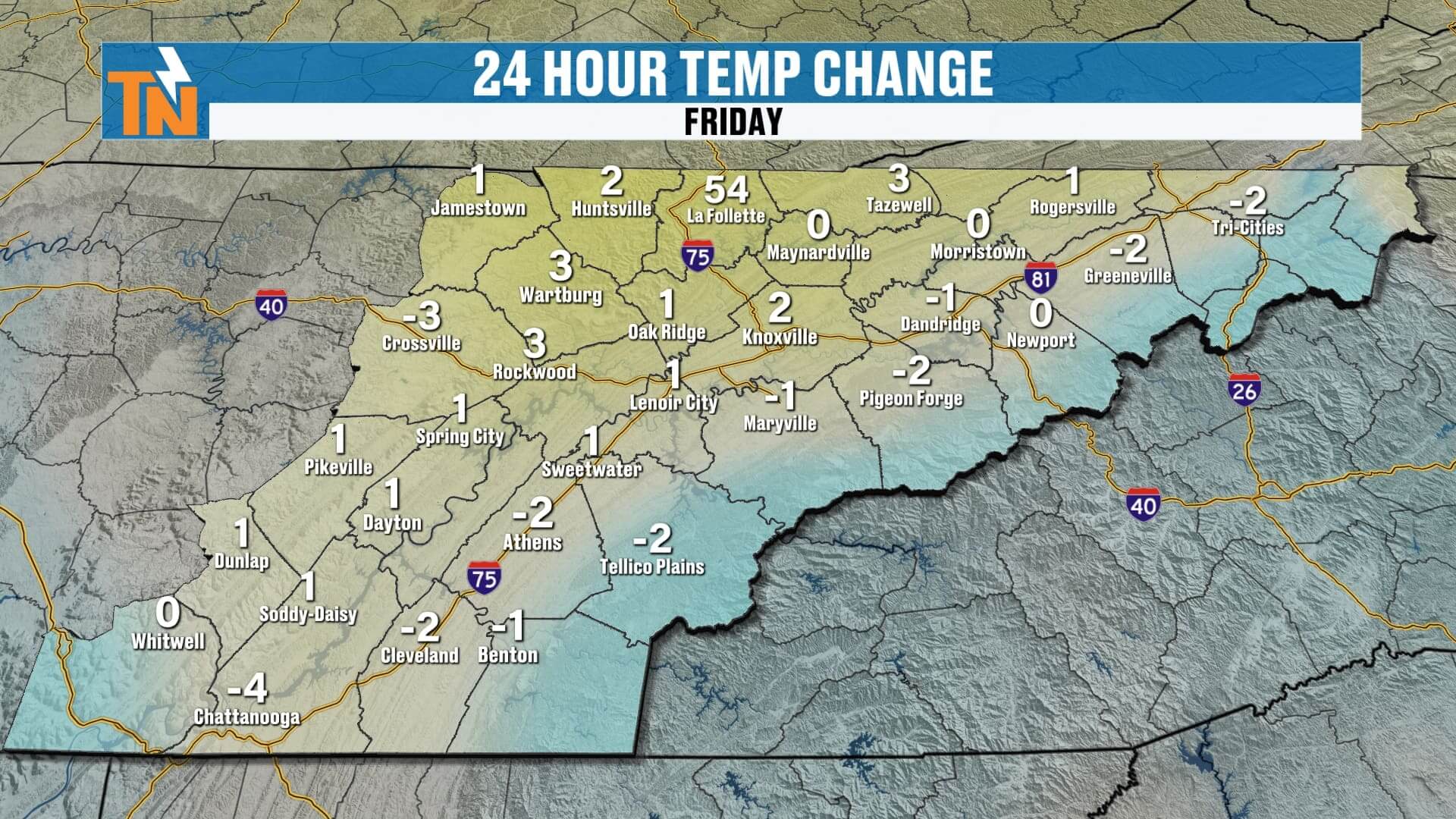
Now, what about the weather? The good news: we’ve got a quiet and comfortable forecast to wrap up the week thanks to a northwesterly flow pattern aloft and high pressure holding firm at the surface.
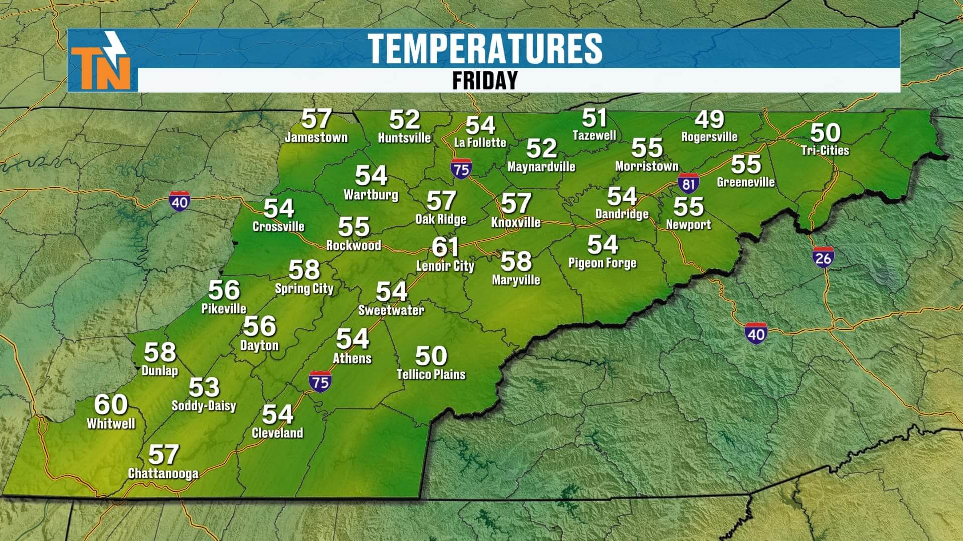
Friday Morning: A Warmer Start
We’re waking up to 50s and low 60s across East Tennessee, a touch warmer than the past couple of mornings. Still comfortable, but not quite as crisp.
-
Knoxville & Valley towns: Mid to upper 50s
-
Plateau: Low 50s
-
Smoky Mountains: Cooler, but still seasonable
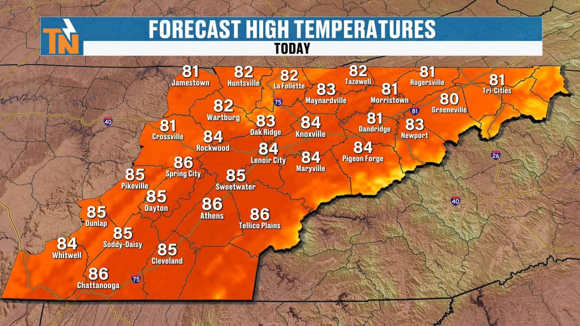
Today’s Forecast: Sunshine, a Few Clouds & a Light Breeze
At the surface, high pressure sits just to our north, while a weak cold front also lingers there. That boundary will slide through overnight, but it won’t do much for us today. Here’s what to expect:
-
Morning: Mostly sunny with comfortable air
-
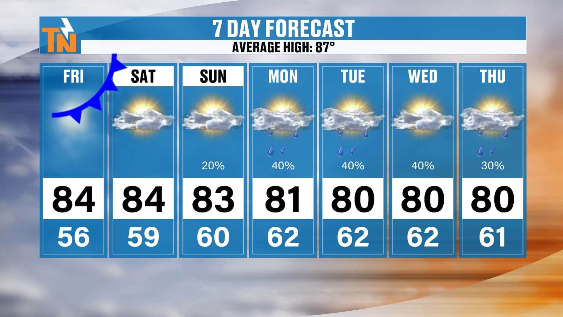
Afternoon: Highs climb into the low to mid-80s, with some spots hitting the upper 80s
-
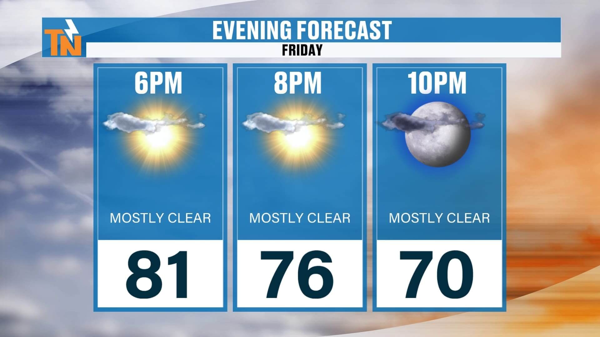
Evening: Perfect for football games and Friday night plans—around 81° by 6 PM, dipping to the 70s by 8 PMand upper 60s by 10 PM
-
Winds: A little bit of a breeze develops, but nothing significant
Bottom line: another gorgeous day across the Tennessee Valley, Plateau, and Smokies.
The Weekend Forecast: Mostly Dry, But Subtle Changes
As we head into Saturday and Sunday, that weak cold front won’t bring much relief. Instead, we’ll start to see a return flow from the southeast—and that changes the pattern just a bit.
-
Saturday: Plenty of sunshine, a few afternoon clouds. Highs in the mid-80s, lows in the 60s. Outdoor events, hiking, and football tailgates all look fantastic.
-
Sunday: Slightly more moisture sneaks in. Still mostly dry, but a stray afternoon shower or thunderstorm can’t be ruled out, especially in the Smoky Mountains and higher elevations.
No washouts this weekend. Outdoor plans—lake days, camping trips, and football—are all good to go. Just keep in mind that clouds and humidity will slowly increase.
Next Week: Higher Rain Chances Return
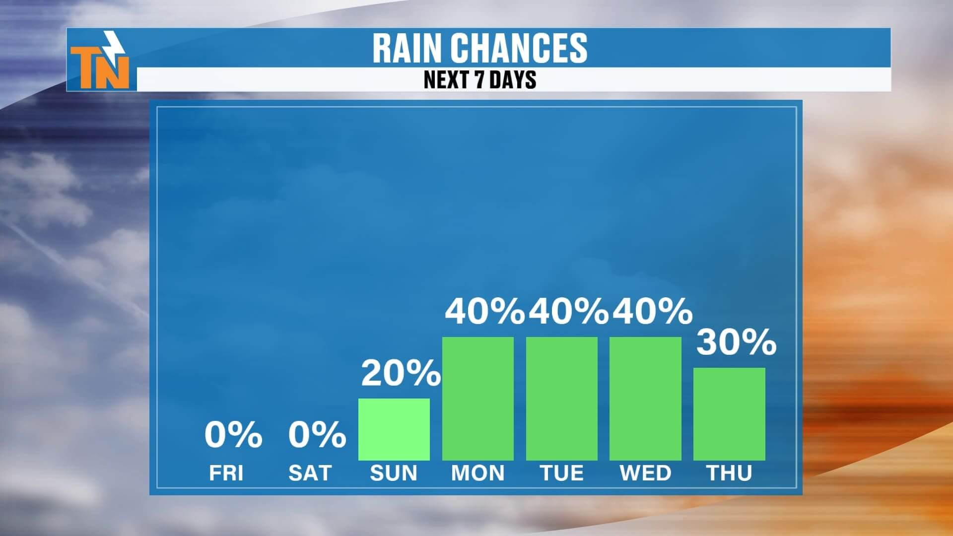
By Monday and Tuesday, dew points climb into the low 60s. That added moisture fuels a better chance for pop-up showers and thunderstorms.
-
Monday–Tuesday: Widely scattered afternoon showers and storms, especially in the mountains. Most Valley locations will still see plenty of dry time.
-
Wednesday: Rain chances linger before a trough digs into the eastern U.S.
-
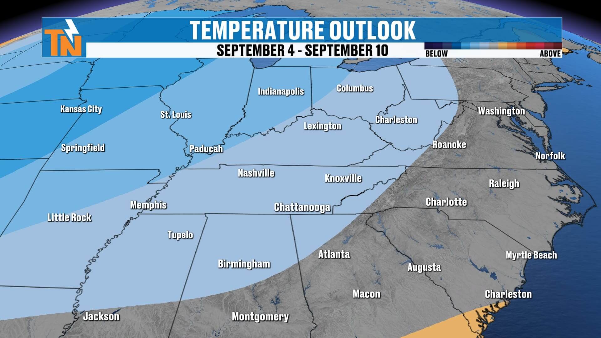
Late Next Week: Another cold front and trough may arrive, dropping our humidity and temperatures again—another taste of fall could be waiting for us by next weekend.
Dew Point Watch: Comfort Level Shifts a Bit
This week has been fantastic with dew points in the 50s, making mornings crisp and afternoons pleasant. But with that southeast flow building this weekend:
-
Dew points rise into the low 60s
-
Morning lows trend warmer (mid to upper 60s)
-
Humidity levels become noticeable again by early next week
Weather Headlines
-
☀️ Friday: Sunny, highs in the 80s, light breeze
-
Football Friday: Perfect weather for tailgates and games
-
️ Weekend: Mostly dry, stray Sunday shower possible in the Smokies
-
Next Week: Rain chances increase Monday–Wednesday
-
Late Week: Another trough may bring a cooler, drier pattern
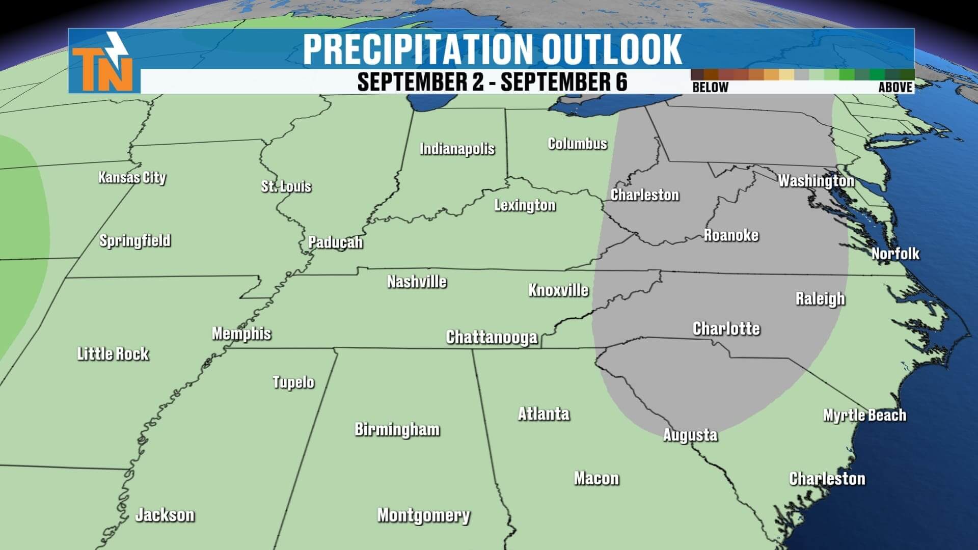
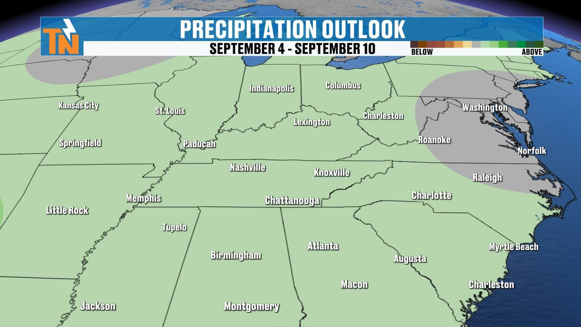
ABOVE AND BEYOND THE 7 DAY FORECAST
Final Word
We’re heading into the last weekend of August on a high note: sunshine, comfortable air, and no major rain systems in sight. Football games tonight, outdoor fun Saturday, and a mostly dry Sunday set us up for a great stretch. Early next week, humidity sneaks back in, bringing a few more showers and storms, but nothing widespread. And as we roll toward next weekend, models suggest another fall-like cool-down is on the horizon.
Don’t forget—you can always stay ahead of the changes with the eastTNweather app. Track radar, get live lightning alerts, and see my latest forecast updates all in one place.
Enjoy your Friday, East Tennessee, and let’s get ready for a big football weekend!