Good morning and happy Wednesday, everyone — happy hump day!
We’ve got one of three cold fronts heading our way over the next seven days, so buckle up for a changing pattern across East Tennessee.

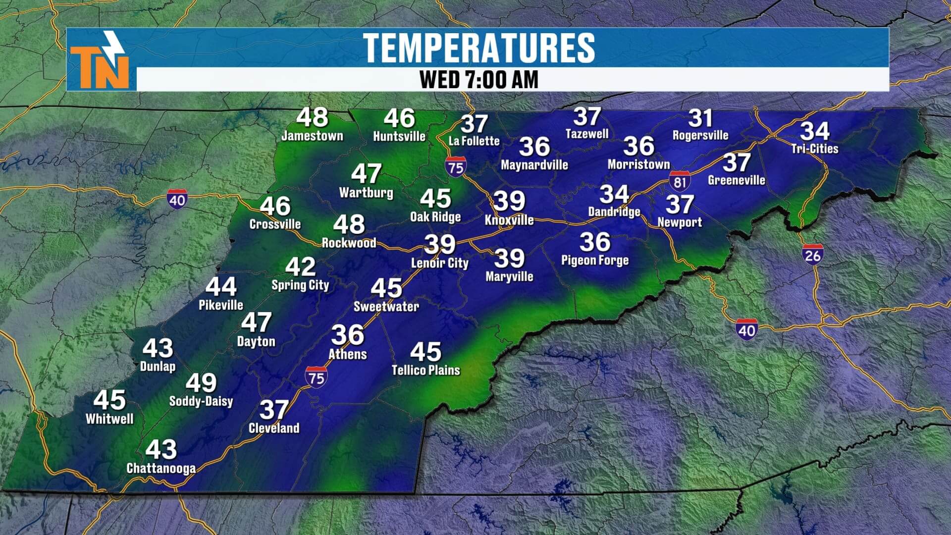

This morning starts off mild, with temperatures in the 40s and 50s — a noticeable improvement from the frosty mornings earlier this week. Clear skies and sunshine dominate early, but the approaching cold front will stir up the wind. Expect gusts between 20 and 25 mph through the afternoon before calming down later tonight.
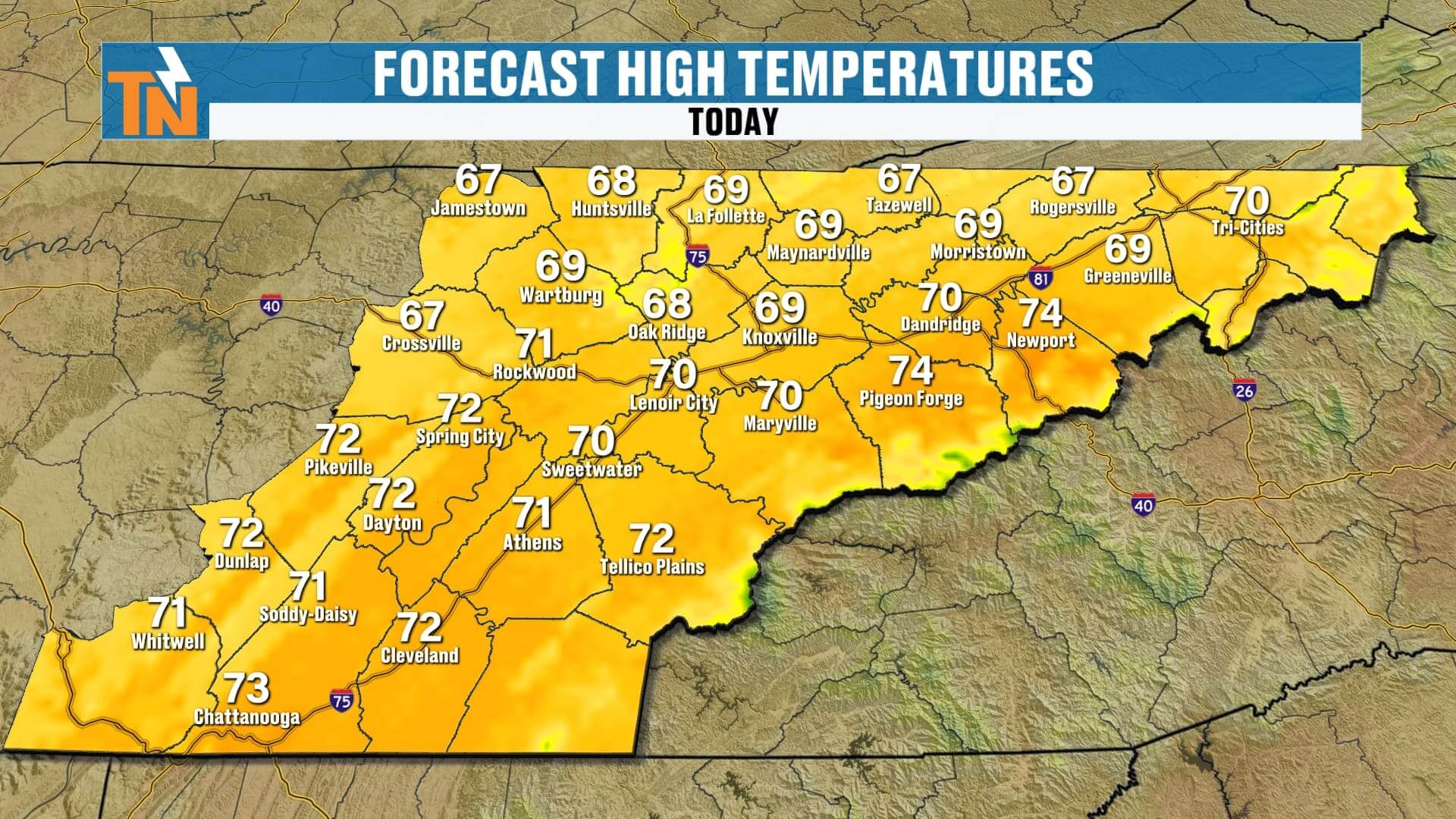
Highs today will climb into the upper 60s to low 70s, well above average for early November. It’ll be a great afternoon to enjoy the sunshine, though you’ll definitely need a jacket after sunset — we’ll be around 57° by 8 p.m.
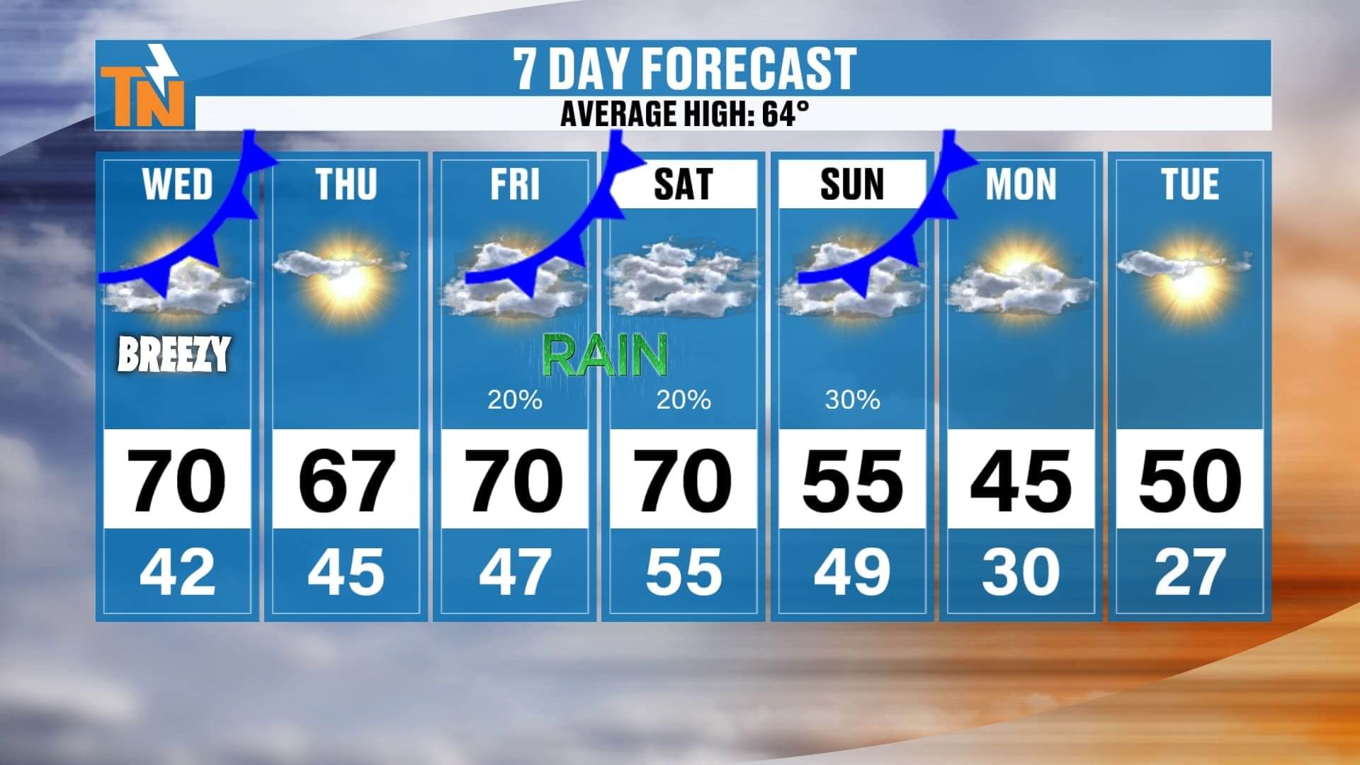
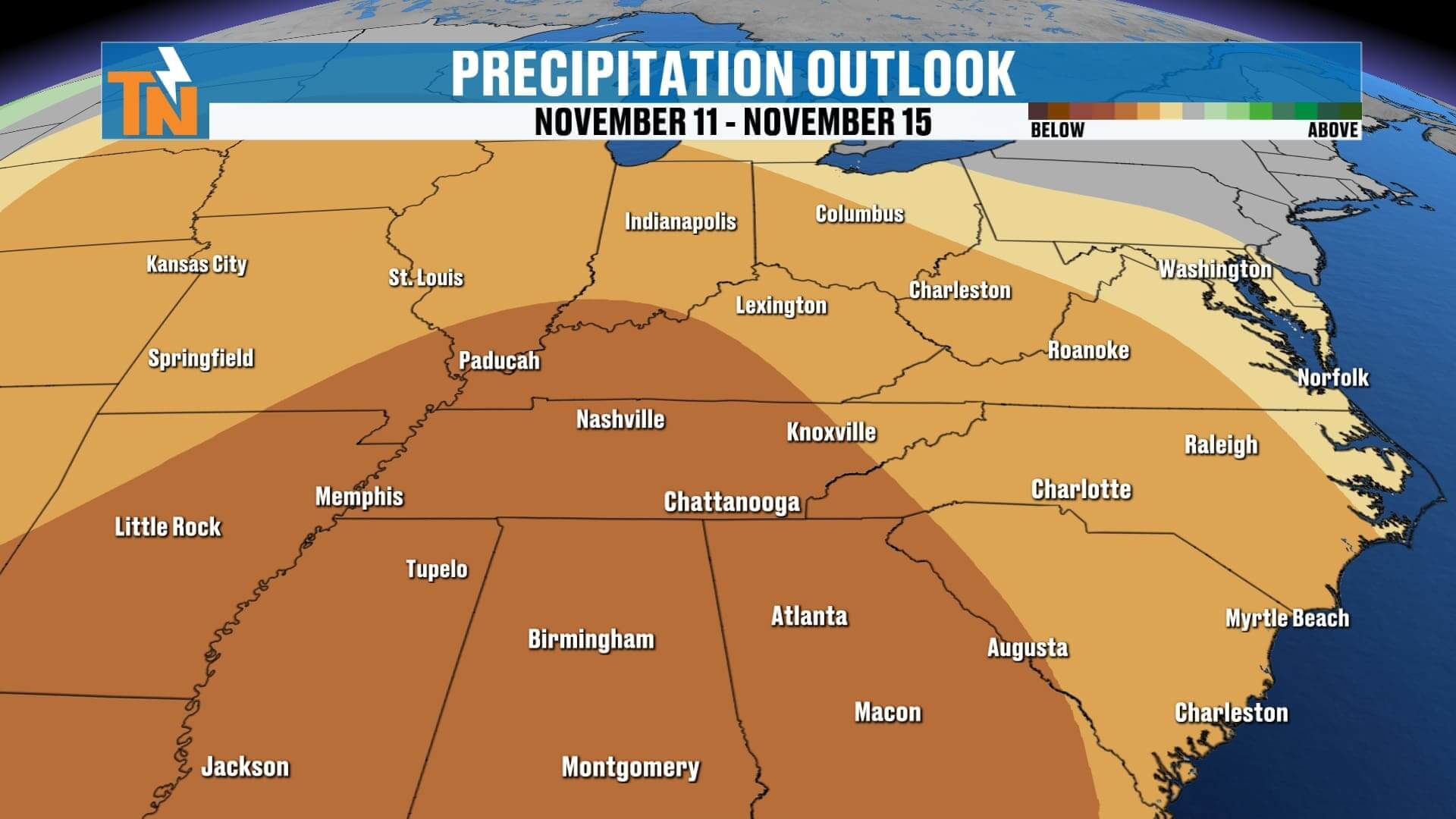
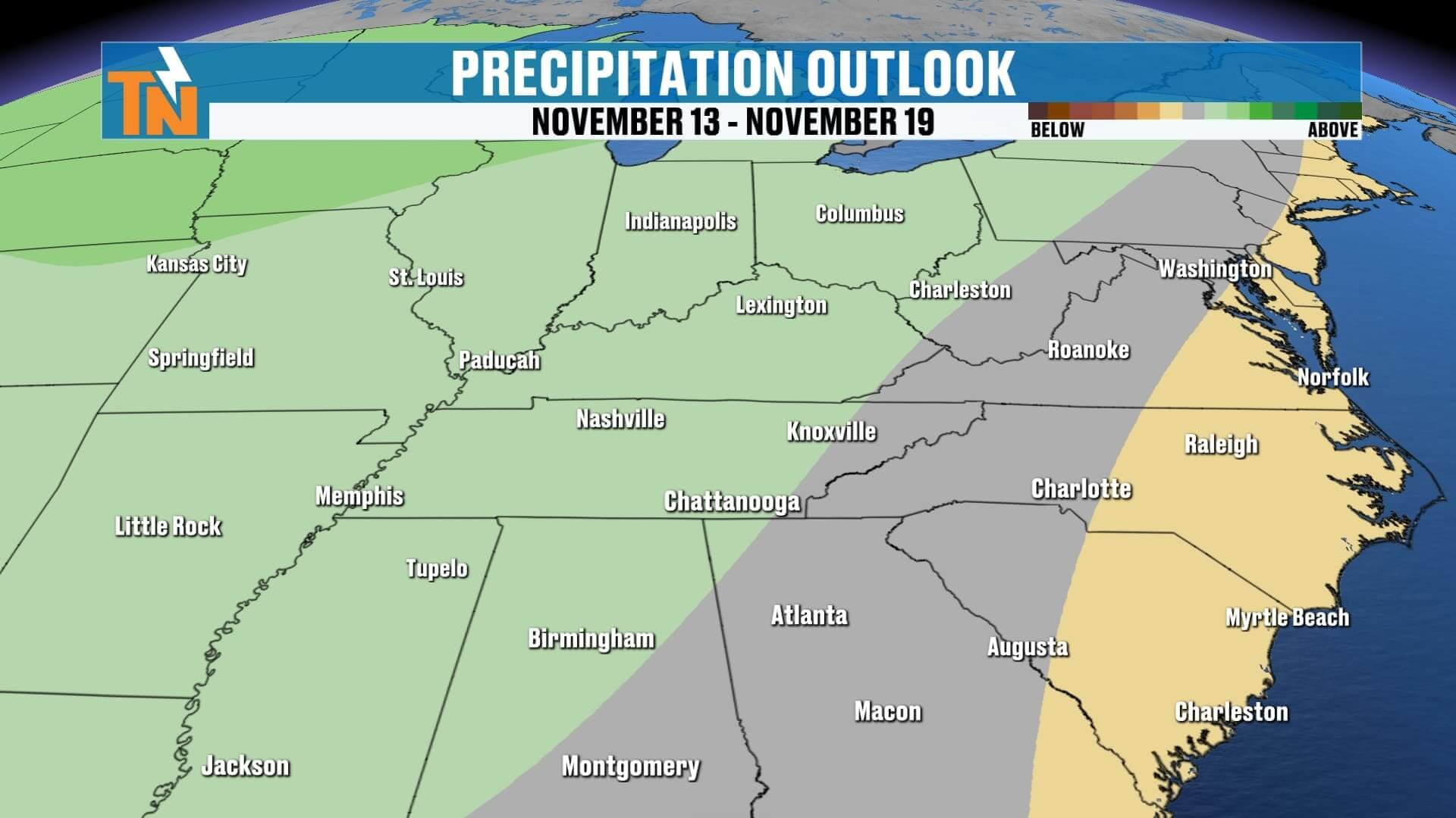
Rain chances begin to increase late Friday and ramp up into Friday night and Saturday morning, when widespread showers move across the region. The rain will fade later Saturday, setting the stage for a colder pattern to develop Sunday into next week.
Let’s look at how it all unfolds:
-
Friday: First cold front brings light to moderate rain, especially overnight.
-
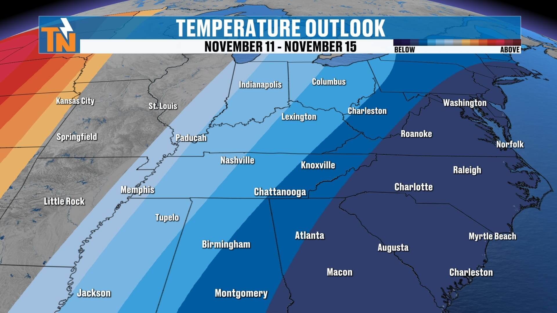
Sunday into Monday: A secondary, stronger cold front moves through with a deep upper-level trough behind it. This system will pull in much colder air, and with just enough lingering moisture, there’s a slight chance we could see a rain/snow mix — mainly in the higher elevations, but possibly even a few flurries across the Plateau or northern Valley.
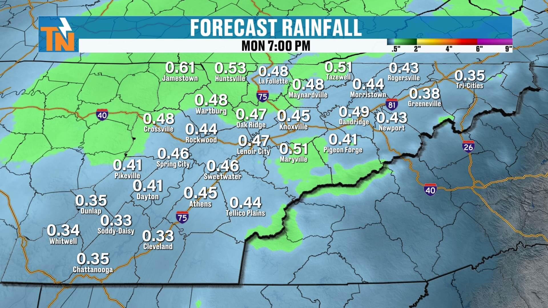
Rainfall totals through Monday night look modest — around a half inch for most areas — but colder air is the bigger story.
Here’s your 7-day outlook:
-
Wednesday: Sunny, breezy, highs near 70°.
-
Thursday: Calm and mild, highs in the upper 60s.
-
Friday–Saturday: Rain develops late Friday, widespread early Saturday.
-
Sunday: Colder, scattered showers or flurries possible.
-
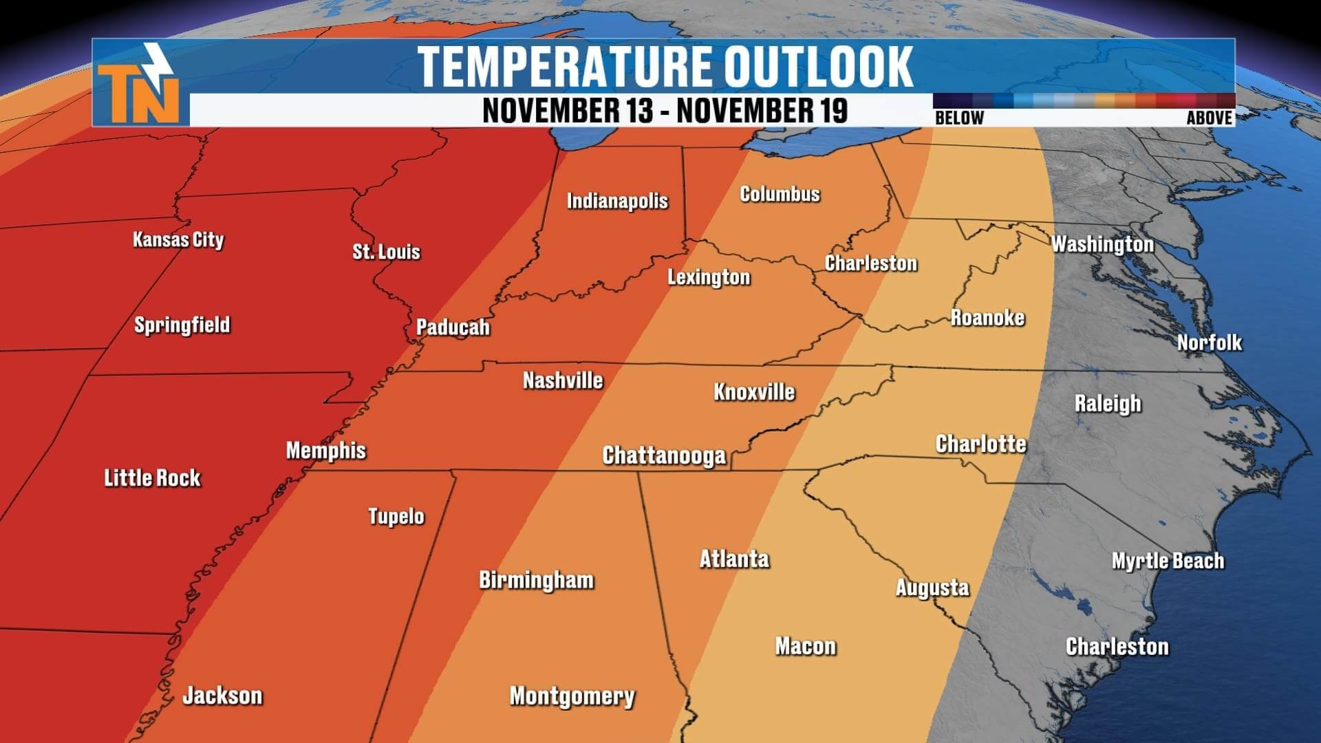
Monday–Tuesday: First hard freeze of the season likely, with lows in the 20s and highs struggling to reach 50°.
So, enjoy the sunshine and warmth while it lasts — winterlike air is waiting in the wings.
If you’re in a hurry but still want to stay ahead of the changing weather, check out Witcher’s One Minute Weather on the East Tennessee Weather App — available anytime for your quick local update.
Have a great Wednesday!