Happy Saturday! Sure hope you have a great day today.
We’re starting the weekend with a warm and very breezy setup across East Tennessee as a moisture-starved cold front pushes toward the region. This front won’t bring much rain, but itwill bring clouds, wind, and eventually some drier and slightly cooler air as we head into Sunday, Monday, and Tuesday.


This morning we’re running 15–20° warmer than yesterday, with lows in the 40s and 50s. A cool start in the lower elevations, but overall a very comfortable morning — perfect conditions if you’re tailgating or heading out early.
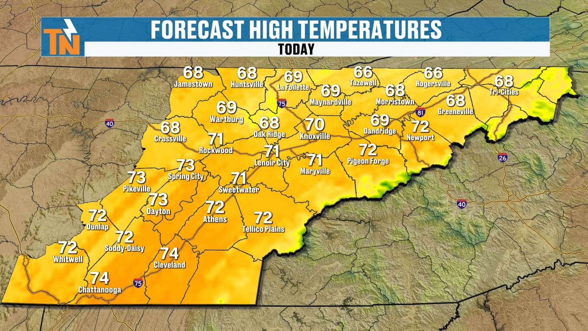
As we move through the afternoon, temperatures climb into the low 70s thanks to a strong southwesterly flow. Expect increasing cloud cover, especially after lunchtime, as a batch of mid- to high-level clouds drifts in ahead of the front. Sunshine will still break through, and even with the clouds thickening at times, it won’t hinder the warmup.
Cloud cover may break up a bit near kickoff for tonight’s football game, before another round of clouds arrives overnight. Winds will be a major player today — gusting 20 to 30 mph, especially across the foothills and mountains. It’s a noticeably breezy setup with that west-southwest wind pumping in warmth.
Tonight, after sundown, the cold front finally slips through. Rain chances remain extremely low during the football game, but a few light showers may develop overnight into early Sunday morning, especially across Upper East Tennessee. Rain totals stay minimal — under a tenth of an inch.
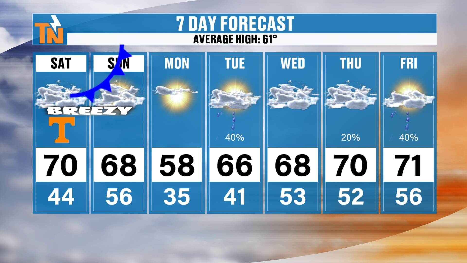
Looking ahead to next week, the colder air behind this front won’t last long. Sunday through Tuesday will be drier and a bit cooler with highs in the upper 50s to low 60s, but then temperatures rebound quickly. By mid- to late week, we’re warming back into the 60s and even low 70s again.
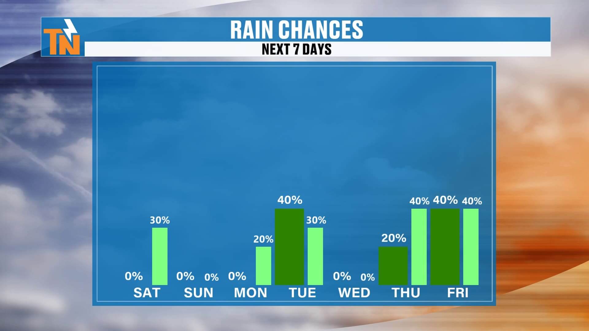
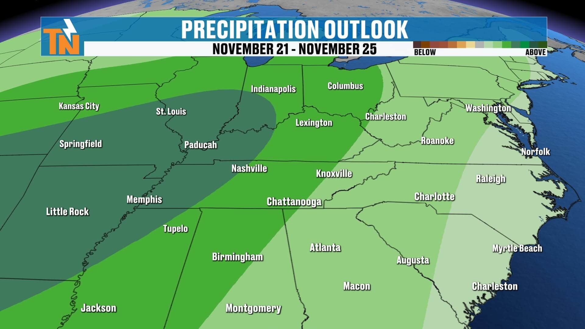
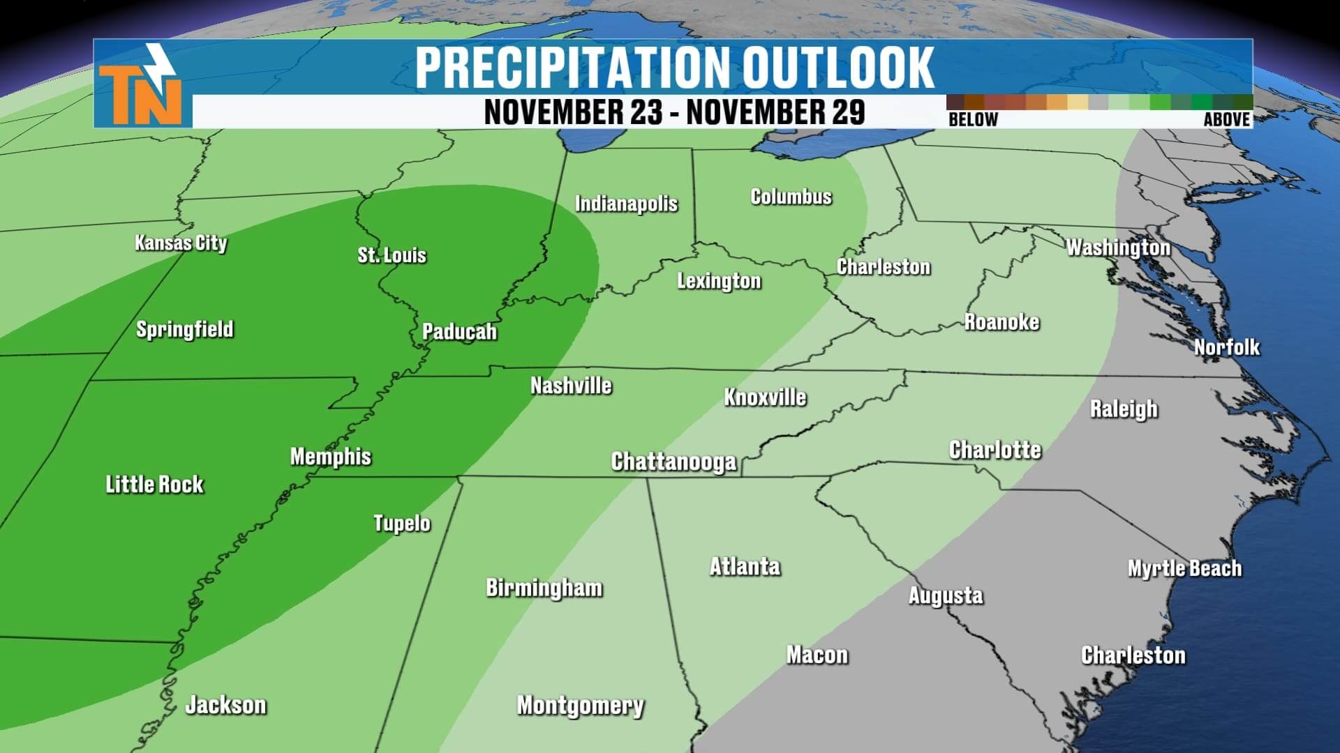
Rain chances increase Monday and Tuesday with a few scattered showers, but the bigger bump in moisture arrives Thursday and Friday, as multiple waves of energy move in. A wetter pattern looks likely to round out the week, with more widespread rain possible heading into next weekend.
Your 7-day outlook keeps today warm and windy, tonight’s front bringing little more than clouds and breezy conditions, and then a gradual climb back to mild temperatures next week. Rain chances trend upward late in the week as a more active pattern takes shape.
Enjoy the warm, breezy Saturday — and we’ll see you back here soon for your next update!