We’ve had a little bit of light rain early this morning with mostly cloudy skies and mild temperatures as a small wave of energy slides off to our east and northeast. But there’s more action heading our way as we wrap up the week.


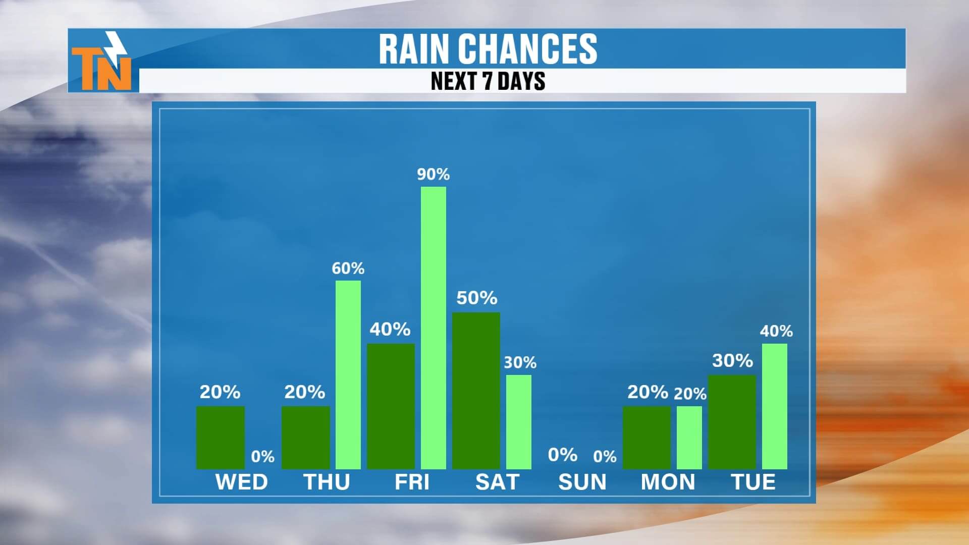
From Thursday into Friday and Saturday, another wave will move through the region, and then early next week yet another trough digs out of the Four Corners. That system is expected to bring in more rain a day or two before Thanksgiving. Overall, we’re tracking a wetter weather pattern as these disturbances line up.
Looking ahead at Thanksgiving week, national travel impacts look fairly manageable right now. Forecast models show rain across parts of the Great Plains, some snow showers across the West and Southwest, and a few snow chances in the Northeast. At this point, nothing looks overly disruptive for major travel routes, but longer-range models will continue to bounce around. You’ve probably seen the social-media hype, but remember—those deterministic model runs flip-flop constantly. I’ll keep you posted with what’s actually reliable.
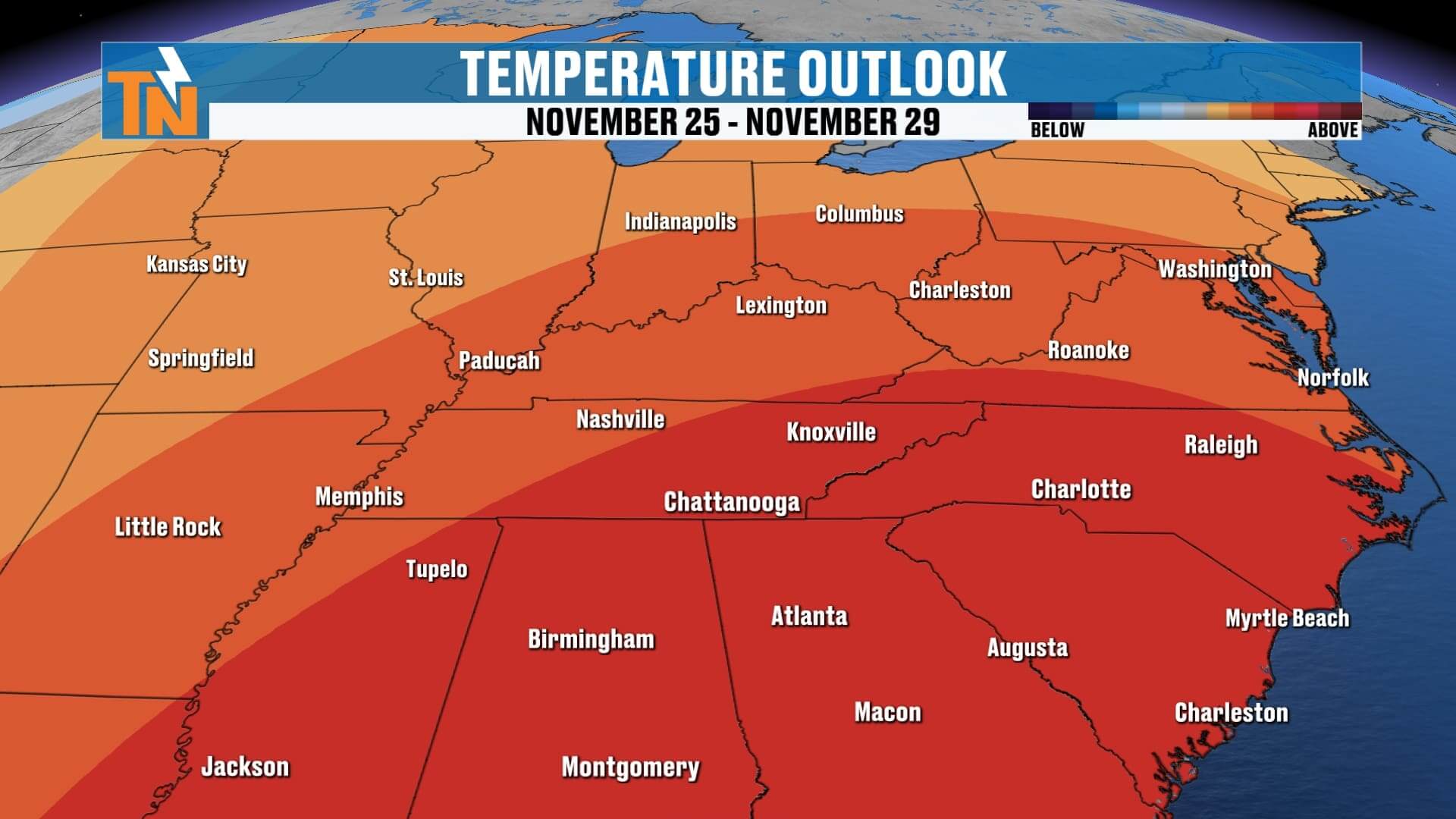
Temperatures this morning are much warmer than yesterday. Most of us are starting in the 50s and low 60s, which is well above average for this time of year. A few spotty showers are still sliding off to the east and southeast, and we’ll stay mostly cloudy through lunchtime. From lunchtime into the mid-afternoon, the clouds will gradually break apart. By the 4–6 p.m. window, expect some pockets of sunshine, although a stray light shower can’t be ruled out late afternoon into the early evening. Nothing significant — just a few nuisance sprinkles and some damp roads early.
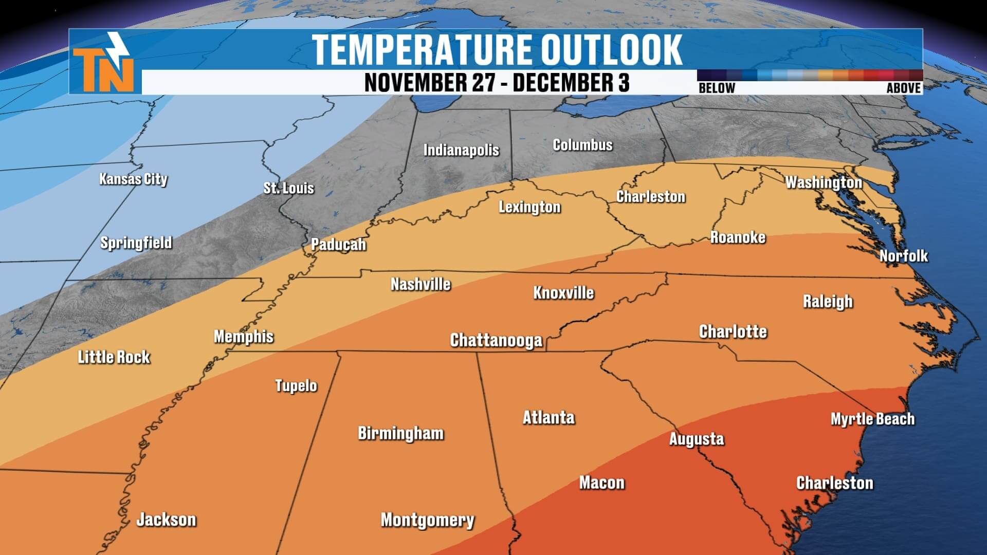
High temperatures today will climb into the 60s and 70s — roughly 10 to 15 degrees above average. Rain chances ramp up Friday night into Saturday, fade out Saturday into Sunday, and then increase again early next week with the incoming storm system from the Southwest. That system carries a lot of energy and looks to bring elevated rain chances as we get closer to Thanksgiving.
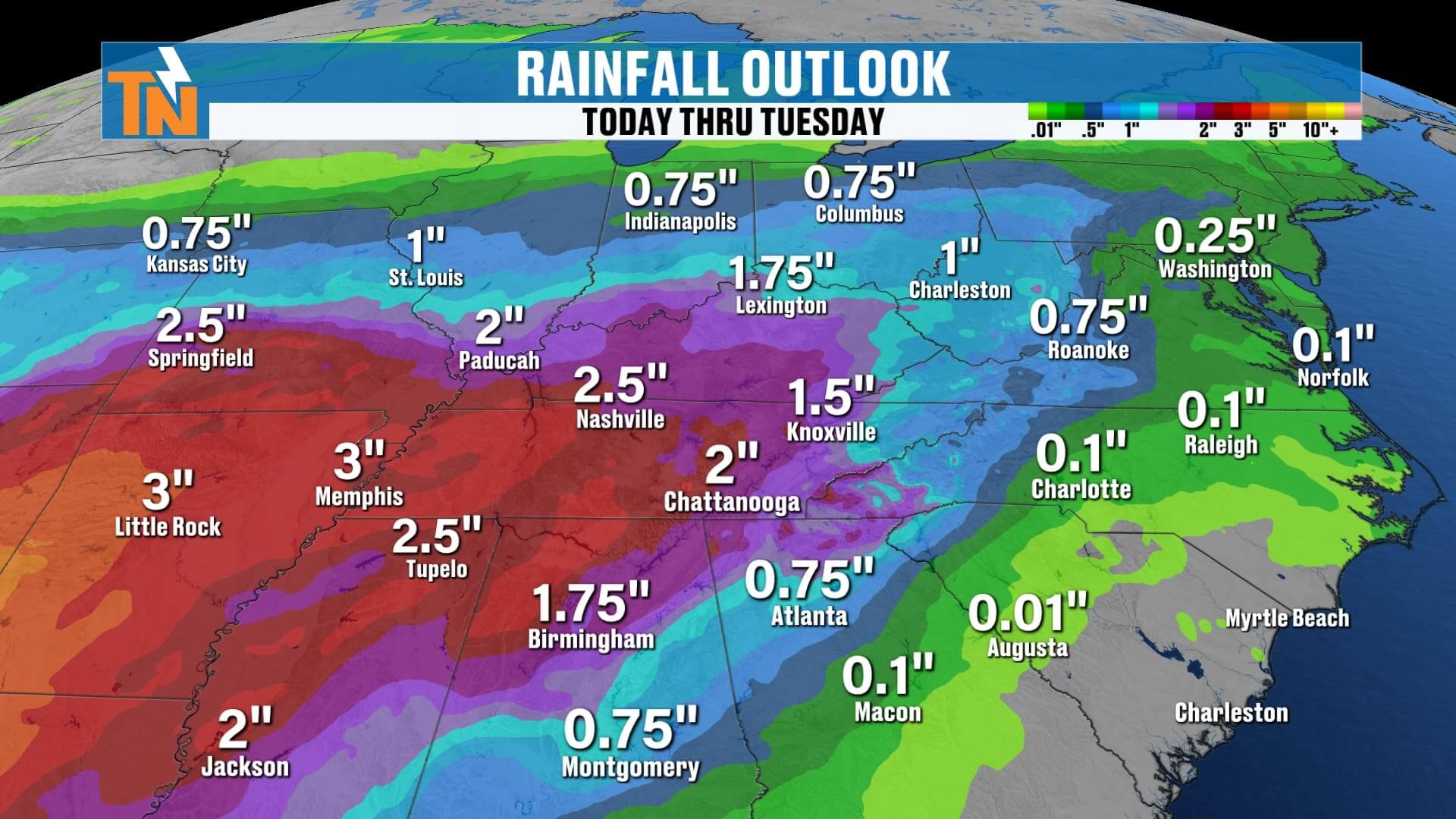
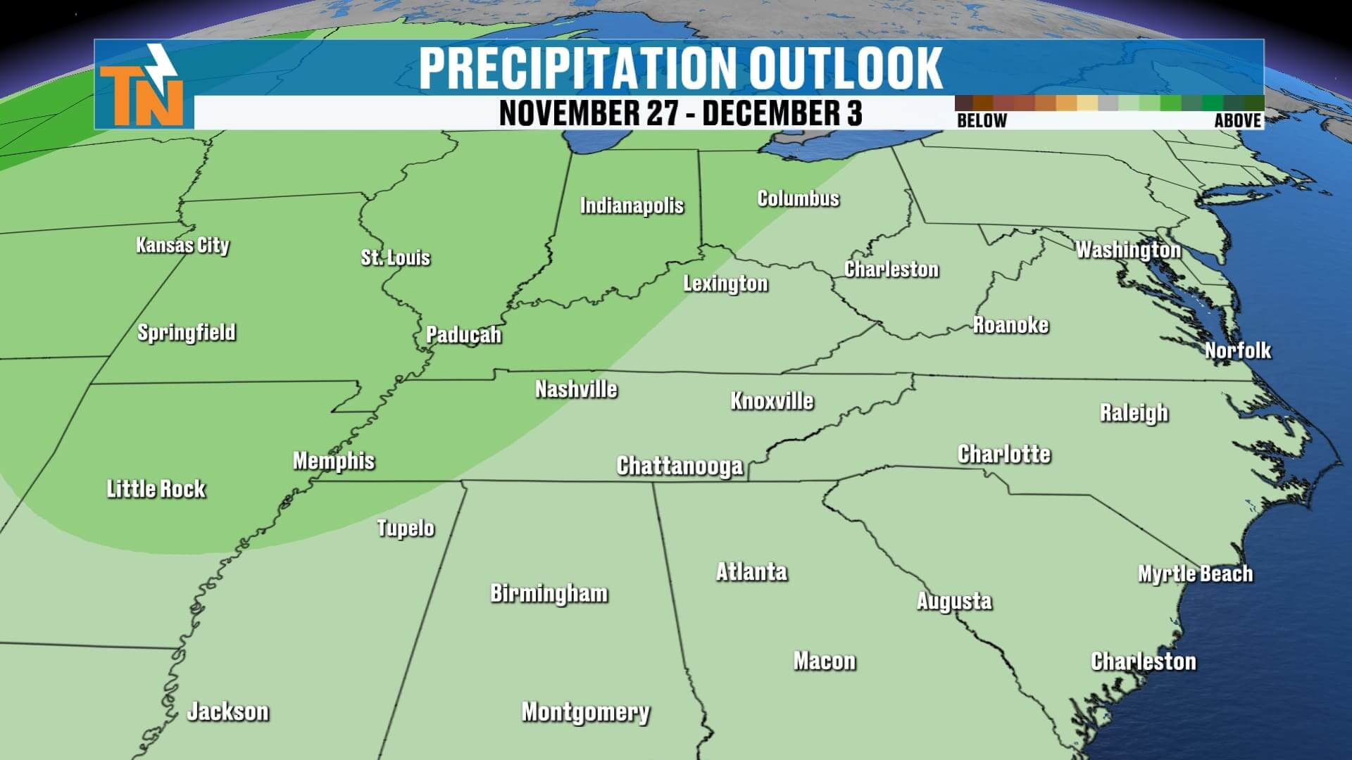
Rainfall totals over the next seven days could add up quickly. Some areas across the region may see one to three inches of rainfall by next Tuesday, especially west of the mountains and along the Tennessee Valley.
Here’s your 7-day forecast:
• Low 70s today through Friday
• Upper 60s Saturday
• Back down closer to seasonal averages Sunday through Tuesday, although technically still slightly above normal
Make sure you’re tracking each of these systems every day with the East Tennessee Weather App. You’ll get interactive radar, daypart forecasts, the full 7-day outlook, and of course Witcher’s One-Minute Weather if you want everything you need to know in just 60 seconds.
Have a great Wednesday — more updates coming soon.