Good morning and Happy Thanksgiving, everybody.
Sure hope you have a wonderful day planned with friends, family, and good food. We’ve got a chilly holiday ahead, with colder temperatures compared to yesterday and several systems lining up over the next week. Let’s slow it down, take our time, and walk through the full extended forecast so you know what to expect from today all the way through next week.
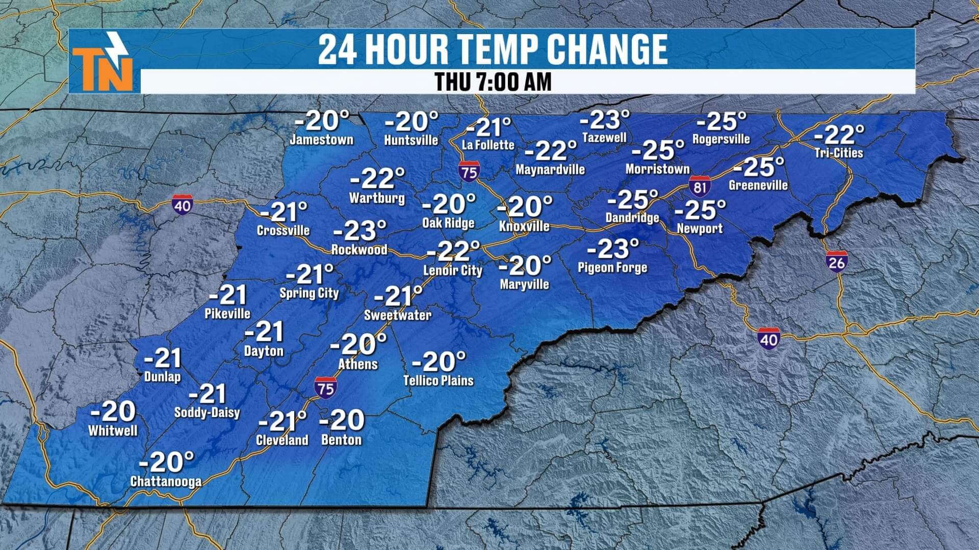
Cold Start: 210° Colder Than Yesterday
This morning is a shock to the system compared to our mild weather earlier this week.
Temperatures are running roughly 20 degrees colder, with:
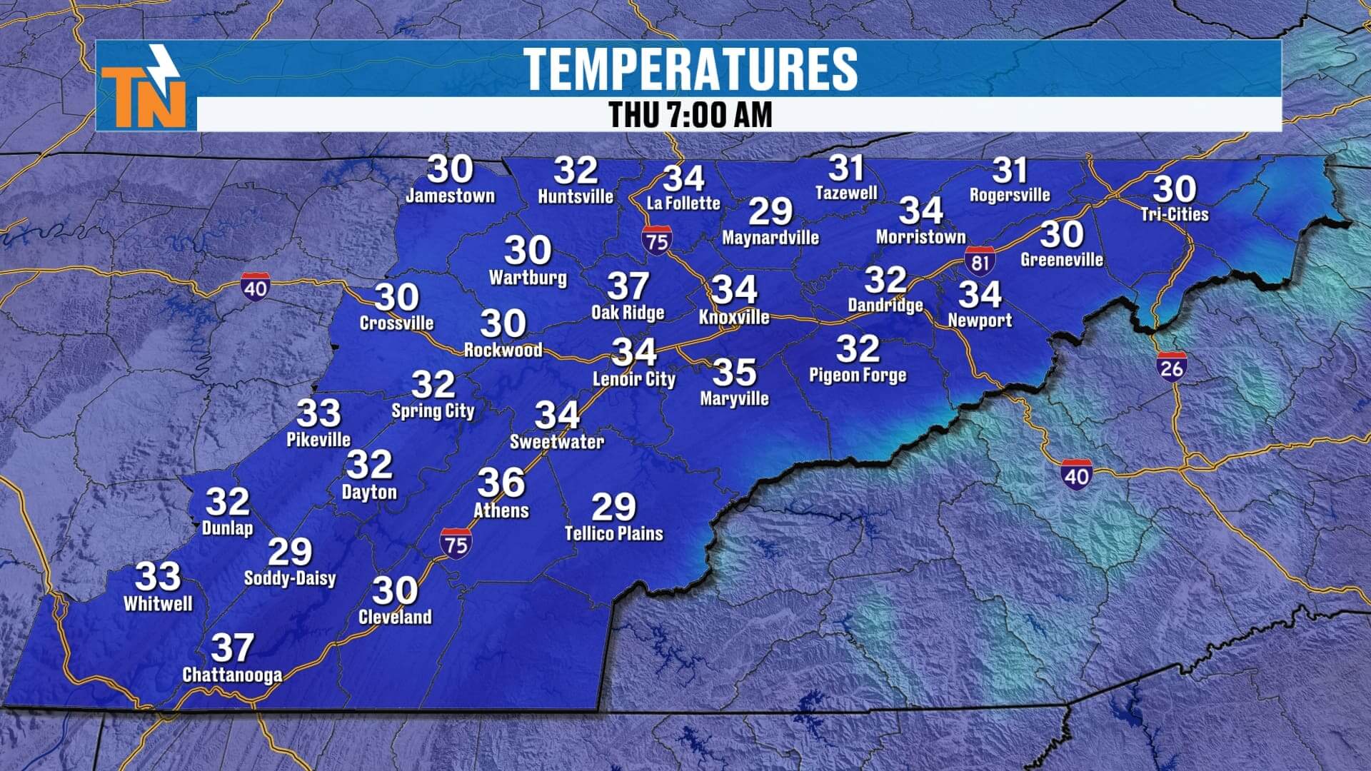
• Mid–20s to mid–30s across East Tennessee
• 37° in Chattanooga
• 36° in Knoxville
• 34° in the Tri-Cities
It’s a crisp, cold start to your Thanksgiving morning — so bundle up as you hop between houses, travel around the region, or head outside for any morning traditions.
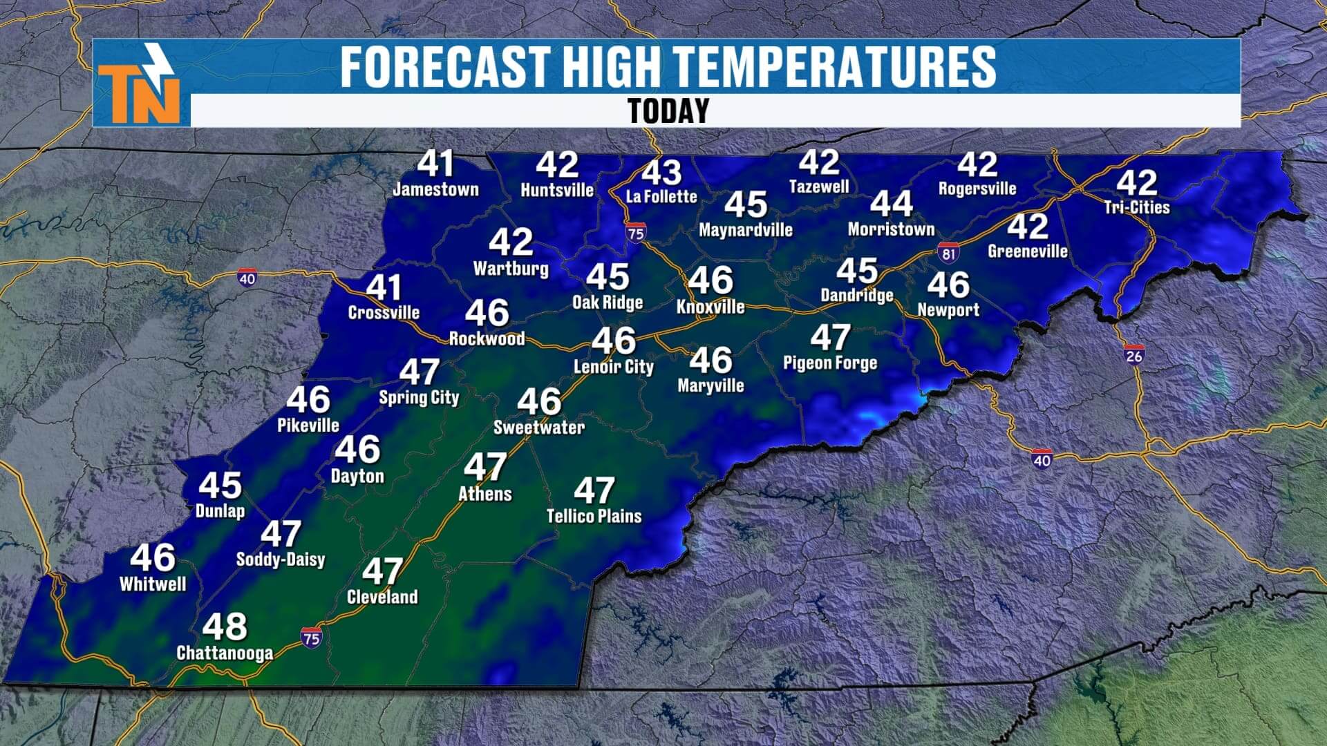
Increasing Sunshine Today — But Staying Cold
While we start with a few early clouds, those will gradually clear as high pressure starts to build in.
Futurecast shows:
• Morning clouds
• Gradual clearing midday
• Sunshine returning late afternoon
• Cold, dry air dominating all day
Even with sun, temperatures struggle to rebound. Highs only reach the 40s today — a full 10 to 15 degrees below average for late November.
Black Friday& Saturday: Cold But Dry
If you’re doing early shopping Friday or heading out for small business Saturday, we stay cold but quiet.
• Black Friday: Dry, cold, highs in the 40s
• Saturday: Dry, chilly, but clouds return late in the day
So both days are perfectly fine for travel, shopping, and holiday fun — just bring the coat.
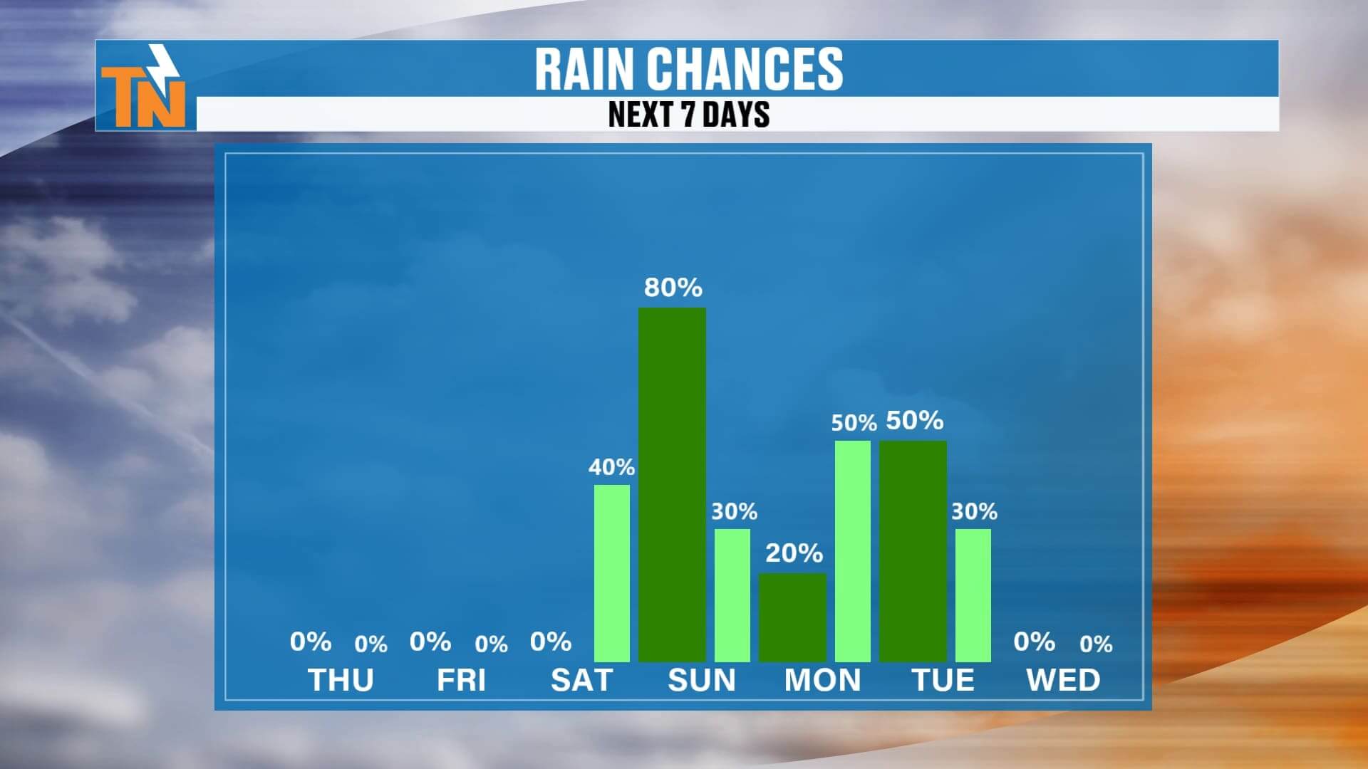
Sunday – Monday: First System Arrives
Our next storm system arrives Sunday into Monday.
• Clouds increase Sunday
• Light scattered rain develops
• Nothing heavy — this is round one
• A chilly rain likely at times into Monday
This first system isn’t overly impressive, but it sets the stage for something bigger behind it.
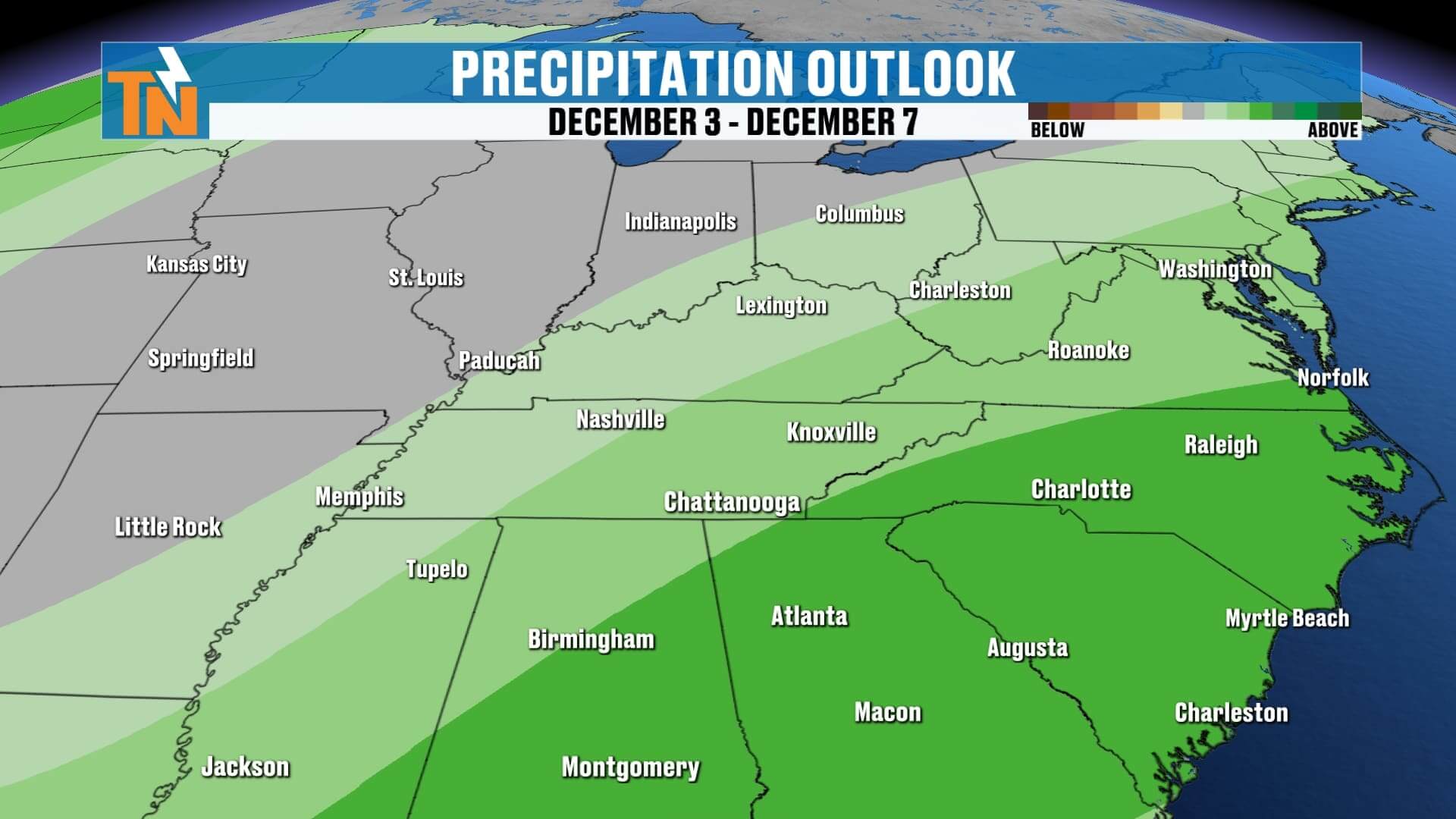
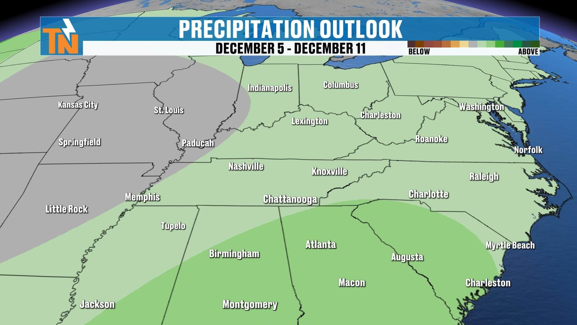
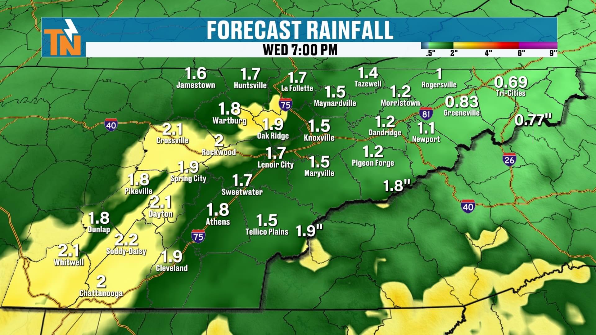
Tuesday – Wednesday: A Stronger System With a Wintry Twist
This is the system to watch.
A deeper wave of energy digs across the Southeast Tuesday into Wednesday, bringing:
• Widespread rain
• Embedded heavier downpours
• Potential for over an inch of rainfall
• Enough cold air nearby for a wintry mix on the table, especially in higher elevations
Model confidence right now:
• Rain – high confidence
• Ice – very low confidence
• Snow – low but slowly increasing confidence
This isn’t shaping up to be a major winter storm, but there is a chance for some wintry weather, especially as colder air rushes in behind the system late Wednesday.
This will continue to evolve — and I’ll keep you updated every day.
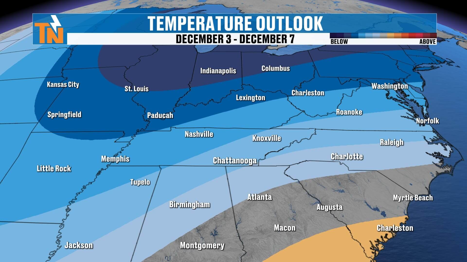
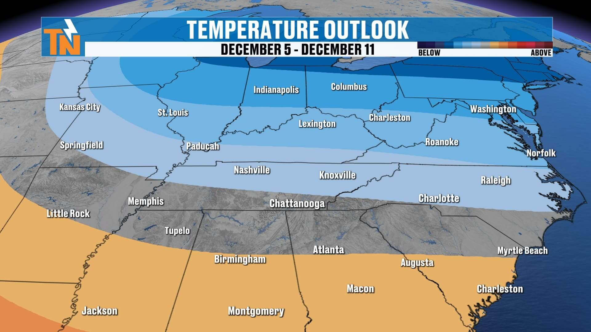
Extended Outlook: Turning More Winter-Like
We’ve been running warm for much of the fall season, but that pattern is shifting.
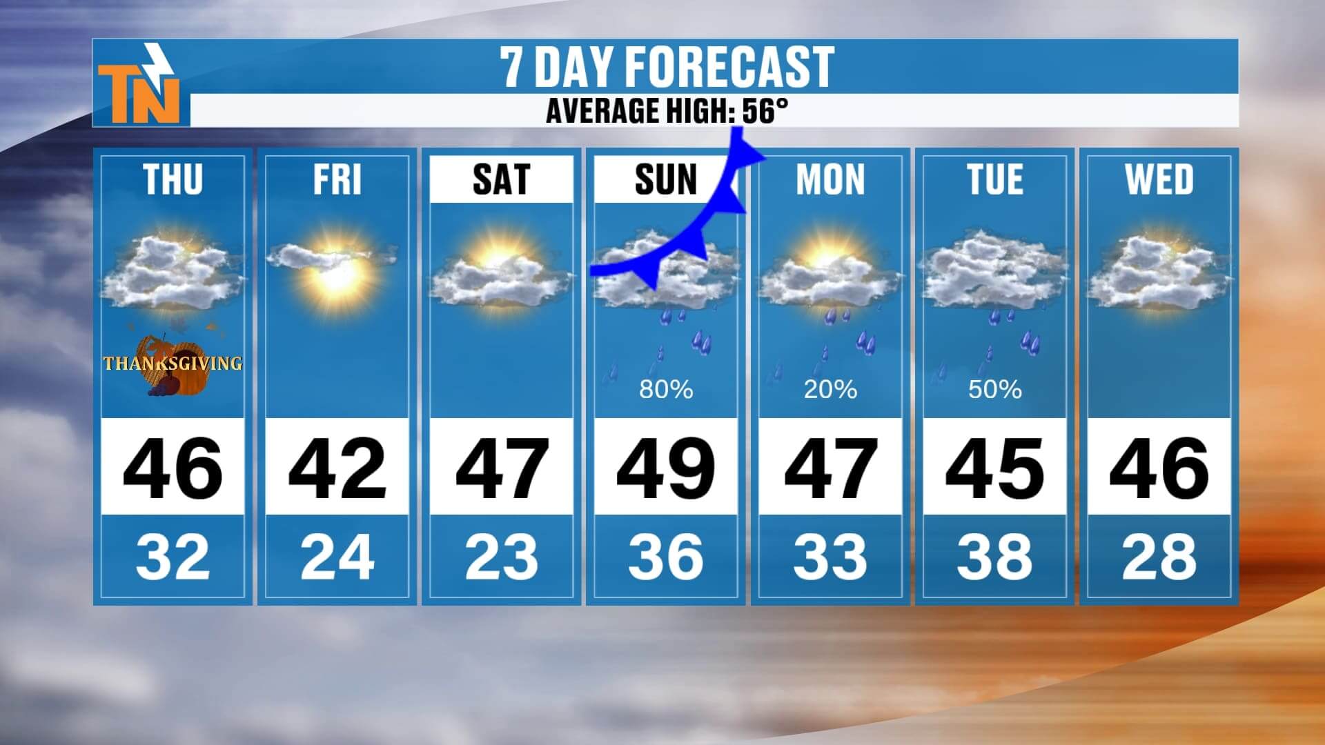
Average high this time of year: 56°
This week and beyond:
• Highs in the 40s
• Lows in the 20s & 30s
• Several opportunities for cold rain or light snow
• A more classic early-winter pattern setting up
Winter weather lovers — your pattern is finally starting to shape up.
7-Day Forecast Summary
• Thanksgiving: Cold, sunny, 40s
• Friday: Cold, dry
• Saturday: Dry, increasing clouds
• Sunday–Monday: First wave of rain
• Tuesday–Wednesday: Stronger system, heavy rain, small snow chance
• Next week: Staying chilly
Final Thoughts
Enjoy the sunshine today — even though it’s cold — and soak up the time with friends and family. A more active, wintry pattern is taking shape, and we’ll be tracking multiple systems over the next week.
If you’re traveling or visiting family today, don’t forget:
Download the East Tennessee Weather App
Check radar, track rain and snow, and get daily forecasts wherever you go.
Happy Thanksgiving — and thanks for checking in!