
Good morning and Happy Wednesday.
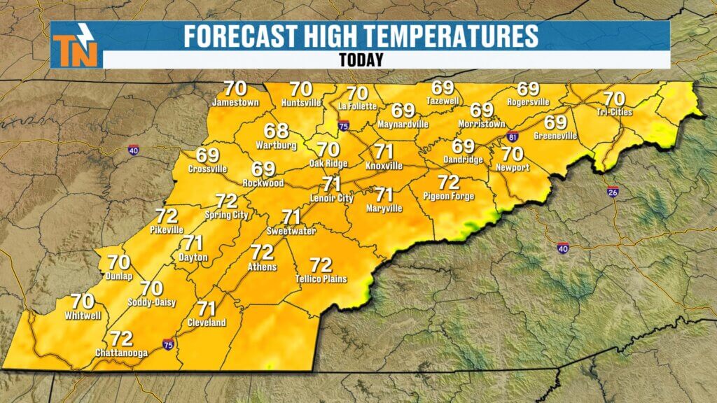
We’re halfway through the work week and the weather is looking great across East Tennessee. After a beautiful day yesterday with highs reaching the upper 60s, we’re continuing that warming trend with even milder conditions on the way.
Quiet and Comfortable Start to the Day
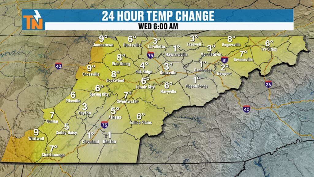
We’re waking up to slightly warmer temperatures compared to yesterday.
- Upper East Tennessee starting cooler in the upper 30s
- Central and southern valley in the 40s and 50s
- Overall a comfortable start with just a light jacket needed
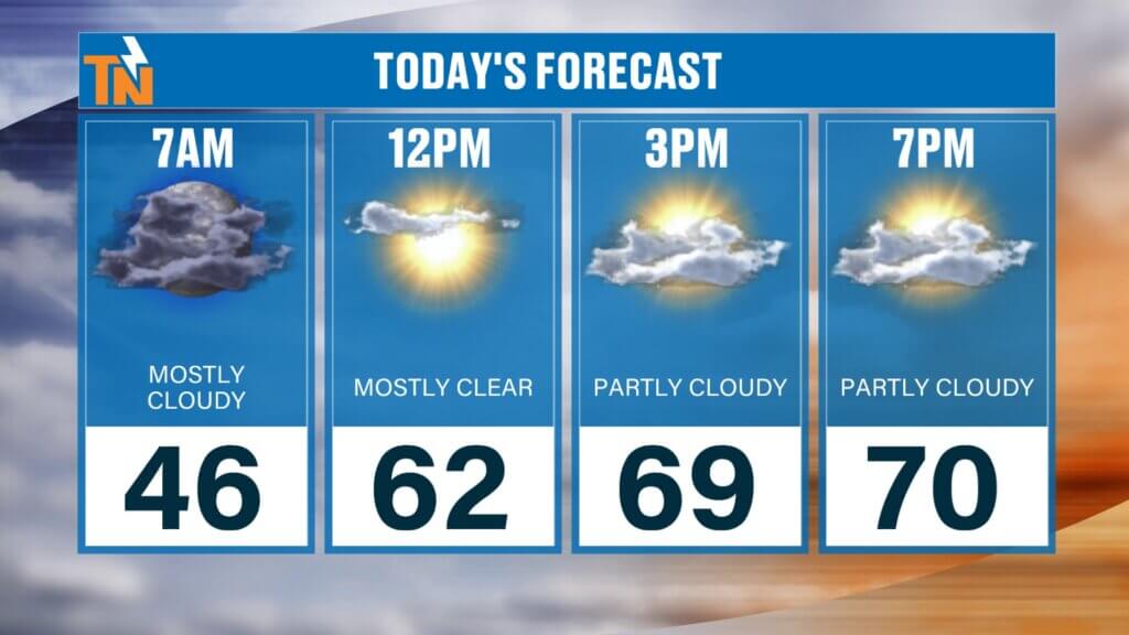
As we head through the day, temperatures will climb steadily.
- Lunch hour: low 60s
- Afternoon: upper 60s to low 70s
- Evening: mild and pleasant, around the low 60s
A perfect day for outdoor plans from start to finish.
Breezy Conditions with a Warming Trend
Winds will be a bit breezy today, though not as strong as what we experienced yesterday.
- Light to moderate breeze at times
- Winds shifting more out of the south
- Helping to bring in warmer air
That southerly flow is key as it continues to push temperatures upward heading into Thursday and Friday.
Smoke Returns with Changing Wind Direction
While recent northerly winds helped clear out smoke and haze, today’s wind shift will bring some of it back.
- Winds turning southerly will pull smoke from fires to our south
- Slight increase in haze possible
- Air quality expected to remain in the good (green) category
So while skies stay mostly clear, you may notice a bit of haze at times.That dry air will stick around through midweek.
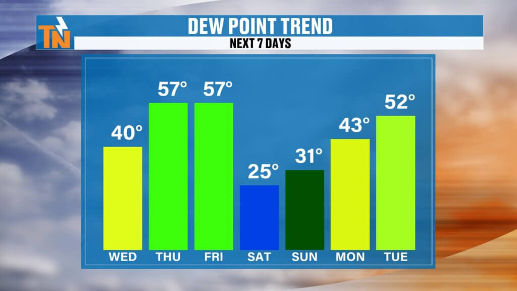

Increasing Moisture Ahead of Friday’s Cold Front
Dew points will begin to rise today and tomorrow, signaling more moisture returning to the atmosphere.
- Today: dry and comfortable
- Thursday: slightly more humid
- Friday: enough moisture for scattered rain showers
This is all ahead of our next weather maker—a cold front arriving Friday.
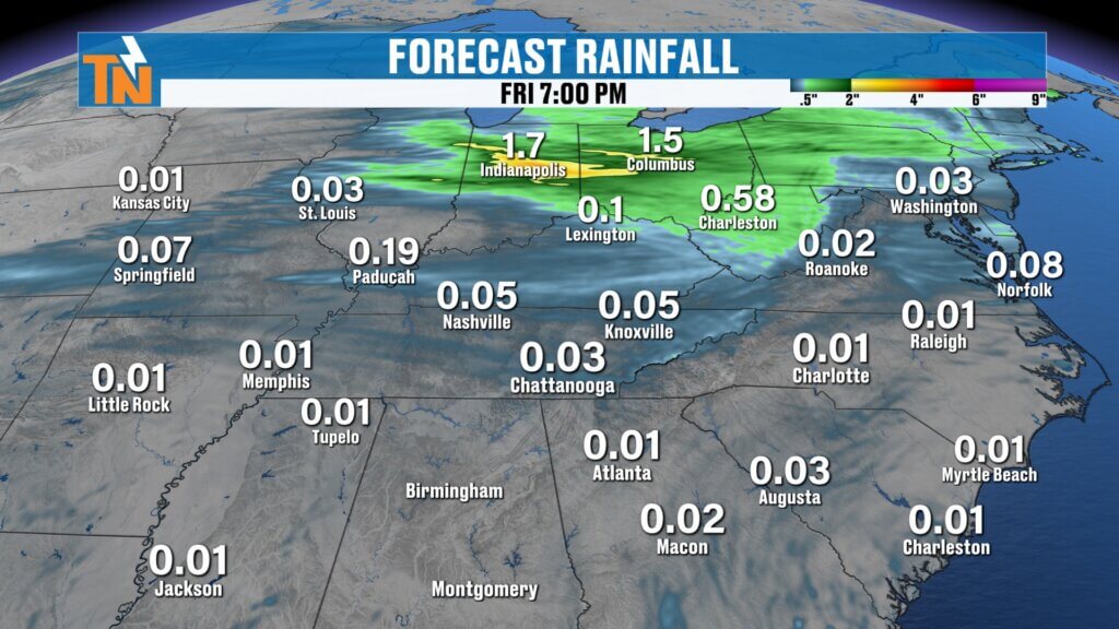
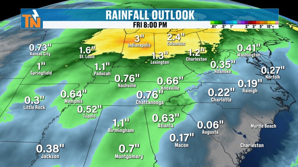
Timing Out Friday’s Rain Chances
Rain chances remain limited, but Friday will be our best opportunity.
- Friday morning: mostly dry
- Friday afternoon into evening: scattered light rain showers develop
- Friday night: lingering showers taper off
Rainfall totals will be light overall.
- Less than a quarter inch expected
- Higher amounts possible in the mountains
- Heavier rain stays north in the Ohio Valley
No severe weather is expected with this system.Most locations will notice clearer skies, but a slight haze is still possible in spots.
Cooler, Drier Weekend Ahead
Behind the front, cooler and drier air moves back in for the weekend.
- Saturday: cooler, highs near 60 with sunshine
- Lower humidity and crisp conditions
- Beautiful blue skies return
It’s a quick cooldown, but a very pleasant one.
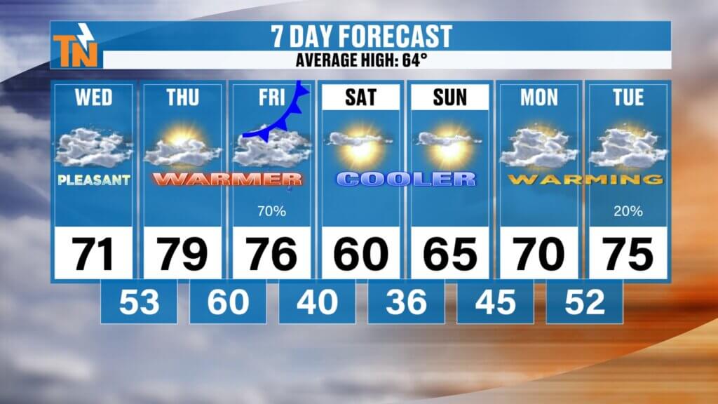
7-Day East Tennessee Outlook
Monday–Tuesday: Mild with highs in the low to mid 70sir for the weekend.Have a great Monday, and we’ll keep you updated as the week unfolds.
Wednesday: Sunny and mild, high near 71
Thursday: Warmer, high near 79
Friday: Light rain showers, high mid 70s
Saturday: Cooler and sunny, high near 60
Sunday: Warming back into the 60s
Final Thoughts
Enjoy the stretch of beautiful spring weather today and tomorrow. While smoke may return slightly with the changing winds, overall conditions remain very pleasant.
Rain chances arrive Friday, but they’ll be light and brief, followed by a refreshing and cooler weekend.
Have a great Wednesday, and I’ll see you back here soon.Enjoy the sunshine, and we’ll keep watching for the next rain opportunity. Have a great Tuesday!

Community Event Spotlight
Next Saturday, come out and join us at Timber Creek Landscape Supply in Powell (off Emery Road) from 10 AM to 2 PM.
- Meet and greet with me
- TK’s Gourmet Food Wagon
- Tiki’s Shaved Ice
- Spend $60 or more and get a free lunch
We’ll have the East Tennessee Weather tent set up—come hang out and kick off spring with us.