
Good morning and Happy Thursday.
Thanks for checking in with your East Tennessee weather update. The warming trend continues today as we stay ahead of an approaching cold front that will bring a small chance for rain as we head into Friday.
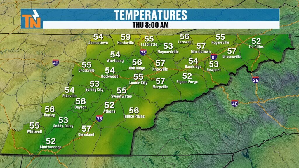
Warm and Breezy Start to the Day
We’re starting off noticeably warmer compared to yesterday.
- Morning temperatures in the 40s, 50s, and even some 60s
- Mid 50s in places like Spring City
- Upper 40s across the Tri-Cities
That milder start is thanks to a strong southerly flow setting up across the region.
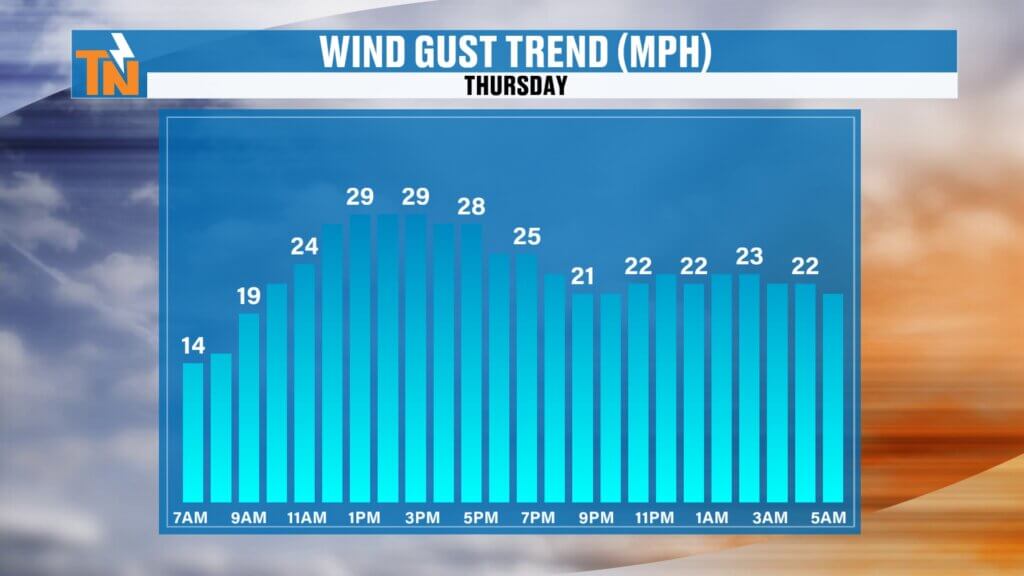
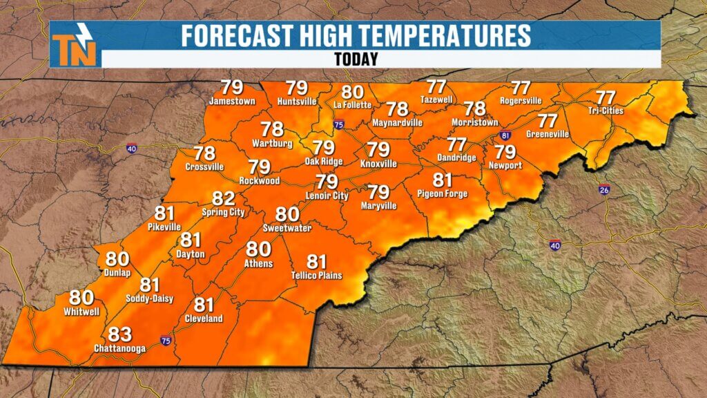
Another Beautiful, Warm Afternoon
Today is shaping up to be another fantastic spring day across East Tennessee.
- Highs climbing into the upper 70s to low 80s
- Breezy winds out of the south and southwest
- Wind gusts between 20 to 30 mph at times
Even into the evening, temperatures stay very mild.
Great conditions for ball games, outdoor plans, and evening activities
Around 77 degrees at 7 PM
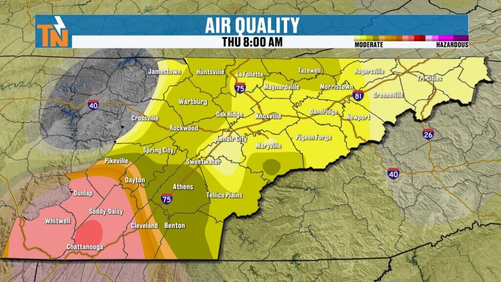
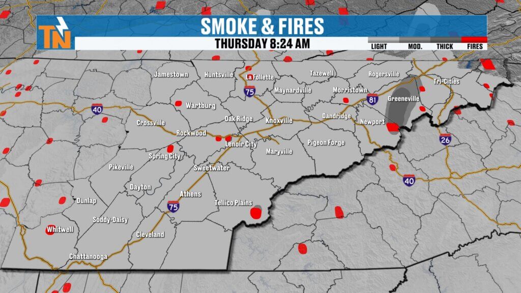
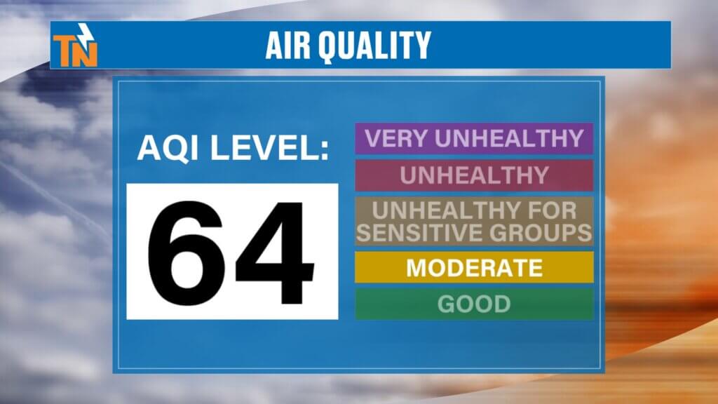
Air Quality Concerns Return
With winds shifting out of the south, smoke from ongoing fires is making a return.
- Air quality has dropped back into the moderate category
- Thicker smoke possible in areas like Greene and Cocke Counties
- Additional smoke near Monroe County and along the foothills and Smoky Mountains
If you’re sensitive to smoke or have respiratory concerns, you may notice the difference today.ir will stick around through midweek.
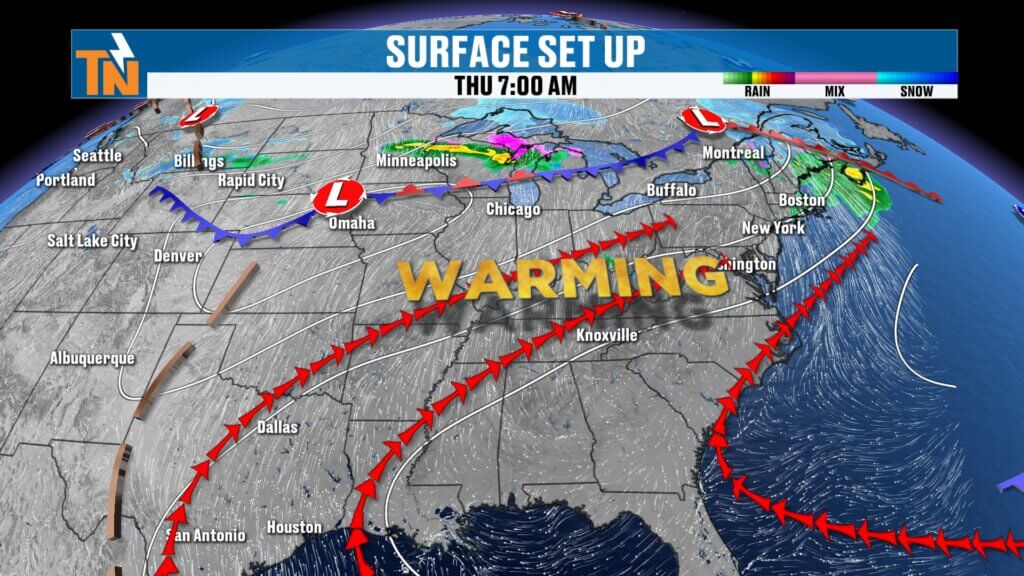
Friday Cold Front Brings Light Rain
A cold front will move through East Tennessee on Friday.
- Morning: dry and breezy
- Afternoon into evening: scattered light rain showers
- No severe weather expected locally
This system is moisture-starved, so rainfall will be limited.
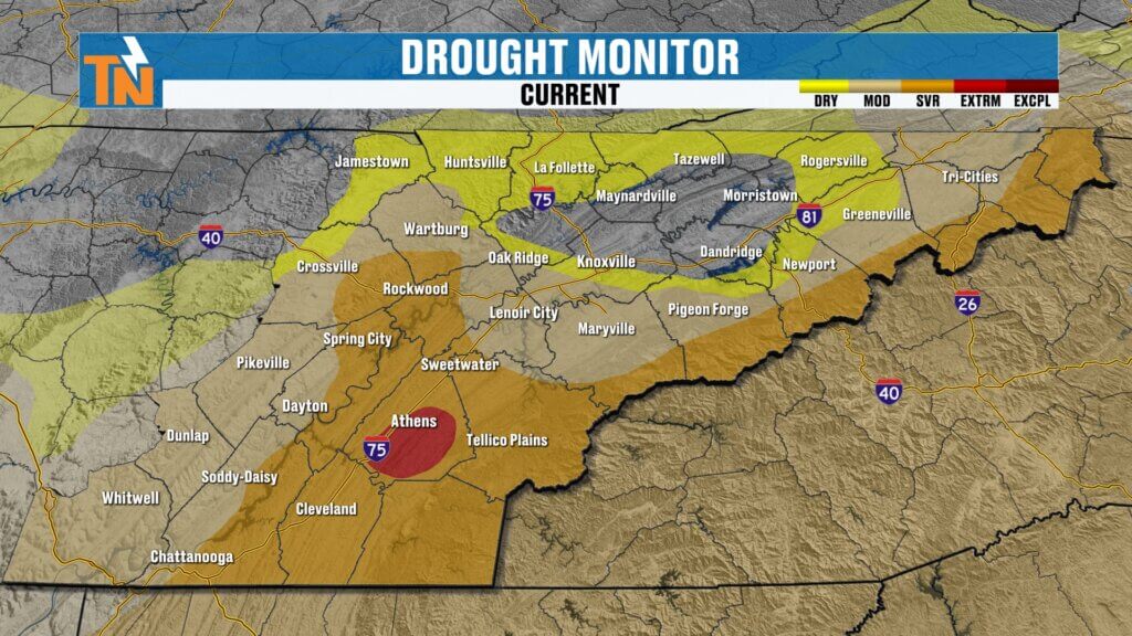
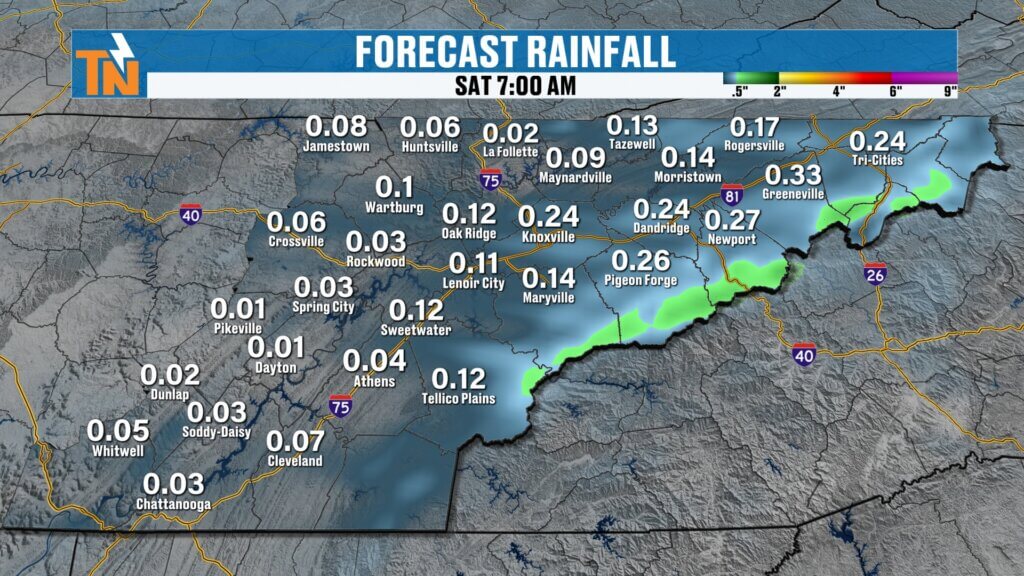
Limited Rainfall and Ongoing Drought Concerns
Even with Friday’s system, rainfall totals remain low.
- Not enough to significantly improve drought conditions
- Drought monitor updates expected to show continued or worsening dryness
- Higher humidity ahead of the front will help slightly with fire concerns
Unfortunately, we still need a more substantial rain event.
Weekend Outlook: Cooler with Elevated Fire Risk
Behind the cold front, conditions change again.
- Saturday and Sunday: cooler and pleasant
- Much lower humidity with dew points dropping into the 20s
- Northerly winds developing
This combination means elevated fire danger will return this weekend.
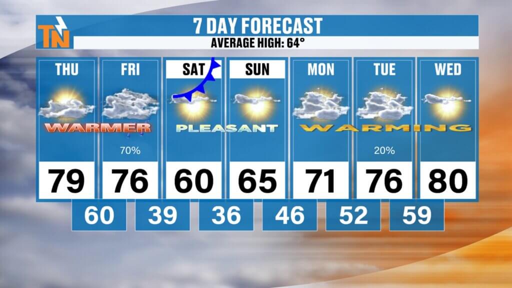
7-Day East Tennessee Outlook
Midweek: Continued warm with increasing rain chances late
Thursday: Warm and breezy, highs near 80
Friday: Light rain showers, still warm
Saturday: Cooler, dry, highs near 60s
Sunday: Pleasant and seasonal
Monday–Tuesday: Warming back into the 70s
Final Thoughts
Enjoy another warm and breezy day today, but be mindful of smoke and air quality concerns. A weak cold front brings only light rain Friday, followed by a cooler and drier weekend.
Fire danger will remain something to watch, especially with low humidity returning this weekend. Hopefully, better rain chances arrive as we head into April.
Have a great Thursday, and thanks for checking in.r the next rain opportunity. Have a great Tuesday!

Community Event Spotlight
Next Saturday, come out and join us at Timber Creek Landscape Supply in Powell (off Emery Road) from 10 AM to 2 PM.
- Meet and greet with me
- TK’s Gourmet Food Wagon
- Tiki’s Shaved Ice
- Spend $60 or more and get a free lunch
We’ll have the East Tennessee Weather tent set up—come hang out and kick off spring with us.