
Good morning and Happy Saturday.
After the warmth of the past couple of days, today brings a noticeable cooldown—but overall, still a pretty nice early spring day across East Tennessee.

Cooler Air Settles In Across East Tennessee
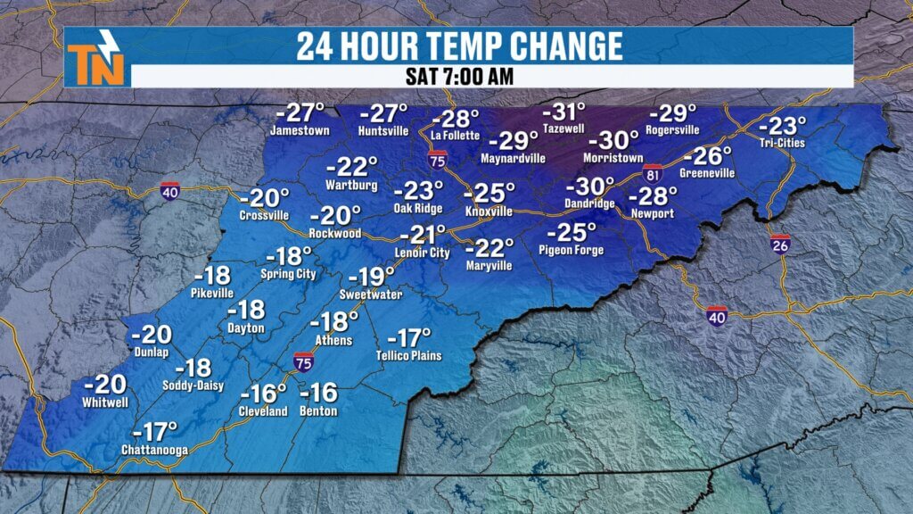
A cold front has pushed through and cooler, drier air is now in place.
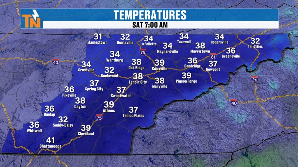
- Morning temperatures in the 20s and 30s, with a few 40s
- Much cooler compared to yesterday’s mid 70s and even low 80s in some spots
- Cool high pressure now dominating the region
It’s a chilly start, but temperatures will recover nicely this afternoon.
Afternoon Forecast: Cool but Pleasant
Despite the chilly start, it turns into a nice afternoon.
- Highs in the upper 50s to low 60s
- Plenty of sunshine
- Still breezy, but manageable
Overall, right where we should be for this time of year.
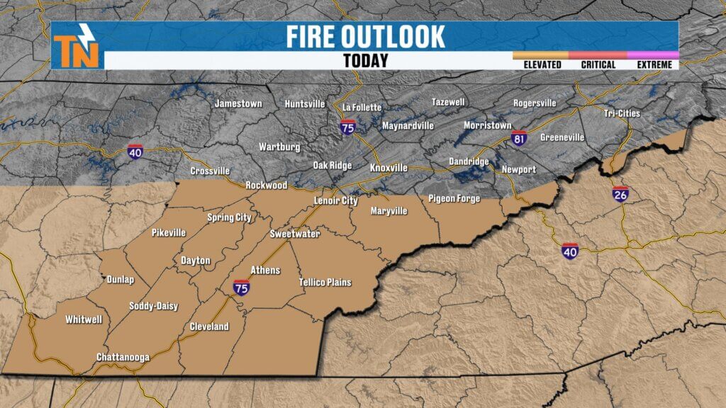
Breezy Conditions and Elevated Fire Danger
Winds will be a big part of the story today.
- Northerly winds gusting 25–30 mph at times
- Strongest winds and driest air south of Interstate 40
- Elevated fire danger in those areas due to low humidity
If you’re outdoors today, especially in southern parts of East Tennessee, be mindful of anything that could spark a fire.
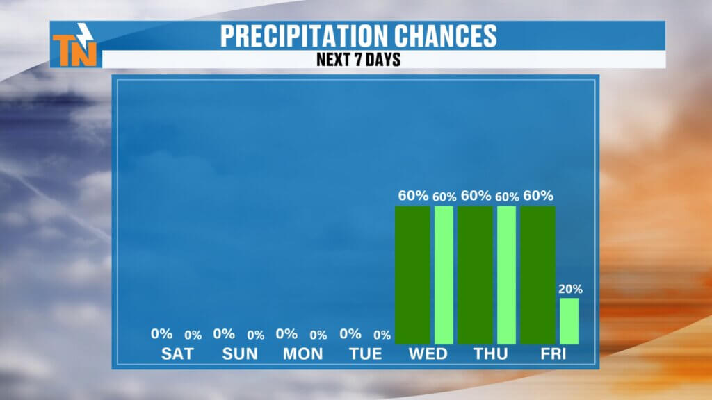
Major Pattern Shift: Wet Weather Builds In Next Week
This is where things get interesting.
- Dry weather holds through Monday
- Rain chances begin increasing Tuesday into Wednesday
- Multiple waves of energy bring a wetter pattern
What’s changed is the amount of moisture expected. Models are now trending much wetter.
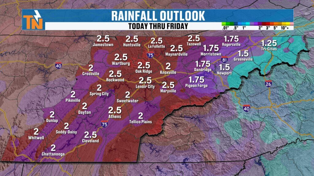
Rainfall Potential: Much-Needed Soaking Rain
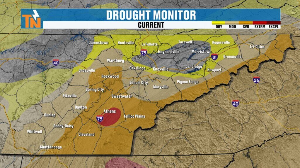
This could be a big deal for drought conditions.
- Around 0.5 inch possible by Wednesday
- Over 2 inches possible by Friday
- Rain continues into Saturday
This is the kind of widespread, steady rain East Tennessee has been needing.
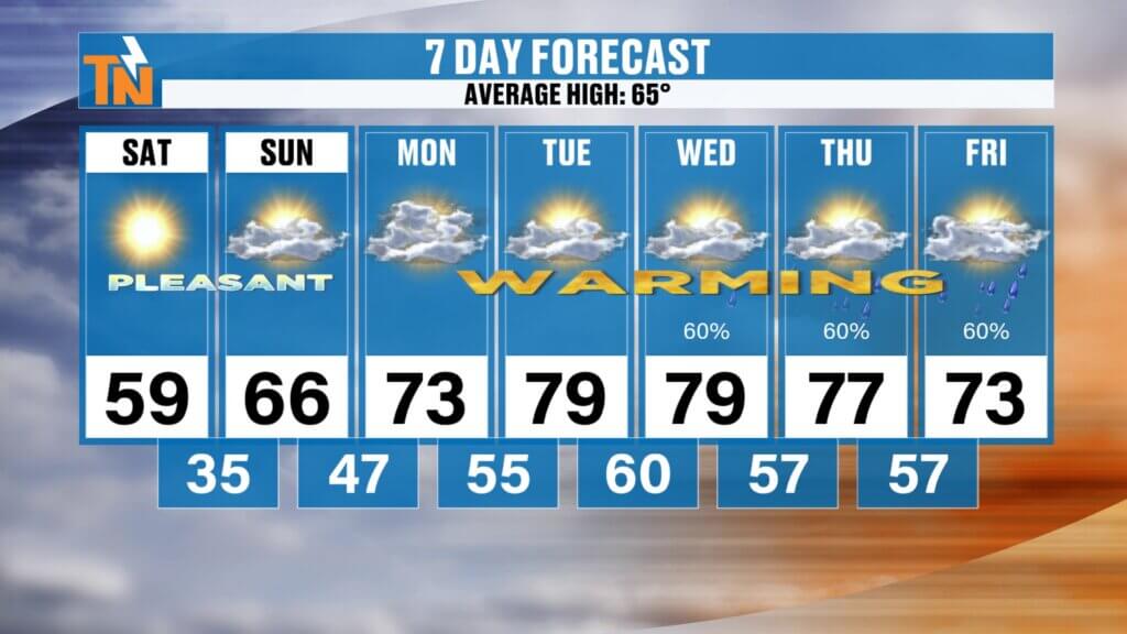
7-Day Outlook
Next weekend: Slightly cooler, but still mild
Saturday: Cooler, breezy (upper 50s to low 60s)
Sunday: Sunny, milder (mid 60s)
Monday: Warm (low 70s)
Tuesday: Increasing clouds (mid to upper 70s)
Wednesday–Friday: Periods of rain, possibly heavy at times

Community Event Spotlight
Come out today and join us at Timber Creek Landscape Supply in Powell (off Emery Road) from 10 AM to 2 PM.
- Meet and greet with me
- TK’s Gourmet Food Wagon
- Tiki’s Shaved Ice
- Spend $60 or more and get a free lunch
We’ll have the East Tennessee Weather tent set up—come hang out and kick off spring with us.