
Good morning and happy Wednesday, East Tennessee!
Thanks for checking in, and I hope you have a great day.
If today’s forecast sounds familiar, that’s because we’re staying in a classic summertime “wash, rinse, repeat” weather pattern. Expect another warm, humid day with scattered afternoon thunderstorms capable of producing very heavy rainfall.
Yesterday, McGhee Tyson Airport reached 91°, right on target for early July. While not everyone saw rain, several communities picked up impressive totals. Flash Flood Warnings were issued for portions of Morgan, Rhea, Meigs, Cocke, and Sevier counties, where slow-moving thunderstorms dumped heavy rain in a short amount of time.
Unfortunately, we’ll have to watch for that possibility again today.
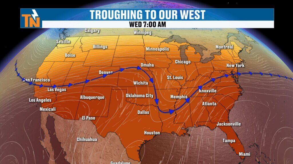
Why the Storm Pattern Continues
A broad upper-level trough remains parked just west of the Tennessee Valley and is only slowly drifting east.
At the same time, a weak disturbance in the middle levels of the atmosphere will move across East Tennessee this afternoon.
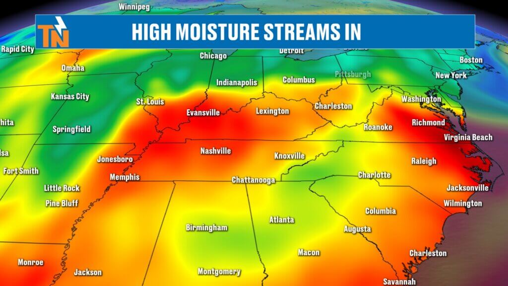
Near the surface, a lingering boundary combined with very humid air will provide plenty of fuel for scattered thunderstorms to develop once daytime heating gets going.
This is a textbook midsummer weather pattern across the Southeast.
Flooding Risk Remains the Primary Concern
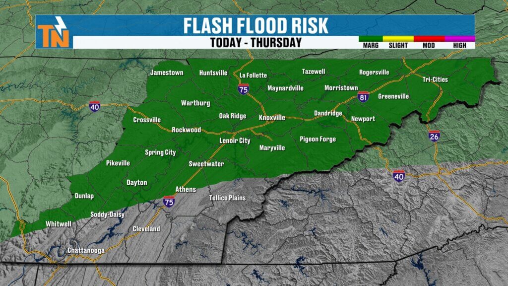
The Weather Prediction Center continues a Level 1 (Marginal) Risk for excessive rainfall today.
We’re not expecting widespread flooding.
However, storms will once again be slow movers, and with abundant tropical moisture available, rainfall rates could become intense.
If storms repeatedly move over the same location, localized flooding and flash flooding can develop quickly.
Areas that picked up heavy rain yesterday will be especially vulnerable if another storm tracks over them today.
Today’s Forecast Timeline
The morning should stay fairly quiet.
We may see areas of patchy dense fog early, but most locations remain dry through late morning.
As we move into the afternoon, scattered showers and thunderstorms will begin developing.
Expected timing:
- Morning: Mostly dry with patchy fog
- Noon to 2 PM: Storms begin developing
- Mid to late afternoon: Greatest storm coverage
- Evening: Storms gradually weaken after sunset
Like the past several days, not everyone will see rain.
But where storms do develop, expect heavy downpours, frequent lightning, and gusty winds.
Temperatures
Morning temperatures started in the 60s, with a few locations seeing dense fog.
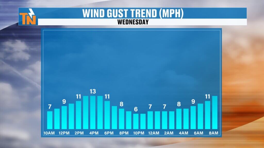
Winds will be just a little breezier today than they have been recently, but nothing significant.
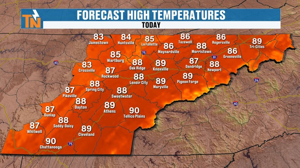
Afternoon highs climb into the upper 80s to around 90 degrees, which is right around average for this time of year.
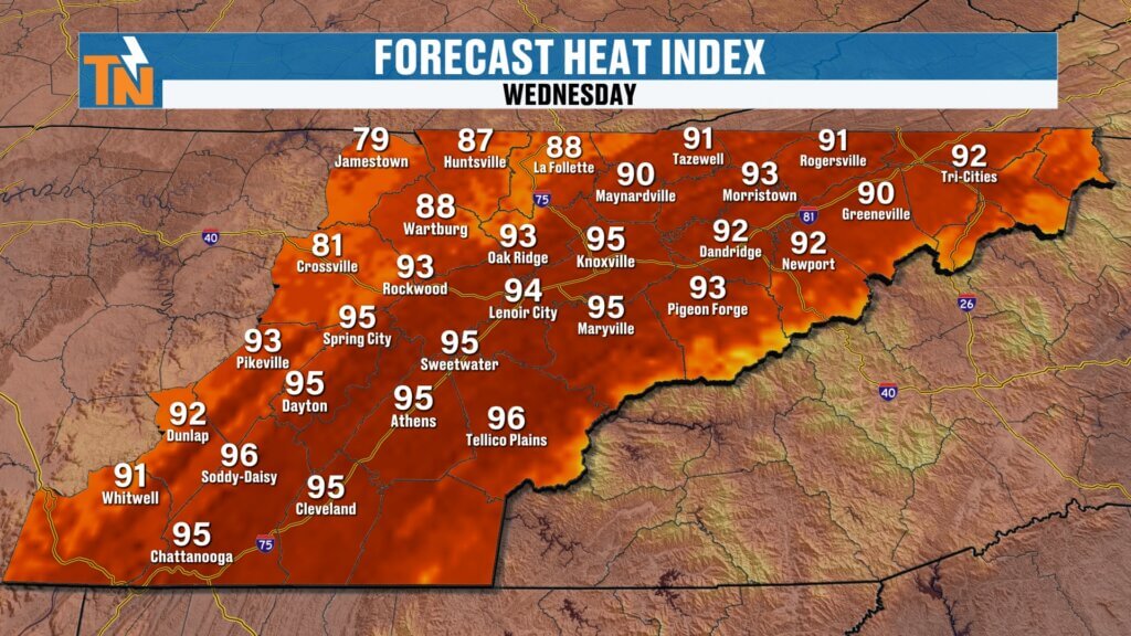
Humidity remains high, so heat index values will still reach the middle 90s during the afternoon.
It’s certainly hot, but still much more comfortable than the extreme heat we experienced last week.
Looking Ahead
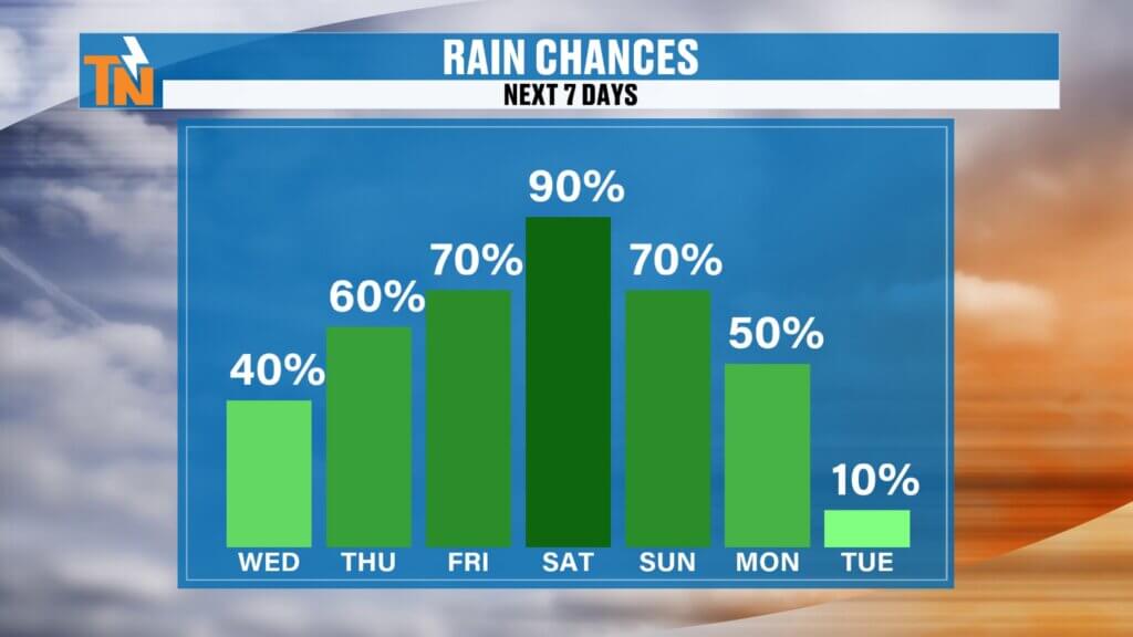
Daily storm chances continue through the remainder of the week, but confidence is increasing that Saturday could become our wettest day.
Right now, rain chances will likely need to be increased into the 80–90% range as we get closer.
We’ll continue refining that forecast over the next couple of days.
Rain Chances
- Wednesday: 40%
- Thursday: 40%
- Friday: 60%
- Saturday: Highest coverage of rain and storms
- Sunday: Scattered storms continue
- Monday: Storm chances remain elevated
Rainfall Outlook
The latest model guidance continues to indicate widespread rainfall through the weekend.
Many locations could receive 2 to 3 inches of rain, with isolated higher amounts where thunderstorms repeatedly move over the same areas.
Because of that, the flood threat doesn’t end today.
In fact, we’ll likely be watching for localized flooding each day through at least Monday.
7-Day Forecast
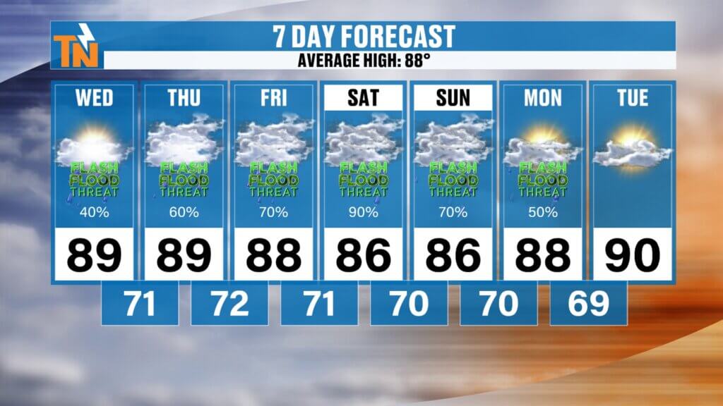
- Wednesday: High near 90°, scattered afternoon storms
- Thursday: High 89°, scattered storms
- Friday: High 88°, increasing rain chances
- Saturday: High 87°, widespread showers and thunderstorms
- Sunday: High 88°, scattered storms
- Monday: High 88°, additional afternoon storms
- Tuesday: Drier weather begins returning
Overnight lows stay in the 70s, while dew points remain in the 70s, keeping humidity levels elevated throughout the forecast period.
Drier Weather May Arrive Next Week
Looking beyond the weekend, forecast models continue to build a ridge of high pressure back across the Southeast during the middle of next week.
If that trend holds, rain chances should begin decreasing by Tuesday and Wednesday.
We’ll still have warm temperatures and high humidity, but afternoon storm coverage should become much more isolated.
Bottom Line
The overall weather pattern isn’t changing much.
Expect another typical July day featuring:
- Warm, humid conditions
- Scattered afternoon thunderstorms
- Locally heavy rainfall
- Isolated flooding concerns
The flooding threat remains with us not only today, but potentially every day through Monday as repeated rounds of slow-moving storms move across East Tennessee.
As always, keep the East Tennessee Weather App nearby to monitor interactive radar, receive weather alerts, and stay ahead of changing conditions.
Have a fantastic Wednesday, and thanks for spending part of your morning with East Tennessee Weather!