
Happy Saturday!
If you’re making plans across East Tennessee this weekend, there’s some good news.
It will not be a washout.
That said, you’ll definitely want to stay weather aware as scattered showers and thunderstorms develop both Saturday and Sunday. While many communities will stay dry for much of the day, any storm that forms could become strong and produce heavy rainfall.
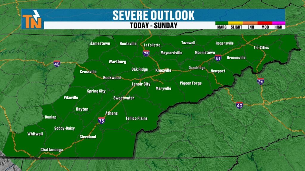
Level 1 Severe Weather Risk Today
The Storm Prediction Center has placed much of East Tennessee under a Level 1 (Marginal) Risk for severe thunderstorms today.
Most storms will remain below severe limits, but a few could produce:
- Damaging wind gusts
- Frequent cloud-to-ground lightning
- Tropical-like downpours
- Brief torrential rainfall
As always during the summer months, storm coverage will be scattered. Some neighborhoods may receive heavy rain while others don’t see a drop.
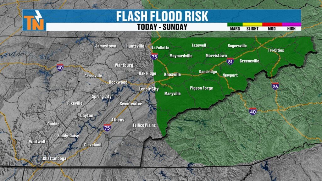
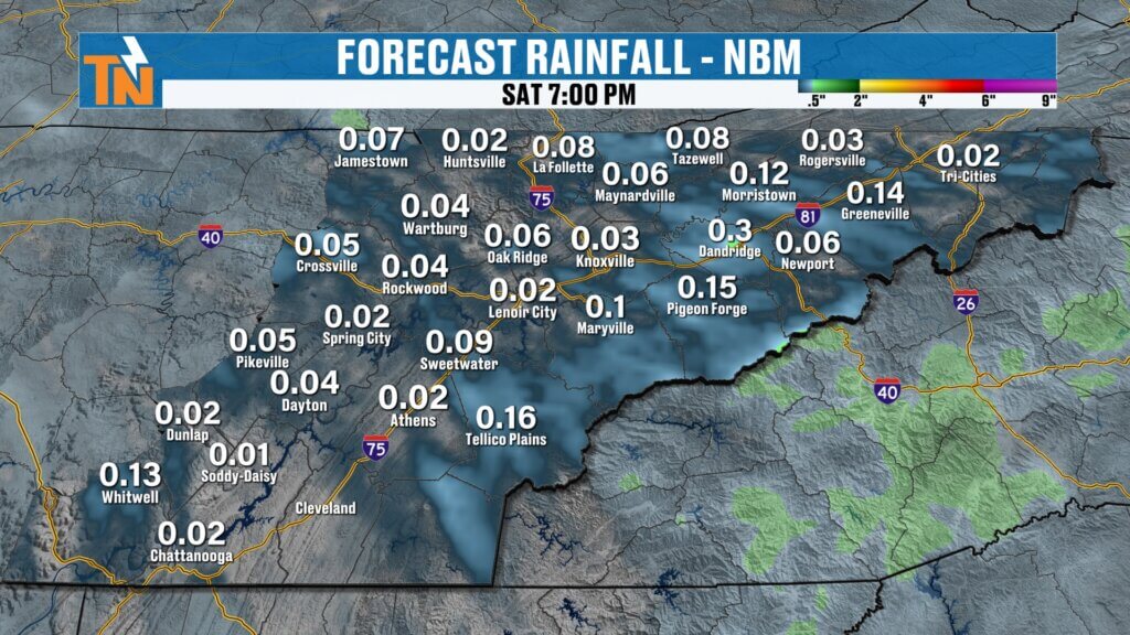
Flooding Concerns Continue
One of the biggest concerns this weekend isn’t necessarily severe weather—it’s the potential for localized flooding.
Many parts of East Tennessee have already received several inches of rain over the past week. If another slow-moving thunderstorm develops over one of those same locations, water can accumulate quickly.
Flooding concerns will be highest in areas that have repeatedly received heavy rainfall over the last several days.
If you encounter a flooded roadway, remember:
Turn Around, Don’t Drown.
Flooding can develop much faster than many people realize.
Another Round of Storms Arrives Sunday
Sunday brings another cold front into the Tennessee Valley.
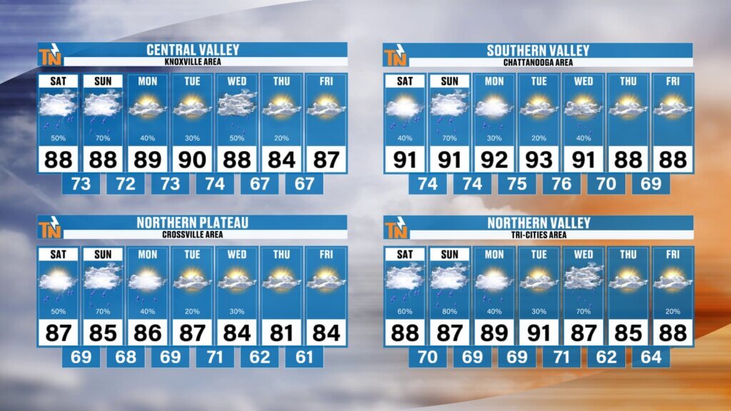
As the front moves through, it will trigger another round of scattered afternoon and evening showers and thunderstorms.
Once again, this won’t be an all-day rain event, but any storm that develops will have the potential to become briefly strong while producing locally heavy rainfall and gusty winds.
If you have outdoor plans this weekend, don’t cancel them—just have a way to monitor the weather and be prepared to make adjustments if storms develop nearby.
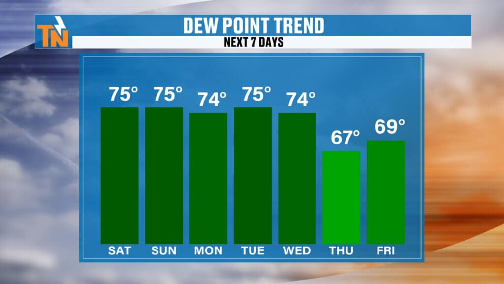
Relief From the Humidity Is Finally in Sight
We’ve all been talking about just how muggy it’s been lately.
It’s been the kind of “air you can wear.”
The good news is that relief is finally showing up in the forecast.
Another cold front arrives around Wednesday, and this one looks much more promising than the recent systems.
Behind the front, we’ll finally begin seeing:
- Lower humidity
- Falling dew points
- More comfortable mornings
- Less oppressive afternoons
Temperatures will still be warm—after all, it is July—but the air should feel noticeably more comfortable by the second half of next week.
Weekend Outlook
Here’s what to expect:
- Scattered afternoon and evening thunderstorms Saturday and Sunday
- A Level 1 severe weather risk with isolated strong storms
- Localized flooding possible where heavy rain falls repeatedly
- Hot and humid conditions with tropical-like air
- Improving comfort levels beginning around Wednesday
Bottom Line
The weekend won’t be a washout, but it won’t be completely dry either.
Plan on dodging a few afternoon thunderstorms, especially during the hottest part of the day. Any storm that develops could produce heavy rainfall, frequent lightning, gusty winds, and isolated damaging wind gusts.
Keep the free eastTNweather app nearby so you can monitor interactive radar, receive lightning alerts, and stay ahead of any storms that develop.
Enjoy your weekend, stay weather aware, and we’ll continue to keep you updated with the latest forecast across all eastTNweather platforms.