Good morning and happy Thursday, everyone!
High pressure is in control today, settling in behind yesterday’s cold front and bringing us abundant sunshine across East Tennessee. Enjoy it while it lasts — because we’ve got another cold front on the way, and this one will pack more of a punch.


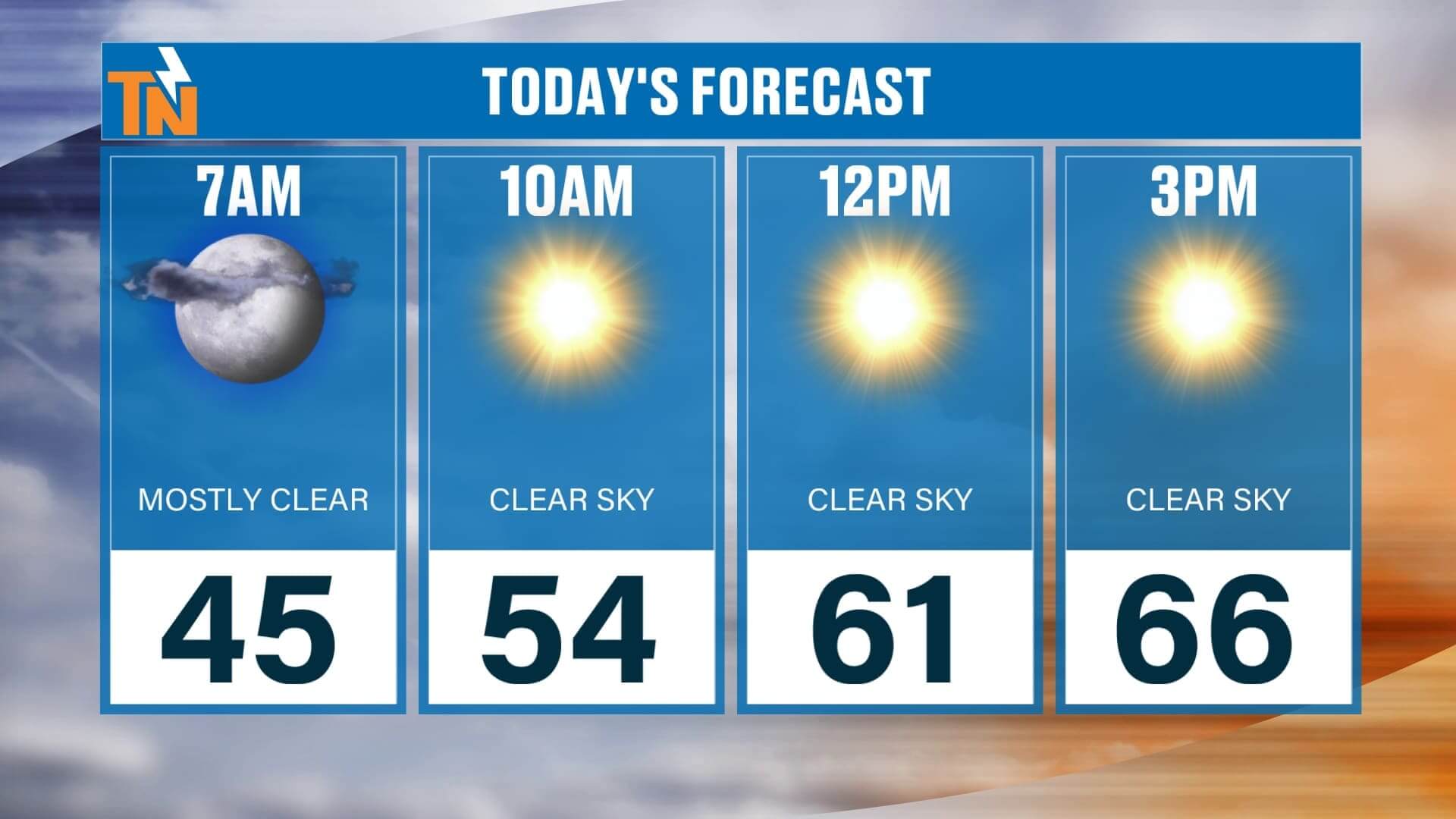

We start the morning in the 40s, warming nicely through the afternoon with highs in the mid to upper 60s — right on track for early November. It’ll be a gorgeous, crisp fall day with light winds and a clear sky. This evening, temperatures fall quickly after sunset — 58° around dinner time, 53° by bedtime — so you’ll definitely want a jacket if you’re out late.


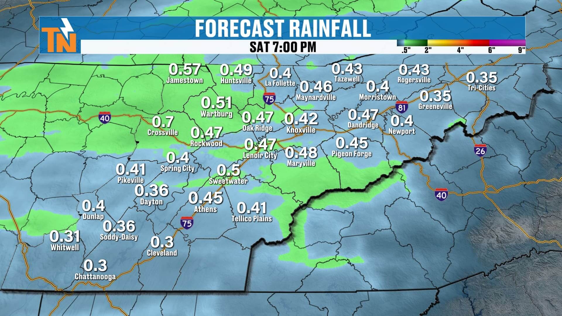
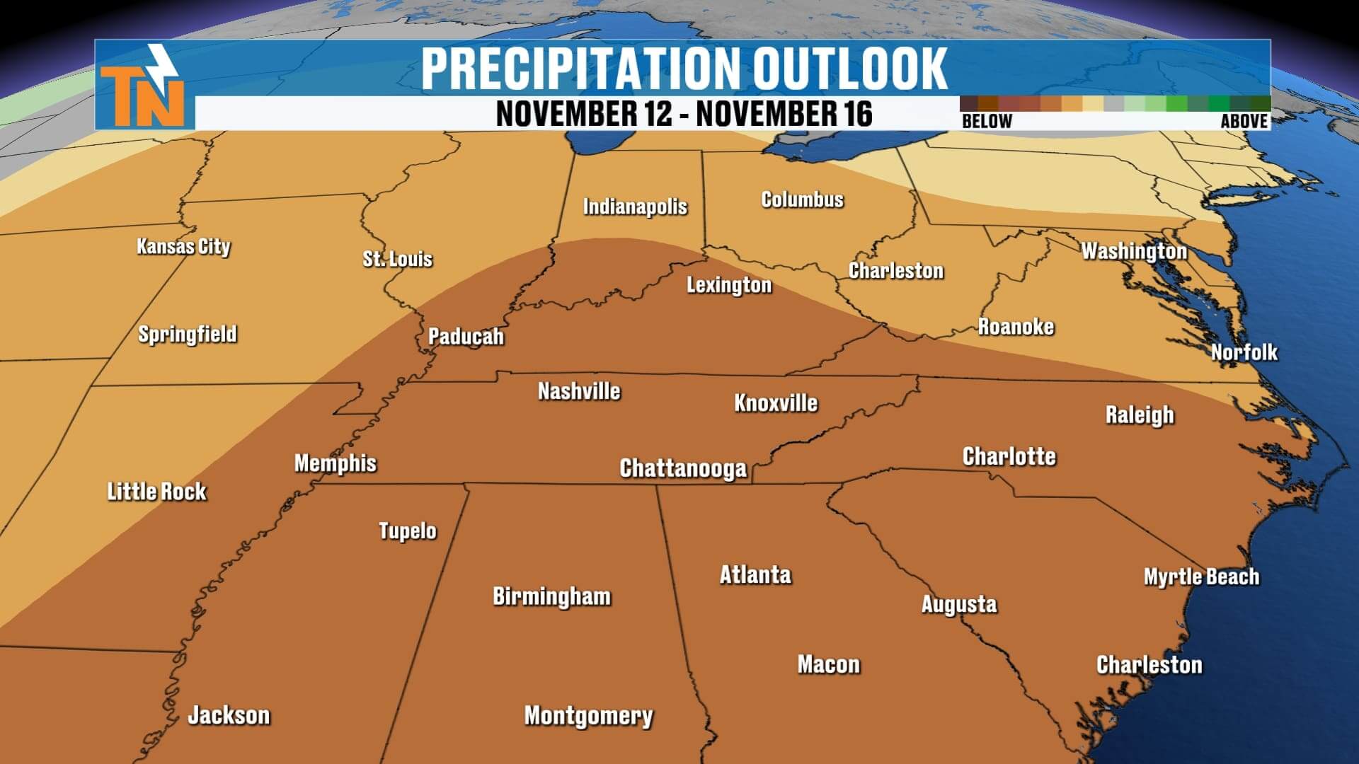
Now, let’s talk about what’s ahead. Our next cold front is approaching from the Pacific Northwest and the Intermountain West. That system will bring showers and isolated thunderstorms Friday evening into early Saturday morning.
The Storm Prediction Center has placed East Tennessee under a Level 1 (Marginal) Risk for isolated strong to severe storms Friday into early Saturday. The main threats will be damaging winds and pea-size hail, primarily along the Cumberland Plateau and northern valley.
Here’s the breakdown:
-
Friday Morning–Afternoon: Increasing clouds, breezy, and mild.
-
Friday Evening (5–9 p.m.): Storms develop across the Plateau, spreading into the Valley.
-
Late Friday Night–Early Saturday: Heavier rain and isolated strong storms possible.
-
Saturday: Clouds linger with a few spotty showers, but most of the day looks dry.
Rainfall totals should range from a quarter to a half inch, with some locally higher amounts.
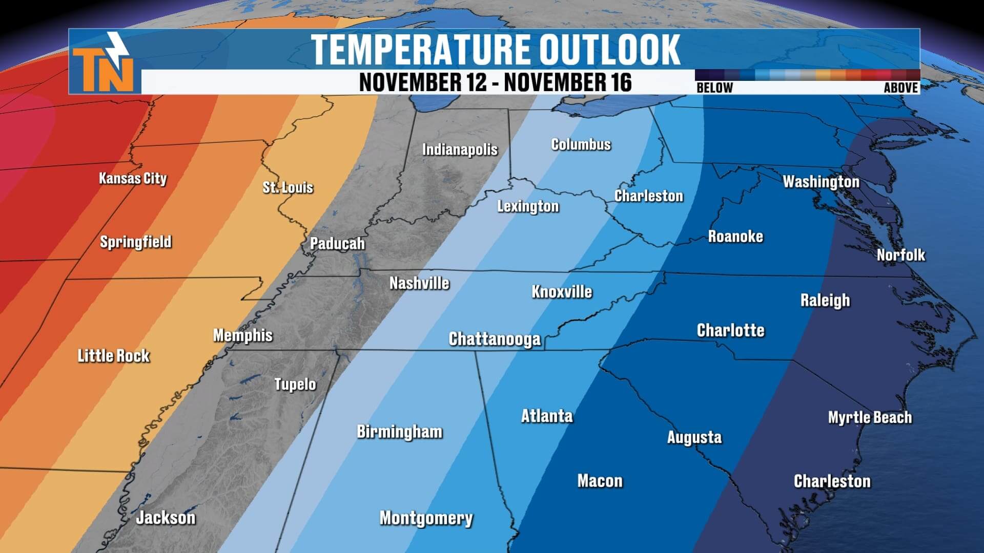
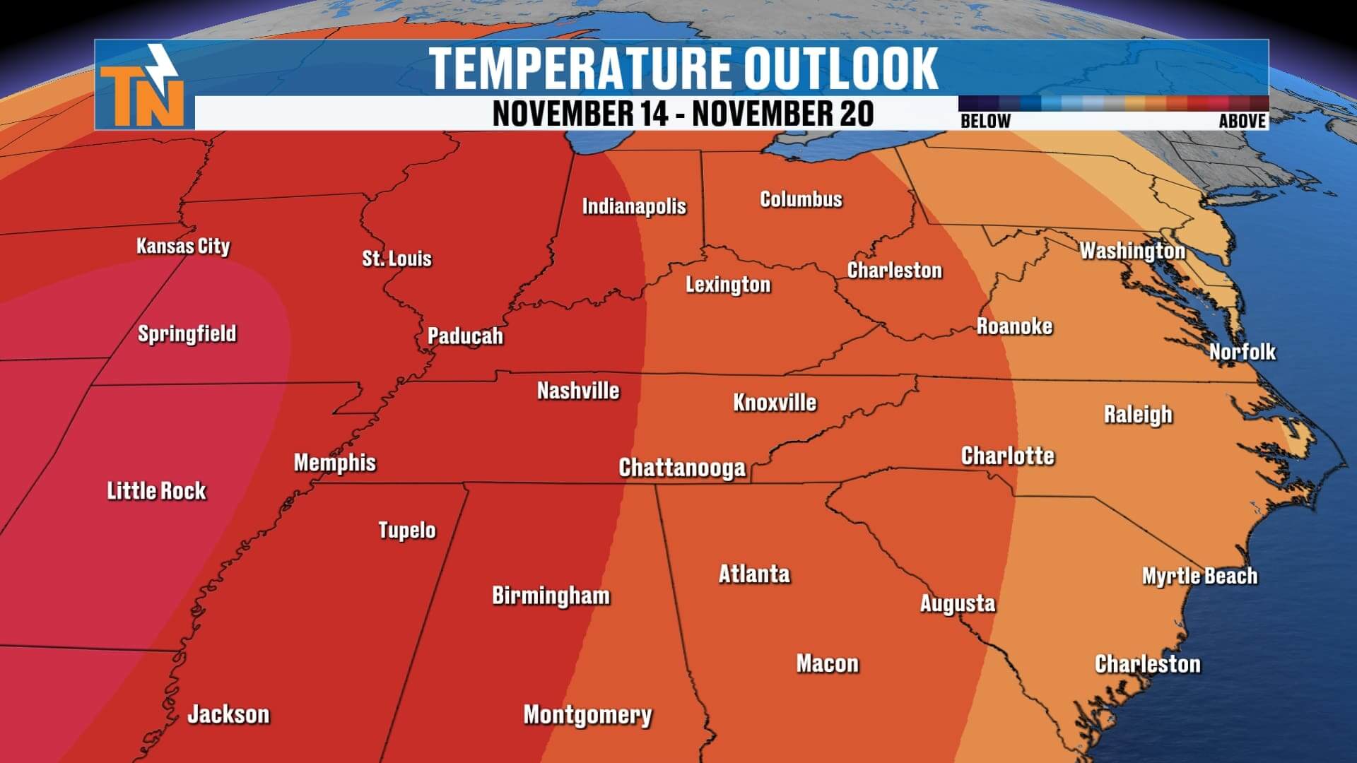
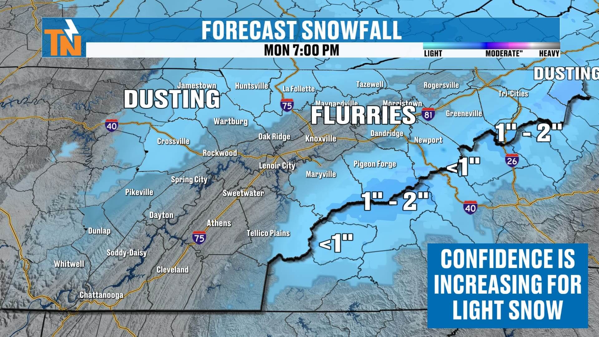
Behind this system comes a strong trough of Canadian air, dropping in Sunday and bringing a reinforced shot of cold air — along with a chance for light snow showers.
Here’s what to expect:
-
Sunday: Falling temperatures through the afternoon, cold northwest winds.
-
Sunday Night–Monday Morning: Light snow showers possible, mainly across the northern Plateau and Smokies.
-
Plateau: A dusting possible on cars and grassy surfaces.
-
Valley: Flurries possible, little to no accumulation.
-
Smokies: 1–2 inches possible on the highest peaks.
-
Now for your 7-day forecast:
-
Thursday: Sunny and pleasant, high 67°.
-
Friday: Increasing clouds, evening rain and storms, high 70°.
-
Saturday: Early showers, partly cloudy later, high 65°.
-
Sunday: Colder with rain changing to snow showers late, high 50°.
-
Monday: Much colder, highs in the 40s, hard freeze likely Monday and Tuesday morning.
-
Tuesday–Wednesday: Widespread frost and chilly mornings with highs rebounding to the 50s.
A true pattern change is on the way — from sunshine and warmth to our first taste of winter by early next week.
If you want a quick, one-minute weather update, check out Witcher’s One Minute Weather on the East Tennessee Weather App — it’s 100% free in your app store.
Have a great Thursday!