
Good morning, East Tennessee! Happy Friday, and thanks for starting your day with your all-digital local weather update from eastTNweather. I’ve been tracking a few big changes for our region—everything from a cold front bringing weekend showers to a refreshing taste of fall air arriving next week. Here’s your detailed breakdown.
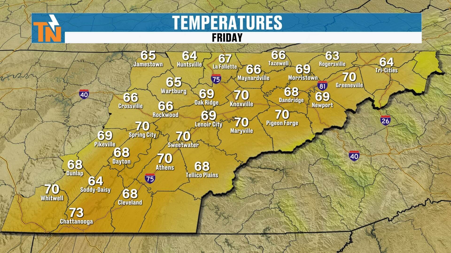
A Comfortabel Start Friday Morning
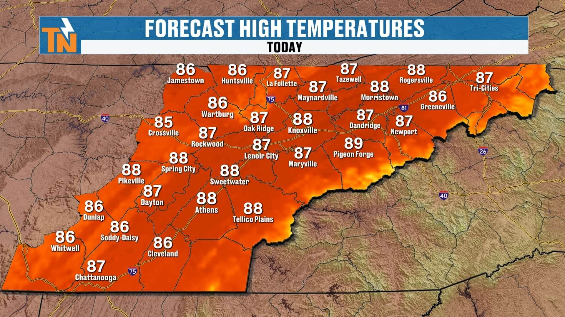
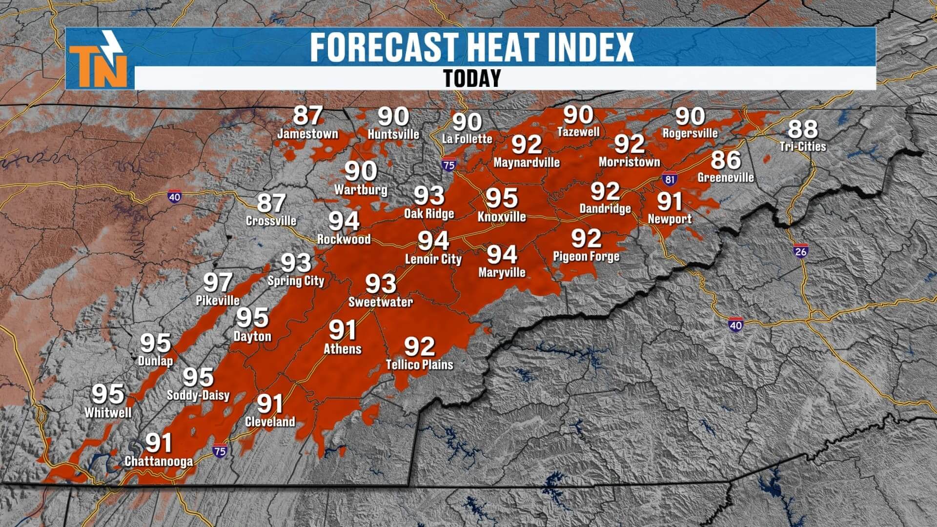
We’re kicking off the day with clear skies and morning temperatures in the 60s and 70s across the Tennessee Valley, Smokies, and Tri-Cities. It feels good outside now, but keep in mind humidity levels remain on the higher side. This afternoon will turn warm and muggy, with highs in the mid to upper 80s. When you factor in humidity, it will feel more like the low to mid-90s.
Friday Forecast: Warm, Muggy, and a Few Storms
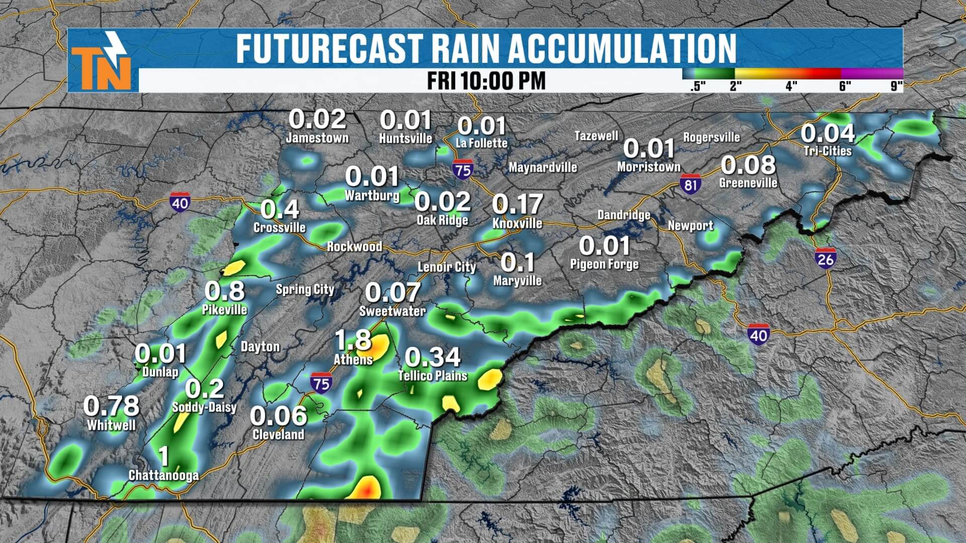
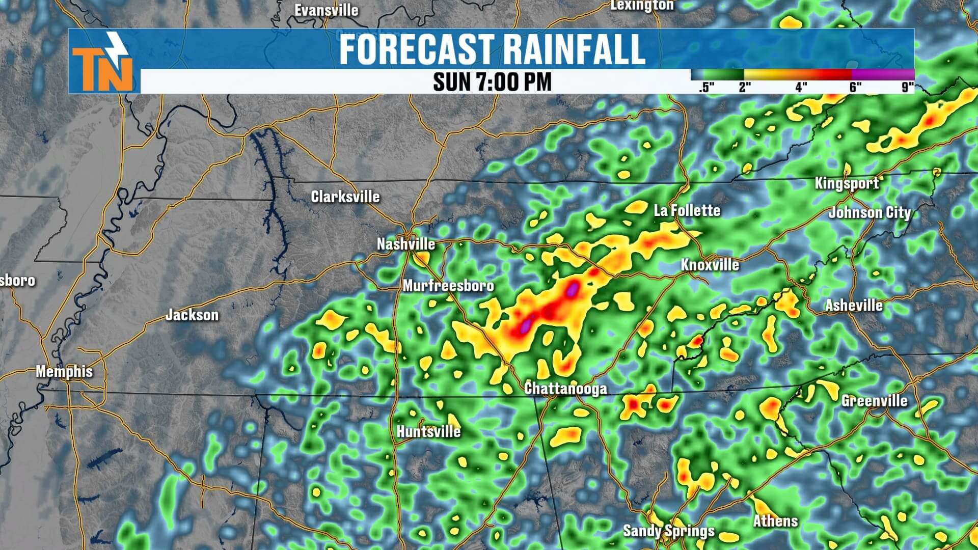
A small wave of energy will spark scattered showers and thunderstorms today, especially south of I-40 where moisture is more abundant. The southern valley and southern Appalachian mountains will see the best chance for rainfall, along with localized flash flooding in spots.
High school football fans: Kickoff temperatures will be near 85° at 6 PM, sliding down to a comfortable 76° by 10 PM. While most games should be fine, keep an eye on our interactive radar in the eastTNweather app for any pop-up storms.

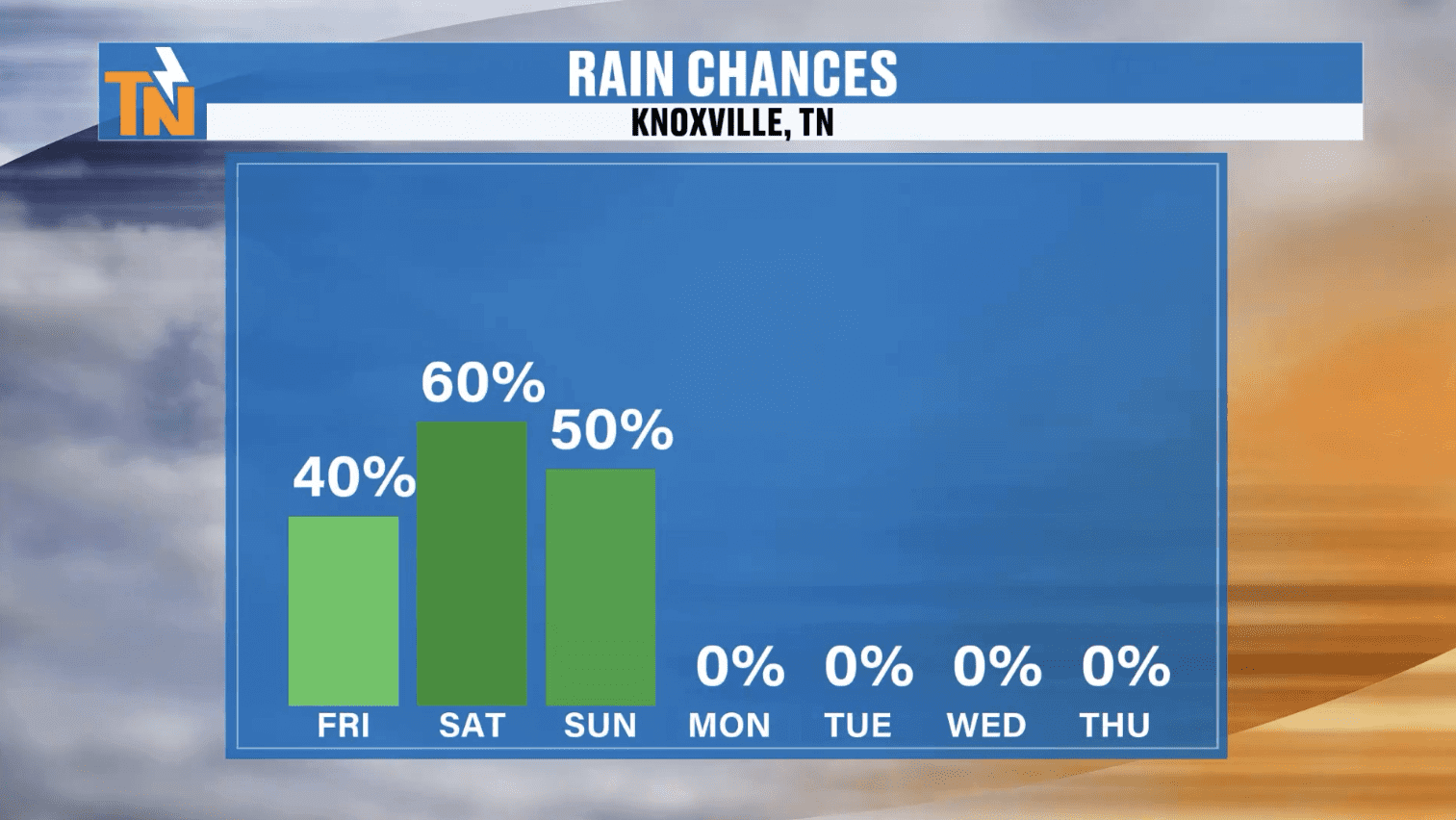
Saturday & Sunday: Elevated Rain Chances
Our next cold front arrives Saturday into Sunday, bringing an uptick in rain and storm coverage.
-
Saturday: Highs in the mid-80s, with scattered showers and thunderstorms. Not everyone will see rain, but if you do, it could come with gusty winds and localized heavy downpours.
-
Sunday: More showers possible, but highs dip again into the low to mid-80s. This is the start of a cooler and drier trend.
A Taste of Fall Next Week
Here’s the part I know you’ll love: fall-like air is on the way!
-
Monday: Highs in the low 80s.
-
Tuesday–Thursday: Temperatures settle into the upper 70s to near 80, with low humidity. Morning lows will dip into the 50s and low 60s—perfect for that first hint of autumn across East Tennessee.
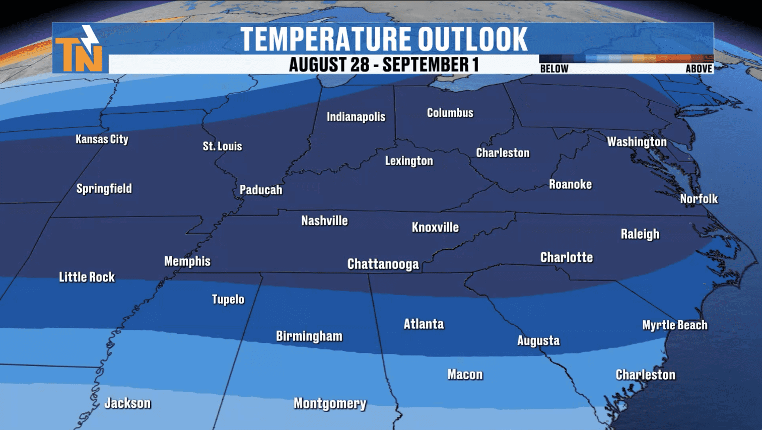
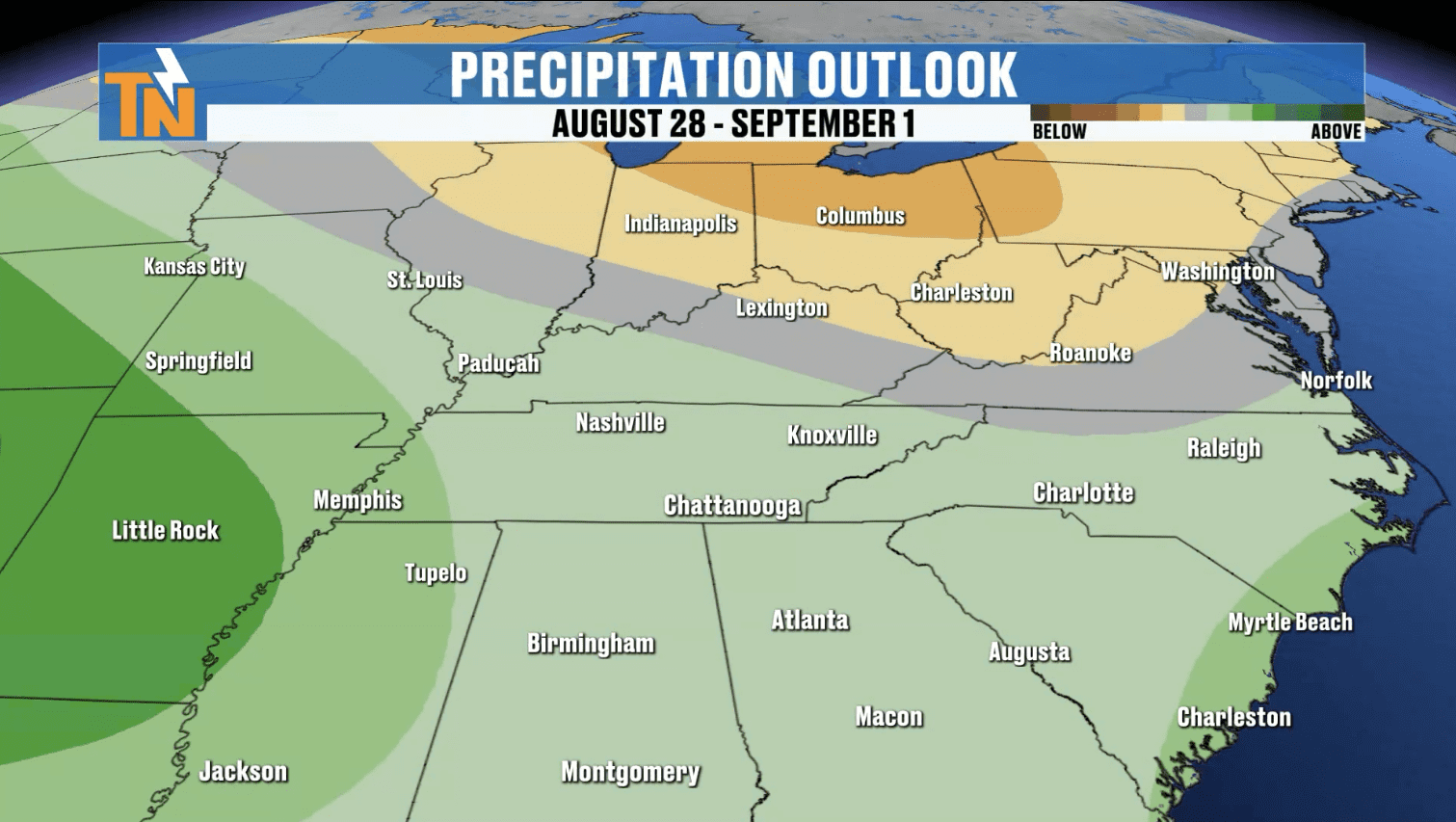
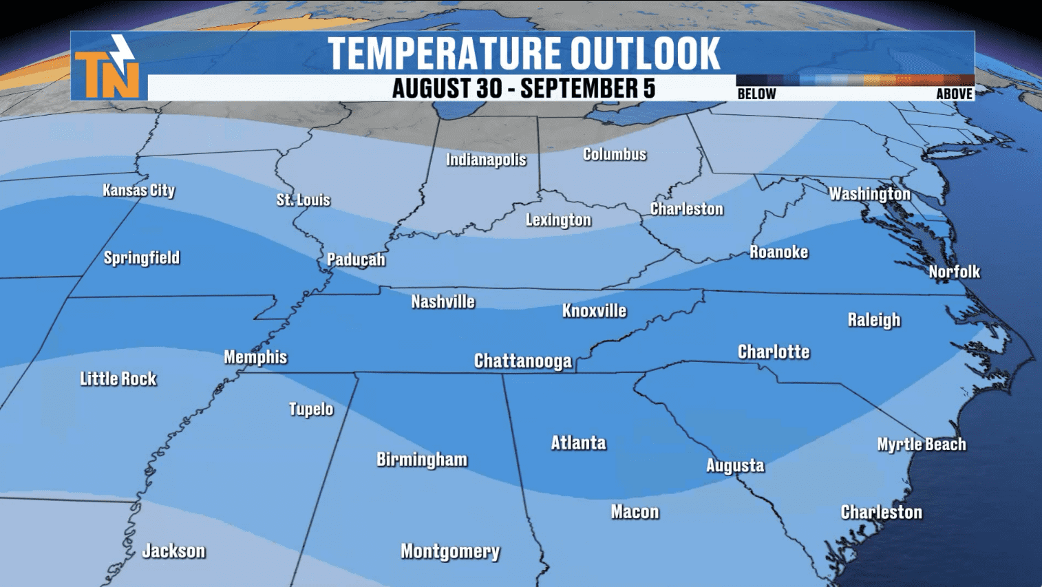
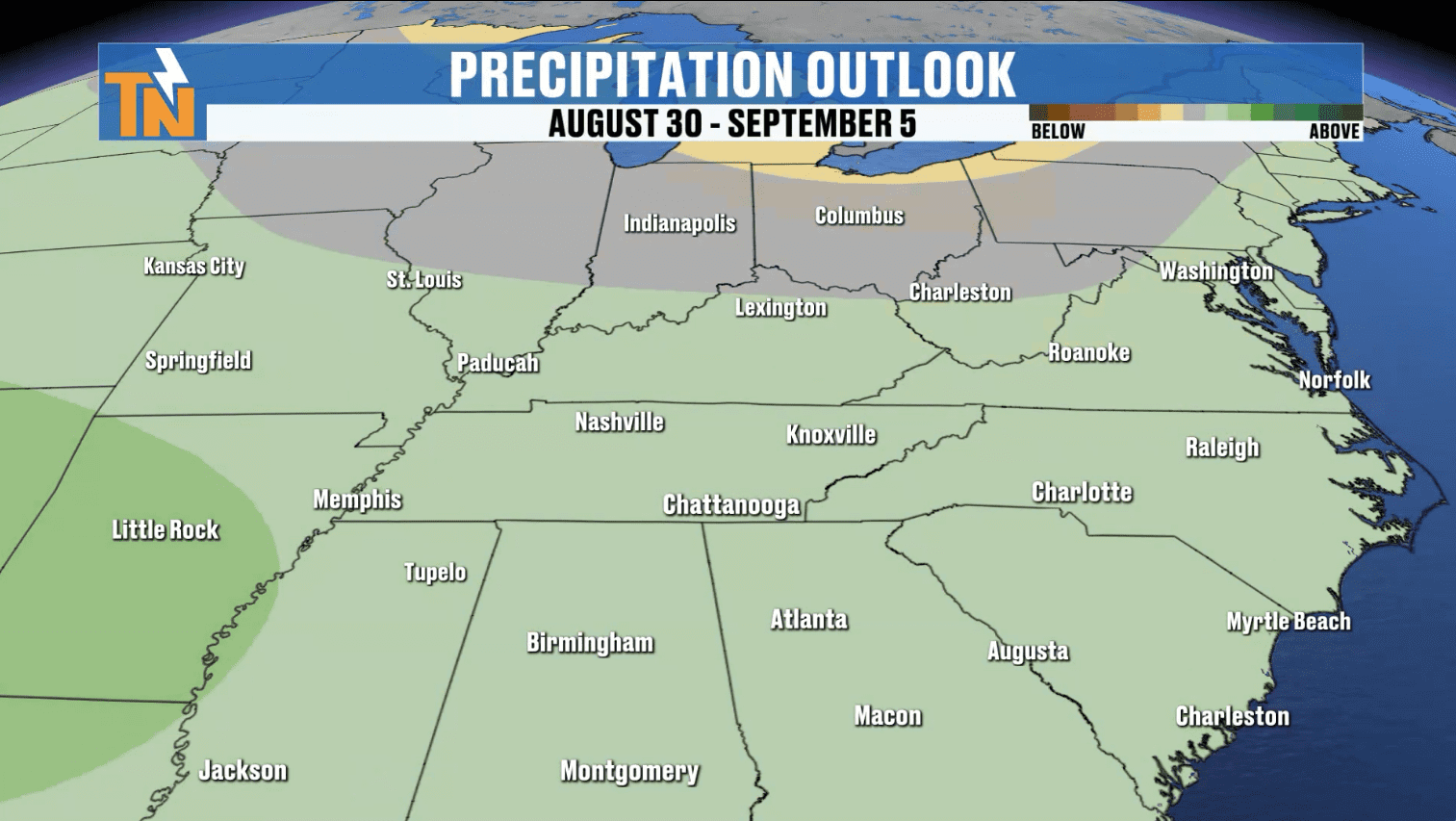
The Climate Prediction Center outlook suggests this trend could last into the first week of September, meaning a break from the heat just as we close out summer.
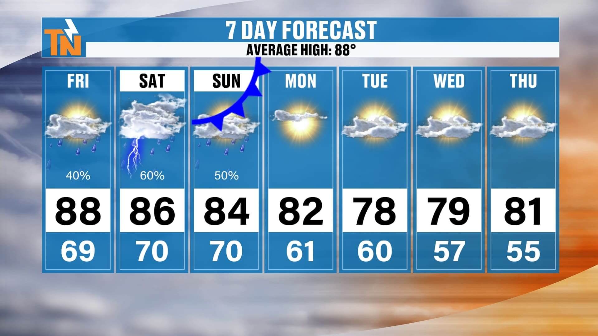
East Tennessee 7-Day Forecast
-
Friday: Highs mid-upper 80s, scattered PM storms (mainly south of I-40).
-
Saturday: Mid 80s, scattered storms, locally heavy rain possible.
-
Sunday: Low-mid 80s, a few showers.
-
Monday: Low 80s, drier air moves in.
-
Tuesday–Thursday: Upper 70s to near 80, low humidity, fall-like mornings.
-
Friday: Seasonal temps, pattern continues.
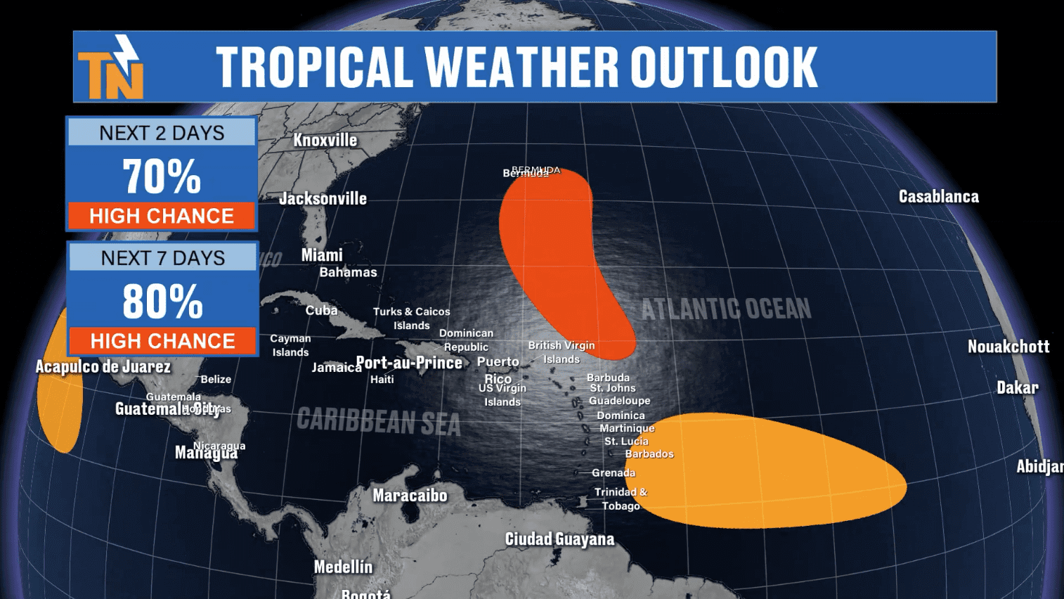
Tropics are Heating Up: Hurricane Erin and More on the Way
While we enjoy our taste of fall here at home, the Atlantic hurricane season is ramping up.
-
Hurricane Aaron is moving into the open Atlantic, stirring up rough surf and dangerous rip currents along the East Coast.
-
Another disturbance has a 70–80% chance of development, which could become Tropical Storm Ferdinand.
-
Additional tropical waves are emerging near the Lesser Antilles, signaling an active stretch ahead.
Stay weather aware if you have travel plans along the coast.
ABOVE AND BEYOND THE 7 DAY FORECAST
Final Thoughts from Your Local Meteorologist.
East Tennessee, enjoy this last taste of summer warmth today before our cold front delivers cooler, drier air next week. Be mindful of localized flooding in the southern mountains this weekend, and of course, keep our interactive radar handy on the free eastTNweather app for real-time updates, lightning alerts, and severe weather coverage.
Thanks for trusting me, Mike Witcher, and eastTNweather—your all-digital, always-on source for East Tennessee weather.
Download the eastTNweather app today for free to stay ahead of changing conditions with interactive radar, live severe weather coverage, push alerts, and daily forecast updates.