
Good morning and Happy Monday.
Thanks for checking in with your East Tennessee weather update. After a warm weekend that brought highs into the mid 80s—just shy of record levels—we’re starting to see a shift in the pattern as a cold front moves through the region this morning.
Cold Front Moving Through This Morning
That cold front is already working its way across East Tennessee early today.
- A few light showers are possible, mainly to our north and northwest
- Best chance for any measurable rain will be across the mountains
- Most valley locations will just see a sprinkle, if anything
This system is losing its punch as it moves in, so rainfall will be very limited.
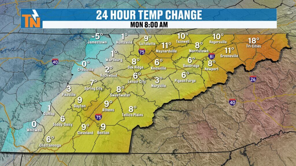
Temperatures Fall Throughout the Day
One of the more noticeable changes today will be temperatures.
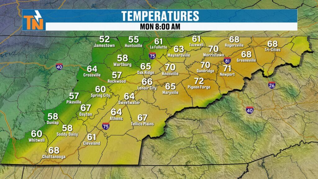
- Morning starts mild in the 60s and even low 70s
- This will be the warmest part of the day
- Temperatures fall into the upper 50s and low 60s by midday
- Afternoon stays steady or slightly cooler
It’s a different feel compared to the weekend warmth.
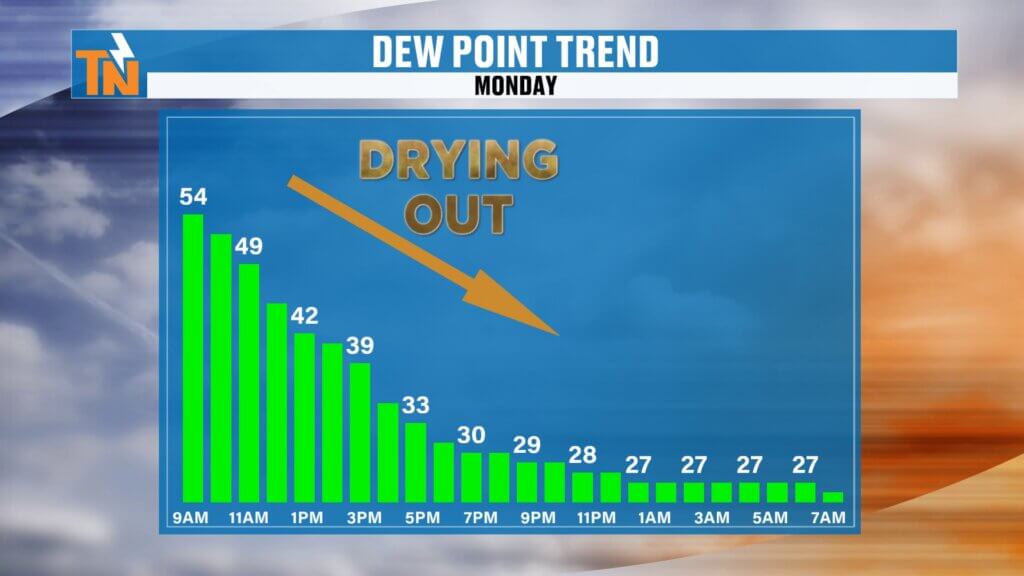
Breezy and Cooler with Clearing Skies
As the front moves through, winds will shift out of the north.
- Breezy conditions develop through the day
- Drier air filters in behind the front
- Skies turn partly to mostly sunny by afternoon
Kids heading home from school will notice a much cooler and more refreshing feel.
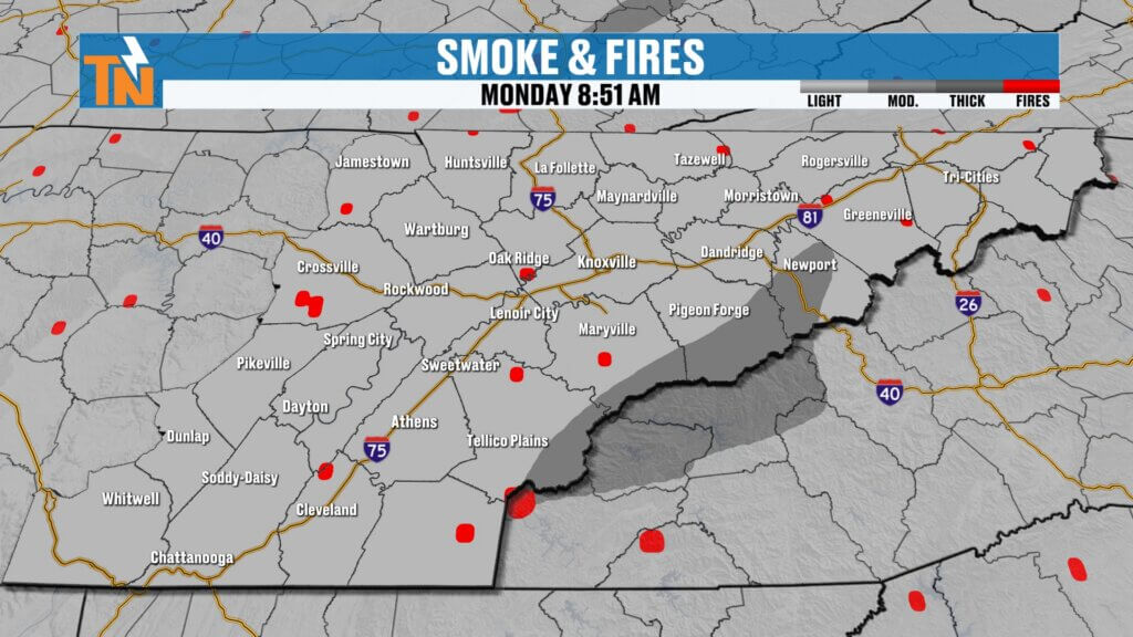
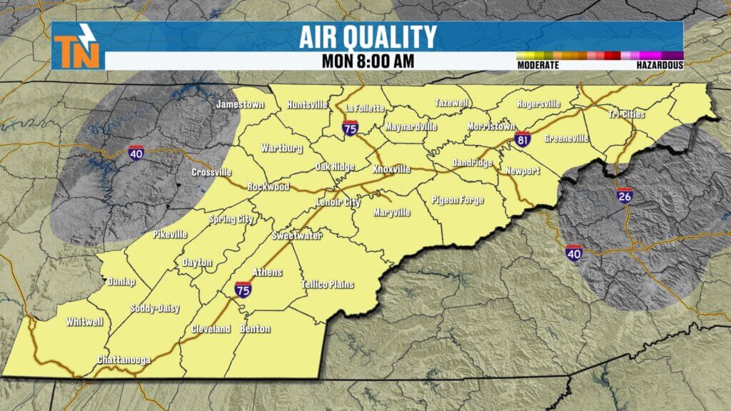
Smoke and Haze Clearing Out
One of the biggest benefits of this cold front is improved air quality.
- Northerly winds will push smoke and haze out of the region
- Air quality improves through the day
- Some localized smoke may linger near active fires
Overall, expect clearer skies and better visibility by this afternoon.

Dry Pattern Continues This Week
This front doesn’t bring much rain—and neither does the next one.
- High pressure builds in Tuesday through Thursday
- Dry, stable weather dominates
- Temperatures remain near seasonal averages
Expect quiet and comfortable conditions for much of the week.
Next System Arrives Late Week
Another cold front is set to arrive Friday night into Saturday.
- Limited moisture with this system as well
- Only light rain chances expected
- No severe weather concerns
These systems continue to be moisture-starved, keeping rainfall totals low.This dry pattern will stick around through Tuesday and most of Wednesday.
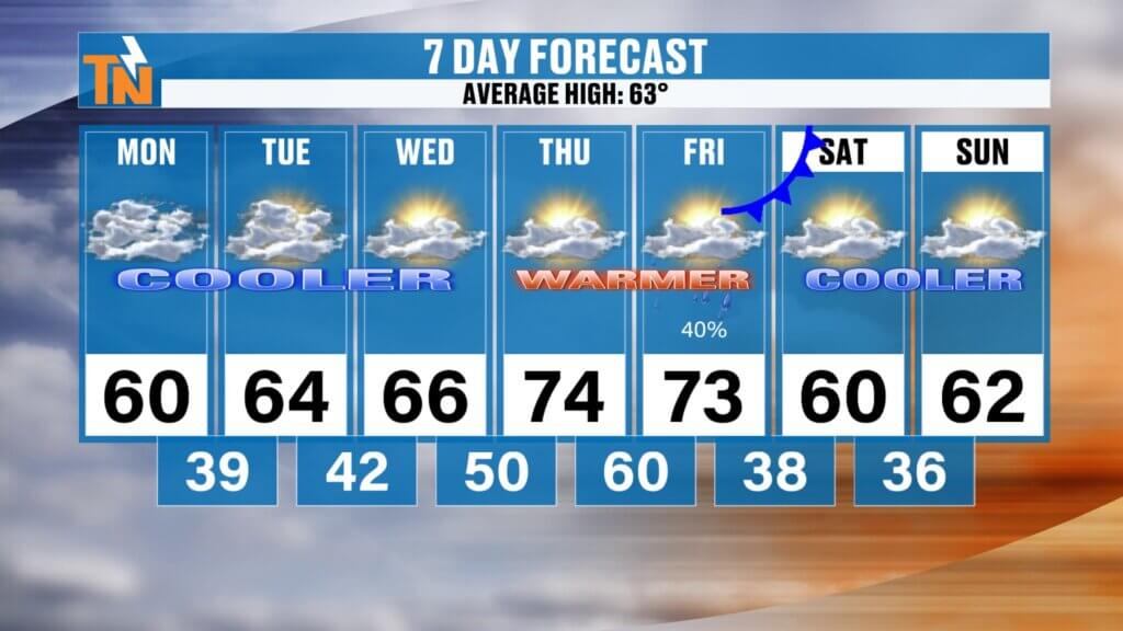
7-Day East Tennessee Outlook
- Monday: Cooler, breezy, highs in the 50s and 60s
- Tuesday: Seasonable with sunshine
- Wednesday: Continued mild and dry
- Thursday: Warmer, back into the 70s
- Friday: Warm with increasing clouds
- Saturday: Slight chance of light rain, cooler
- Sunday: Dry and cooler, highs in the 50s and 60s
Final Thoughts
After a near-record warm weekend, cooler and drier air is settling in across East Tennessee today. The cold front brings a refreshing change, clearing out smoke and dropping temperatures back to more seasonal levels.
Rain chances remain low this week, and while temperatures will bounce around a bit, there are no major weather threats on the horizon.
Have a great Monday, and we’ll keep you updated as the week unfolds.

Community Event Spotlight
Next Saturday, come out and join us at Timber Creek Landscape Supply in Powell (off Emery Road) from 10 AM to 2 PM.
- Meet and greet with me
- TK’s Gourmet Food Wagon
- Tiki’s Shaved Ice
- Spend $60 or more and get a free lunch
We’ll have the East Tennessee Weather tent set up—come hang out and kick off spring with us.