Good morning and happy Sunday, everyone!
We’ve got some light rain showers around the area this morning as a weak upper-level disturbance swings through the region. Roads are wet across much of East Tennessee, especially west of Knoxville, and if you’re traveling along Interstate 40 toward the Plateau, you’ll definitely run into those showers.
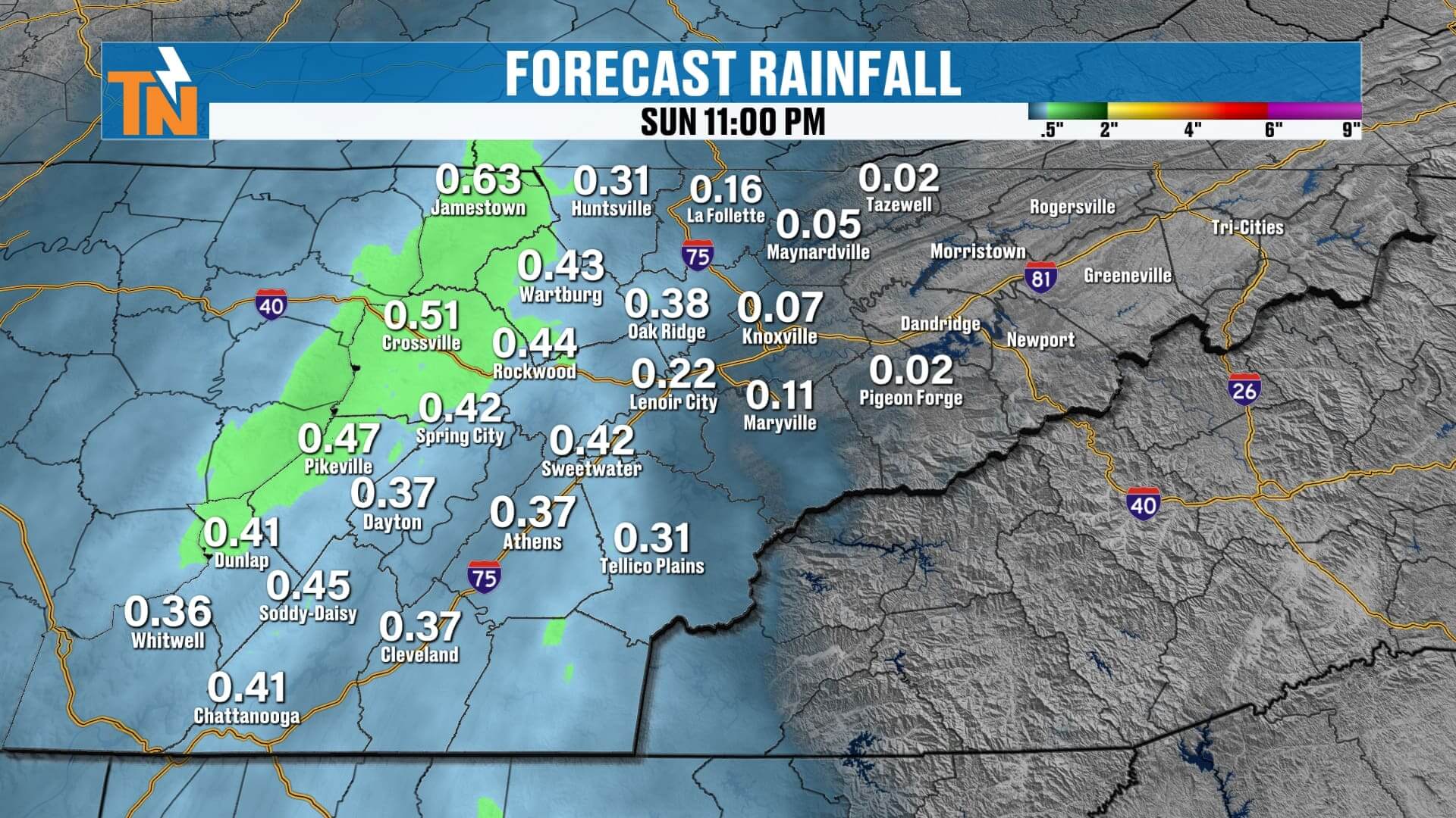
The good news — most of this morning’s rain will fade by late morning or early afternoon. However, as the low-pressure system gets a little closer, a few pop-up showers and even isolated thunderstorms could develop this afternoon. A few of these may produce some small, pea-size hail, thanks to colder air higher up in the atmosphere.
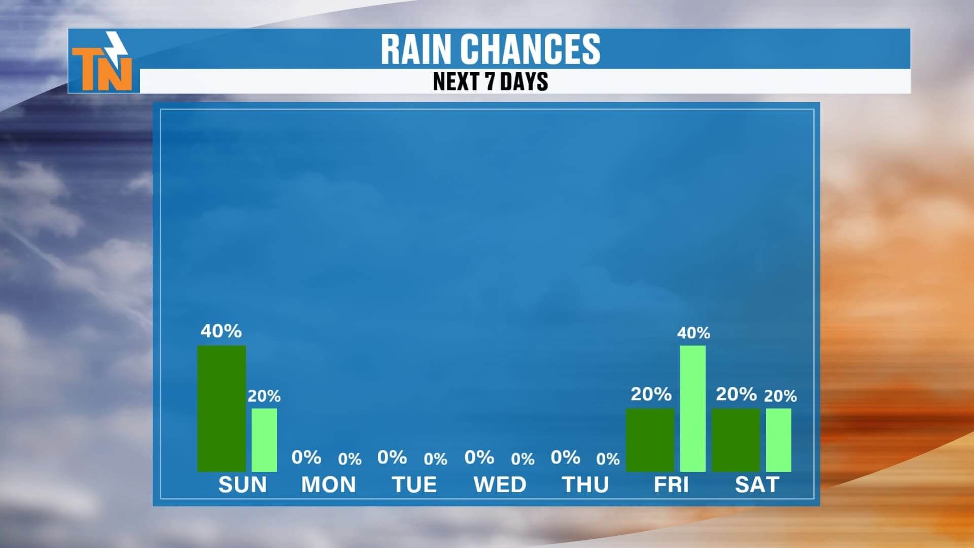
Rain chances will linger through the early evening, mainly across the Cumberland Plateau, including Morgan, Scott, Fentress, and Cumberland Counties. Farther east — Knoxville, the Foothills, and the Tri-Cities — rainfall will be more limited, and many areas may see very little measurable rain before it’s all said and done.
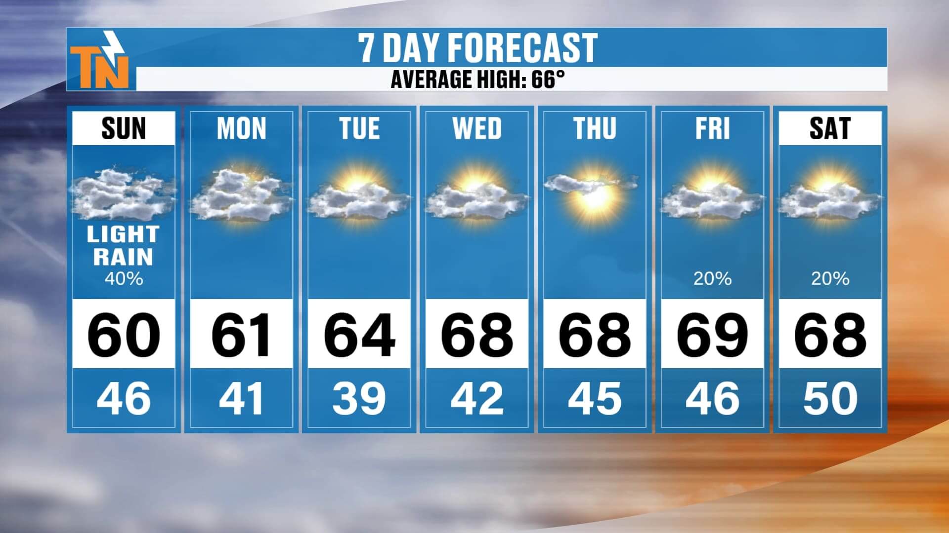
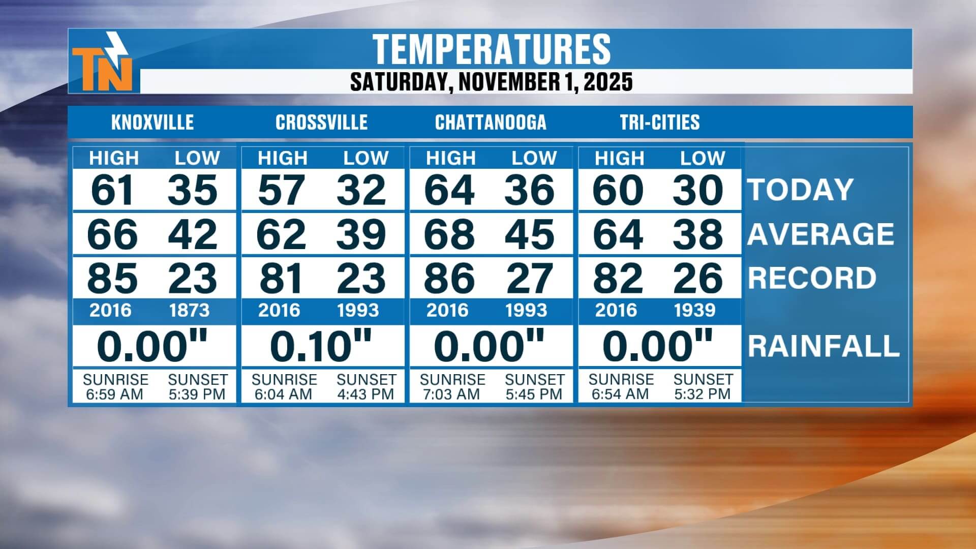
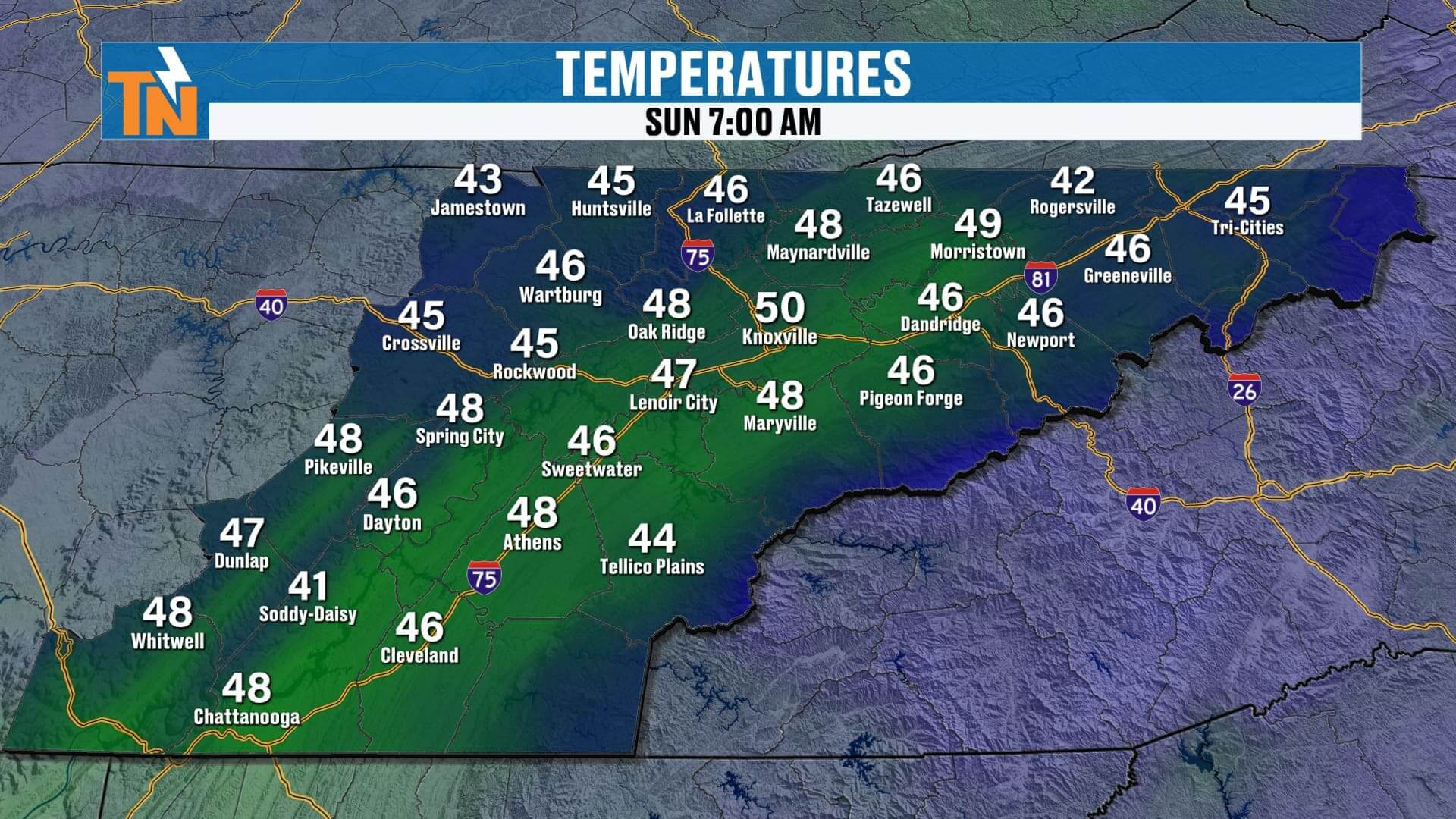
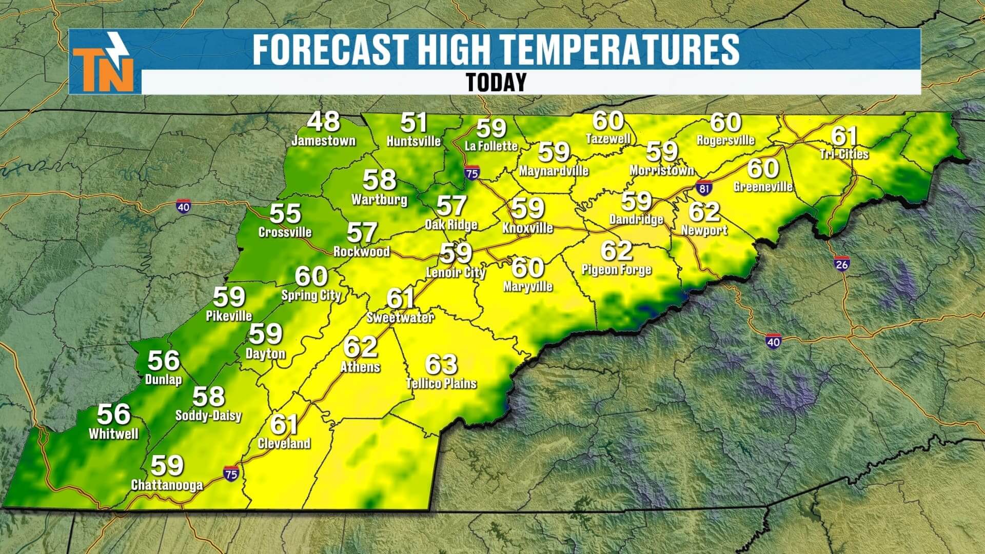
We start this Sunday morning in the 40s, so it’s mild but seasonably cool. Afternoon highs will climb into the upper 50s and low 60s. The Plateau and northern counties will stay a bit cooler due to thicker clouds and better rain coverage, while the Valley warms a bit more with some breaks of sun.
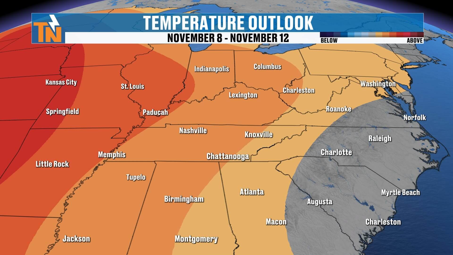
Once this system moves out tonight, we’re setting up for a beautiful stretch of dry and quiet weather through much of the upcoming week. High pressure builds in, bringing plenty of sunshine and a warming trend. By mid to late week, highs will push into the upper 60s to near 70°, a few degrees above average for early November.
Looking ahead:
-
Sunday: Scattered light rain, a few isolated storms with small hail possible. High near 60°.
-
Monday–Thursday: Dry, sunny, and warmer. Highs in the upper 60s to low 70s.
-
Friday–Saturday: A weak disturbance may bring a few light showers, but totals will stay low.
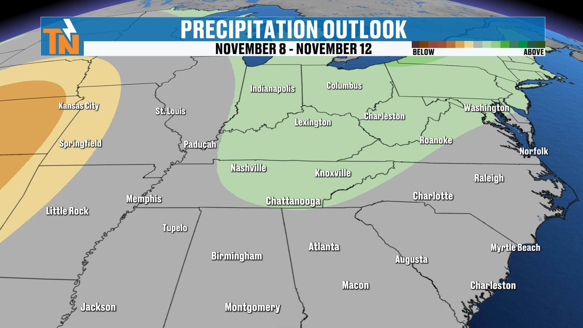
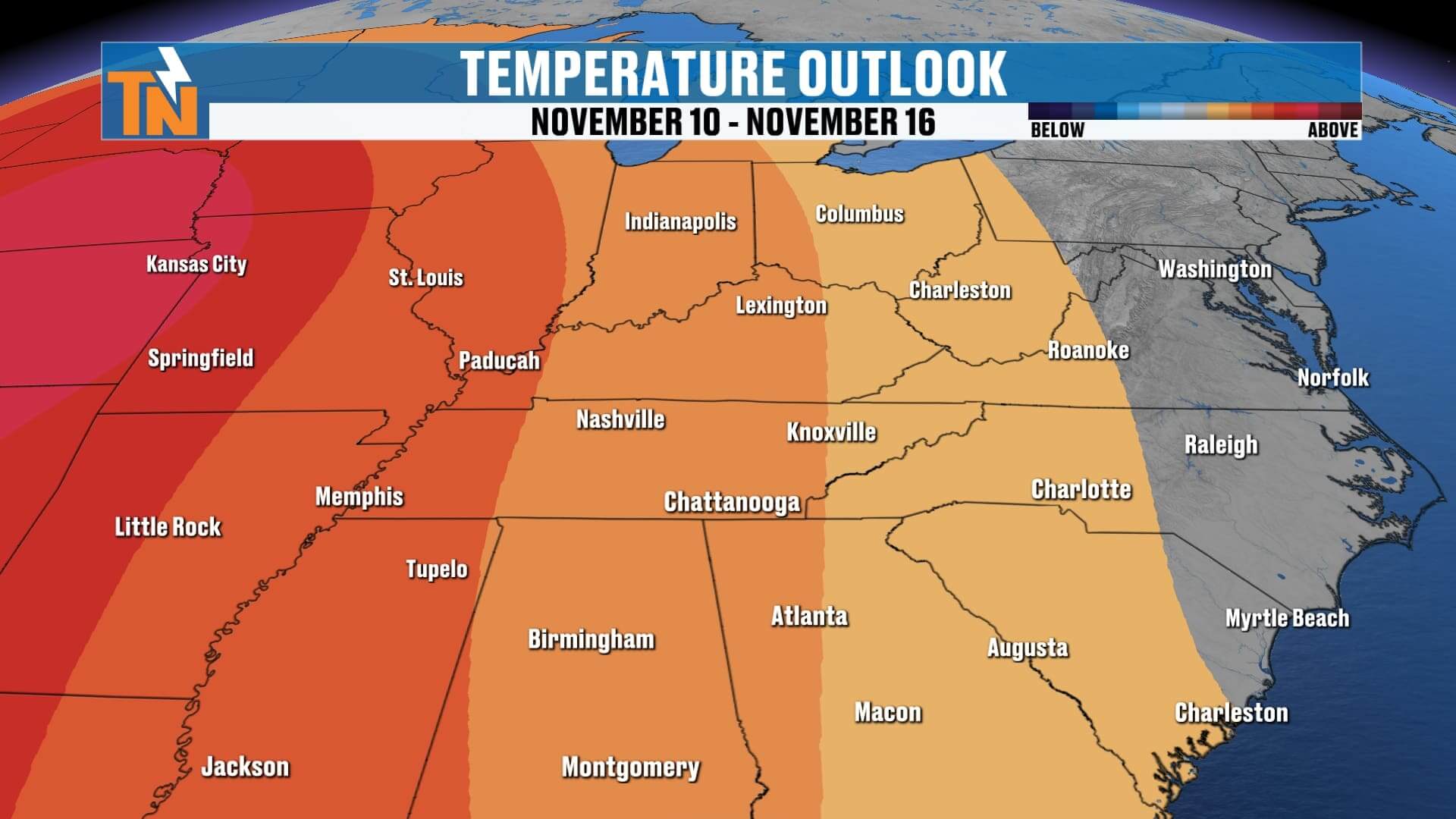
Overall, the Climate Prediction Center continues to show above-average temperatures and below-average rainfall across East Tennessee through mid-November — meaning a pleasant, mild pattern continues.
Thanks for checking in with your local forecast! And if you ever just want a quick weather update, check out Witcher’s One Minute Weather on the East Tennessee Weather App — available anytime, seven days a week.
Have a great Sunday, everyone!