
Good morning and Happy Saturday.
Thanks for checking in. We’ve got a quiet and pleasant day ahead, but there are a couple of important things to watch—especially fire danger today and a shift toward wetter weather next week.
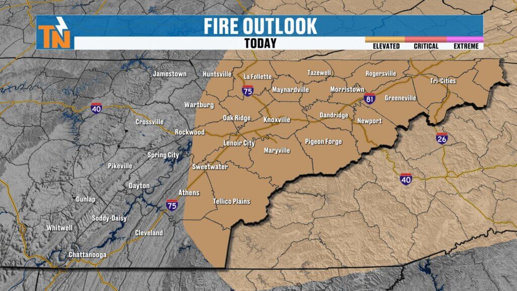
Dry Air and Elevated Fire Danger Today
A ridge of high pressure is in control, keeping conditions very dry across the region.
- Extremely low humidity in place this afternoon
- Surface winds shifting to the south and southwest
- Elevated fire danger, especially across the eastern half of East Tennessee
Even though winds won’t be quite as strong as yesterday, the dry air will make it easier for fires to spread.
Breezy Start with Cool Morning Temperatures
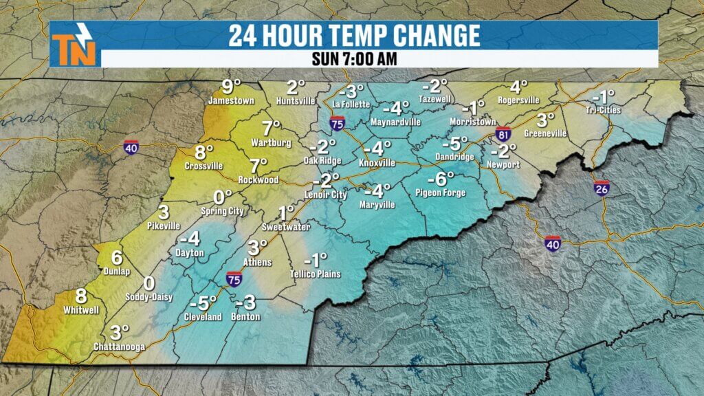
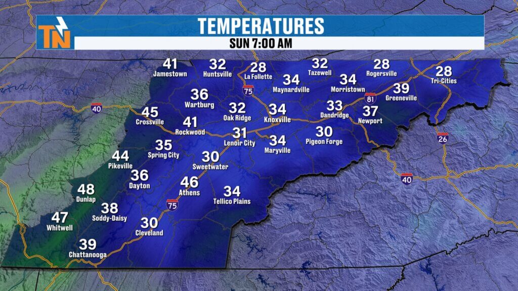
It’s another chilly start to the day.
- Morning lows in the 20s, 30s, and a few 40s
- Breezy conditions, especially in the mountains
- Winds gradually increasing for most areas through the day
You’ll still want a jacket early, but it warms up nicely later on.
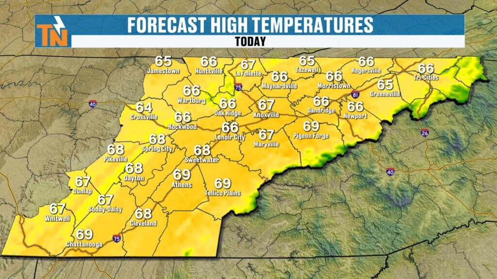
Afternoon Forecast: Sunny and Seasonable
Overall, today is a really nice spring day.
- Highs in the mid to upper 60s
- Plenty of sunshine
- Light to moderate breezes
Right around average for this time of year and great for outdoor plans.Overall, right where we should be for this time of year.
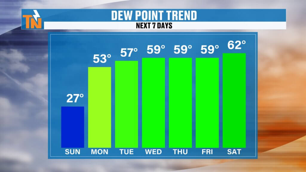
Moisture Builds Back In This Week
Changes are coming as winds shift and humidity increases.
- Dew points rise steadily starting Sunday
- More moisture returns to the atmosphere
- Setup begins for increasing rain chances
This marks the transition away from the dry pattern we’ve been stuck in.
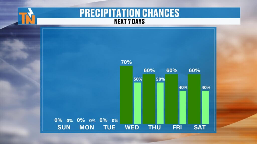
Rain Chances Increase Mid to Late Week
While the weekend stays mostly dry, the pattern turns more active.
- Dry through Monday and much of Tuesday
- Rain chances increase Wednesday and Thursday
- More widespread showers Friday into Saturday
A ridge over the Southeast will initially keep heavier rain west of us, but that will gradually shift.
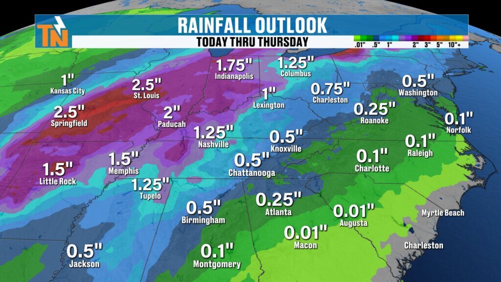
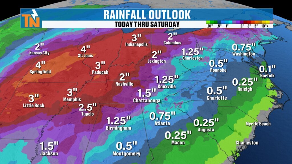
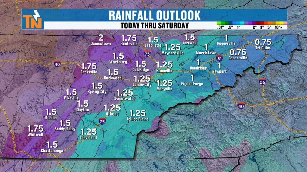
Rainfall Outlook: Helpful for Drought Conditions
This upcoming system could bring meaningful rainfall.
- Over 1 inch possible by next weekend
- Heavier totals likely west of Interstate 75
- Lighter, but still beneficial rain east of I-75
This is exactly the kind of rain East Tennessee needs to help ease drought conditions.
Easter Weekend Outlook (Early Look)
Looking ahead toward next weekend:
- Continued chances for scattered showers
- Best chance for rain on Easter Sunday appears later in the day
- Timing will likely change, so stay tuned for updates
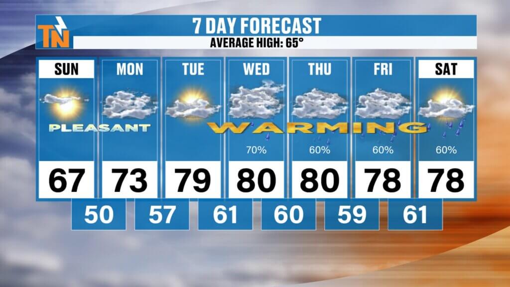
7-Day Forecast Snapshot
- Saturday: Sunny and dry (upper 60s)
- Sunday: Warmer (low 70s)
- Monday–Tuesday: Warm and more humid (upper 70s to low 80s)
- Wednesday–Saturday: Increasing rain chances, periods of showers
- Next weekend: Mild with lingering rain chances
Final Thoughts
Enjoy the sunshine and comfortable temperatures today, but stay mindful of the elevated fire danger. Big changes are on the way as we transition into a warmer, more humid, and eventually wetter pattern next week.
Have a great Sunday, and don’t forget—you can always stay up to date with the latest conditions, radar, and forecasts on the eastTNweather app.Wednesday–Friday: Periods of rain, possibly heavy at times