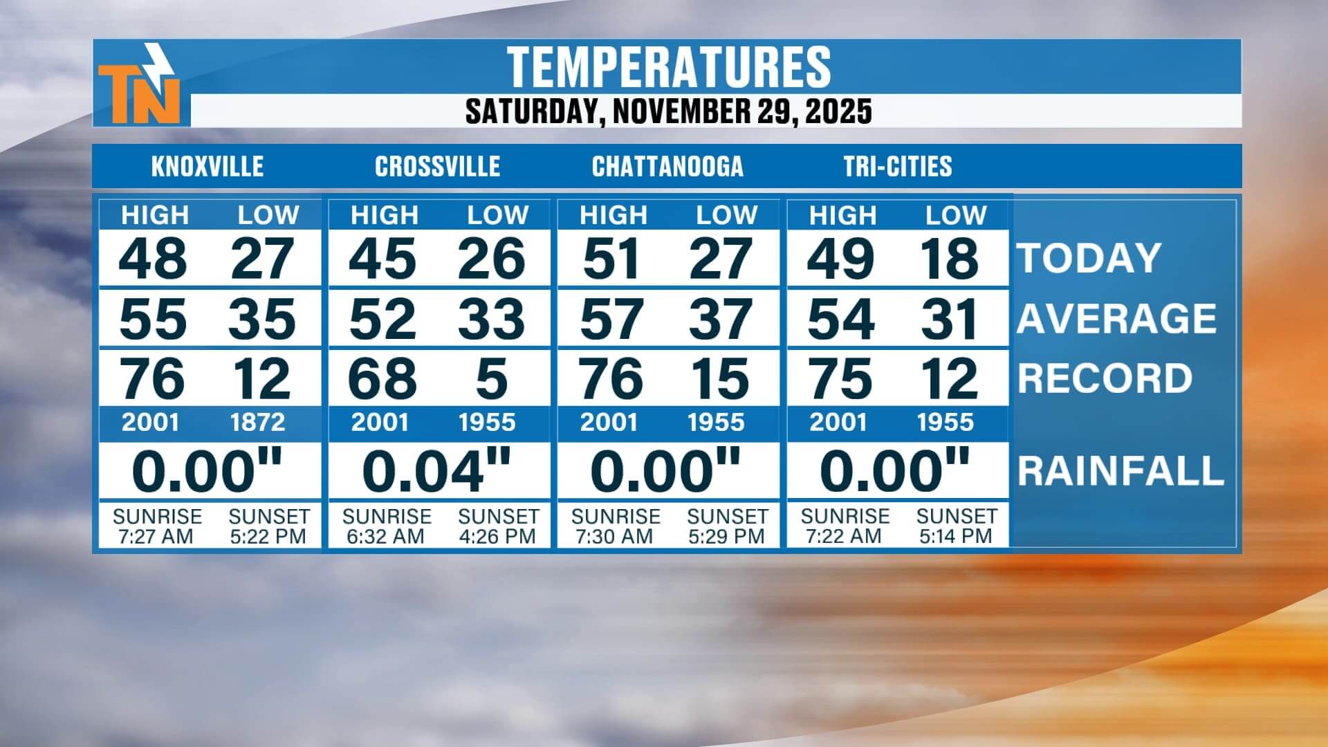
Happy Sunday, everybody.
Sure hope you’re having a great day so far. We’re tracking several systems over the next five to seven days, starting with some light rain and cloudy conditions today, followed by a stronger storm system Monday into Tuesday, and yet another one as we head toward next weekend. Let’s walk through your full long-version forecast.
Gray, Dreary, and Damp Today
We began the morning with areas of light rain and even a touch of wintry mix in the higher elevations. No travel issues at all, but the atmosphere is doing something interesting today:
• A low-level inversion has set up — the air is slightly warmer aloft
• Low-level moisture is trapped near the ground
• That keeps the sky gray, overcast, and stubborn
• Occasional light rain and drizzle continue through the day
It’s one of those dreary, chilly days where it feels colder than the number on the thermometer.
The good news?
By late afternoon, skies should start to break up, and sunshine makes a return before sunset. So if you’re shopping, running errands, or getting a jump on the work week, take the sunglasses along with the jacket.
Milder Start Today, But Don’t Get Used to It
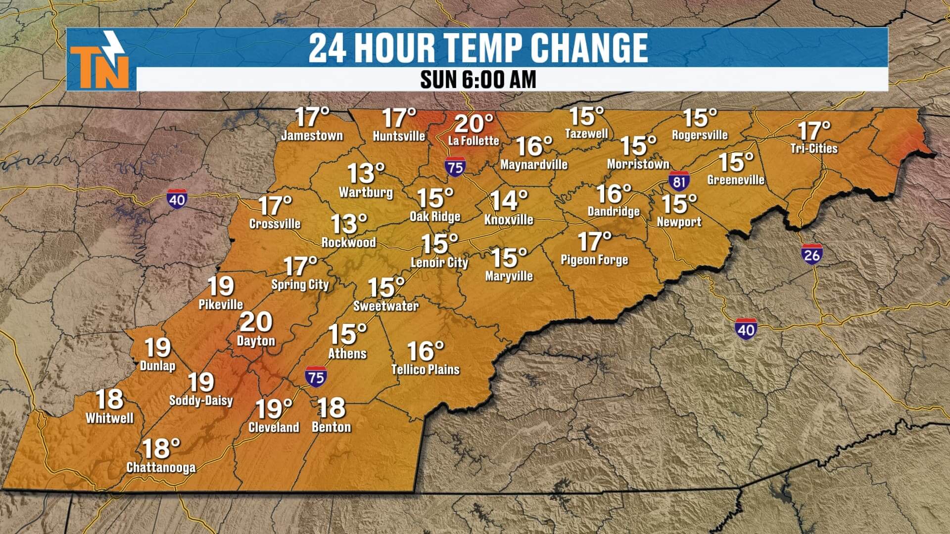
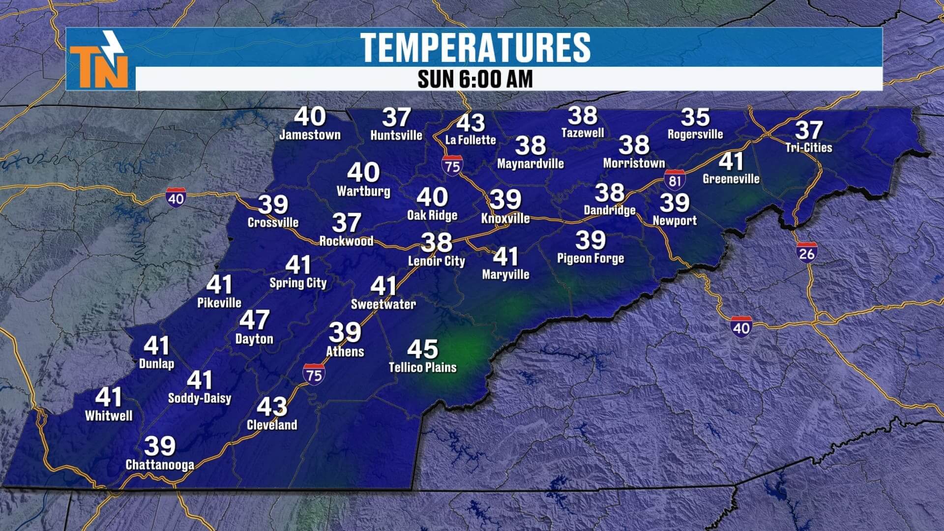
Compared to the last few mornings, we started the day 10 to nearly 20 degrees warmer. Many locations were in the 30s and 40s, which felt noticeably better than those frigid mornings earlier this week.
But this mild trend is short-lived.
Winds are also picking up, especially across the mountains, where a wind advisory has now expired. Most of us see gusts of 15–25 mph at times through the afternoon.
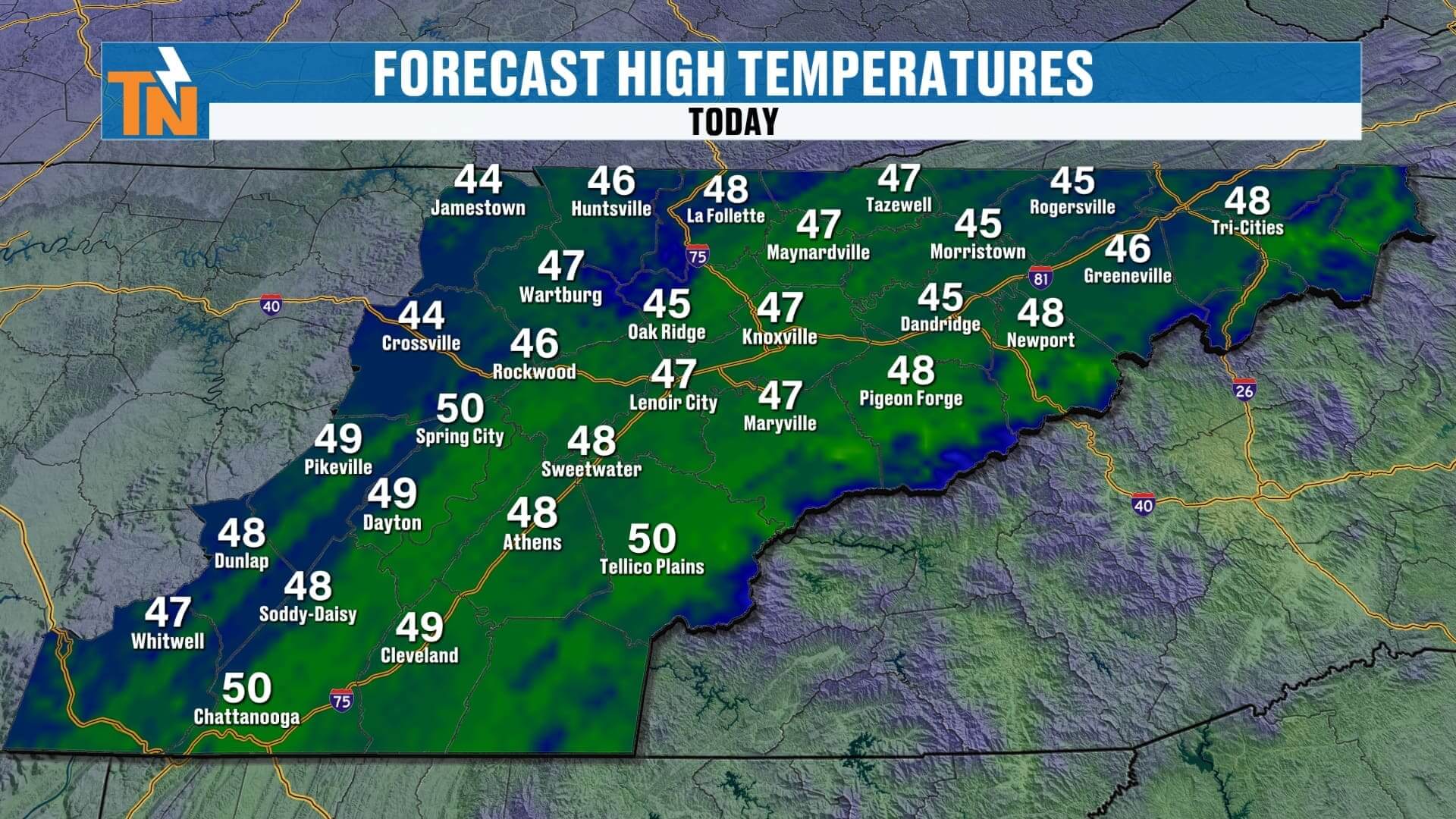
High temperatures today only reach the 40s, so even with a milder morning, it’s still a chilly Sunday overall.
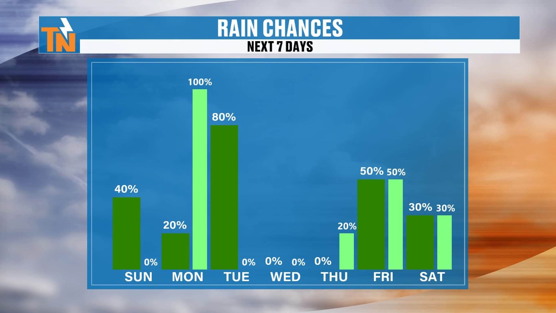
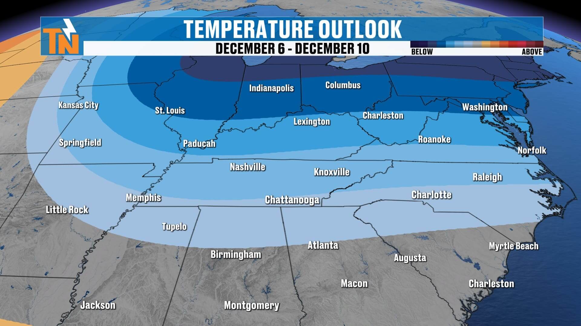
Next System: Monday Night Into Tuesday with Heavy Rain and a Wintry Mix Possible
Our next storm system arrives late Monday and continues into Tuesday.
Here’s how it develops:
• Monday: Increasing clouds
• Late Monday: Light rain begins
• Monday night: Moderate to heavier rain develops
• Tuesday: Colder air rushes in behind the system
• As colder air arrives, light snow or a wintry mix becomes possible
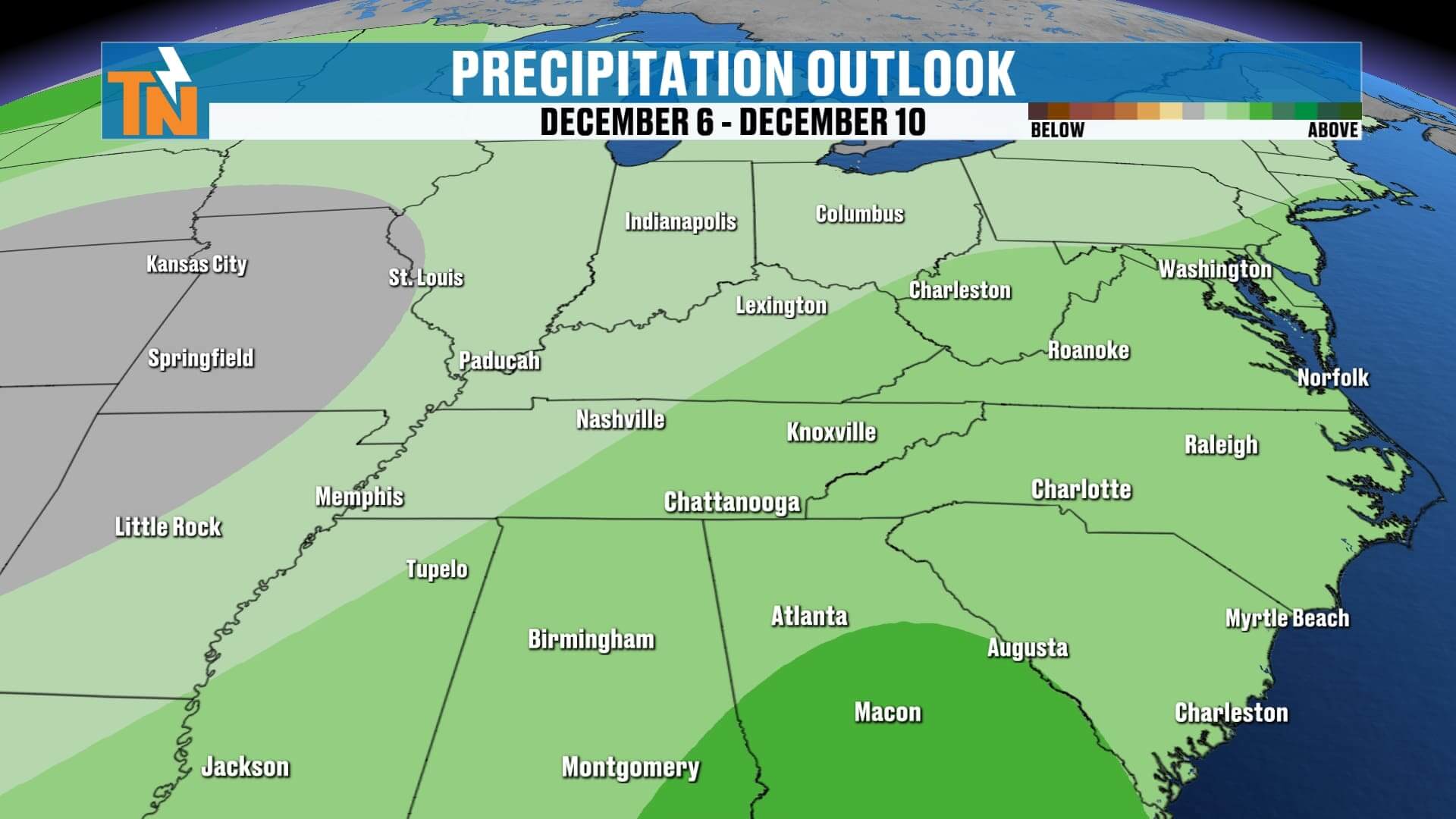
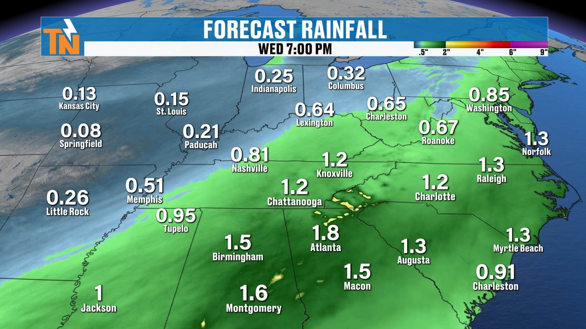
Most model guidance agrees that the bulk of the moisture stays north into Kentucky and the Ohio Valley, meaning for East Tennessee this will be mainly a cold rain event.
Rainfall totals look to exceed 1 inch area-wide, with pockets higher in Plateau and mountain regions.
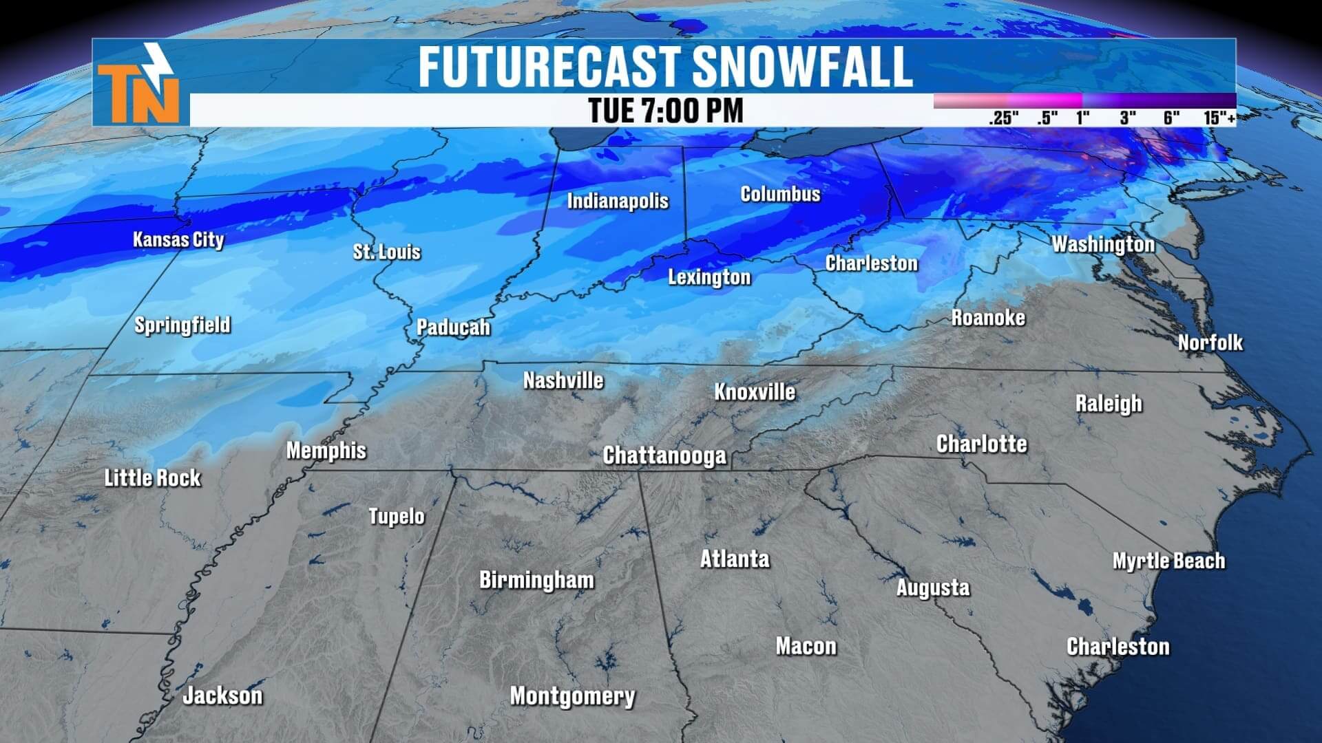
Light Snow Possible Tuesday as Temperatures Crash
Even though the majority of the moisture is rain, we do have:
• A classic “horseshoe” of moisture loss around East Tennessee
• Just enough wrap-around energy
• Rapidly falling temperatures Tuesday
This combination suggests light snow showers are possible Tuesday, especially:
• Cumberland Plateau
• Foothills
• Smoky Mountains
• Higher ridge lines
Confidence is low to moderate, but increasing slowly.
A Wild Temperature Drop on Tuesday
This is the tricky part of the forecast.
Official highs will likely occur just after midnight early Tuesday morning, then temperatures fall all day:
• Early Tuesday morning: Low–mid 40s
• Midday Tuesday: Upper 30s
• Afternoon Tuesday: Mid 30s
• Tuesday night: Plunging into the 20s
This is a true “reverse temperature day,” where the number you see in the forecast does not tell the whole story. The afternoon will be significantly colder than the morning.
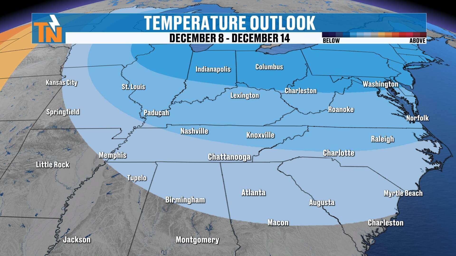
Another System Arrives Next Weekend
Once we get past Tuesday’s system:
• Wednesday: Dry, cold
• Thursday: Dry, seasonable
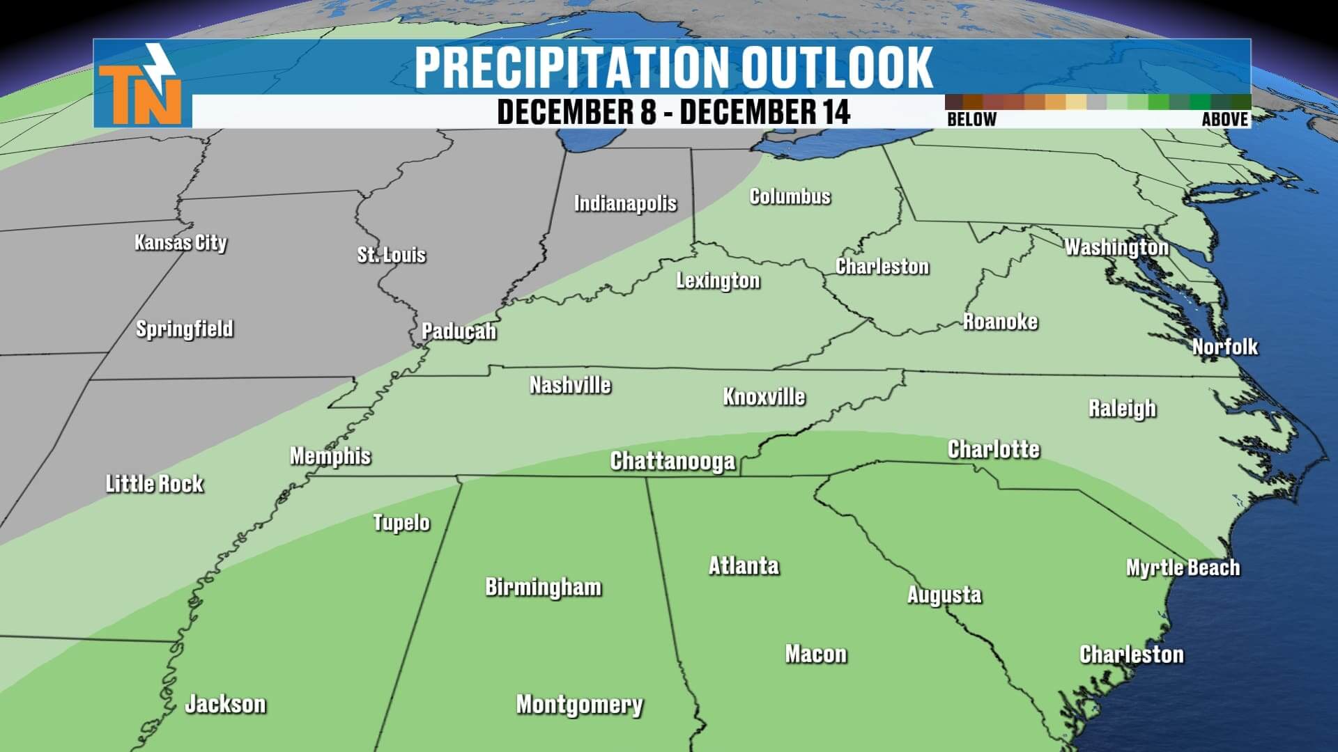
• Friday–Saturday: Another rain-maker arrives
• Temperatures stay in the 40s and 50s heading into next weekend
So yes — we stay active through the entire 7-day stretch.
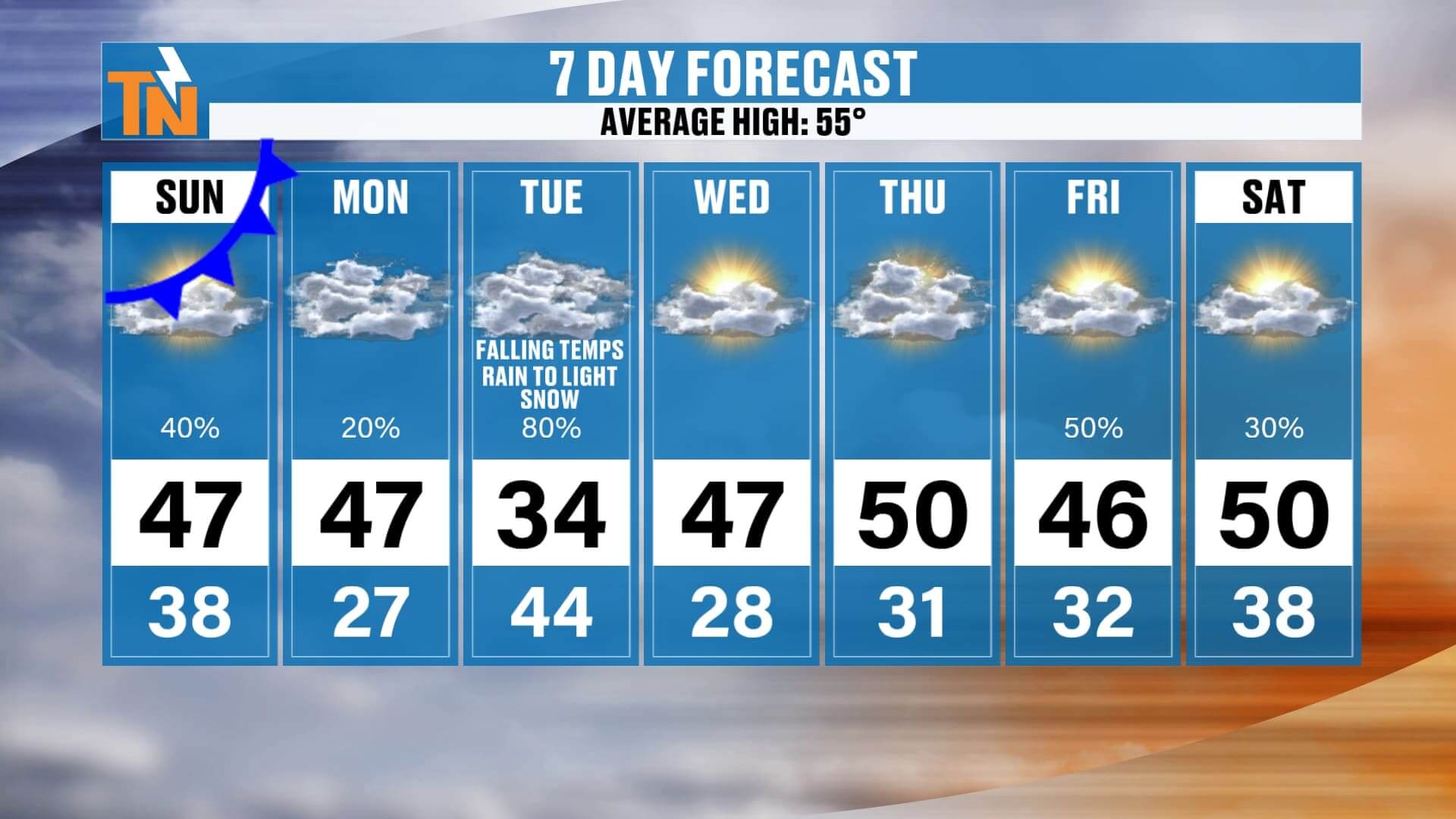
7 Day Forecast Overview
• Sunday: Light showers, gray, highs in the 40s
• Monday: Increasing clouds, late-day rain
• Tuesday: Rain → light snow chance, temps falling from 40s to 30s
• Wednesday & Thursday: Dry, cold
• Friday–Saturday: Next rain system arrives
Average high is 55° — and we’ll be well below that on Tuesday and again next weekend.
Final Notes
Stay tuned over the next 48 hours. This Monday–Tuesday system could still shift slightly north or south, impacting how much rain vs. snow we see. I’ll keep updating the forecast as new data arrives.
And as always:
Download the East Tennessee Weather App
Track the rain, check future radar, view the 7-day, and get real-time alerts — all from your phone.
Sure hope you have a great day. I’ll see you again soon!