Good morning and happy Friday, everybody!
Sure hope you have a great day today. That “Friday” feeling hits a little different when the weather is this good — and we’ve got a gorgeous day lined up across East Tennessee.

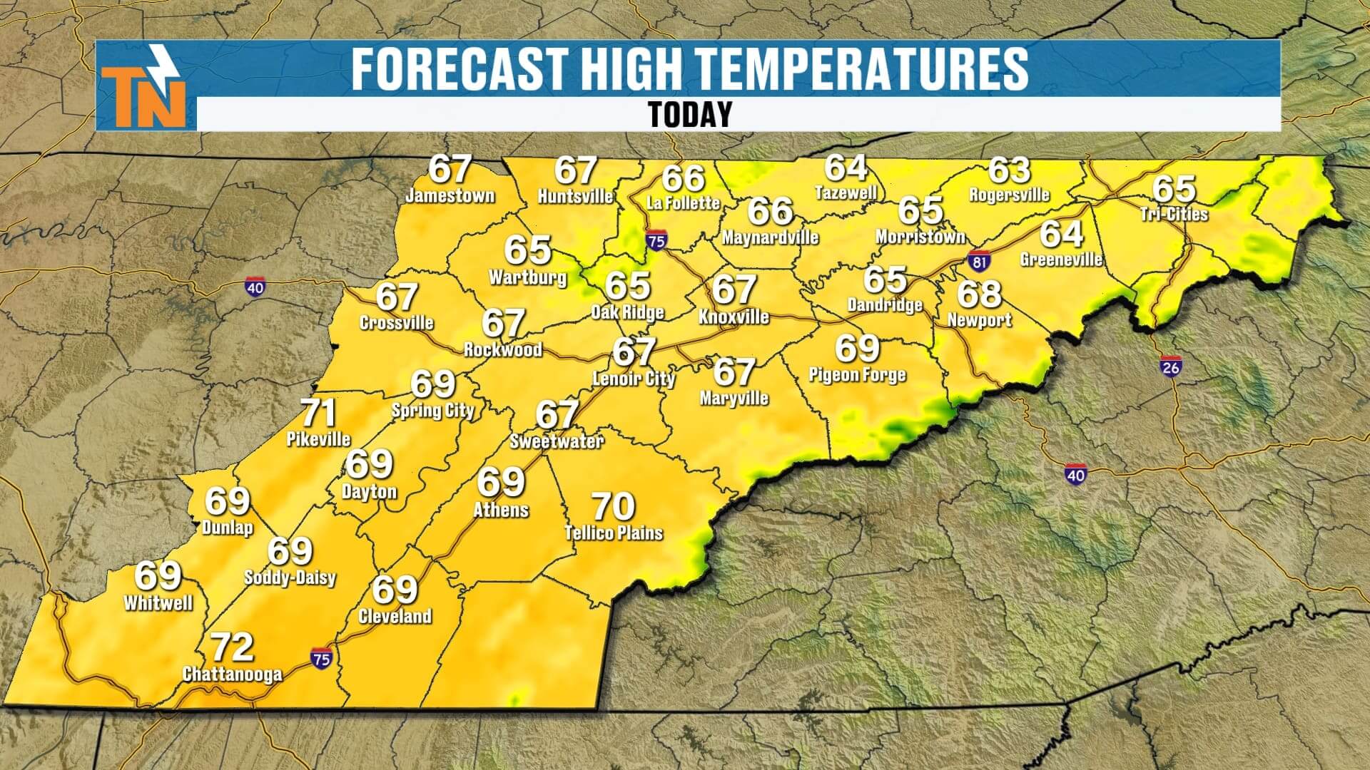
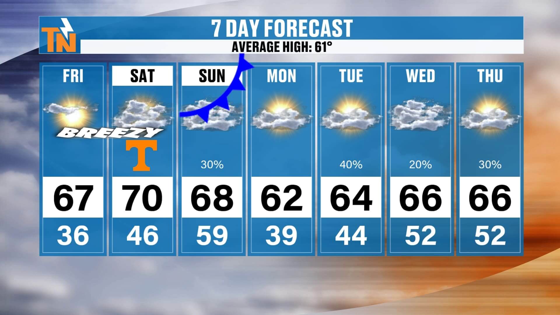
We’re starting the morning off cool and comfortable in the 30s and 40s, but sunshine will take over quickly. A few thin, high clouds may filter in from time to time, but it won’t stop us from warming into the upper 60s to low 70s, which is running above average for this point in November. If you’ve got evening plans, temperatures dip to about 53° by 8 PM, so keep a light jacket handy.
As we head into Saturday morning, low temperatures actually come up a bit. Most of us will start in the 40s, and we’ll warm right back into the upper 60s and low 70s. The big change Saturday will be the wind. A cold front approaches from the west, which will kick up breezy and gusty conditions. The mountains of East Tennessee may flirt with wind advisory criteria, so keep that in mind if your Saturday plans take you into the foothills or Smokies.
Saturday itself looks mostly sunny with increasing high clouds later in the day. After sunset and into early Sunday morning, the cold front slides through. Cloud cover will increase, but moisture is limited. Expect only a few light showers at most — mainly across Upper East Tennessee, southeastern Kentucky, southwest Virginia, and the Smokies. For most, it’s a brief and minimal rain event.
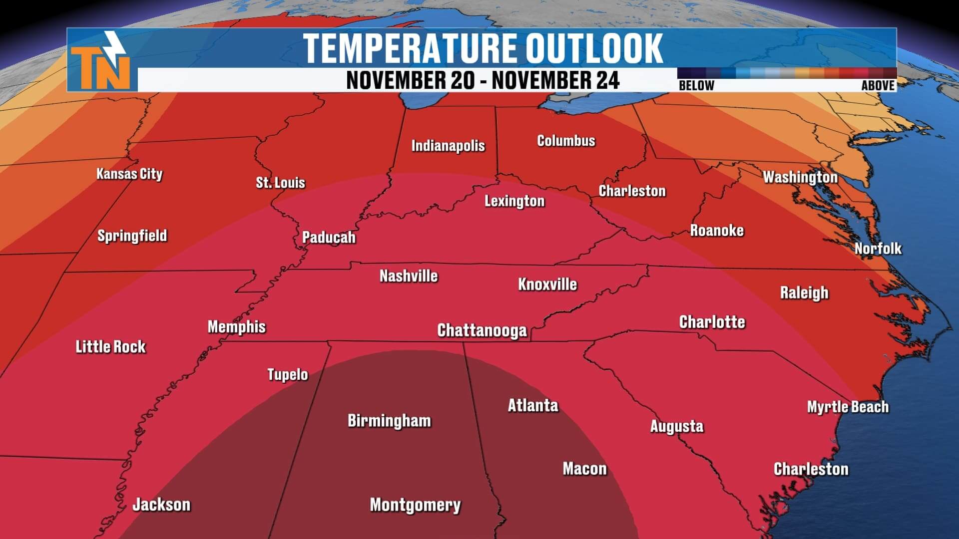
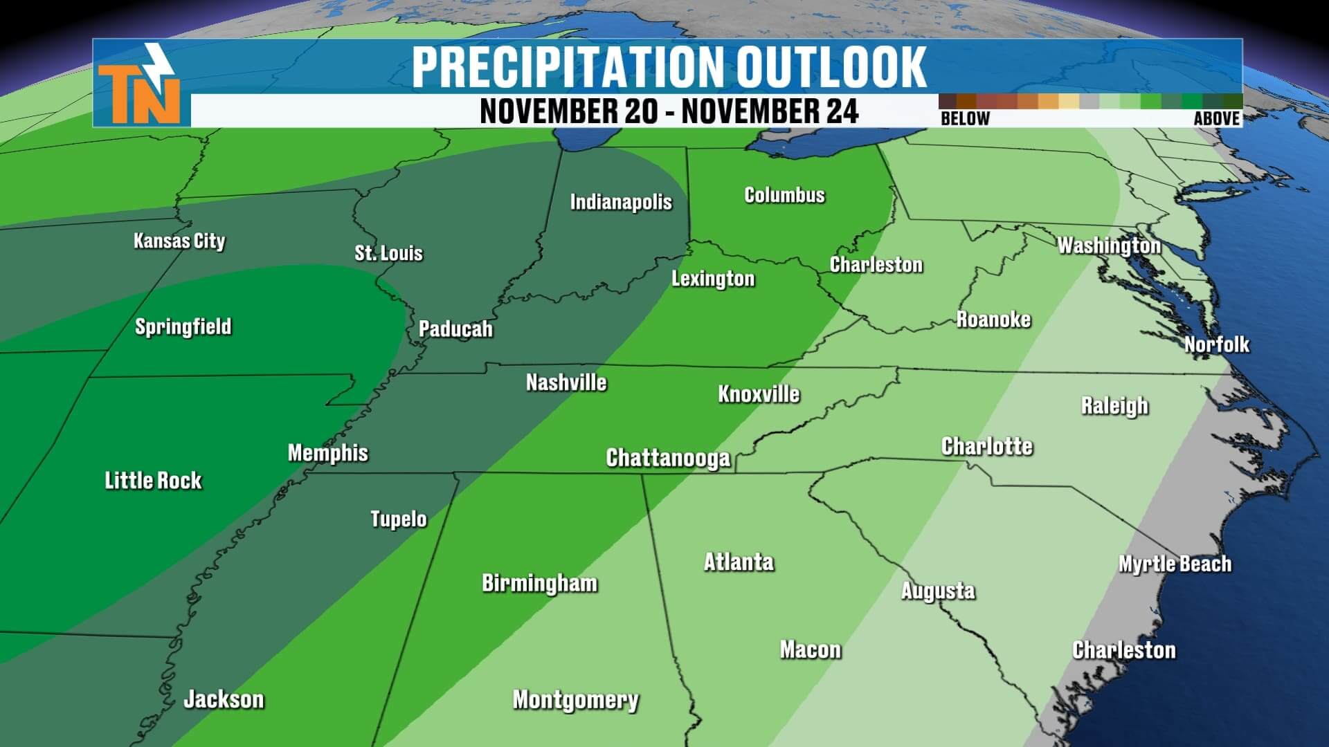
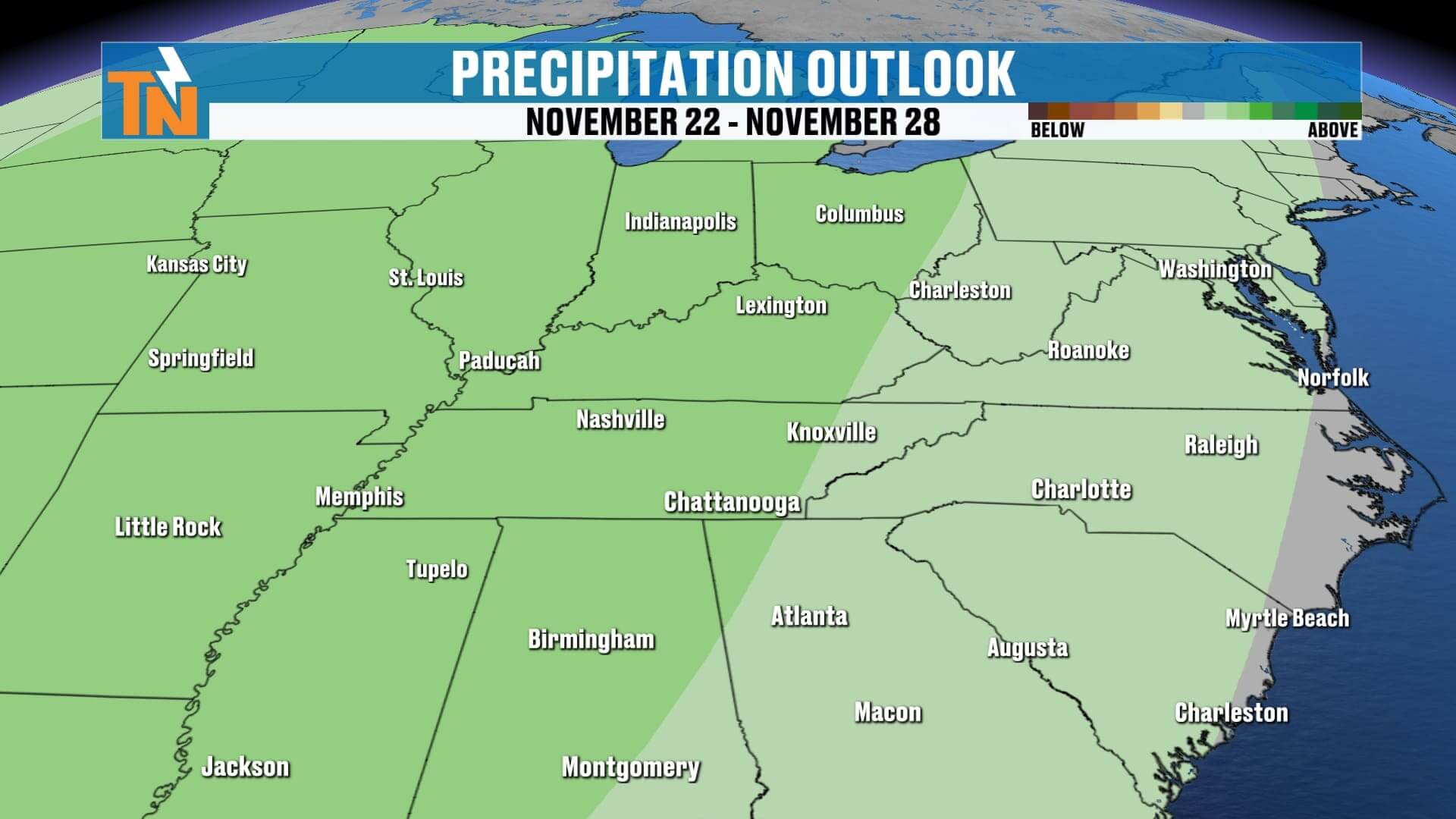
Looking into next week, several waves of rain begin to set up across the region. Right now, rain chances generally run 20–40%, but more significant rainfall will take shape just west of us, with the Tennessee Valley catching lighter totals early on. We’ll keep a close eye on how that pattern evolves.
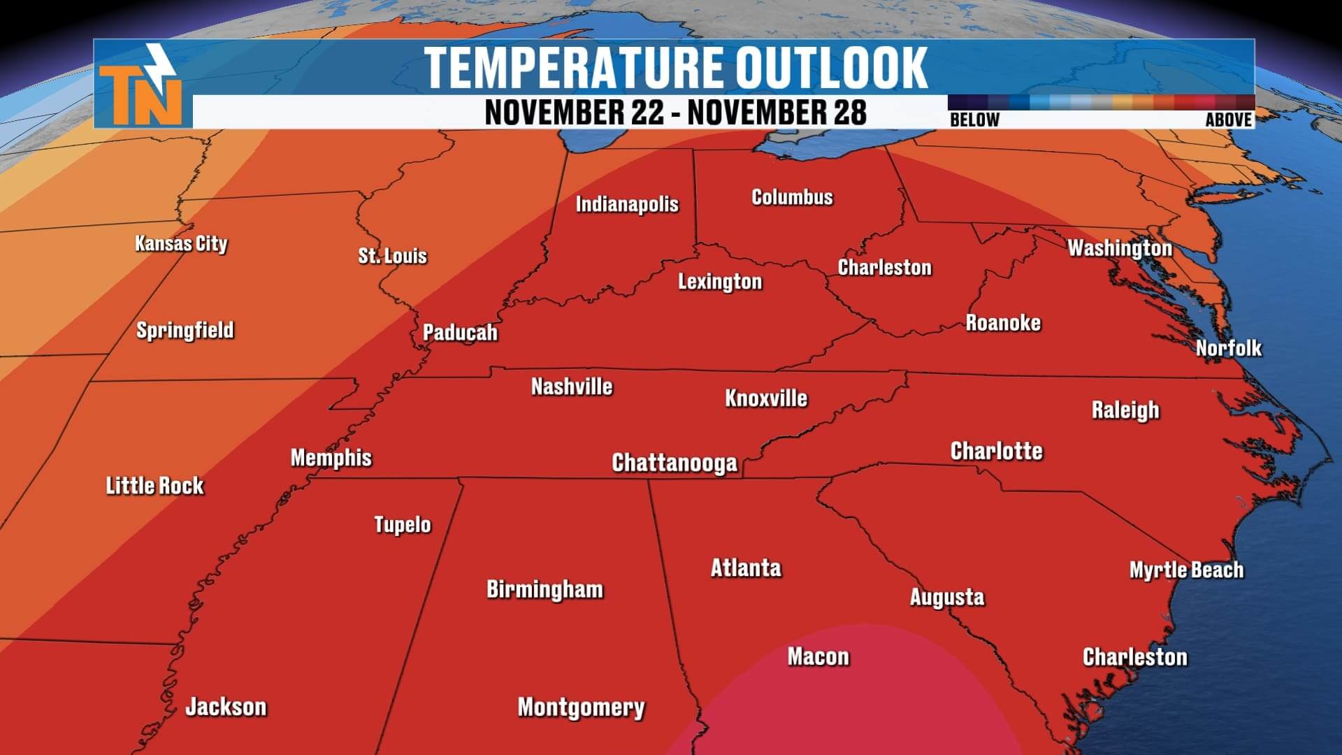
Your 7-day forecast keeps things warm through Saturday, then slightly cooler behind Sunday’s front. Early next week, temperatures rebound into the mid-60s with those passing rain chances returning. A more active pattern develops next week and beyond — and yes, the mountains may see another chance for some light snow with those passing systems down the road.
If you’re heading to Neyland Stadium Saturday, kickoff temperatures look nearly perfect at 70°. A spotty shower is possible late, but nothing that should disrupt your game plans.
And remember — if you ever want a quick, one-minute weather update, check out Witcher’s One Minute Weather on the East Tennessee Weather app, eastTNweather.com, or YouTube. And don’t forget to download the free East Tennessee Weather app to track changes every day right from your phone.
Have a great Friday — and enjoy this beautiful weather!