
Good morning, East Tennessee!
Happy Saturday, and happy game day! The orange suit is back, my friends, as Tennessee takes the field at Neyland Stadium this afternoon. Whether you’re tailgating on campus, watching from the Smoky Mountains, or grilling out at home, the weather looks just about perfect—though it will definitely be on the warm side.
Weather Headlines
-
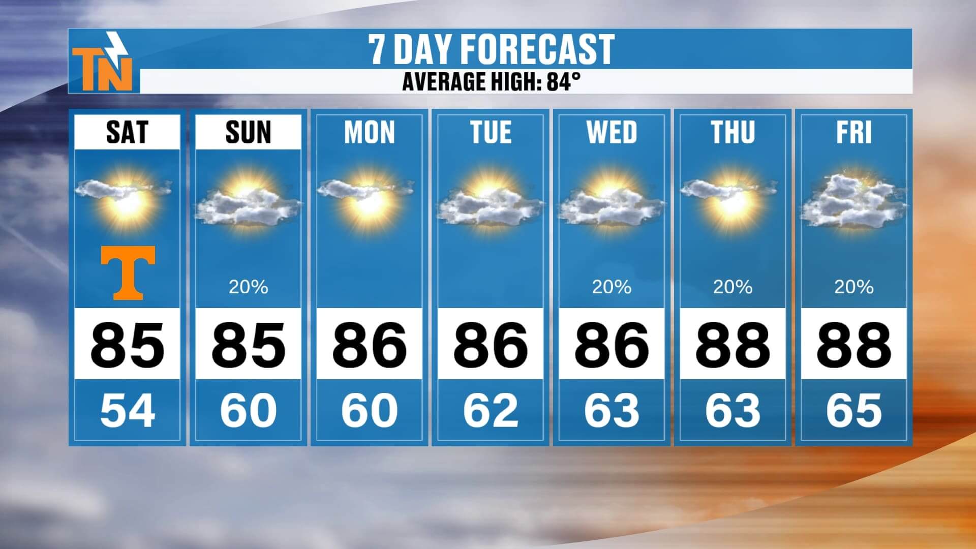
Game Day Saturday: Warm and sunny, kickoff temps in the mid 80s
-
☁️ Sunday: Mix of sun and clouds, stray shower possible, highs in the 80s
-
️ Next Week: Dry and warm Monday–Tuesday, upper 80s by midweek
-
⛰️ Midweek Mountains: Isolated showers possible in the Smokies Wednesday–Friday
-
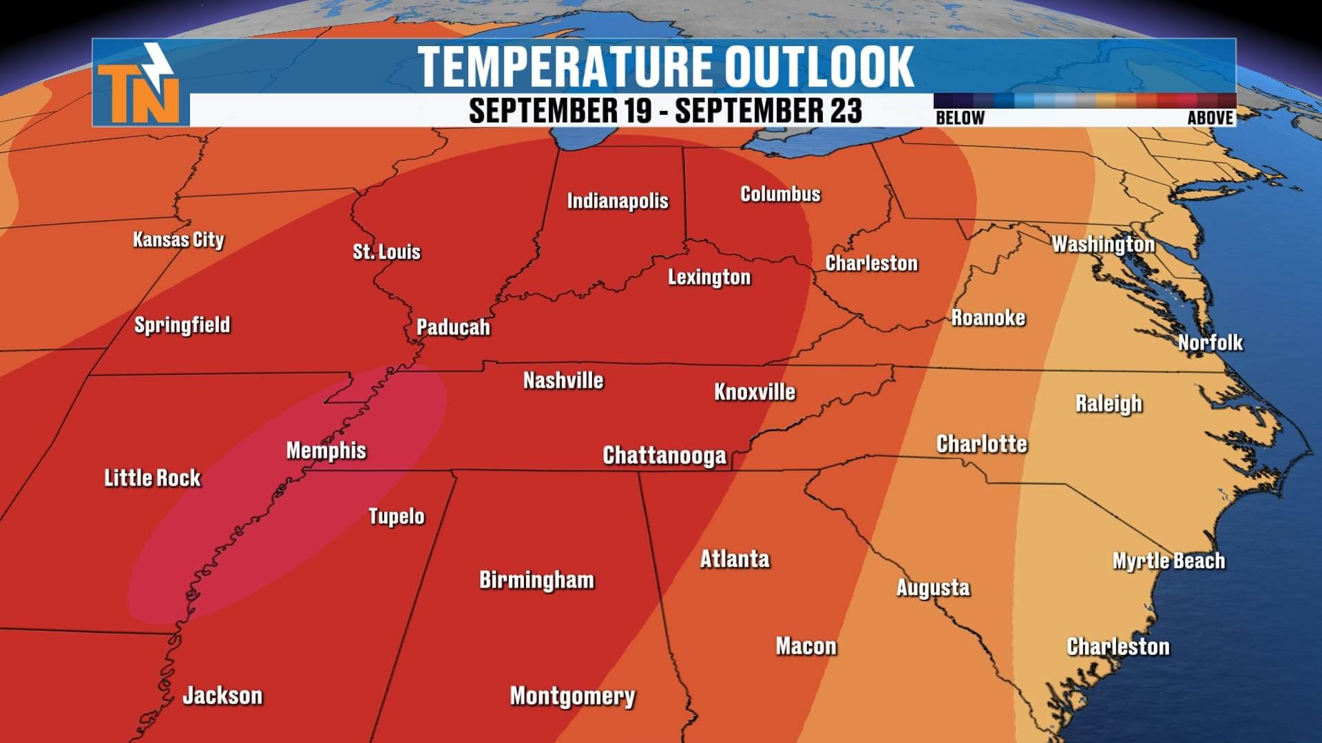
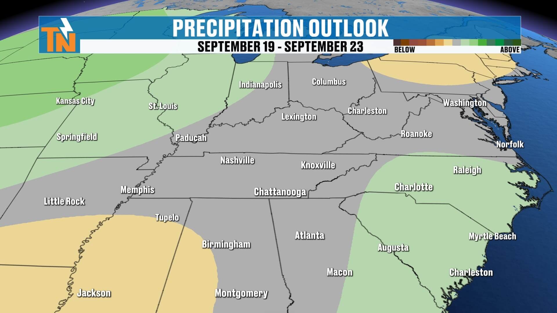
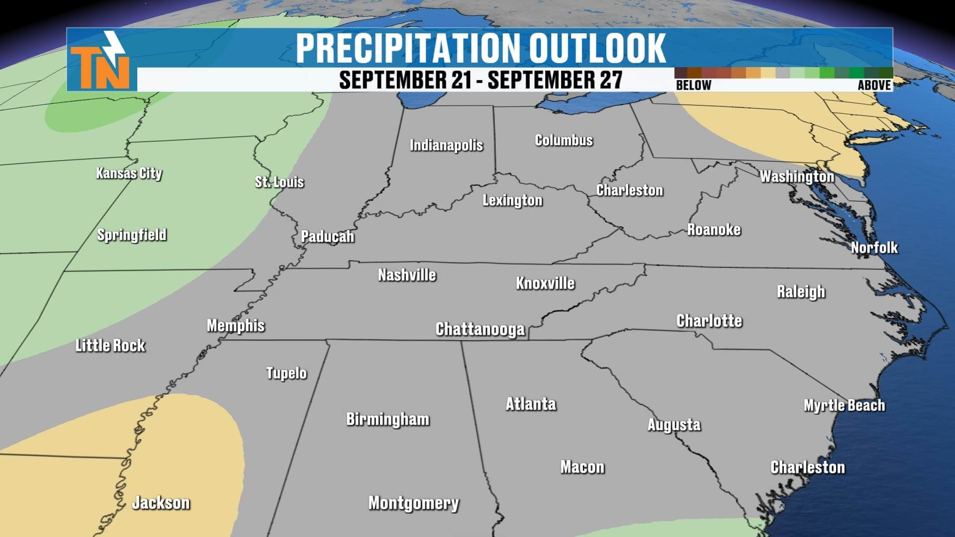
September Outlook: Trending above average and mostly dry through month’s end
Today’s Forecast: Sunny, Warm, and Perfect Football Weather
High pressure is firmly in control, keeping skies mostly sunny and rain chances near zero. Temperatures will climb steadily through the day:
-
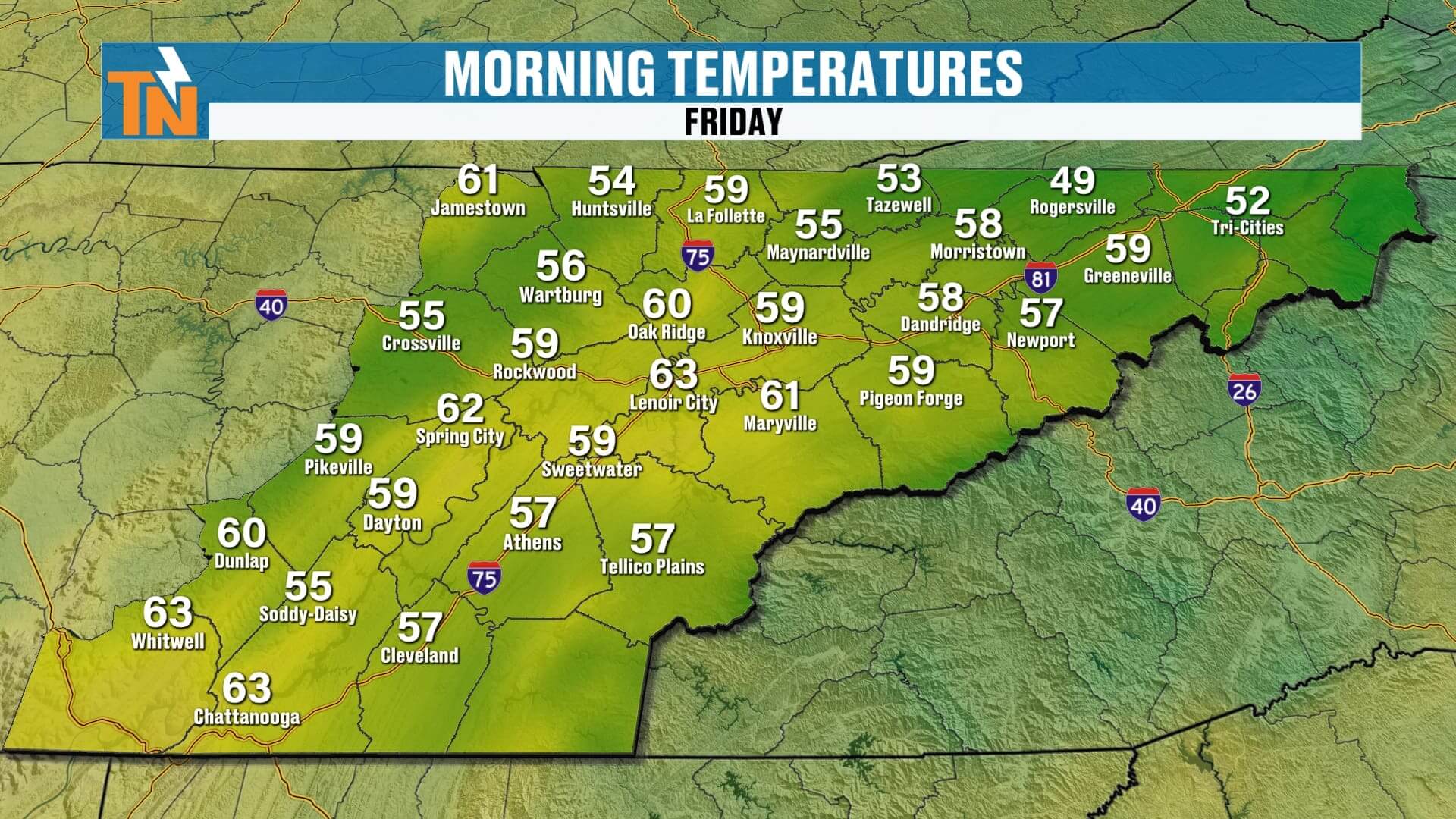
Morning Tailgates: Comfortable in the 60s and 70s
-
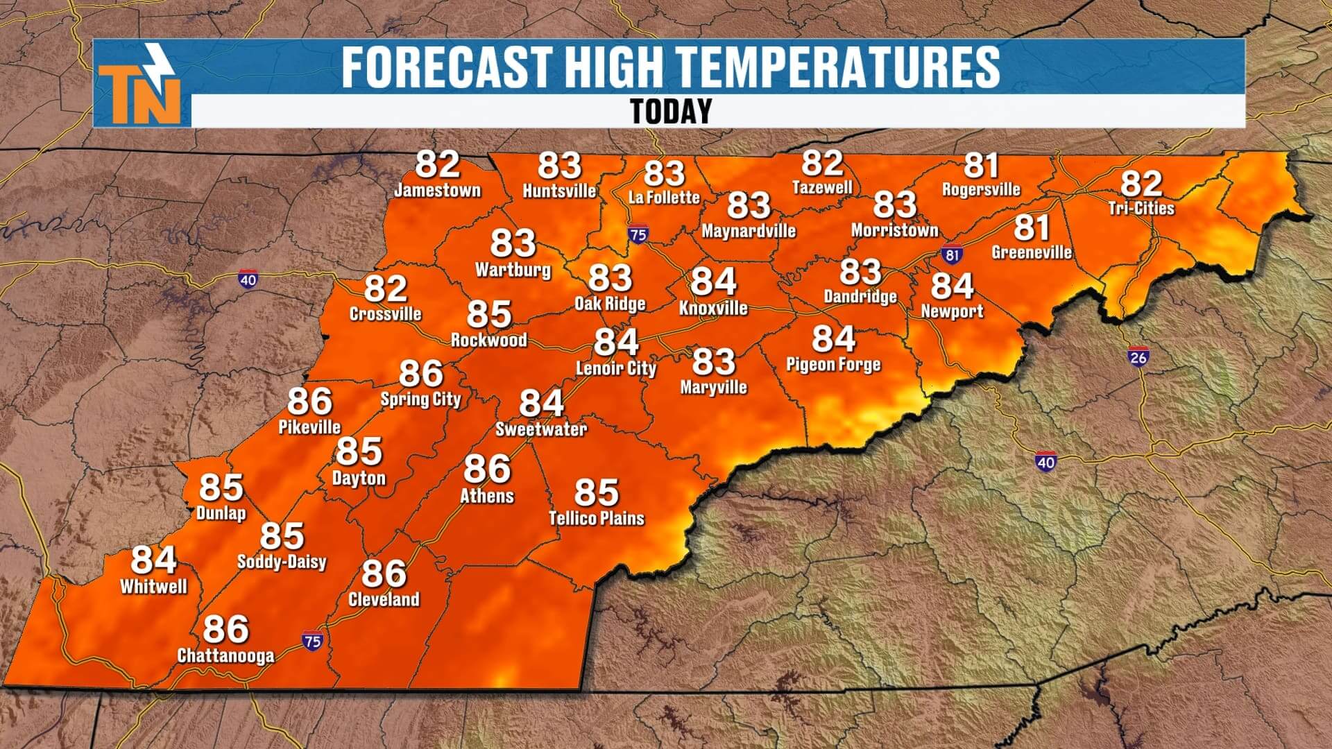
Noon: Around 80° with bright sunshine
-
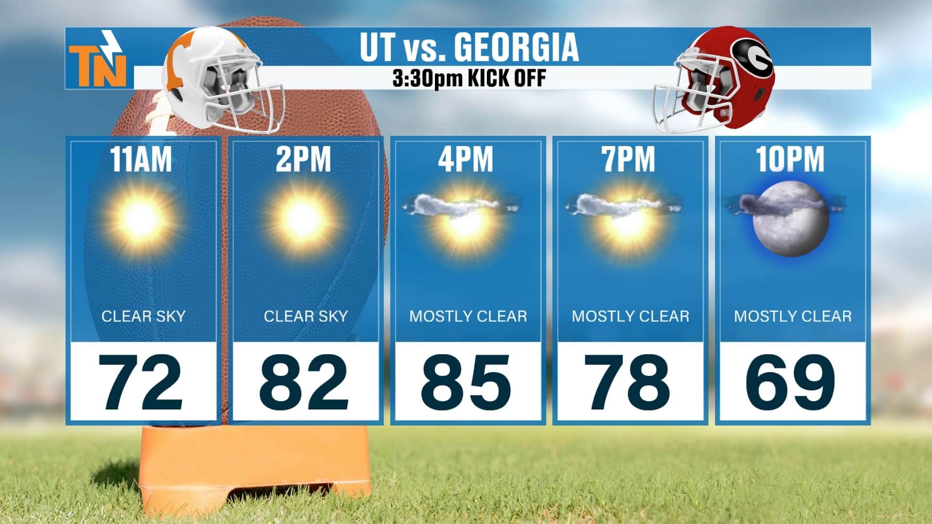
Kickoff (3:30 PM): Mid 80s in Knoxville, some spots could reach the upper 80s
-
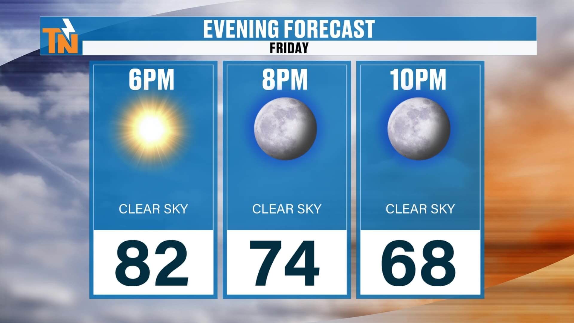
Fourth Quarter: Cooling to the low 80s by sunset
If you’re headed to the game, plan for a toasty late-summer feel. Sunscreen, sunglasses, and water bottles are a must. By tonight, conditions cool into the upper 60s—perfect for a post-game fire pit or an evening out around town.
Sunday: Clouds Increase, Slim Shower Chances
Sunday brings a slight shift in the pattern. A disturbance sliding south out of the Ohio Valley will bring more clouds into East Tennessee.
-
Morning: Crisp start in the 50s across much of the Valley and Plateau.
-
Afternoon: Highs climb into the low to mid 80s, with some upper 80s possible.
-
Sky Conditions: A mix of sun and clouds, at times looking overcast, especially north of I-40.
-
Rain Chances: Only about 20% at best, mainly to cover for a stray shower that could slip south with the disturbance. Most communities will stay dry.
Bottom line: more clouds than rain for Sunday, but still a very comfortable day for outdoor plans.
Looking Into Next Week: Warmth Builds Again
High pressure continues to dominate, keeping most of us dry to start the week.
-
Monday & Tuesday: Sunny, dry, highs in the mid to upper 80s.
-
Midweek: A coastal low over the Carolinas could throw some extra moisture our way. That may spark a few showers or thunderstorms across the Smokies and mountain counties Wednesday through Friday. For the Valley, rain chances stay low.
-
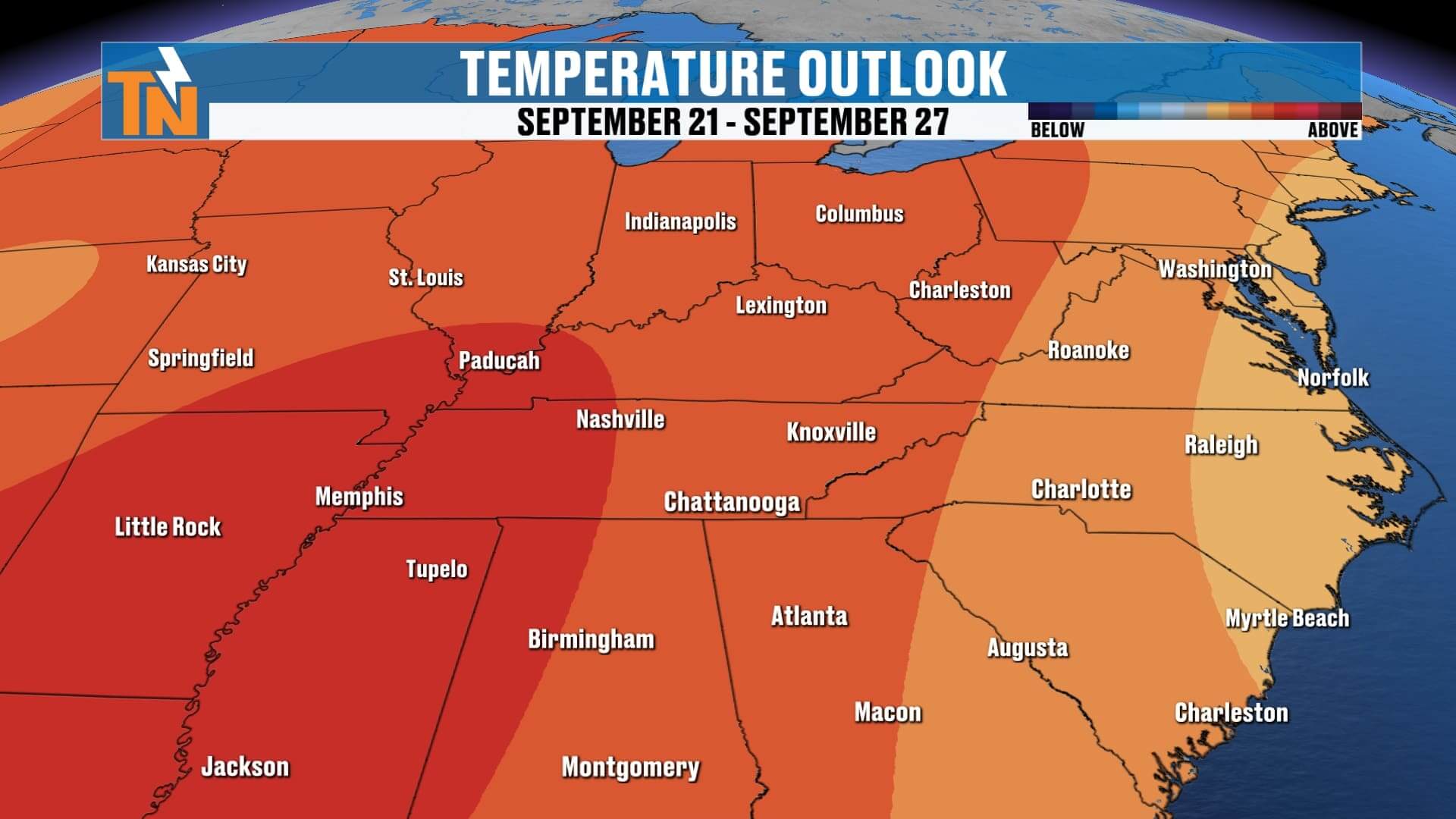
Late Week: Temperatures push into the upper 80s, with above-average warmth returning across much of East Tennessee.
Climate Outlook: September Ends on a Warm Note
While we opened September with a refreshing stretch of fall-like air, the back half of the month is trending warmer and drier.
-
Average High This Time of Year: 84°
-
This Week’s Highs: Trending at or above average, pushing near 90° in spots by late week
-
Rainfall Outlook: About average for September, which is already one of East Tennessee’s driest months
The Climate Prediction Center projects above-average temperatures sticking around through the end of September, possibly carrying into early October.
ABOVE AND BEYOND THE 7 DAY FORECAST
Final Word
Today is picture-perfect for UT football, with sunshine, warm temperatures, and no rain worries. Sunday brings more clouds and a slim chance of a shower, but most of us will stay dry. Next week continues the theme—warm, mostly dry weather, with highs pushing into the upper 80s.
Remember, you can always check quick updates, interactive radar, and push alerts on the eastTNweather app. Plus, find extended video forecasts on Roku TV, Amazon Fire, and YouTube.
Enjoy your Saturday, enjoy the game, and I’ll see you back here tomorrow with the latest updates!