
Good morning, East Tennessee!
Happy Tuesday, and thanks for checking out your local digital forecast with eastTNweather. I’m meteorologist Mike Witcher, and I hope you’re starting the day with a hot cup of coffee and a smile because today is going to be another beautiful late-August day across the Tennessee Valley, Plateau, and Smoky Mountains.
Sunrise & Morning Setup
We’re starting off the day with some high-level clouds drifting across the southern valley—just enough to add a little color to sunrise this morning. Those clouds are tied to some upper-level energy to our south and a ridge of high pressure anchored across the Desert Southwest. Meanwhile, an upper-level low has been spinning across the Great Lakes, keeping us in a northwest flow. That’s been the key to delivering our fresh, fall-like weather pattern since the weekend’s cold front.
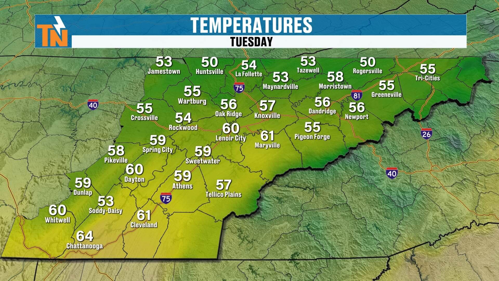
Temperatures early this morning are crisp and comfortable:
-
Valley towns (Knoxville, Maryville, Athens): Low to mid-50s
-
Plateau (Crossville, Jamestown): Upper 40s to near 50°
-
Smokies & higher elevations: Even cooler, with some mid-40s reported
It’s a refreshing start—about 10° cooler than just a few days ago. Jackets at the bus stop this morning won’t be a bad idea for the kids.
Today’s Forecast: Sunshine Dominates
Here’s what you can expect today across East Tennessee:
-
Morning: High thin clouds give way to mostly sunny skies by mid to late morning.
-
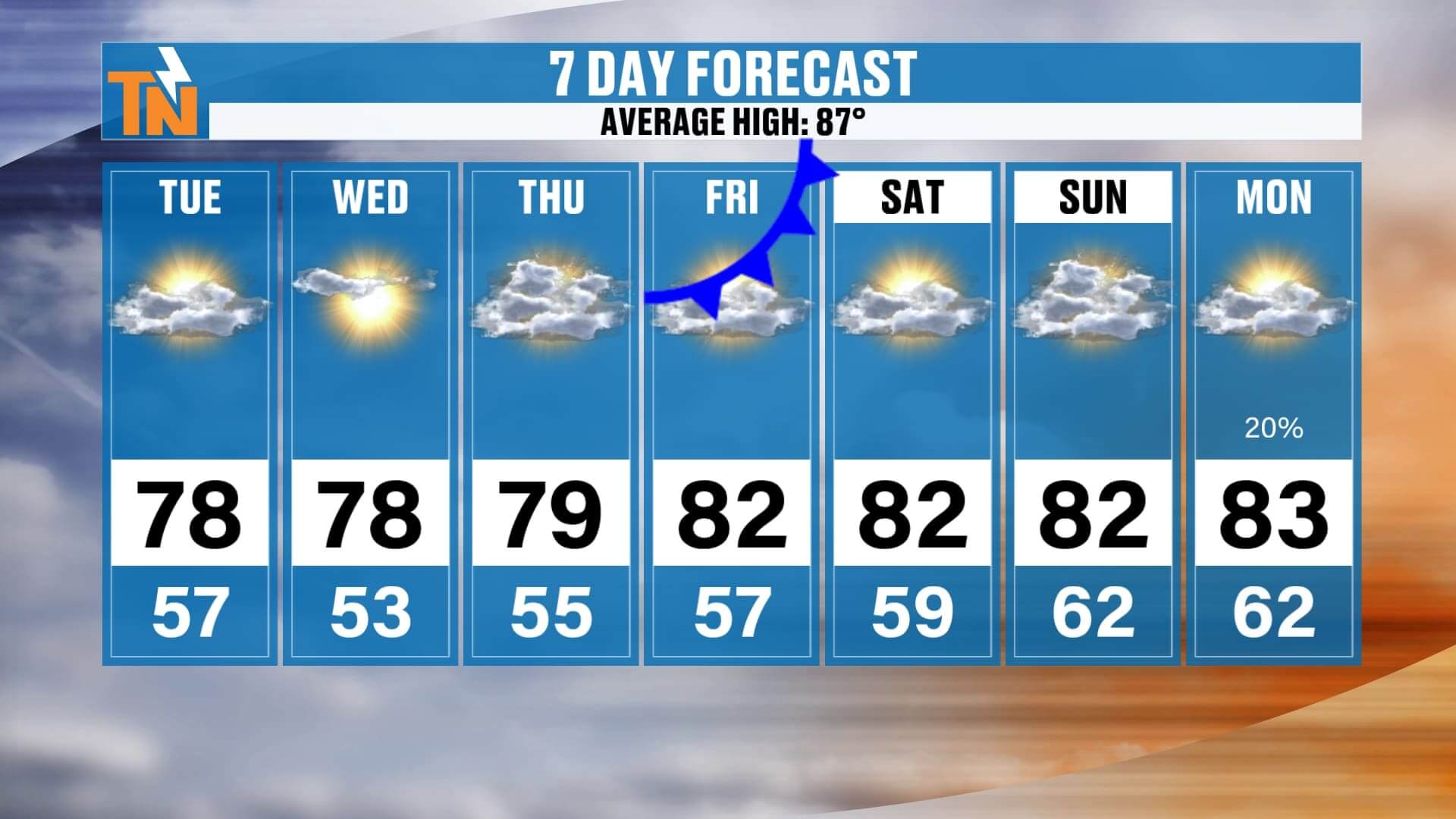
Afternoon: Fair-weather cumulus clouds bubble up, but no rain in the forecast. Temperatures climb into the upper 70s to low 80s, running just below average for late August.
-
Evening: By 6 PM, we’ll be near 75°, making for a gorgeous evening to get outdoors, grill out, or enjoy dinner on the back patio. By 10 PM, temperatures fall into the mid-60s under mostly clear skies.
And for the photographers out there—those high clouds will likely return by sundown, setting the stage for another vivid East Tennessee sunset. Don’t forget to send in your Witcher Pictures!
Midweek Outlook: Quiet & Comfortable
Our quiet stretch of weather continues Wednesday and Thursday, thanks to strong high pressure holding across the Southeast.
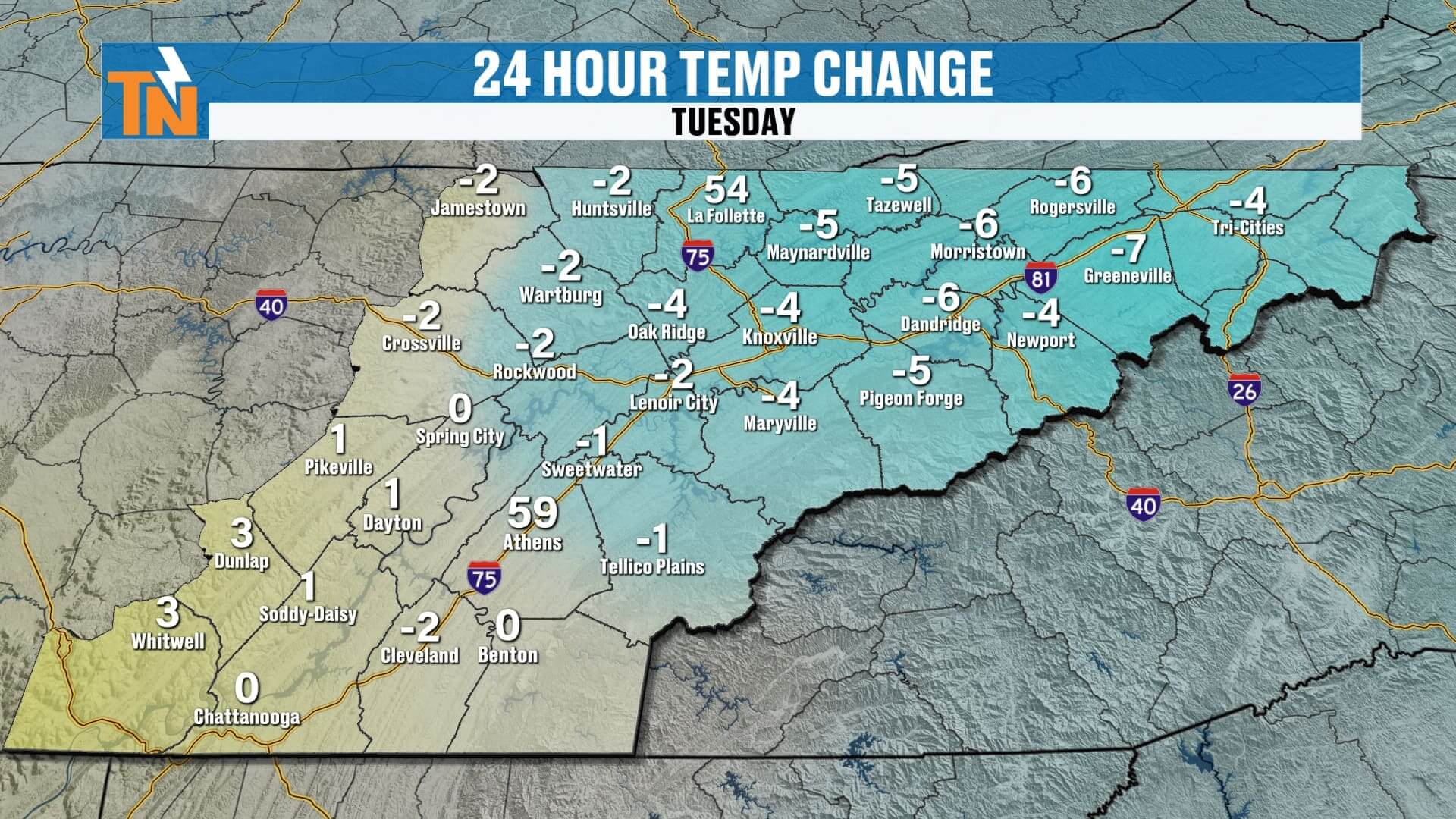
-
Wednesday Morning: Could be the coolest start of the week, with many Valley towns dipping into the low 50s and some 40s again for the Plateau and Smokies.
-
Wednesday–Thursday Afternoons: Highs remain in the upper 70s to near 80°, with low humidity making it feel even better.
-
Skies: Expect abundant sunshine with just a few fair-weather clouds.
This is about as good as it gets for late August in East Tennessee—comfortable air, blue skies, and no major storm systems in sight.
Holiday Weekend Preview: A Few Changes
Looking ahead to Labor Day Weekend (Saturday, Sunday, and Monday), a weak cold front will slide through Friday, bringing only a slight chance for a stray shower. Don’t expect much rain—most of us will stay dry.
Here’s how things play out:
-
Friday: Front passes through. A light breeze develops, humidity ticks up slightly ahead of it, then drops again behind it.
-
Saturday–Sunday: Mostly sunny with highs in the low 80s. Dew points remain comfortable, though slightly higher than earlier this week.
-
Monday (Labor Day): A 20% chance of a stray shower or storm, but most of the region stays dry.
If you’re planning to camp in the Smokies, hit the lake, or enjoy backyard barbecues, the weather looks nearly perfect: cool mornings, warm afternoons, and very little chance of rain.
Weather Headlines
-
Beautiful sunrise & sunset skies today with high thin clouds
-
️ Highs in the 70s/80s, lows in the 50s (40s on the Plateau & Smokies)
-
☀️ Sunshine dominates all week, coolest morning likely Wednesday
-
Holiday weekend: mostly dry, only a stray shower possible Labor Day
-
️ Fantastic camping & outdoor weather across East Tennessee
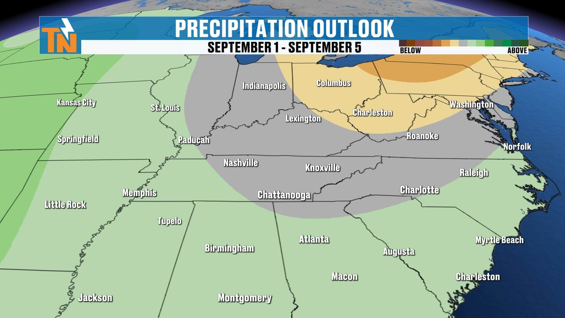
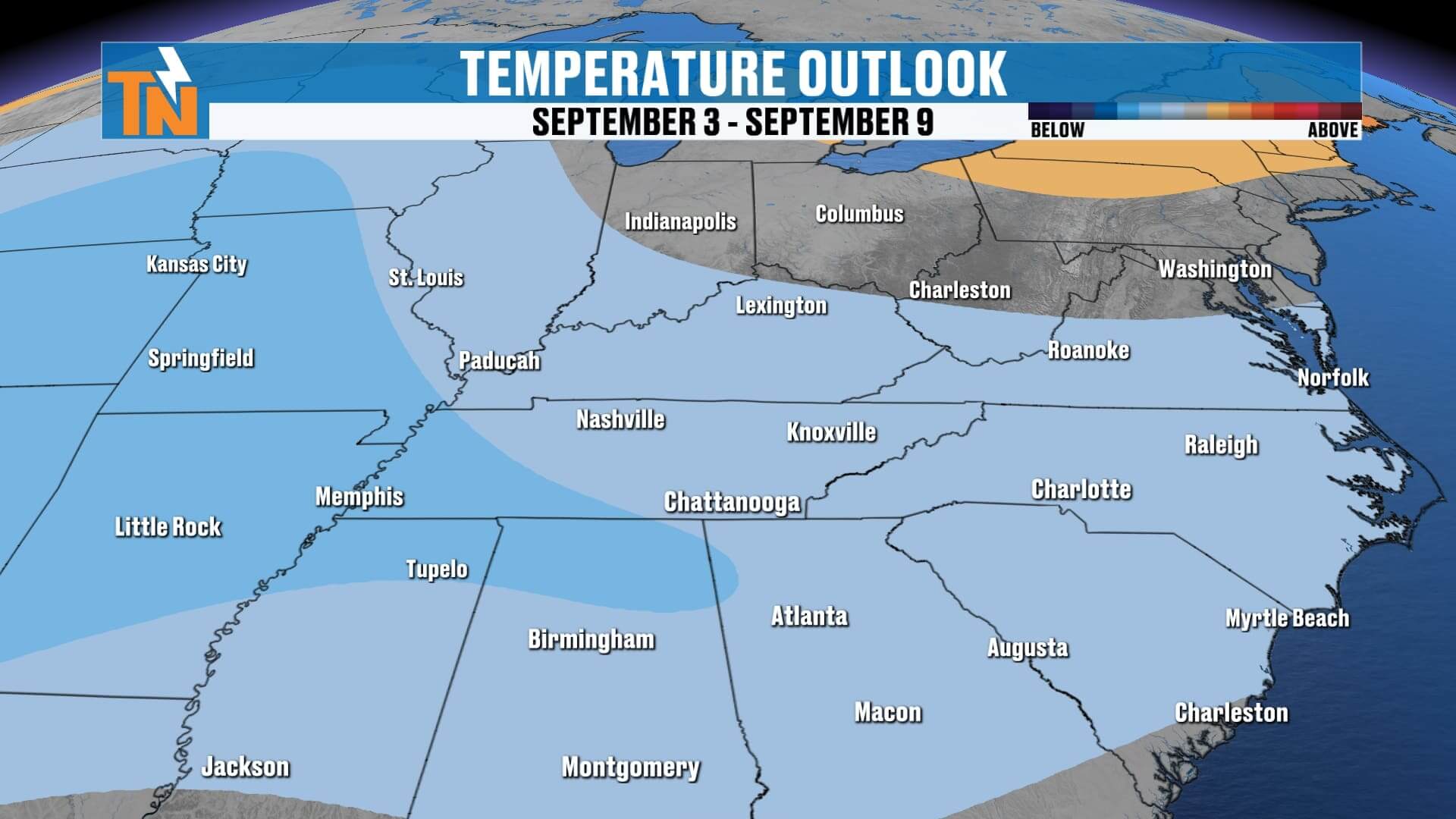
ABOVE AND BEYOND THE 7 DAY FORECAST
Final Word
East Tennessee is getting one of the best late-August stretches of weather we’ve seen in a while. Crisp mornings, low humidity, and comfortable afternoons—it’s the kind of forecast that has everyone talking about “false fall.” If you’ve got outdoor plans this week or over the holiday weekend, you’re in luck. Just keep an eye out for a slight uptick in humidity by Labor Day, along with a stray shower or two.
Don’t forget, you can track every update on the eastTNweather app—complete with interactive radar, live push alerts, and lightning-within-15-miles warnings. Stay connected on your phone, tablet, Roku, Amazon Fire, or YouTube.
Enjoy this picture-perfect Tuesday, and I’ll see you back here with updates as we track toward the holiday weekend!