Good morning and happy Monday, everyone!
After some fresh snow overnight, it’s a cold, raw, heavy-coat kind of day around East Tennessee. We’re waking up to scattered snow showers, biting wind, and the coldest air of the season so far — and the day’s just getting started.
The Setup
While most of East Tennessee hasn’t seen much accumulation, that was expected. The main energy — a compact “bowling ball” low diving out of Chicago — will swing through the Tennessee Valley today, sparking rounds of convective snow showers this afternoon. These will be hit-or-miss, but where they do form, snow could come down fast enough to briefly lower visibility and coat grassy areas.
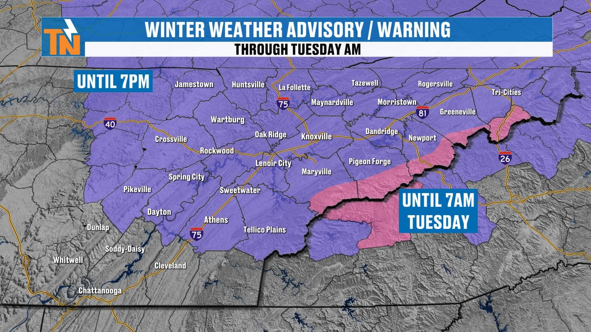
Advisories & Warnings
-
Winter Weather Advisory: Cumberland Plateau through 7 PM today
-
Winter Storm Warning: Highest peaks of the Smokies
-
Winter Weather Advisory: Surrounding mountain counties through Tuesday morning
The mountains remain the main focus, but the Plateau and northern valley could sneak in a quick burst or dusting.
Timeline
-
Morning: Light snow and flurries taper for a bit; breezy and cold.
-
Midday–Afternoon: Convective snow bands develop. Some areas will see bursts of snow; others may stay dry.
-
Evening: Snow activity winds down. Skies clear overnight.
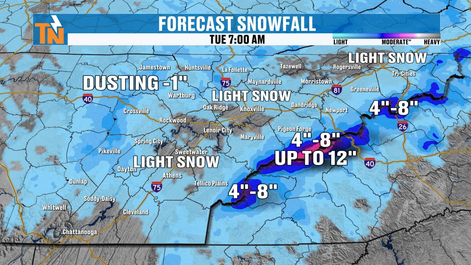
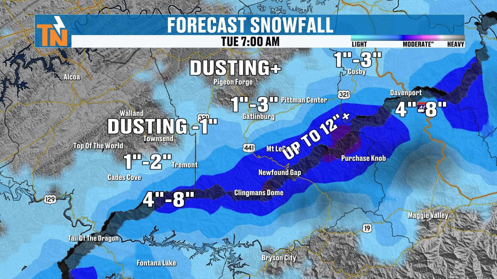
Snow Totals
-
Valley: Flurries or a light dusting possible
-
Cumberland Plateau: Dusting to 1″ on grassy/rooftop surfaces
-
Foothills (Pigeon Forge, Gatlinburg, Townsend): Dusting to 1–3″ possible
-
Smokies (highest peaks): 4–8″, with localized 10–12″ totals on Mt. LeConte, Clingmans Dome, and Newfound Gap
Travel & Road Conditions
Road temps rise above freezing this afternoon, so anything that sticks will quickly melt. However, refreezing is likely tonight as temperatures fall back into the teens and 20s, so watch for slick spots early Tuesday morning.
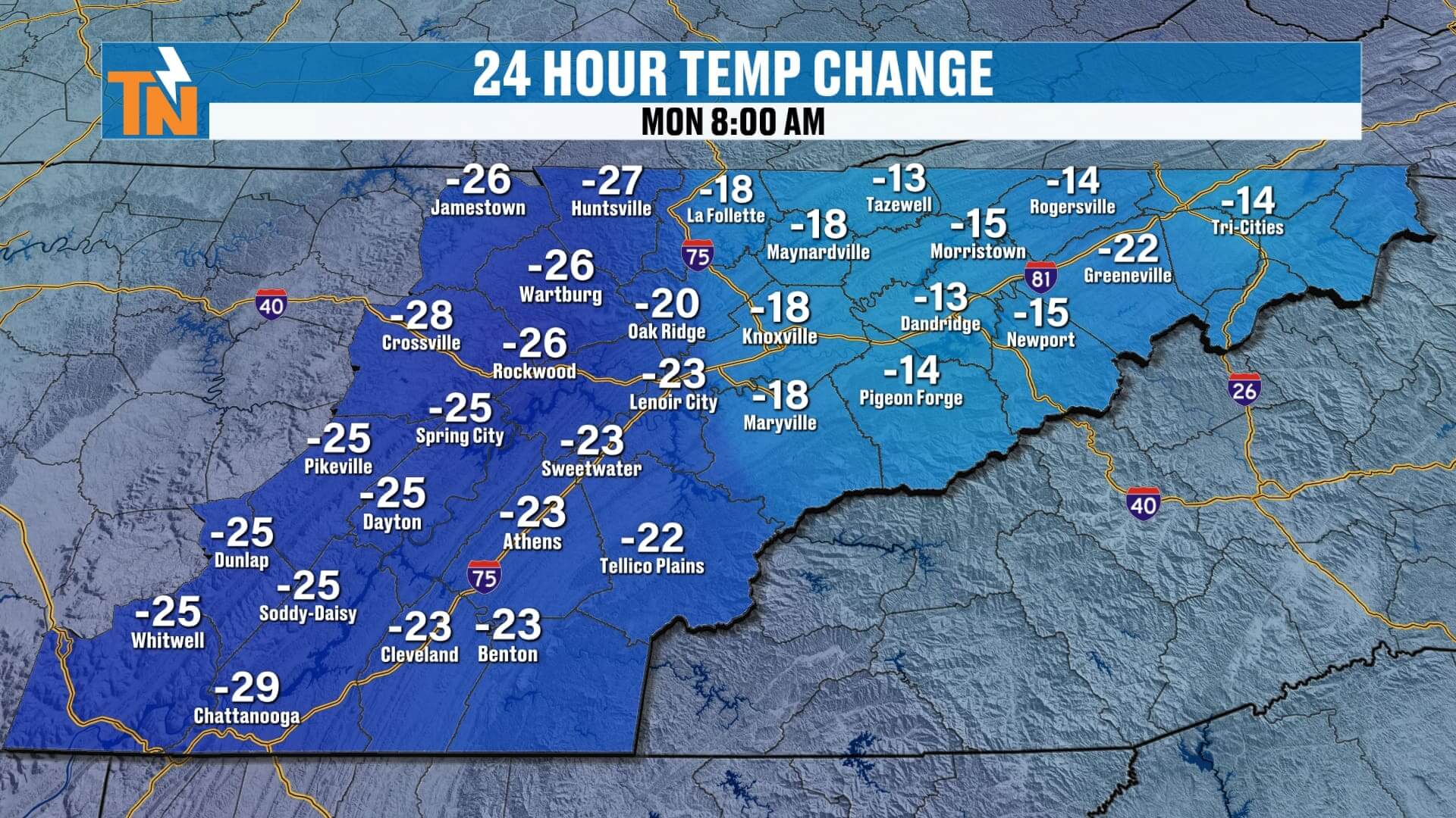
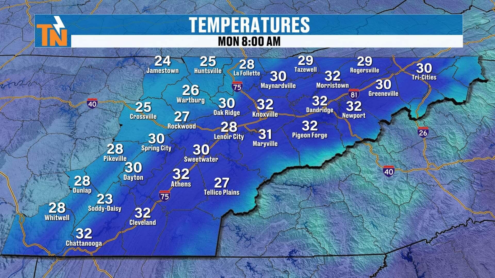
Temperatures & Wind Chills
-
Morning: 20s and 30s
-
Afternoon: Highs only in the mid–upper 30s
-
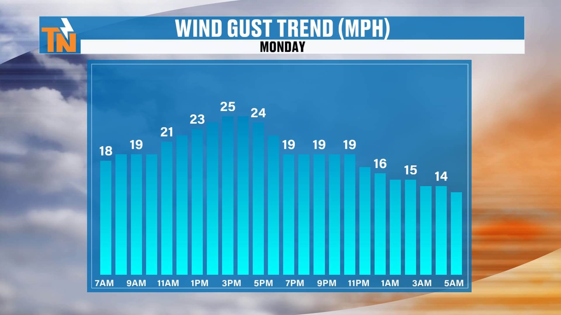
Wind: Northwest 10–20 mph, gusting higher
-
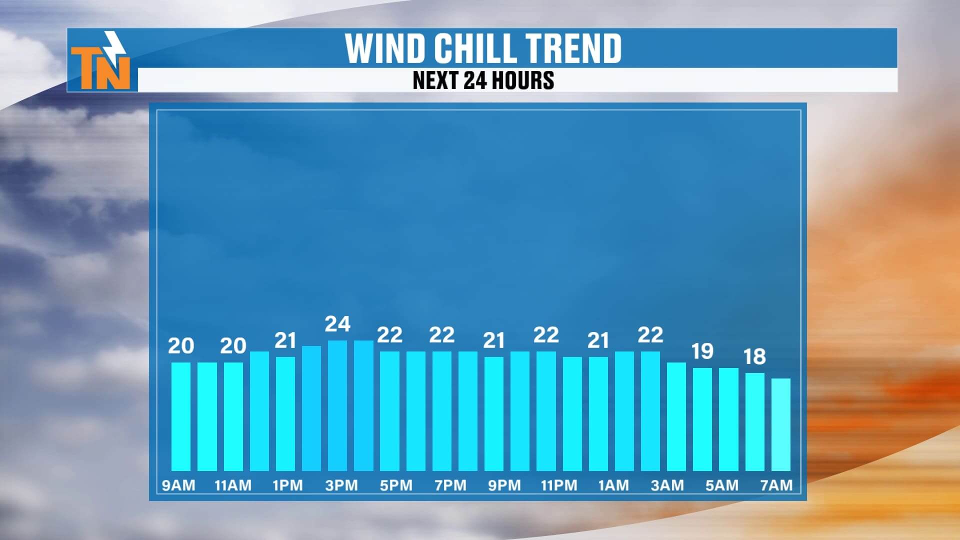
Feels Like: 20s all day due to wind chills
Tonight & Tuesday Morning
Bone-chilling cold with lows in the teens to low 20s. Clear skies, light wind, and frost potential.
Looking Ahead
-
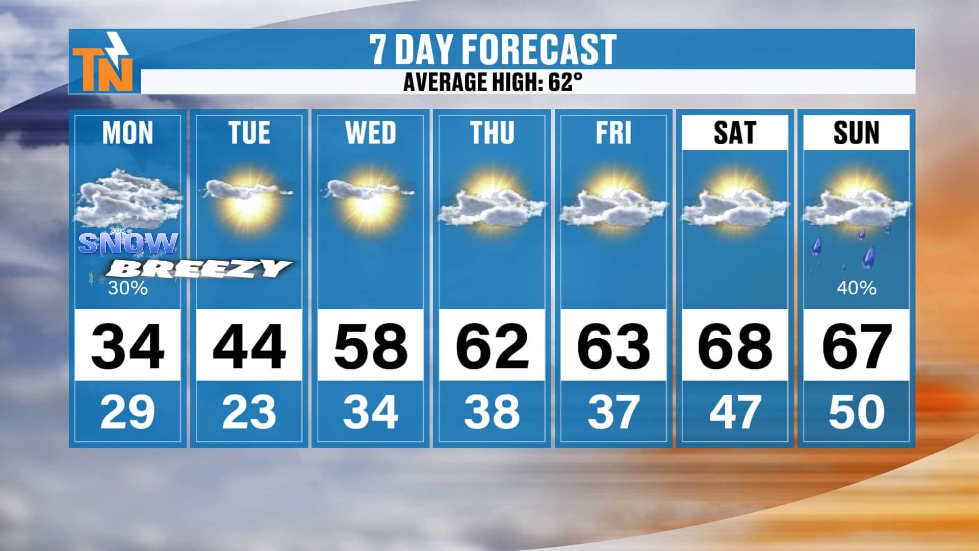
Tuesday: 44°, still breezy and cold.
-
Wednesday–Weekend: Warming trend returns; 50s by midweek, 60s to near 70° by the weekend.
Quick Takeaway
A few bursts of snow today, especially in the mountains and Plateau. Bitter cold and gusty winds make it feel like winter has officially arrived.
If you capture snow photos, share them with me on social or upload them through the East Tennessee Weather app — and don’t forget to check the interactive radar to track snow showers in real time. Bundle up out there and stay warm!