
Severe Storms Move Out, Sunshine Returns
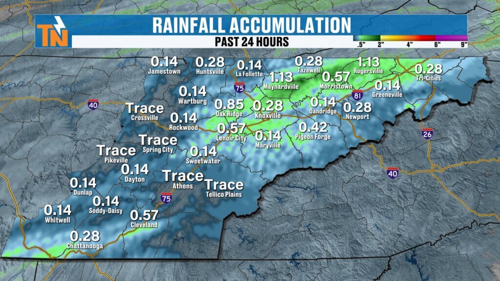
Happy Friday! Sure hope you have a great day today. It certainly started off active across East Tennessee. An intense line of showers and thunderstorms — including a few strong to severe storms — pushed through early this morning as a cold front swept east and southeast of the region.
That line packed a punch with heavy rain and gusty winds, but the good news is it moved through quickly. As it exits, we’ll see rapidly improving weather conditions. Sunshine returns, and a ridge of high pressure begins building in behind the front, temporarily stabilizing our weather pattern.


Windy & Warm This Afternoon
Behind the cold front, winds remain strong through the first half of the day. Southwest wind gusts are reaching up to 45 mph, especially across the mountains where a Wind Advisory remains in effect until early afternoon.
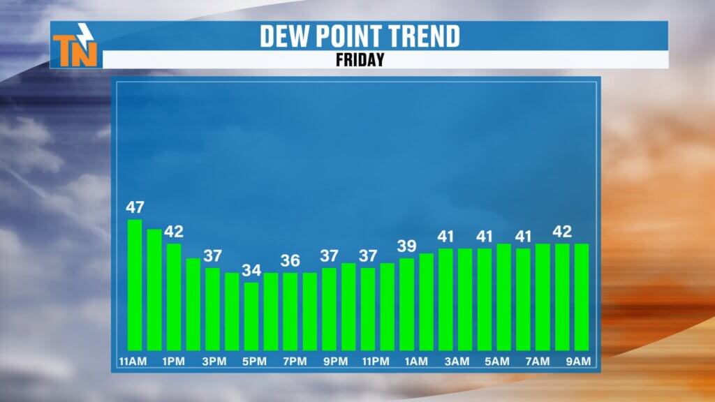
It was an unusually warm start to the day, with temperatures in the 50s, 60s, and even low 70s early this morning. Rain-cooled air briefly knocked temperatures down, but we’ll rebound this afternoon with highs climbing back into the 70s under abundant sunshine.
Dew points drop quickly this afternoon as drier air settles in, giving us crystal-clear skies and a much less humid feel.
Another Round of Rain Overnight
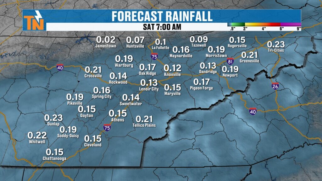
Clouds increase again this evening as the next disturbance approaches. Another wave of low pressure moves in overnight, bringing a fresh round of rain to East Tennessee.
This system will make for a soggy start to Saturday morning, similar to what we experienced yesterday — overcast skies, patchy fog, and damp conditions early.
Rainfall totals overnight into Saturday morning look light to moderate, generally between 0.10″ and 0.33″, but locally higher totals are possible in heavier showers.
More Rain Saturday Night Into Sunday
After a break Saturday afternoon, rain chances increase again Saturday night into Sunday as yet another wave of energy moves through the Tennessee Valley.
This marks the beginning of a significant pattern shift.
As the low pressure system tracks east, colder air surges in behind it. A strong northwesterly flow develops, signaling the return of winter-like conditions across the Appalachian region.
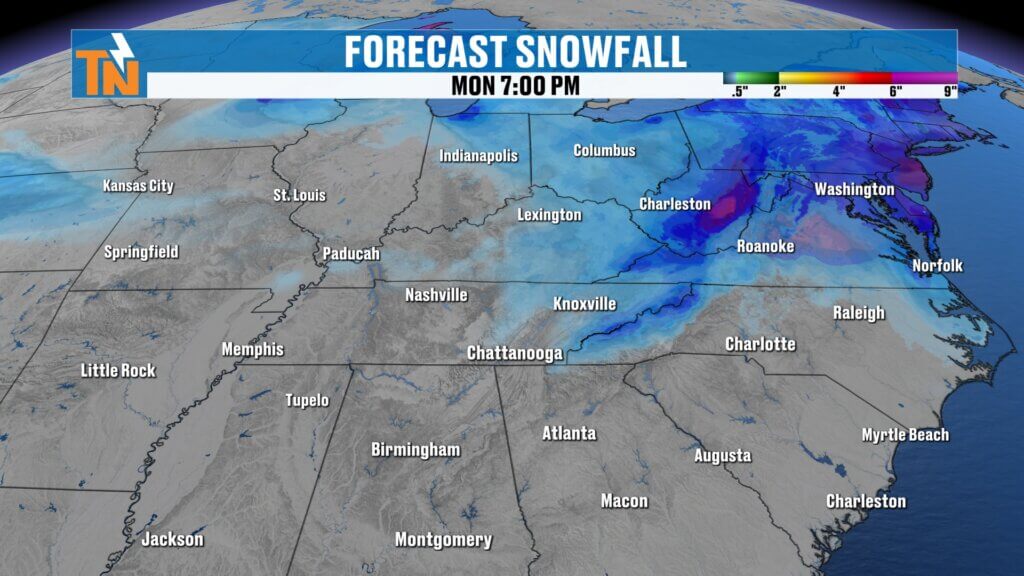
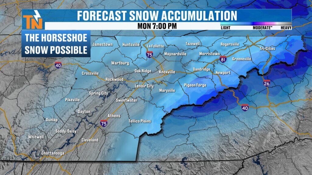
Mountain Snow Returns to the Smokies
As colder air filters in Sunday into Monday, rain transitions to snow showers in the higher elevations.
This classic northwest flow setup favors snowfall across:
- The Cumberland Plateau
- Upper East Tennessee
- The Great Smoky Mountains
- The broader Appalachian Mountains
Heavier snow accumulations are expected across West Virginia and higher elevations of the central Appalachians, but here in East Tennessee, the “classic horseshoe” pattern sets up again.
Snowfall projections currently suggest:
- Smoky Mountains: 1 to 3 inches, possibly 2 to 4 inches in the highest elevations
- Plateau & Upper East Tennessee: Light snow showers, minor accumulations possible
Old Man Winter is not quite ready to step aside just yet.
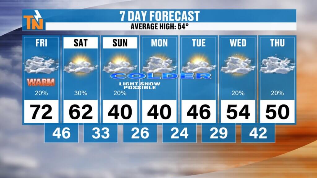
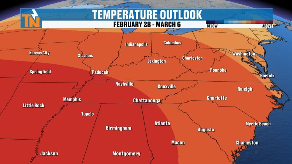
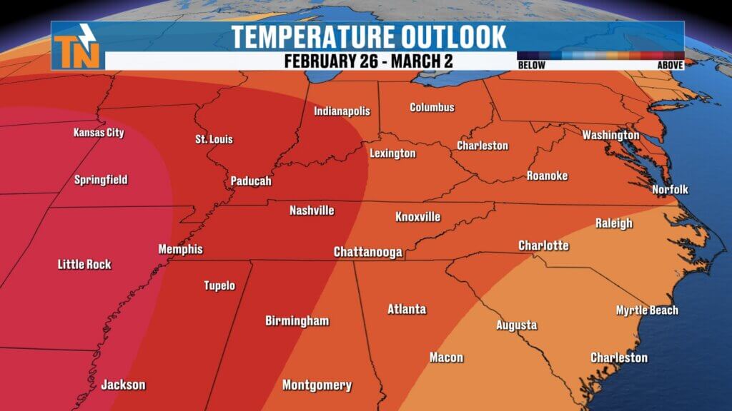
Temperature Outlook: Big Pattern Change
- Friday: High near 72°
- Saturday: Cooler at 62°
- Sunday & Monday: Highs in the 40s with colder air firmly in place
- Midweek: Rebound back into the 50s
This is a sharp but short-lived cooldown before temperatures moderate again next week.
Extended Forecast & What to Watch
We remain in an active weather pattern with multiple disturbances bringing rounds of rain, gusty winds, and mountain snow.
Stay alert for:
- Additional rainfall totals
- Changing snow forecasts in the mountains
- Strong northwest winds behind Sunday’s system
For the latest updates, interactive radar, and real-time alerts, be sure to check the East Tennessee Weather App.
Have a great Friday, and enjoy the sunshine before the next wave moves in.