
Good morning and thanks for checking in with your East Tennessee morning weather update. We have a busy forecast ahead with rain showers this morning, near-record temperatures again today, and a growing severe weather threat late Wednesday into early Thursday. Another storm system may also arrive late this weekend into early next week.
Let’s break down the details of what’s happening across the Tennessee Valley.
Morning Showers Moving Through East Tennessee
We’re starting the day with scattered rain showers moving across the region, thanks to a weak disturbance sliding through the Tennessee Valley.
The bulk of the stronger overnight storm activity remained farther south across Georgia and Alabama, but this leftover wave of energy is producing some light showers across East Tennessee early this morning.
A radar recap from the last several hours shows a line of showers moving west to east across the region.
Fortunately, these showers are moving into more stable air, which means they should gradually weaken as they continue eastward.
Timing the Rain Today
The majority of today’s rainfall will occur during the morning hours.
Expected Timeline
Early Morning – 8 or 9 AM
- Line of showers moving across the region
- Light to moderate rain in spots
Late Morning
- Rain begins weakening
- Mostly cloudy skies
Afternoon
- Hit-and-miss sunshine
- A few isolated spotty showers possible
By the time we get past lunchtime, the rain coverage should become much more scattered.
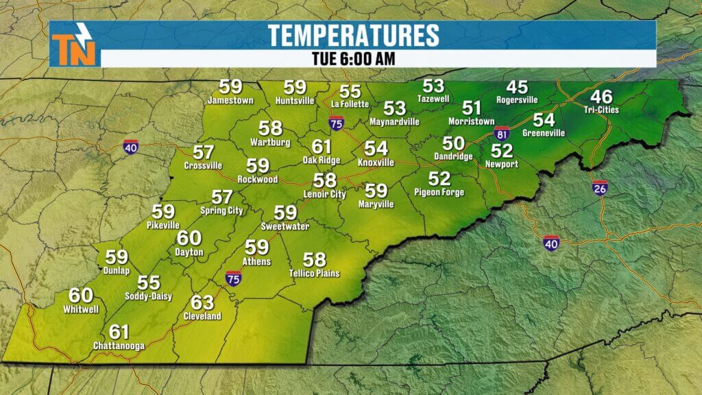
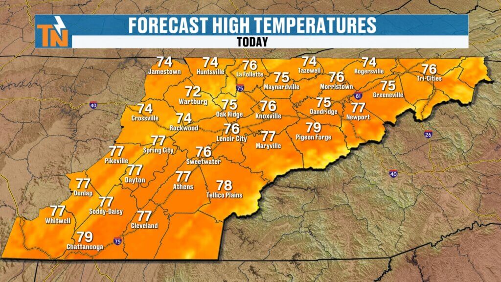
Warm Temperatures Continue Across the Region
Even with the clouds and early rain, temperatures remain well above average.
Most areas started the morning in the 50s and even low 60s, which is quite mild for early March.
By this afternoon, expect high temperatures climbing back into the mid to upper 70s, putting us close to near-record warmth once again.
This continues the recent stretch of spring-like weather across East Tennessee.
Next Major Storm System Arrives Wednesday Night
While today’s rain is fairly minor, the next significant weather system arrives late Wednesday into early Thursday.
This system originates from a developing trough near Baja California, which will combine with energy moving across the Plains to create a stronger storm system moving into the Southeast.
As the system approaches, it will produce several days of severe weather across the Mississippi Valley and Southeast.

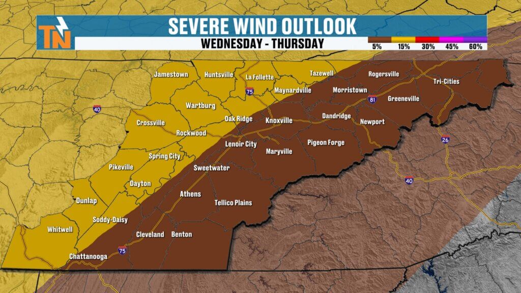
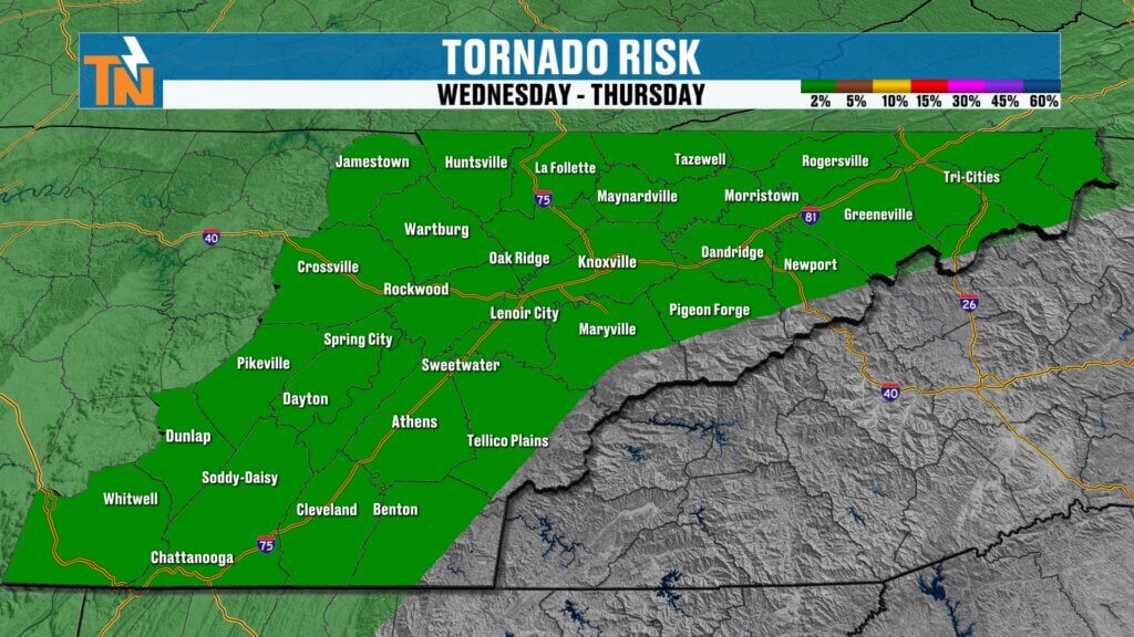
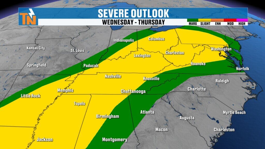
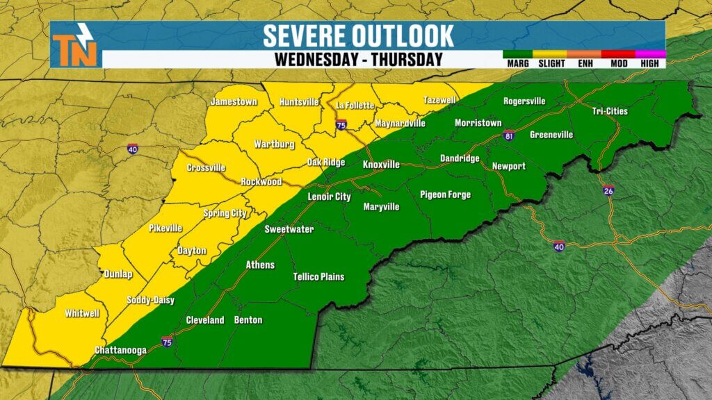
Severe Weather Risk for East Tennessee
According to the Storm Prediction Center, parts of East Tennessee are now included in a severe weather outlook for Wednesday night into early Thursday morning.
The current outlook includes:
- Level 2 risk (Slight Risk) west of Interstate 75
- Level 1 risk (Marginal Risk) across the eastern portion of East Tennessee
This places the Cumberland Plateau and areas west of the I-75 corridor at the highest risk locally.
Primary Storm Threats Wednesday Night
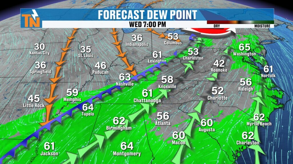
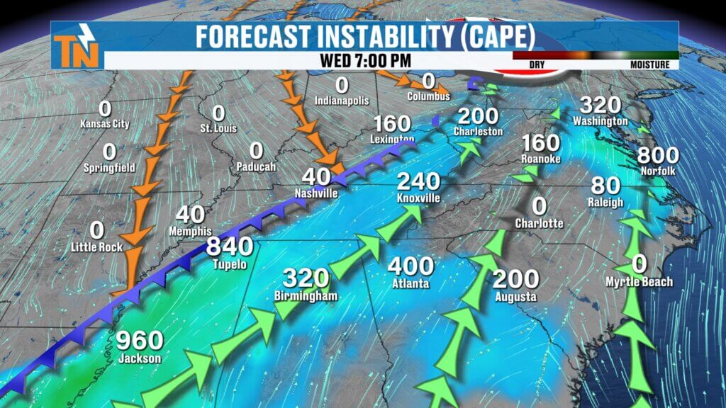
As the cold front approaches, warm and humid air will surge into the region.
Forecast dew points climbing into the 50s and low 60s will provide moisture for storms.
Possible storm hazards include:
- Damaging wind gusts
- Large hail
- Isolated tornado potential
The tornado threat appears highest across the Cumberland Plateau, where atmospheric wind shear will be strongest.
Storm Timing Wednesday Night
Current model guidance suggests storms will begin approaching the region Wednesday evening.
Potential Timeline
Wednesday Evening (around 7 PM)
- Storms approaching Middle Tennessee
Late Evening
- Line of storms moving toward the Cumberland Plateau
Overnight Wednesday Night
- Storms moving across East Tennessee
Some rotation may develop along the leading edge of the storm line, especially across Fentress and Cumberland counties along the Plateau.
However, as the storms move eastward toward the Tennessee Valley, the instability and wind energy should decrease, reducing the severe threat somewhat.
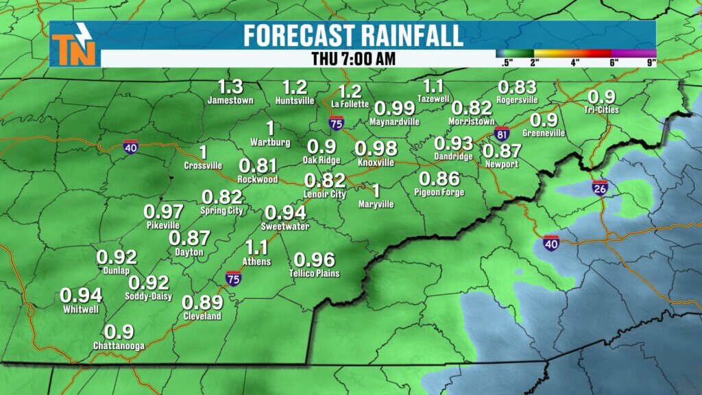
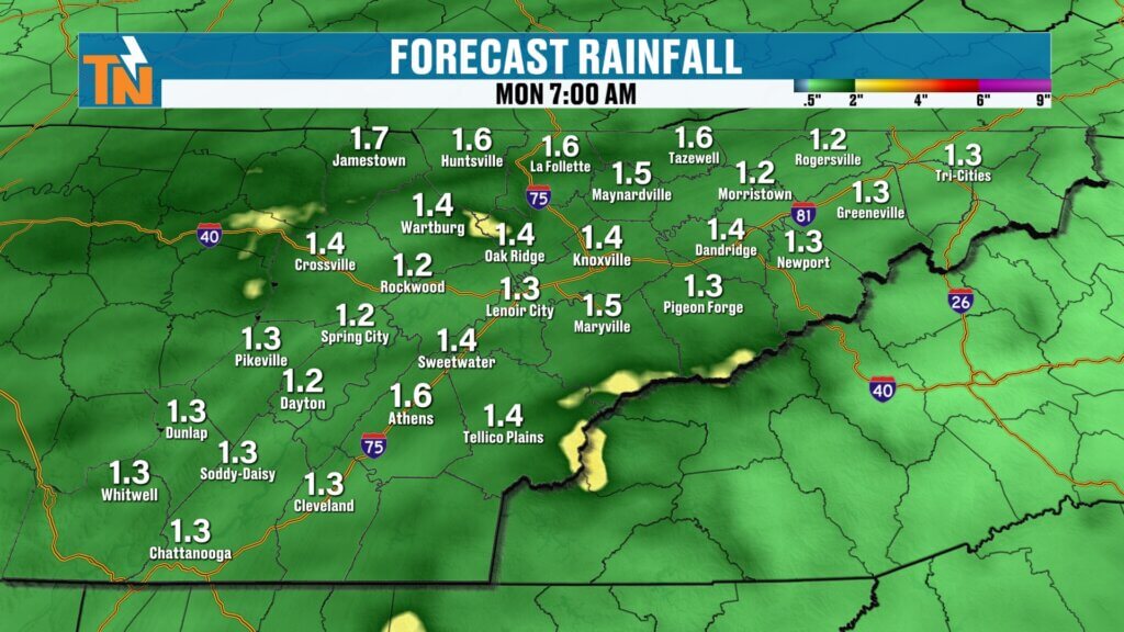
Rainfall Totals from the Midweek System
The midweek system will also bring beneficial rainfall across the region.
Most areas can expect around:
- Approximately 1 inch of rainfall
This will help provide much-needed moisture across parts of the region that have been dealing with dry conditions.
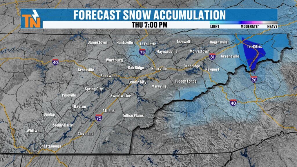
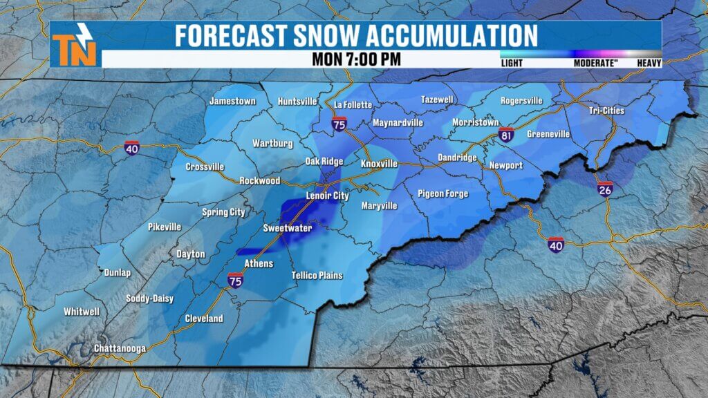
Cooler Air Arrives Behind the Cold Front
Once the storm system passes, a cooler air mass will settle into the Tennessee Valley.
High temperatures will drop from the 70s and low 80s earlier in the week to the low 50s by Thursday afternoon.
Some light snow could even fall across the highest elevations of the Smoky Mountains and Upper East Tennessee, though travel impacts are not expected.
Another Storm System Late Weekend
The weather pattern remains active as we head toward the weekend.
Another storm system is expected to develop Sunday into Monday, bringing:
- Increasing winds
- Another round of rainfall
- Possibly colder air again
At this point, valley locations are unlikely to see snow, though mountain areas could see a few light snow showersdepending on how temperatures evolve.
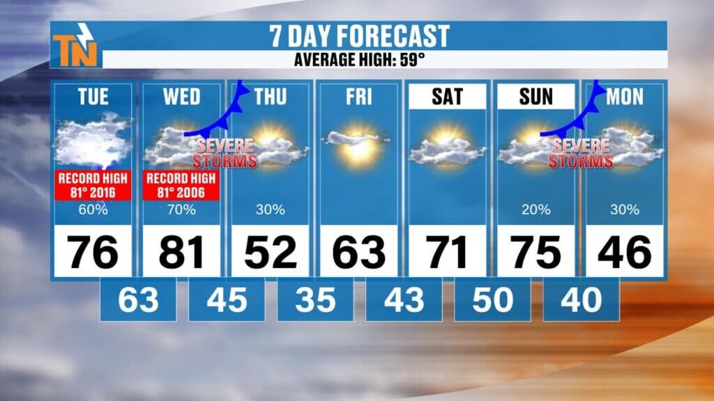
East Tennessee 7-Day Weather Outlook
Tuesday: Warm with highs near 76° and a mix of sun and clouds
Wednesday: Near-record warmth around 81°
Wednesday Night: Showers and strong storms possible
Thursday: Cooler with highs in the low 50s
Friday: Mostly sunny with highs in the low 60s
Saturday: Mild and quiet
Sunday – Monday: Next storm system brings rain and gusty winds
Final Thoughts
East Tennessee has a very active weather pattern over the next week with three separate storm systems to watch:
- Morning showers today
- A stronger system Wednesday night into Thursday
- Another storm system late Sunday into Monday
The midweek system will be the one to monitor most closely for strong to severe storms across parts of the region.
Be sure to check back for updates and stay weather aware as we move through the week.
Have a great day and thanks for checking in.