
Good morning and thanks for checking in for your East Tennessee weather update. We’ve got a lot going on today — from a blood moon lunar eclipse early this morning to near-record high temperatures this afternoon. And while the short-term forecast stays warm and mostly dry, rain chances begin to increase as we head into the weekend and beyond.
Let’s break it down.
🌕 Blood Moon & Lunar Eclipse Over East Tennessee
If you’re reading this before 6:33 AM, step outside and take a look at the sky. A full moon lunar eclipse — often called a “blood moon” — is taking place this morning.
Mid-level clouds have been drifting across parts of East Tennessee, but many areas should still get a glimpse of the eclipse before sunrise. If you manage to catch it, send in your photos.

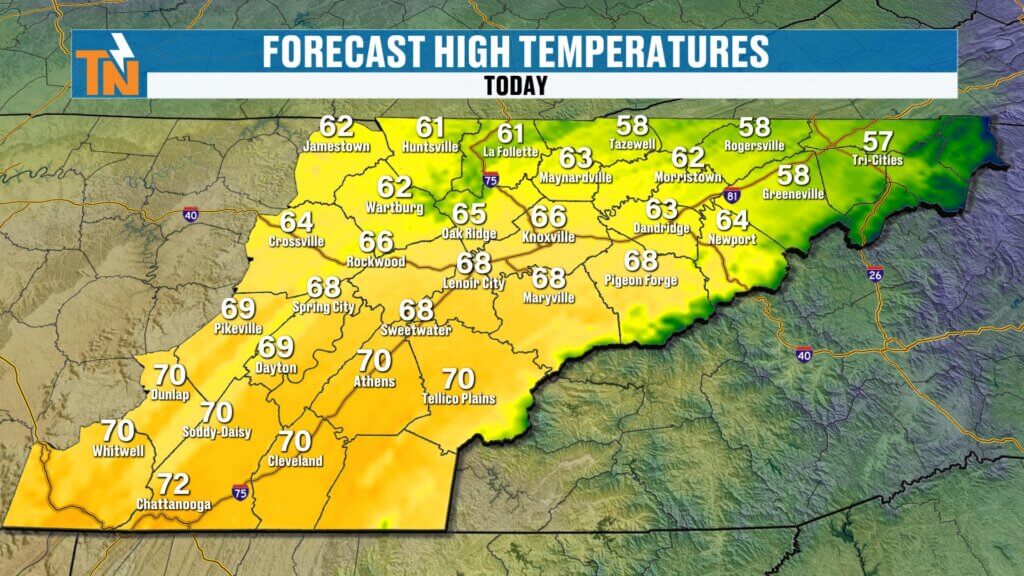
Today’s Forecast:
- Morning lows: 30s for a few, but most in the 40s and 50s.
- Afternoon highs: Mid to upper 60s.
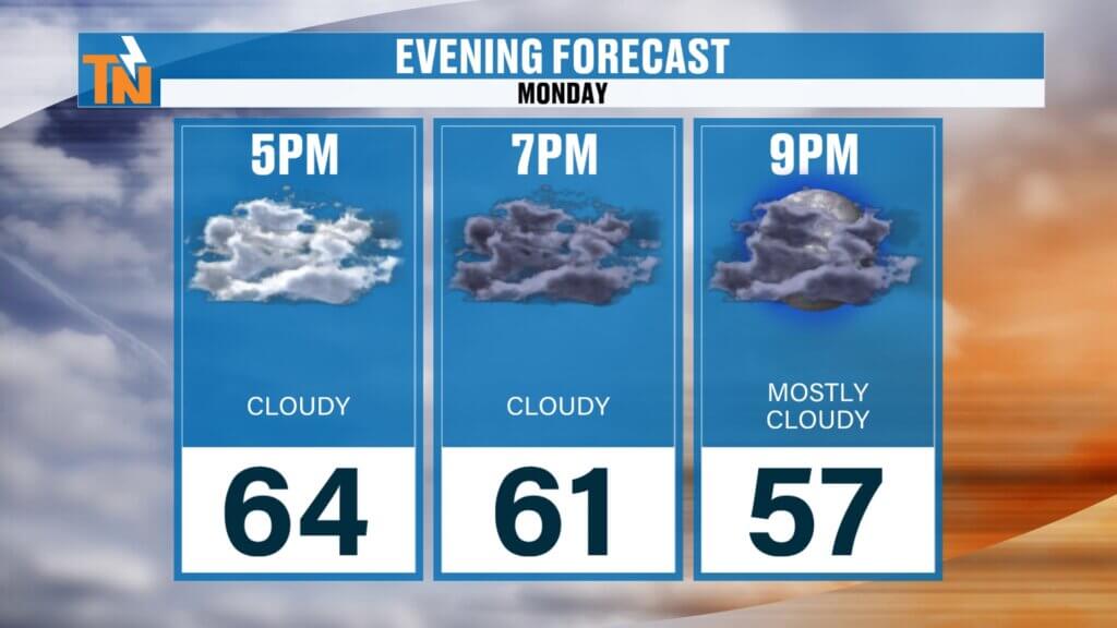
- Increasing clouds throughout the day.
- Gusty southwest winds developing.
These temperatures are running well above seasonal norms and approaching near-record levels for this time of year.
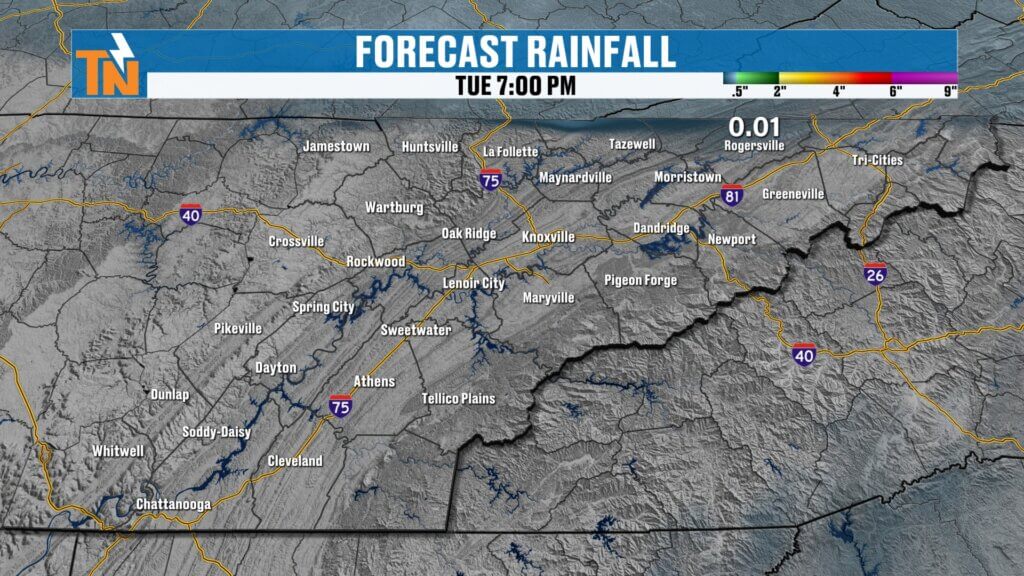
🌦️ Weak Wave Brings Spotty Showers North of I-40
A weak upper-level disturbance is sliding through this morning.
From now through midday, areas along the Tennessee-Kentucky border could see a few light showers. This is not a widespread rain event, and many communities will stay dry.
By early afternoon:
- That wave quickly exits.
- Skies remain partly cloudy.
- Warm southwest flow continues.
Rain coverage remains minimal through Thursday, with most organized precipitation staying west and northwest of East Tennessee.
🌀 Bigger Pattern Shift: Trough to the West, Battle Zone to the North
In the upper levels of the atmosphere, the jet stream continues to strengthen. A ridge dominates the Southeast, while a trough digs into the Intermountain West.
The “battle zone” — where warm and cold air masses collide — is currently positioned across the Ohio Valley and along and west of the Mississippi River Valley. That’s where most of the active weather is taking shape.
But as this trough gradually shifts east, it will begin nudging rain chances closer to East Tennessee.
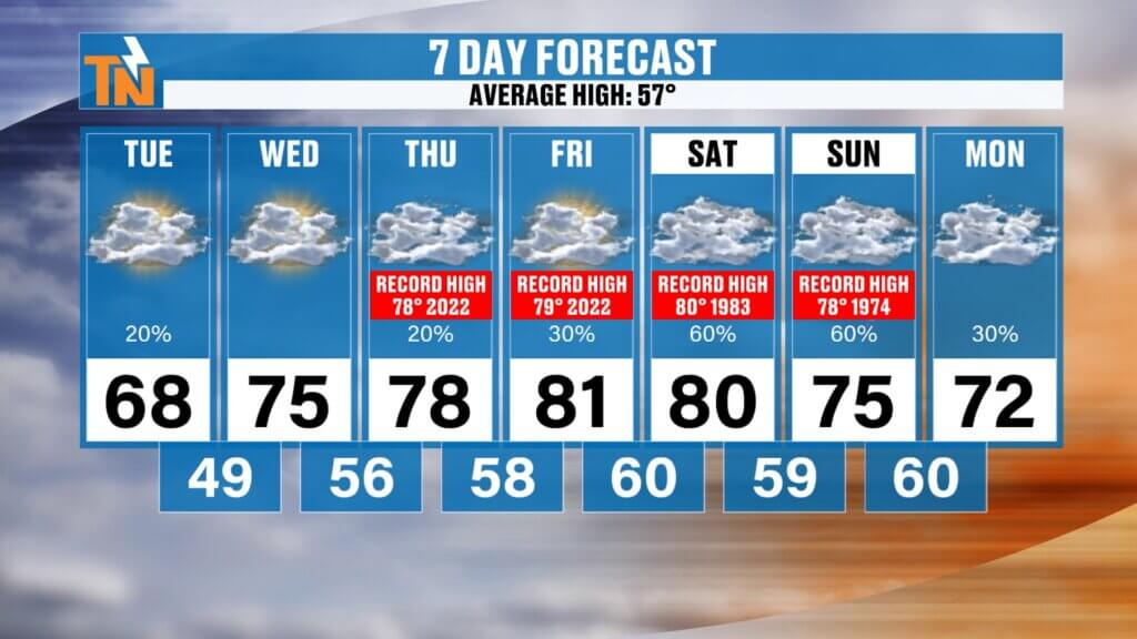
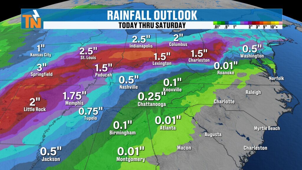
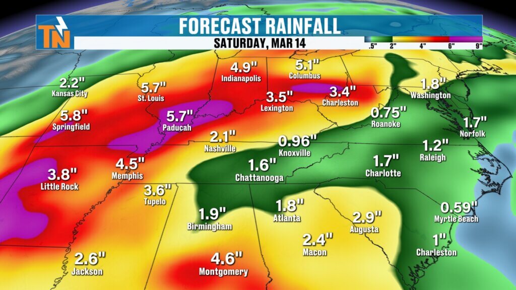
🌧️ Weekend Outlook: Increasing Rain and Elevated Storm Chances
As we head into Saturday and Sunday, rain chances begin to climb.
Forecast guidance — including the GFS model — shows:
- Most rain through Friday staying north and west of us.
- Showers pushing into East Tennessee by Saturday into Sunday.
- Potential rainfall totals of three-quarters of an inch to around one inch through the weekend and early next week.
While not a guaranteed washout, this marks a transition toward a more unsettled pattern.
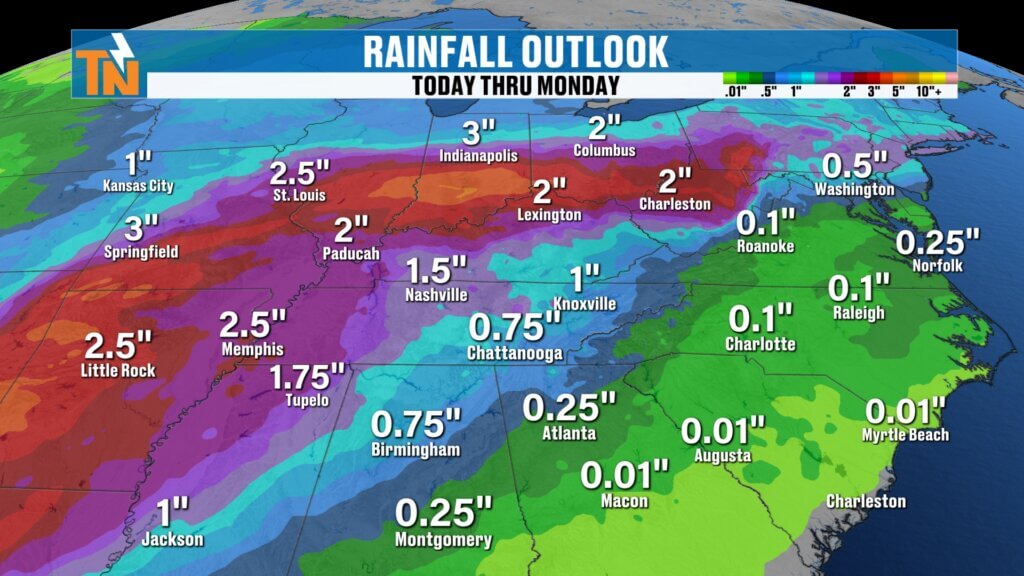
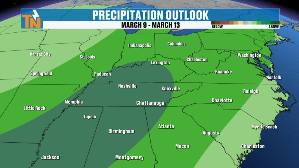
🔮 Extended Outlook: Elevated Rain Chances Continue Into Mid-March
Looking beyond the 7-day forecast:
- The Weather Prediction Center’s 6–10 day and 8–14 day outlooks both highlight above-average precipitation chances.
- Temperatures remain above average in the short term.
- Rainfall totals could trend upward as we move deeper into mid-March.
Model guidance will continue to fluctuate from run to run, so it’s important to watch trends rather than focusing on one specific rainfall number.
The general takeaway: Elevated rain chances appear likely beyond the weekend.
🌡️ Temperature Trend Summary
Beyond 7 days: Above-average temperatures with increasing precipitation potential.
Today: Near-record warmth, mid to upper 60s.
Thursday: Mild and partly cloudy.
Friday: Warm and mostly dry.
Weekend: Increasing clouds and rain chances.

Final Thoughts
Today’s headline: Near-record highs and a beautiful lunar eclipse to start the morning.
Short term: Warm and mostly dry.
Late weekend into next week: Increasing rain chances as the jet stream shifts and the western trough moves east.
Enjoy the warmth today. Get outside if you can. And keep checking back as we fine-tune rainfall expectations for the weekend and beyond.
Have a great day.