
Good morning and happy Wednesday. Thanks for checking in with your East Tennessee morning weather update. After a quiet and comfortable start to the day, we’re heading into a stretch of above-average temperatures, near-record warmth, and increasing rain chances as we approach the weekend.
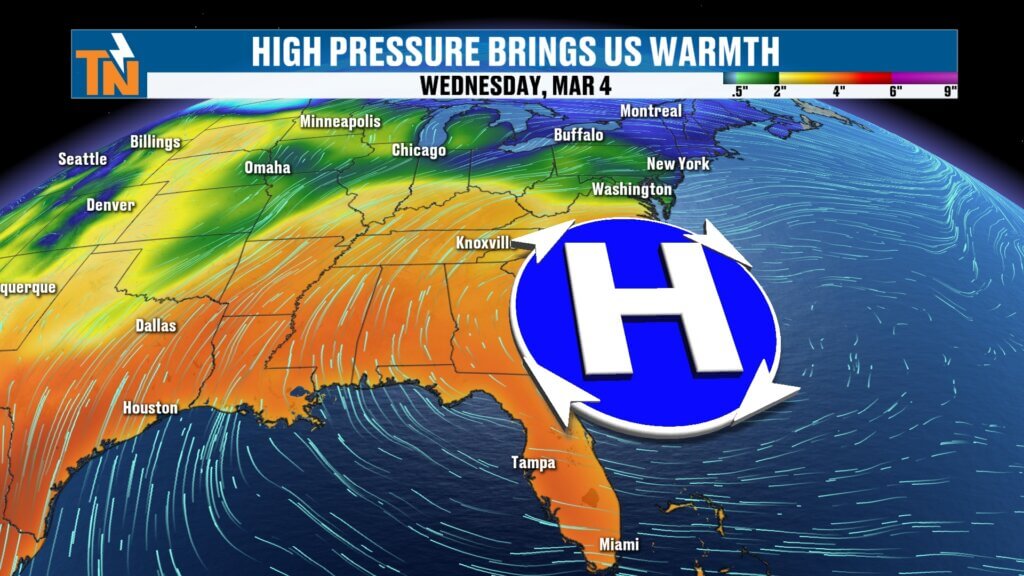
High pressure continues to dominate the Southeast today, but changes are already brewing in the larger weather pattern. A stronger system will eventually move in, bringing showers, thunderstorms, and possibly a bigger storm threat early next week.
Let’s walk through the forecast.
Warm Spring-Like Weather Returns Across East Tennessee
High pressure anchored along the East Coast is helping to push warm air northward into the Tennessee Valley. With colder air locked up well to our north, temperatures today will climb well above seasonal averages.
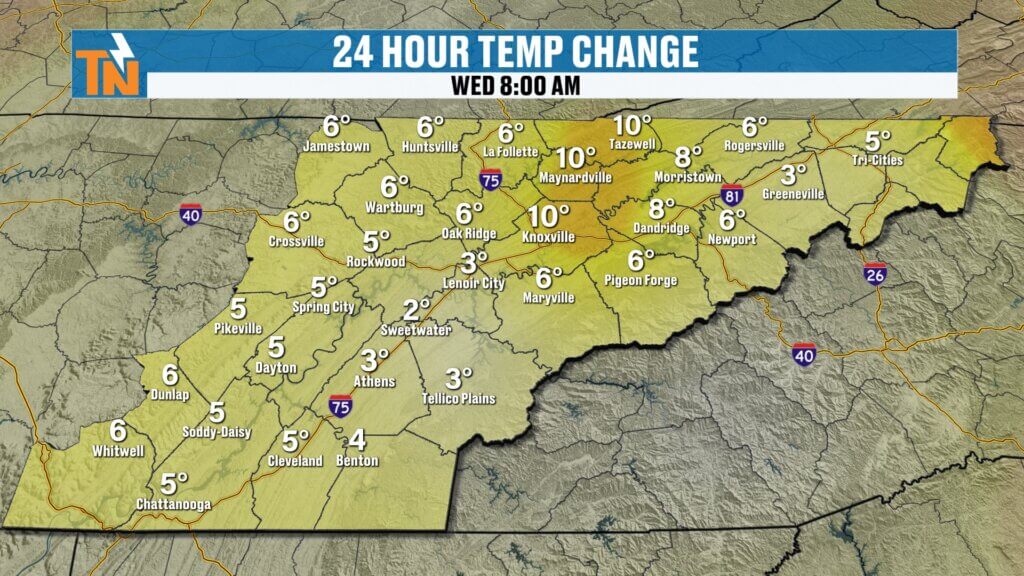
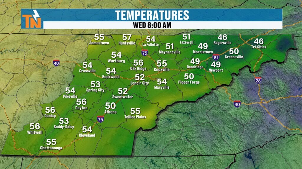
We started the morning off warmer than yesterday, with most locations sitting in the 50s and a few upper 40s across higher elevations. It’s a quiet and comfortable start to the day.
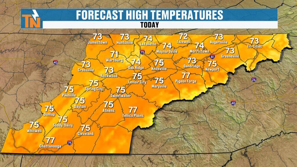
By this afternoon, expect a mix of sunshine and clouds with highs reaching the mid to upper 70s across the region.
Expected High Temperatures Today
- Knoxville: 75°
- Tri-Cities: 73°
- Crossville: 73°
- Chattanooga area: mid-70s
It will feel much more like late spring than early March.
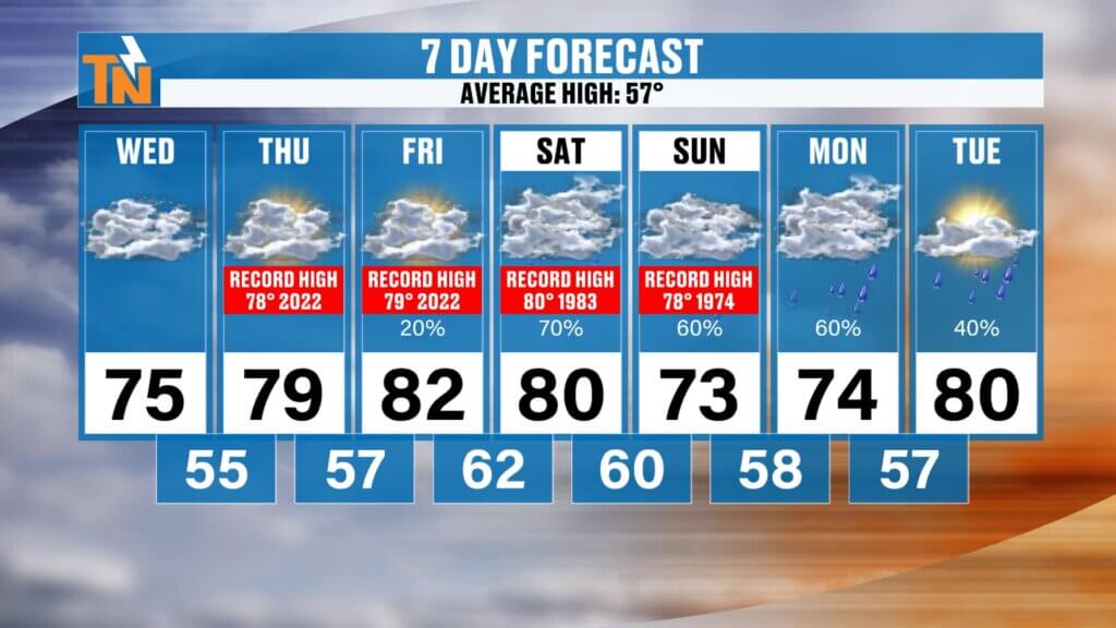
Record High Temperatures Possible Late Week
While today will be warm, the real headline arrives Thursday through Saturday when near-record or record-breaking temperatures become possible across East Tennessee.
Here’s a look at the potential records:
- Thursday: Forecast 79° (record 78°)
- Friday: Forecast 82° (record 79°)
- Saturday: Forecast 80° (record 80°, set in 1983)
That’s a remarkable warm stretch for early March and another clear sign that a strong ridge of high pressure remains in control across the Southeast.
Why the Atmosphere Is Warming Up
Looking at the larger weather pattern, the jet stream currently sits well west of the Tennessee Valley, with a deep trough digging into the western United States.
This pattern creates a classic setup:
- Warm air surging northward across the Southeast
- Colder air trapped across the western U.S.
- Storm energy developing along the jet stream boundary
As that trough slowly shifts east, it will eventually break down the ridge and allow a cold front to approach the region this weekend.
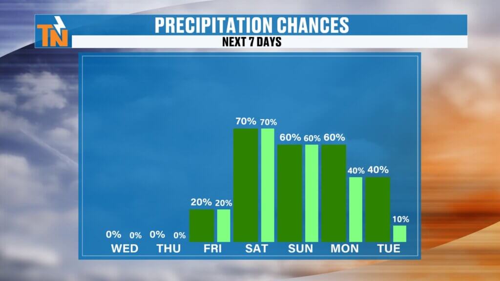
Friday: Isolated Showers and Thunderstorms Possible
By Friday, moisture begins to increase across the Tennessee Valley as winds shift to a southerly flow, bringing more humidity into the region.
With dew points climbing into the 60s and increasing atmospheric instability, we could see:
- A few isolated afternoon showers
- Possibly a rumble of thunder
These storms will be scattered and not widespread, but they mark the beginning of a more active pattern.
Weekend Cold Front: Better Chance for Rain and Thunderstorms
The main weather maker arrives over the weekend as a cold front pushes eastward toward East Tennessee.
This system will be much stronger across the Plains and Mississippi Valley, where severe weather is expected. As the front reaches our region, storms will likely weaken somewhat but still bring increasing chances for showers and thunderstorms.
Timeline for Weekend Weather
Friday Night
- Atmosphere briefly settles down.
Saturday Afternoon & Evening
- Increasing clouds.
- Showers and thunderstorms begin moving in.
Saturday Night into Sunday
- Highest rain chances across East Tennessee.
- Periods of showers and thunderstorms possible.
By late Sunday, the front should begin sliding east, gradually allowing rain chances to taper off.
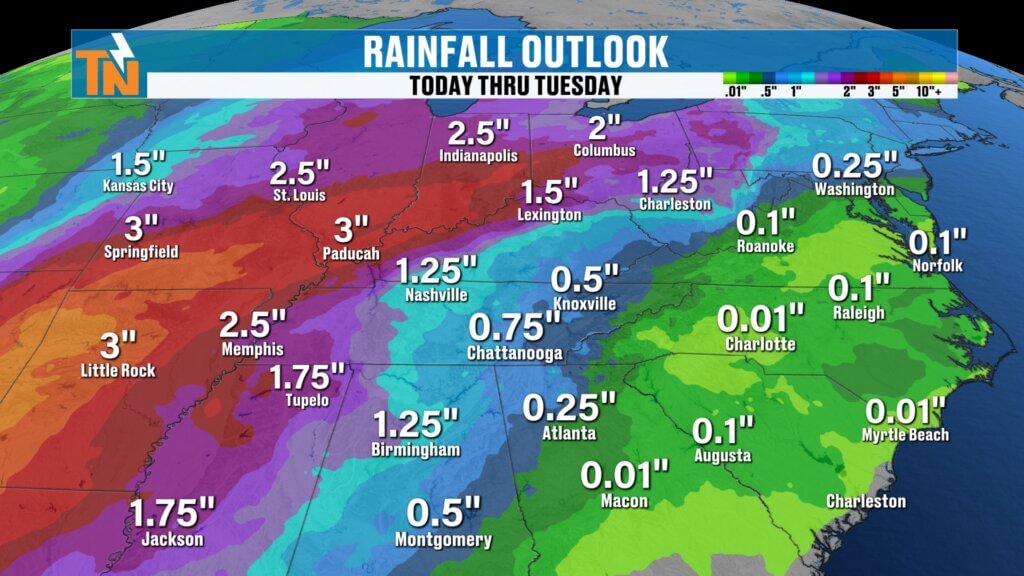
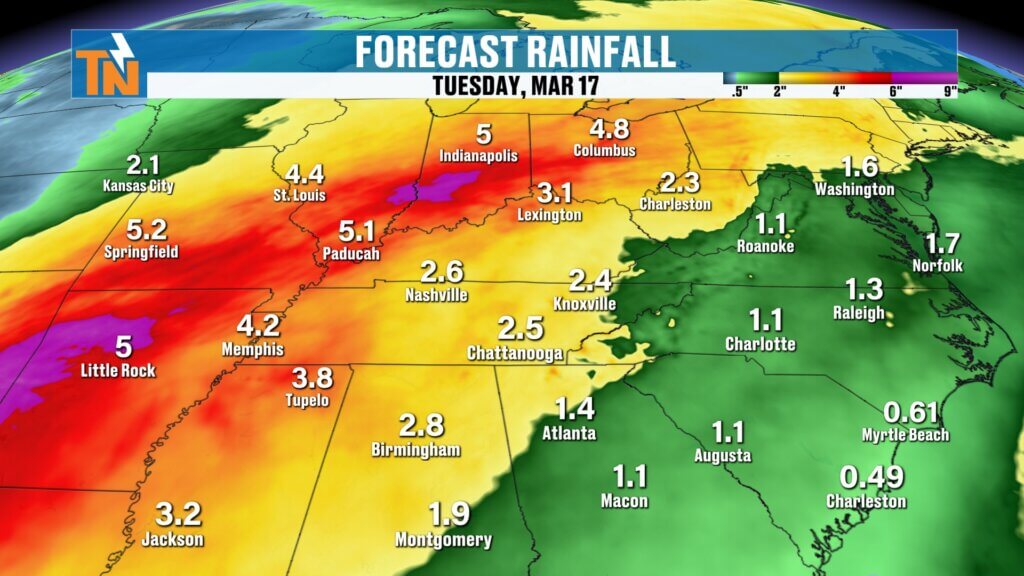
Rainfall Totals Through Early Next Week
Current forecast models suggest East Tennessee could receive around three-quarters of an inch to one inch of rainfallthrough Tuesday.
This would be beneficial rainfall, especially as portions of the region have been dealing with gradually increasing drought conditions.
Even beyond the seven-day forecast, the pattern continues to trend slightly wetter than average, meaning additional opportunities for rain may develop.
Early Next Week: Cooler but Still Above Average
Once the weekend system moves through, temperatures will cool slightly early next week. However, we are still expected to remain above seasonal averages for much of the extended forecast.
Rain chances will decrease Monday and Tuesday as the front moves out.
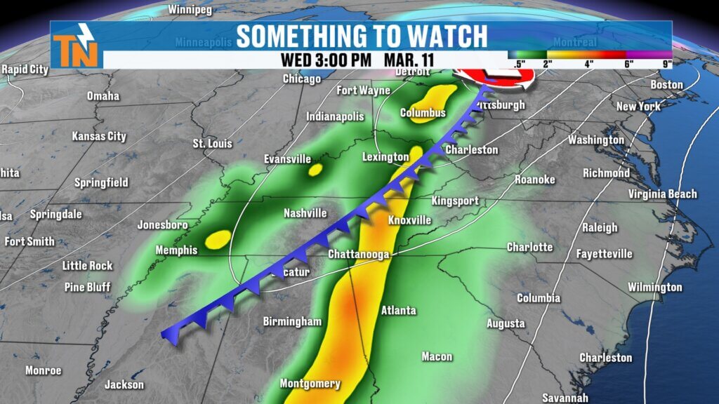
Watching Another Potential Storm System Around March 10–13
Looking further ahead, another storm system is already showing up in the long-range forecast models.
This system could arrive sometime between March 10th and March 13th and may be stronger than the one arriving this weekend.
That system could:
- Drag a stronger cold front through the region
- Pull colder air southward
- Bring the potential for strong or possibly severe thunderstorms
It’s still too early to know the exact impacts, but it’s something we’ll be monitoring closely over the coming days.
East Tennessee 7-Day Weather Outlook
- Wednesday: Mix of sun and clouds, highs mid-70s
- Thursday: Near-record warmth, upper 70s
- Friday: Low 80s possible, isolated showers or storms
- Saturday: Very warm with increasing storm chances
- Sunday: Showers and thunderstorms likely
- Monday: Rain tapering off, slightly cooler
- Tuesday: Drying out with mild temperatures
Final Thoughts
East Tennessee is in the middle of a remarkable warm stretch for early March, with several days of near-record high temperatures possible. While today and tomorrow stay mostly dry, rain and thunderstorm chances increase as we head into the weekend.
Make sure to check back daily for updates, especially as we continue tracking the weekend cold front and the potential stronger storm system arriving around mid-March.
Have a great Wednesday, and thanks for checking in.