
Good morning, East Tennessee!
Happy Wednesday. I hope you’ve got the rain gear ready, because if you’re not seeing showers right now, there’s a decent chance you’ll run into some rain before the day is done. A cold front is knocking on our door, and that means a soggy setup for midweek before we dry things out again this weekend.
Morning Radar Check: Showers on the Move
We’re waking up with a batch of scattered showers pushing from west to east across the region this morning. Locally heavy downpours are possible, and a few rumbles of thunder can’t be ruled out.
Here’s a quick radar tour of the hotspots:
-
Southern Valley: From Kingston to Farragut, showers are sliding into Knox County, with rain also impacting Greenback, Sweetwater, Athens, Etowah, and Tellico Plains.
-
Upper East Tennessee: Rain is filling in across Greene, Washington, and Sullivan Counties.
-
Northern Blount & Anderson Counties: Showers are beginning to push in and may bring brief heavy rainfall.
Don’t forget—you can track these showers right from your phone using the eastTNweather app’s interactive radar.It lets you scroll back two hours or look ahead to future radar projections so you can plan your commute or outdoor activities more confidently.
Wednesday Forecast: Scattered Rain, Below Average Temps
The morning batch of rain will move east, but energy in the atmosphere keeps shower chances alive into the afternoon and evening.
-
Morning: Scattered showers, locally heavy rain possible.
-
Afternoon: Spotty showers redevelop; not everyone gets wet, but most will see at least a passing shower.
-
Evening: Showers taper, though clouds linger.
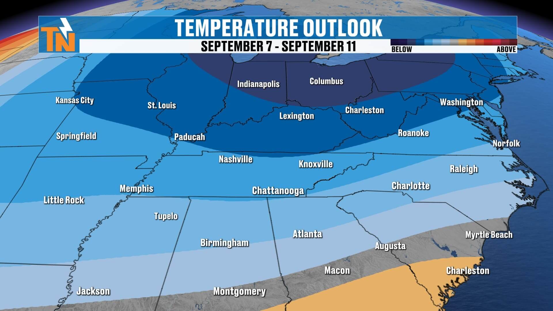
Highs: Upper 70s to near 80°, staying below the seasonal average of 87°.
Tonight: Down to the upper 60s by 10 PM, with clouds holding overhead.


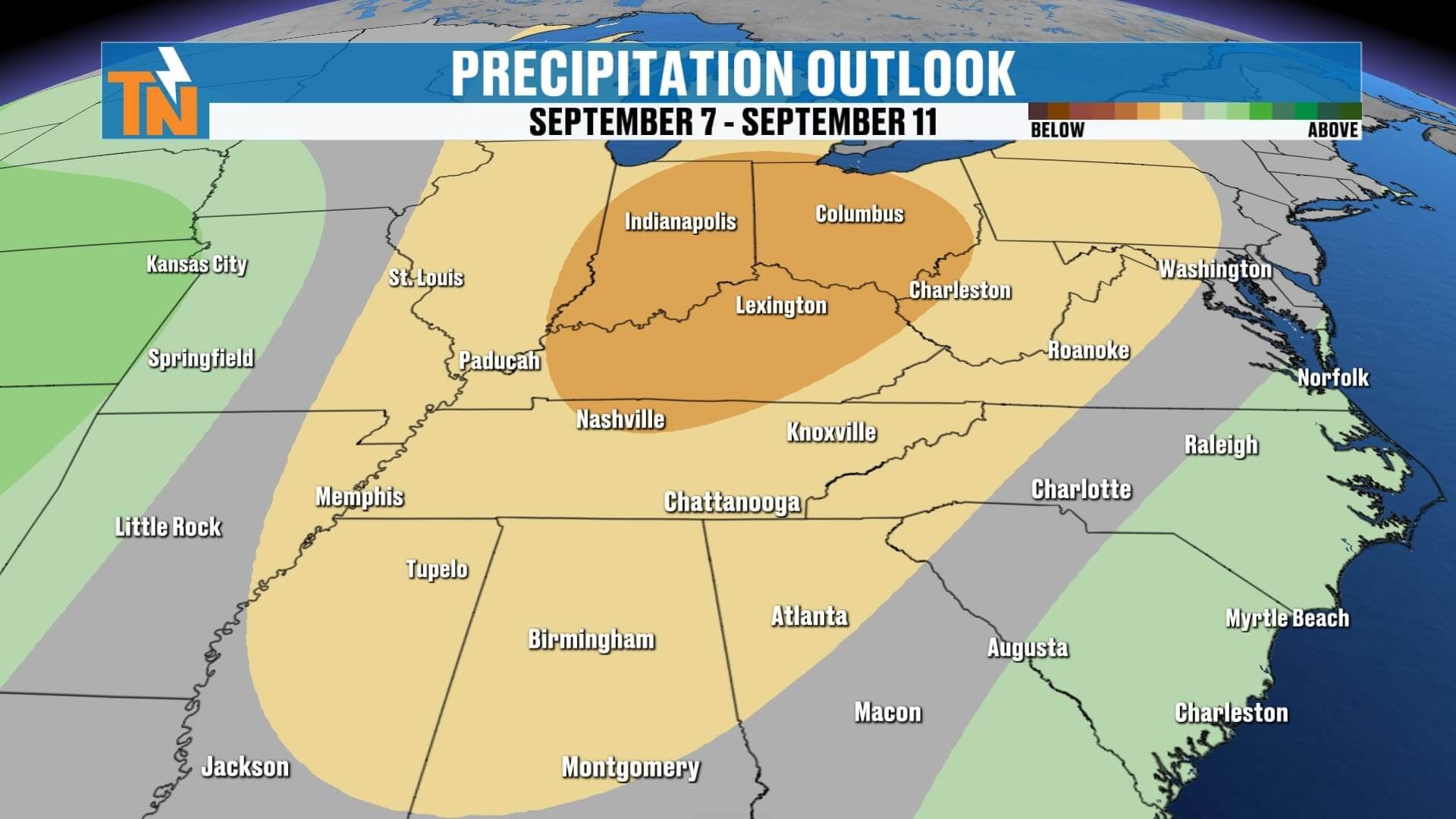
Thursday: Cold Front #1 Brings Widespread Showers and Storms
Our first cold front arrives Thursday, and with it comes the best chance for more widespread rain and storms.
-
Morning: A few showers possible before sunrise.
-
Afternoon: Cold front sparks additional showers and thunderstorms, especially after lunchtime.
-
Evening: Rain continues for the drive home and into the night, with locally heavy rainfall possible.
By the end of Thursday, most of East Tennessee should have picked up some much-needed rainfall.
Friday Into Saturday: Cold Front #2 & UT Football
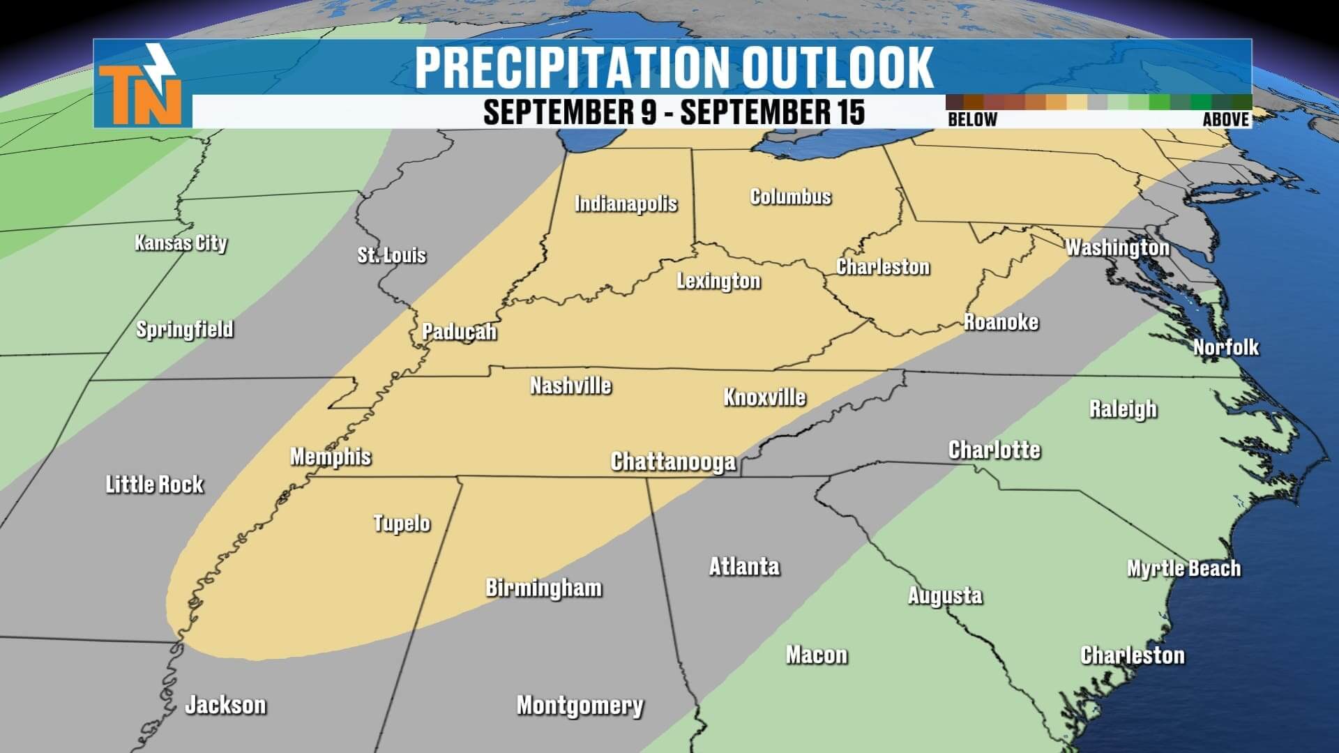
Cold Front #1 slides south Friday, but a second cold front isn’t far behind.
-
Friday: Mostly dry, seasonable highs in the low 80s. A few stray showers possible, but overall quieter.
-
Saturday: Cold Front #2 moves in. Showers possible in the morning, and additional rain may fire up by mid-afternoon—right around the 3:30 PM kickoff for Tennessee vs. ETSU.
-
Tailgating: Be prepared for showers around Neyland Stadium during the morning and afternoon. Have rain gear handy for both the tailgate and the game.
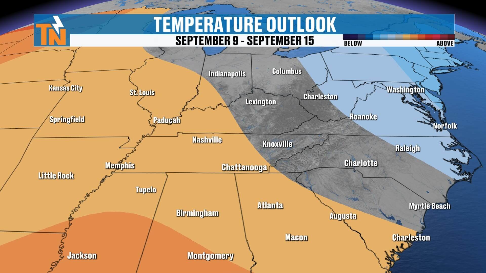
Sunday & Early Next Week: Dry, Crisp and Fall-Like
Once the second front clears out, we’ll be rewarded with another stretch of cooler, drier weather.
-
Sunday: Sunshine returns, highs upper 70s to low 80s, dew points fall back into the 50s.
-
Monday: Gorgeous—cool morning lows in the 50s, highs near 80°.
-
Tuesday: Rain chances return with another wave of energy.
7 Day Forecast at a Glance
Wednesday: Scattered showers, highs upper 70s–80°
-
Thursday: Cold Front #1, widespread showers/storms, cooler evening
-
Friday: Stray shower, otherwise quiet, seasonable highs low 80s
-
Saturday: Cold Front #2, scattered showers, UT game may see rain
-
Sunday: Dry, sunshine, crisp air, highs upper 70s
-
Monday: Cool morning, dry & sunny, highs near 80°
-
Tuesday: More showers possible with next system
Weather Headlines
-
️ Wednesday: Scattered showers across East Tennessee, locally heavy downpours
-
⛈️ Thursday: Cold Front #1 brings widespread rain and storms
-
Saturday UT Football: 3:30 kickoff may feature rain showers; keep ponchos ready
-
️ Sunday & Monday: Sunshine, dry, crisp, below-average temps
-
Next Week: Another refreshing fall-like stretch ahead

ABOVE AND BEYOND THE 7 DAY FORECAST
Final Word
It’s a wet Wednesday across much of East Tennessee, and the soggy pattern continues Thursday with Cold Front #1. After a quieter Friday, Cold Front #2 rolls through Saturday, meaning tailgaters and Vol fans at Neyland Stadium should prepare for showers. But the good news—once the weekend fronts move through, Sunday and Monday look fantastic with sunshine, crisp mornings, and highs in the 70s and low 80s.
Stay ahead of the rain with the eastTNweather app. Use the interactive radar, get lightning alerts, and check push notifications for the latest updates across Knoxville, the Plateau, and the Smokies.
Enjoy your Wednesday, East Tennessee, and I’ll see you back here soon with more updates!