
Happy Sunday and thanks for checking in with your East Tennessee morning weather update. After a warm and somewhat active Saturday, the big takeaway is that severe weather largely stayed away from our area. Instead, we picked up some light rainfall and experienced record-breaking temperatures across parts of the Tennessee Valley.
While today will bring mostly cloudy skies and occasional light rain showers, the bigger weather story will arrive midweek when another storm system could bring stronger storms and heavier rainfall.
Let’s walk through the forecast.
Sunday Forecast: Mostly Cloudy with Scattered Showers
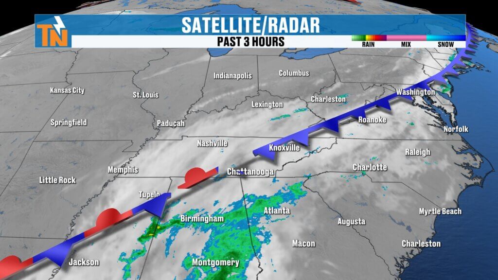
The rain is not completely finished just yet. A few pieces of energy in the atmosphere will continue moving through the region today, which means scattered light rain showers remain possible throughout the day.
This will be more of a nuisance rain pattern, rather than steady or heavy rainfall.
What to Expect Today
- Mostly cloudy skies
- Periodic light rain showers
- A small disturbance during the afternoon may briefly increase rain chances
- Some sunshine may return late in the day before sunset
Mild Temperatures Continue Across the Tennessee Valley
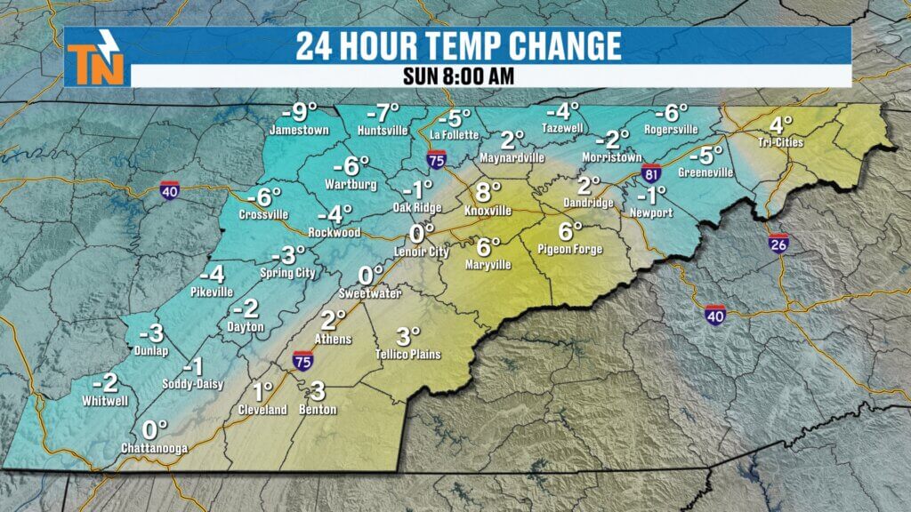
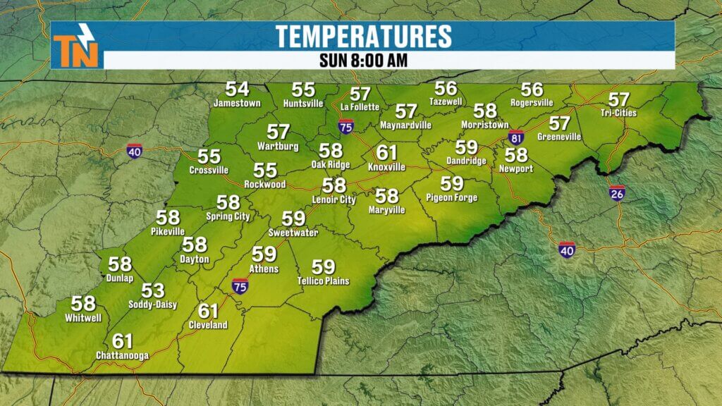
Temperatures this morning are slightly cooler than yesterday but still very comfortable for early March.
Many locations started the day in the mid to upper 50s, which is already close to the average high temperature of 59 degrees for this time of year.
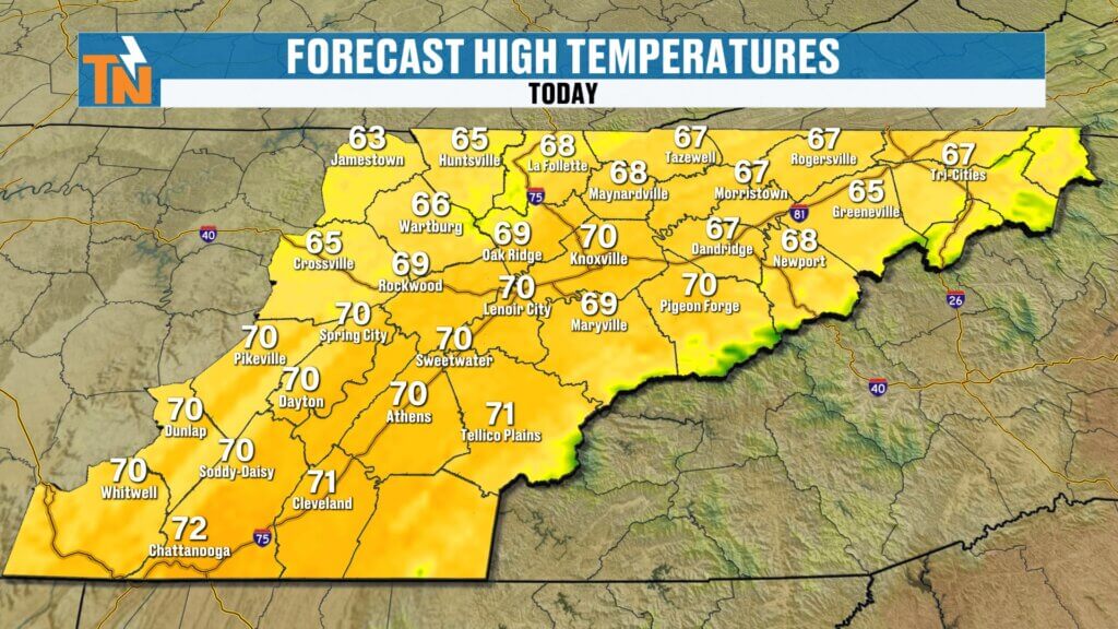
Forecast Highs Today
- Upper 60s to low 70s across East Tennessee
Even with the cloud cover and occasional showers, temperatures will remain above average for the season.
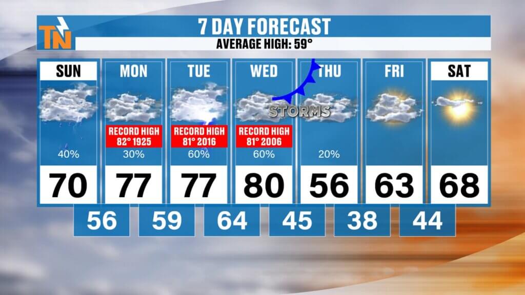
East Tennessee 7-Day Weather Outlook
Next Weekend: Temperatures returning to the 60s and near 70
Sunday: Mostly cloudy with scattered light showers
Monday: Mild with a slight chance of showers
Tuesday: Warm and mostly cloudy
Wednesday: Increasing clouds, storms possible late
Thursday: Cold front with showers and thunderstorms
Friday: Cooler but improving weather
Quiet Weather Early in the Week
From now through Tuesday, the weather pattern will remain somewhat unsettled but not overly active.
We may see occasional light showers, but widespread rainfall is not expected early in the week.
Most of the heavier precipitation will remain to our north and northwest across the Ohio Valley during this time.
Near-Record Temperatures Continue Before the Front
Before the midweek cold front arrives, temperatures will continue running above average.
While records may not necessarily be broken early in the week, we will likely see temperatures approaching record levels Monday through Wednesday.
Warm air ahead of the storm system will keep temperatures well above seasonal norms.
Cooler Air Arrives Late Week
Once the midweek cold front moves through, cooler air will briefly settle into the Tennessee Valley.
Expect:
- Falling temperatures Thursday
- Highs returning closer to seasonal averages
However, the cool-down appears short-lived, with temperatures rebounding back into the 60s and possibly near 70 degrees later next week.
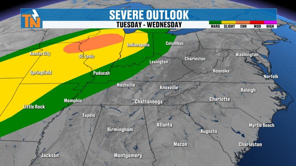
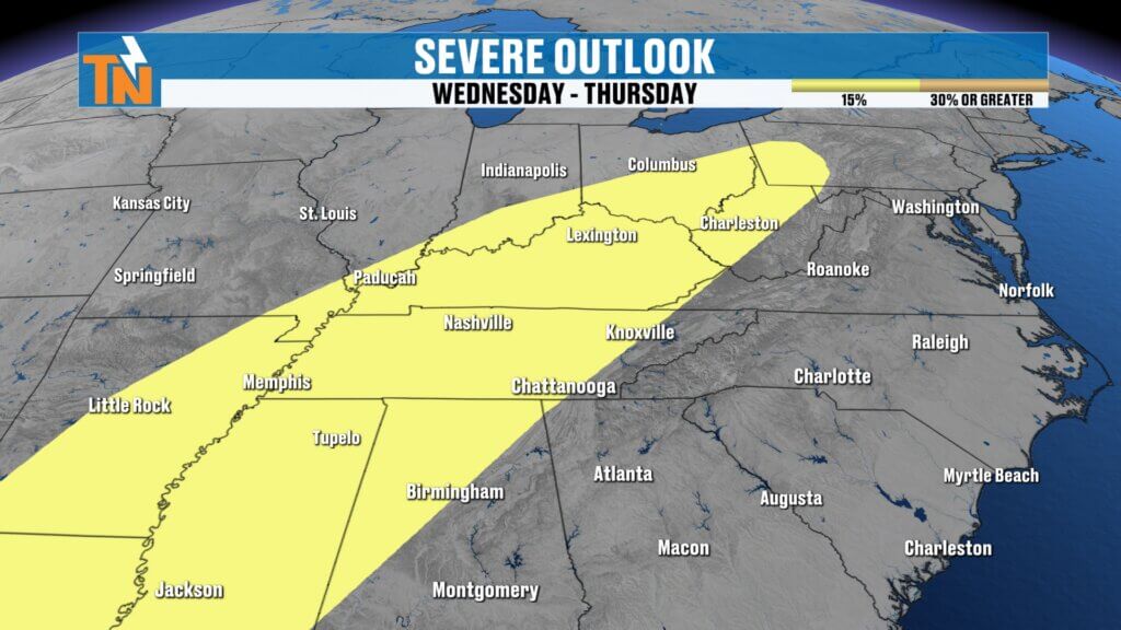
Stronger Storm System Arrives Midweek
The next significant weather maker arrives Wednesday into Thursday as a deep upper-level trough moves toward the Tennessee Valley.
This system will bring:
- Increasing wind
- Widespread showers
- Thunderstorms
- Potential for strong to severe storms
The Storm Prediction Center already has parts of the region outlined in a Day 3 severe weather outlook, indicating a growing chance for stronger storms as the system approaches.
Currently, the risk area includes Level 1, Level 2, and Level 3 severe storm probabilities across parts of the Southeast and Tennessee Valley.
As the system moves closer, we will get a better idea of how strong storms could become locally.
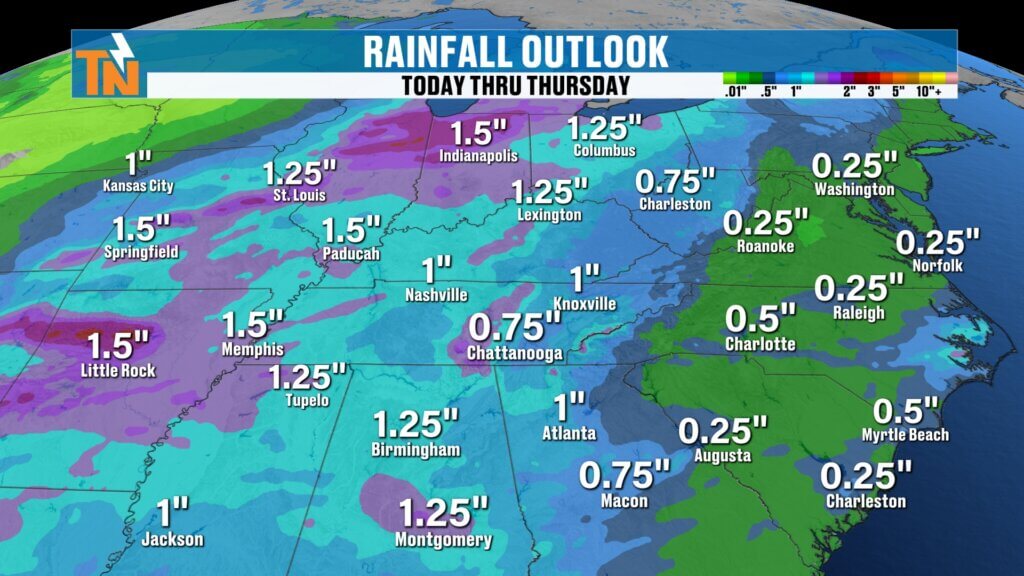
Rainfall Potential from the Midweek System
This midweek storm system has the potential to bring more substantial rainfall to East Tennessee.
Current projections suggest:
- Around one inch of rainfall possible by Thursday morning
- Locally higher amounts where storms develop
This would provide much-needed moisture across the region.
Final Thoughts
While Saturday brought record warmth and some rain, the severe weather threat stayed mostly away from East Tennessee. Today will feature scattered showers and cloudy skies, but nothing particularly impactful.
The next system to watch arrives Wednesday night into Thursday, bringing the possibility of stronger storms and heavier rainfall.
Until then, keep the umbrella handy today and enjoy the mild temperatures.
Have a great Sunday and thanks for checking in.