Quick Take
-
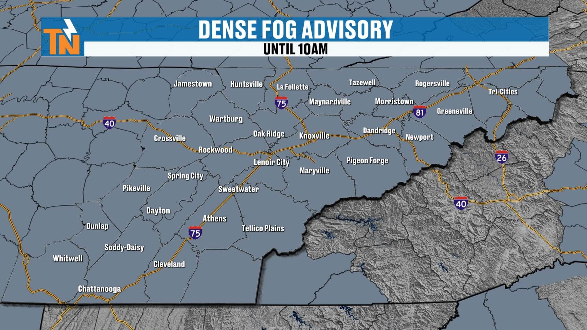
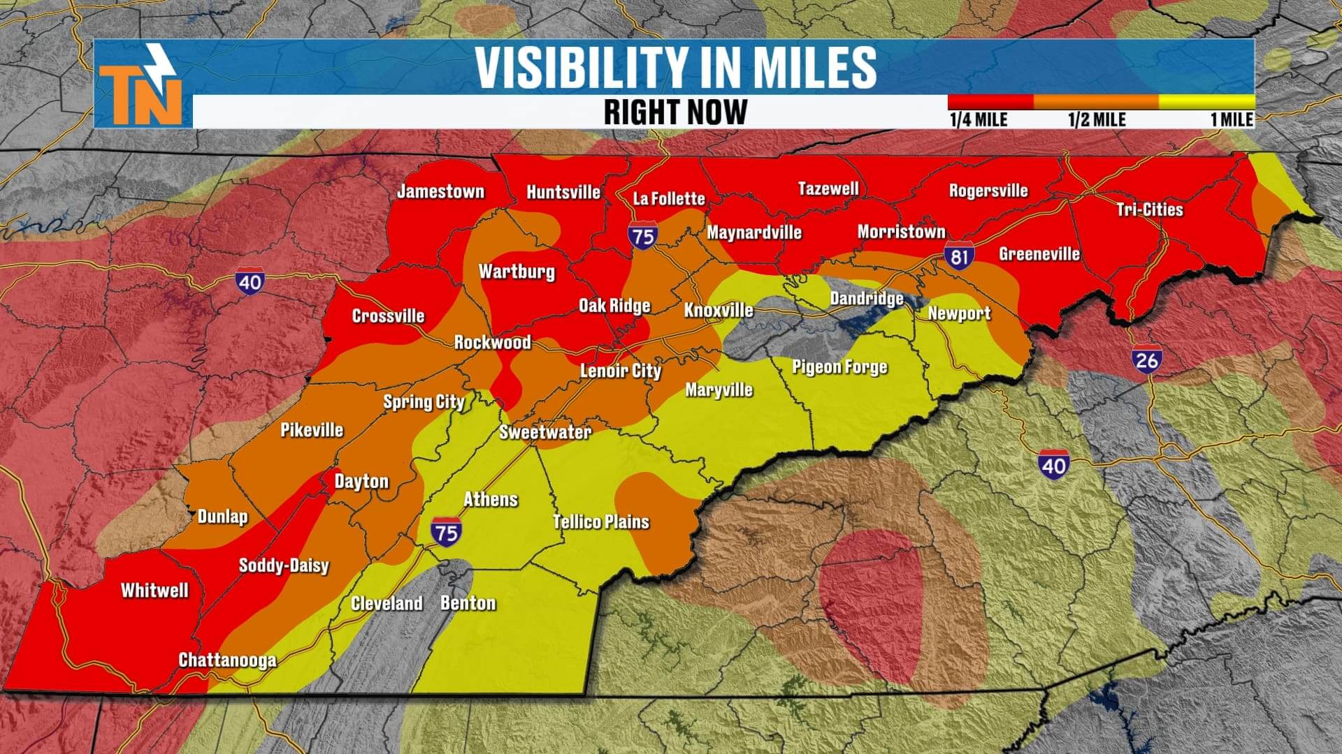
Dense fog advisory until 10 AM—slow down and use low beams.
-
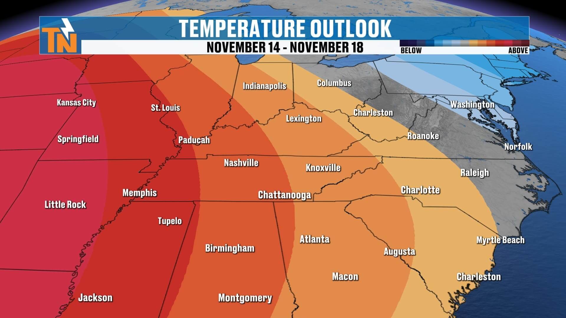
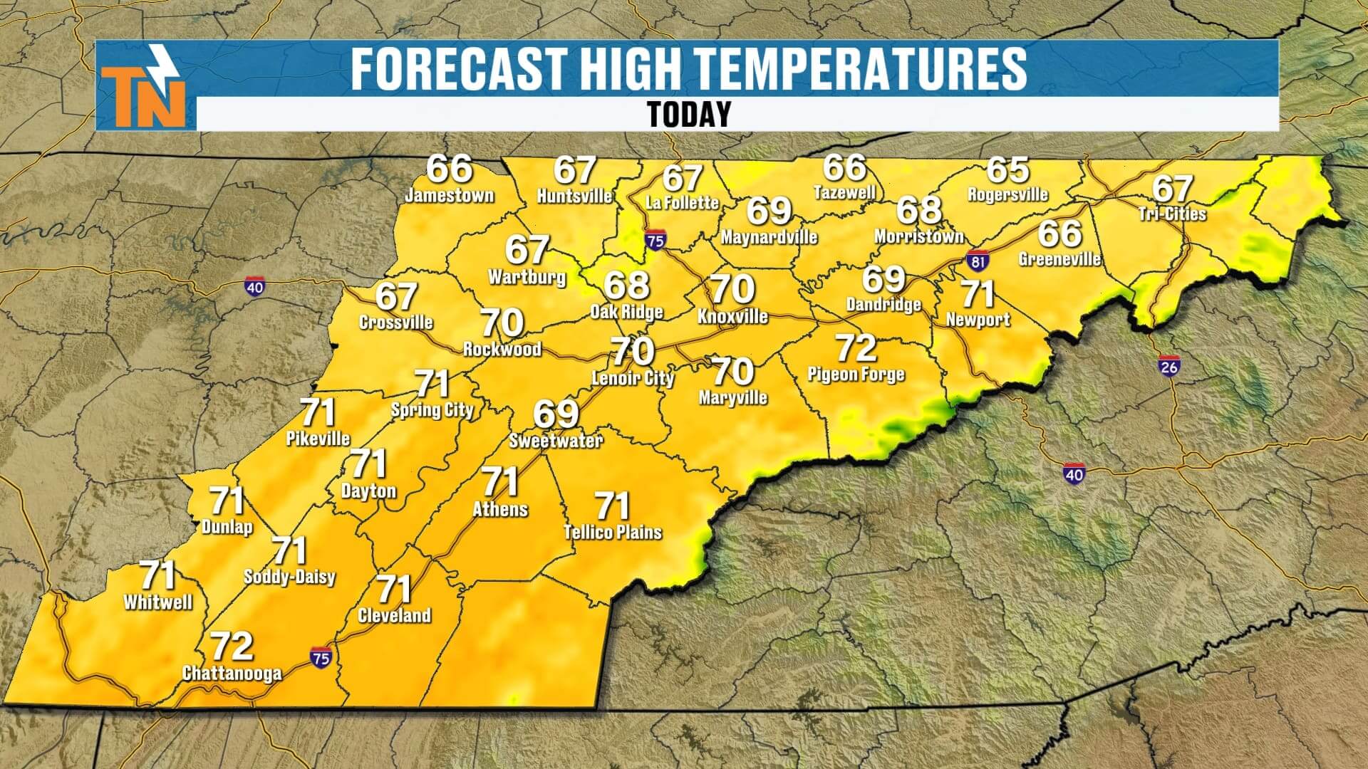
Mild today: 60s to low 70s, light wind, increasing high clouds.
-
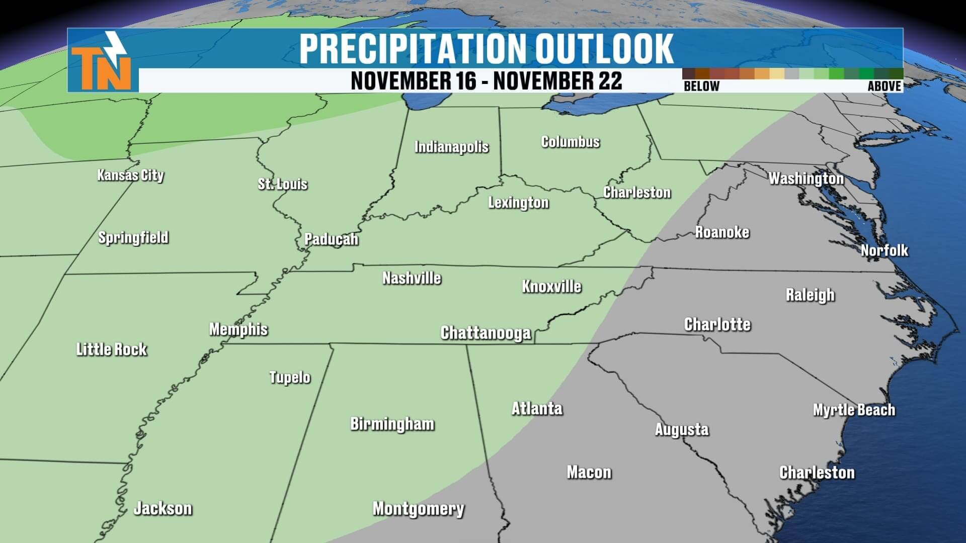
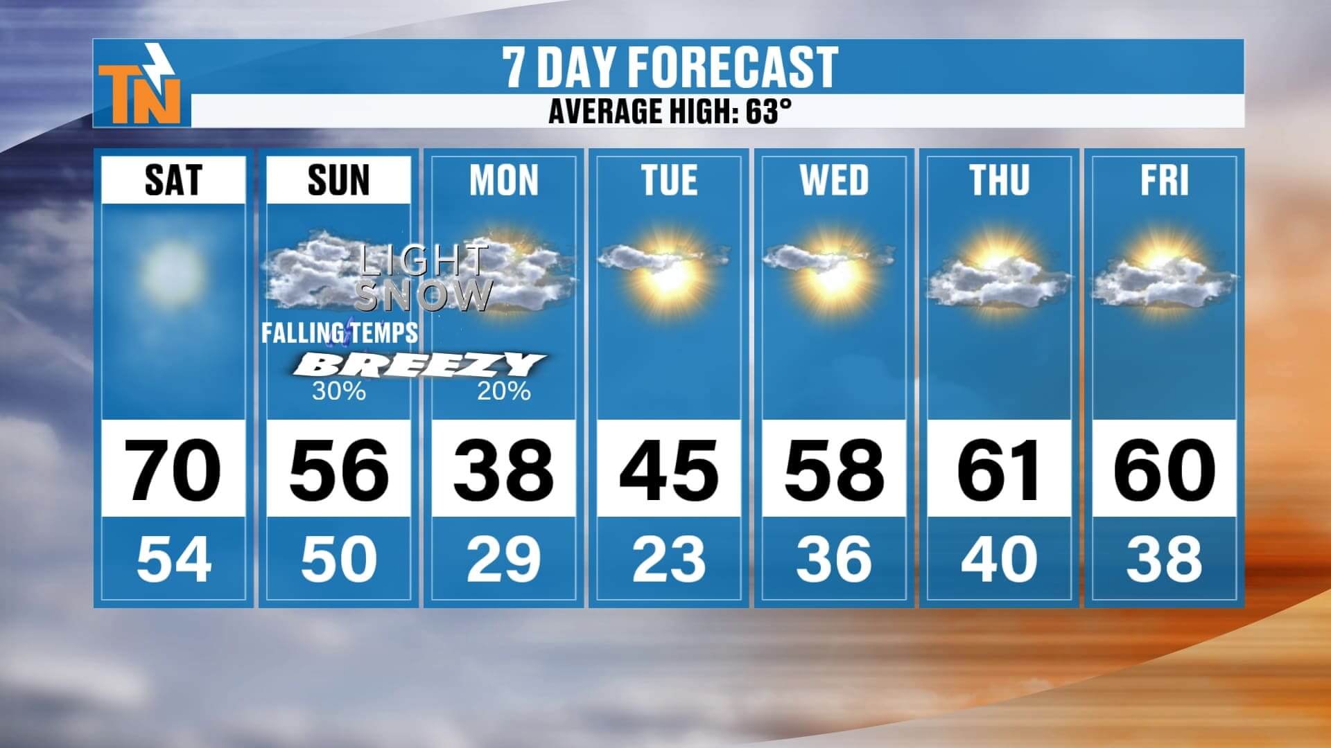
Big change Sunday: temps fall late day, gusty NW winds, rain changing to snow (mountains first).
This Morning
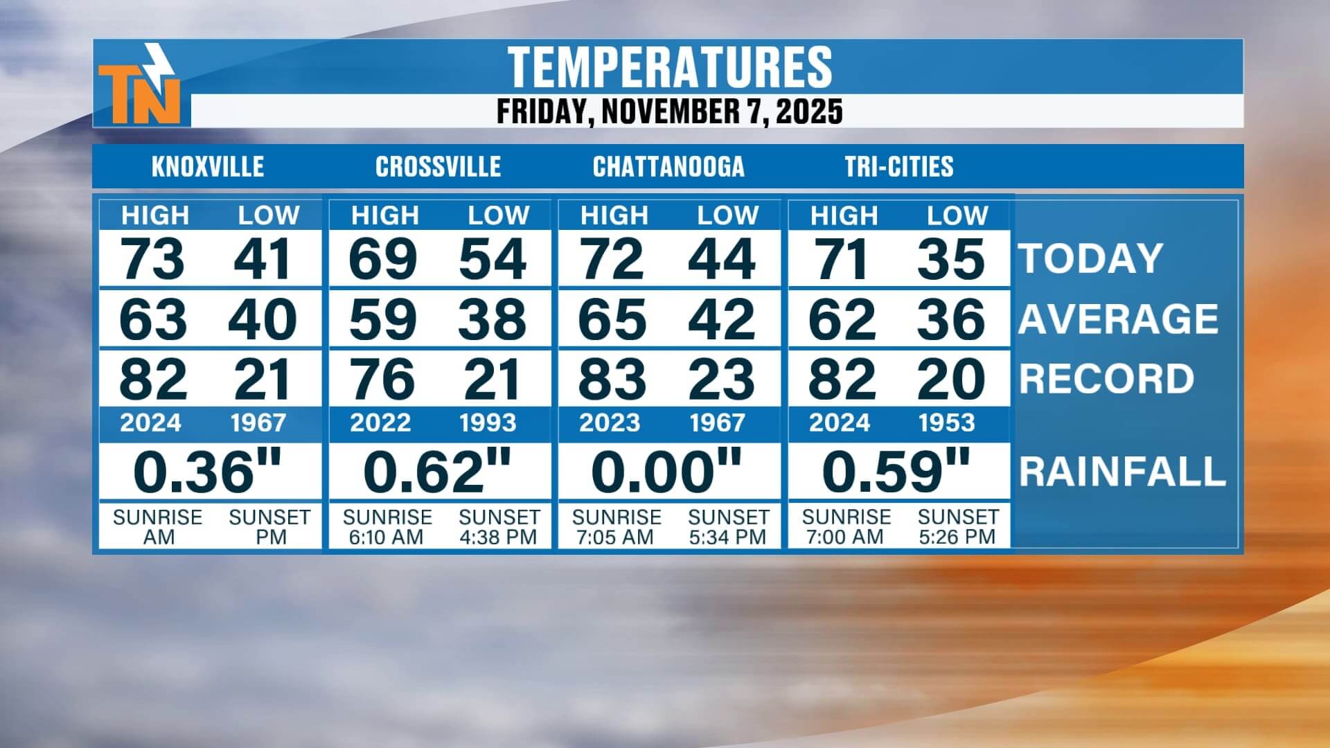
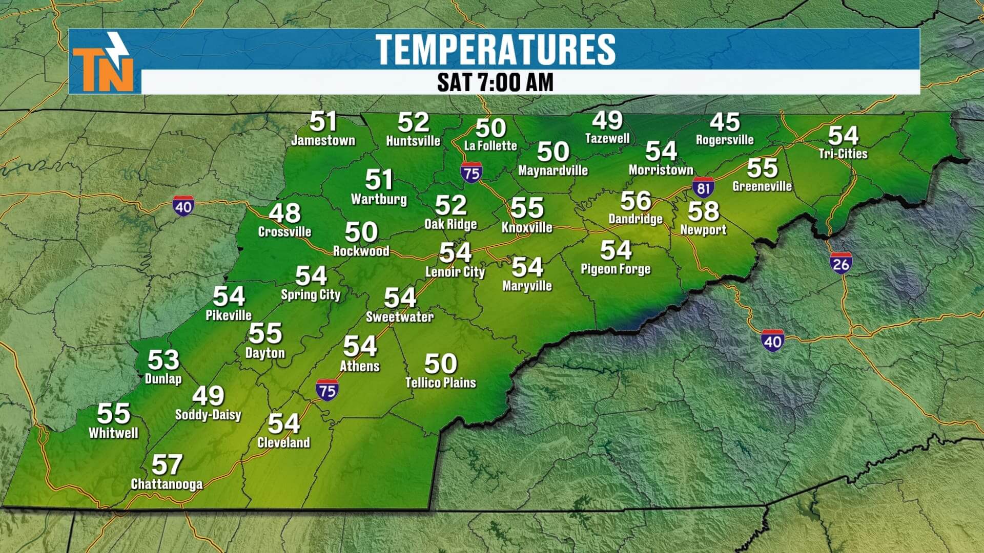
Patchy dense fog from last night’s rain. It thins 10 AM–noon. We start in the 50s—much warmer than yesterday.Today (Saturday)
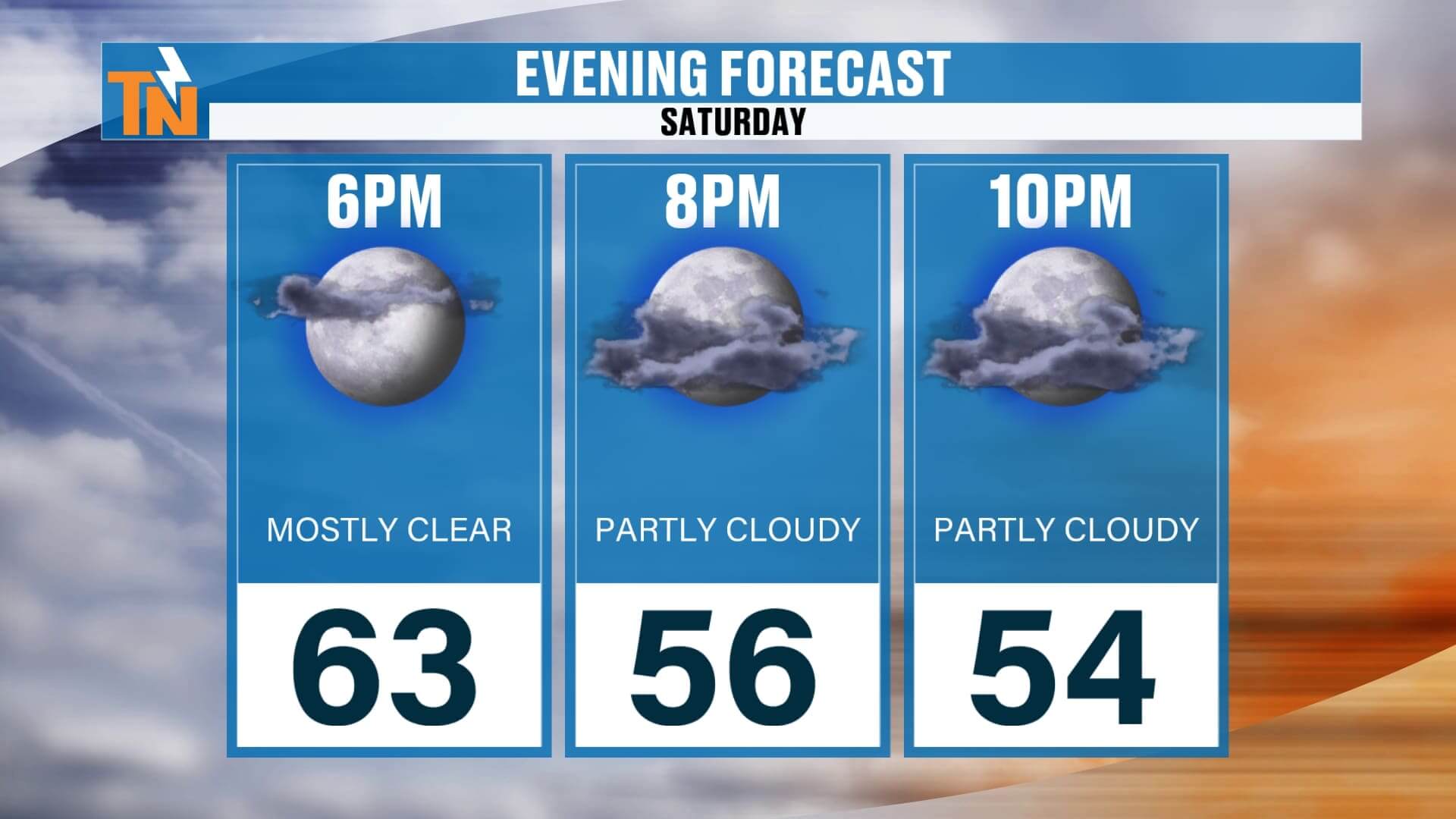
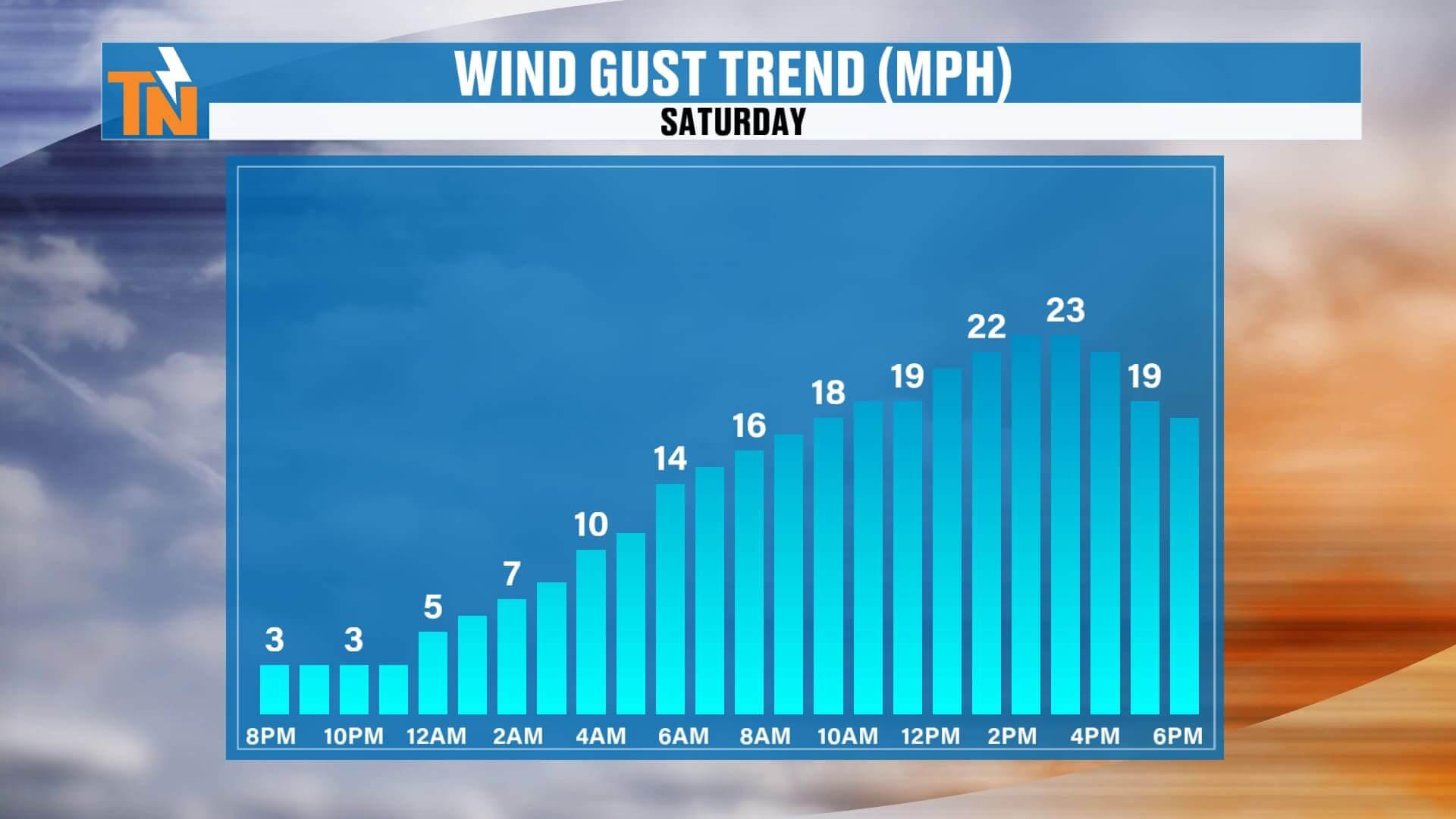
Filtered sun with mid–high clouds thickening a bit south of I-40. Light breeze. Highs: mid 60s to low 70s. Great for outdoor plans. Evening: 64° at 6 PM, 59° at 8 PM, 55° by 10 PM.
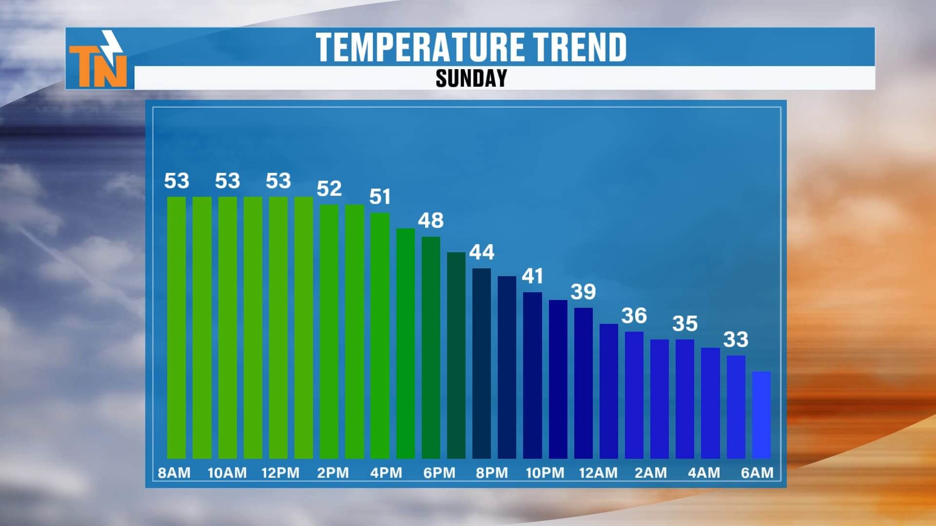
Sunday: Here Comes the Front
A deep trough digs in. Expect increasing clouds and a strengthening NW wind. Temps hold in the 50s early, then drop 2–4 PM and through the evening—you’ll feel it by dinner.
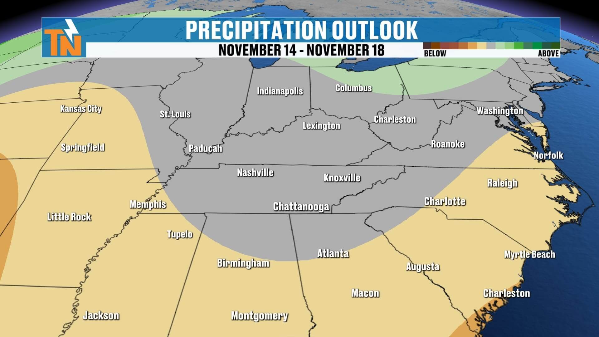
Rain → Snow Timing
-
4–7 PM Sunday: Snow showers develop across the Smokies; rain/snow mix possible Plateau and higher ridges.
-
Sunday night: Light snow showers expand into parts of the valley and Plateau while mountain snow continues.
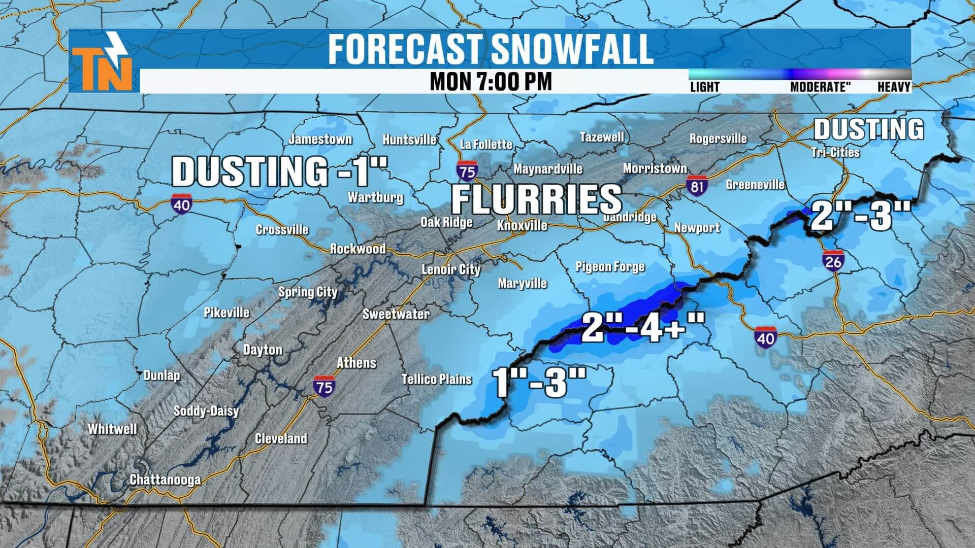
Snow Amounts (confidence now higher)
-
Cumberland Plateau: a dusting up to 1″ on grassy/rooftop surfaces.
-
Valley: flurries/light coatings possible; warm ground limits impacts.
-
Smokies (highest peaks): 2–4″+ with classic NW flow/orographic lift.
Travel impacts Monday morning look minor for most; roads mainly just wet/chilly outside the high terrain.
Early Next Week
-
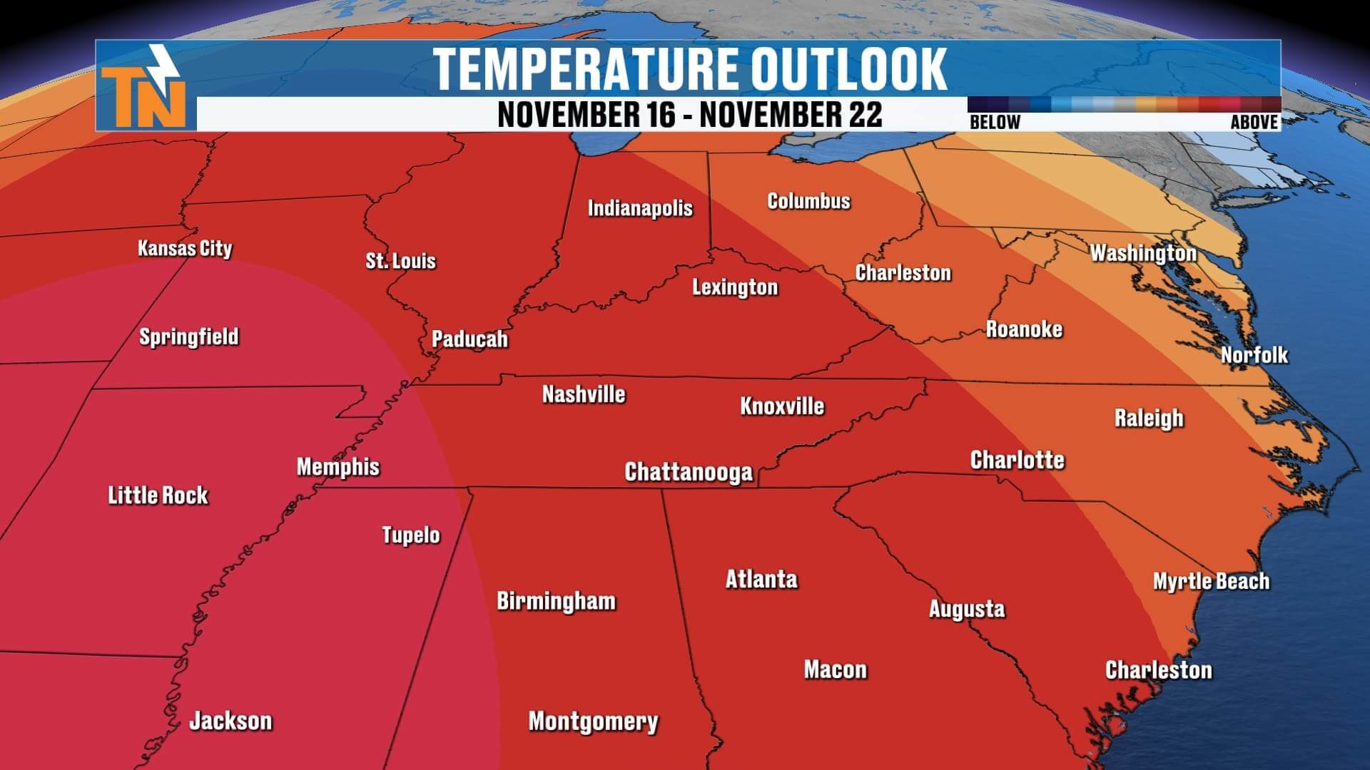
Monday–Tuesday: Winter preview. Hard freeze both mornings (20s). Afternoon highs only in the 40s.
-
Mid to Late Week: Gradual rebound into the 50s and 60s with quieter weather.
Stay Updated
Use the East Tennessee Weather app for interactive radar, push alerts, and my One-Minute Weather updates. Search “East Tennessee Weather” in your app store.