
Good Morning, East Tennessee
Happy Monday, everybody!
I hope you had a great weekend. Today will be our final active weather day before a much more comfortable stretch settles into East Tennessee. The biggest challenge with today’s forecast is uncertainty. We know a cluster of thunderstorms is expected to move southeast toward the Tennessee Valley, but exactly where it tracks will determine who sees the strongest storms and who may miss out on the worst weather altogether.
The bottom line: stay weather-aware this afternoon and evening.
Severe Weather Risk Depends on Storm Track
A cluster of thunderstorms currently developing to our north and northwest will dive southeast throughout the day.
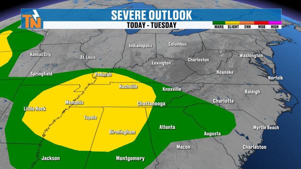
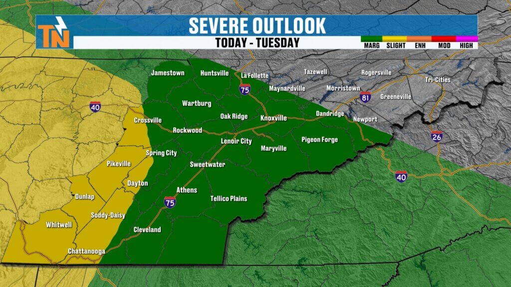
The latest outlook from the Storm Prediction Center places the greatest severe weather threat across Middle Tennessee, West Tennessee, northern Mississippi, and northern Alabama. However, East Tennessee remains under a Level 1 risk, especially along and south of Interstate 40.
The uncertainty comes down to the exact track of the storm complex. Some forecast models take it farther south, while others bring it directly across East Tennessee. Because of that, adjustments to the forecast are likely throughout the day.
Main Threats If Storms Hold Together
If the storm cluster reaches East Tennessee with enough strength, the primary threats would be:
- Damaging wind gusts
- Large hail
- Frequent lightning
- Heavy rainfall
At this time, damaging straight-line winds appear to be the greatest concern.
Timing: When to Stay Alert
Most of the day should be quiet.
Forecast timing currently suggests:
- Morning through lunchtime: Mostly dry
- Early afternoon: Isolated showers possible
- Mid to late afternoon: Storm complex approaches
- 3 PM to 7 PM: Highest potential for strong storms
- Evening: Storms gradually move out
One important note: these types of thunderstorm clusters often move faster than forecast, so don’t focus too much on exact timing. Plan to stay weather-aware beginning around midday and continue monitoring conditions through the evening hours.
Warm and Humid Ahead of the Storms
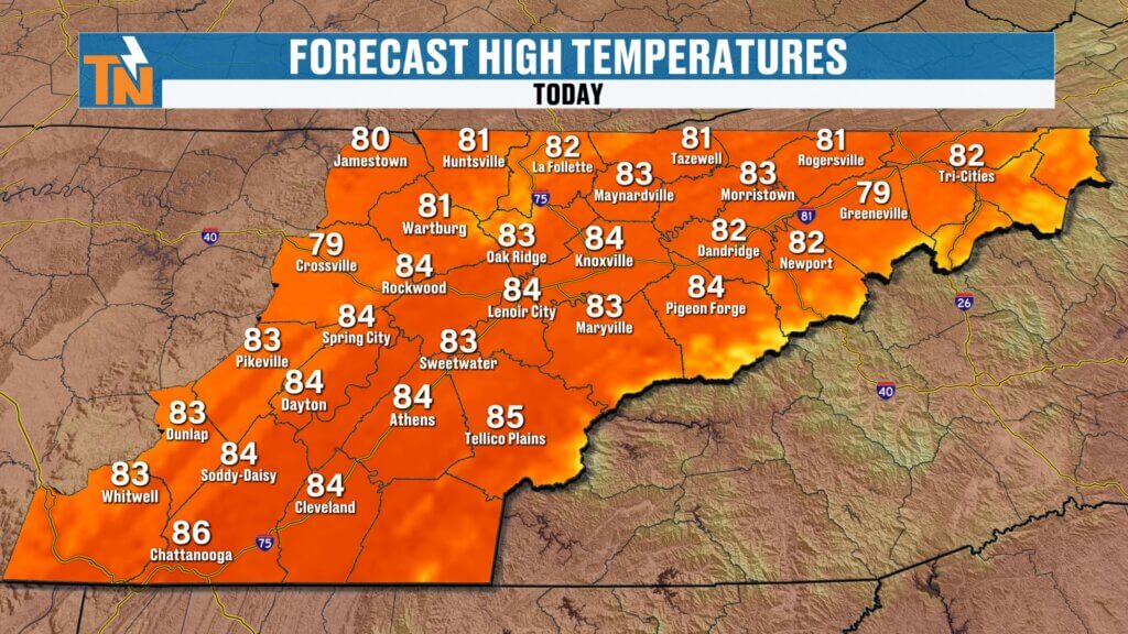
Temperatures this morning are running much warmer than the last few days, with many locations starting in the 60s and even a few lower 70s.
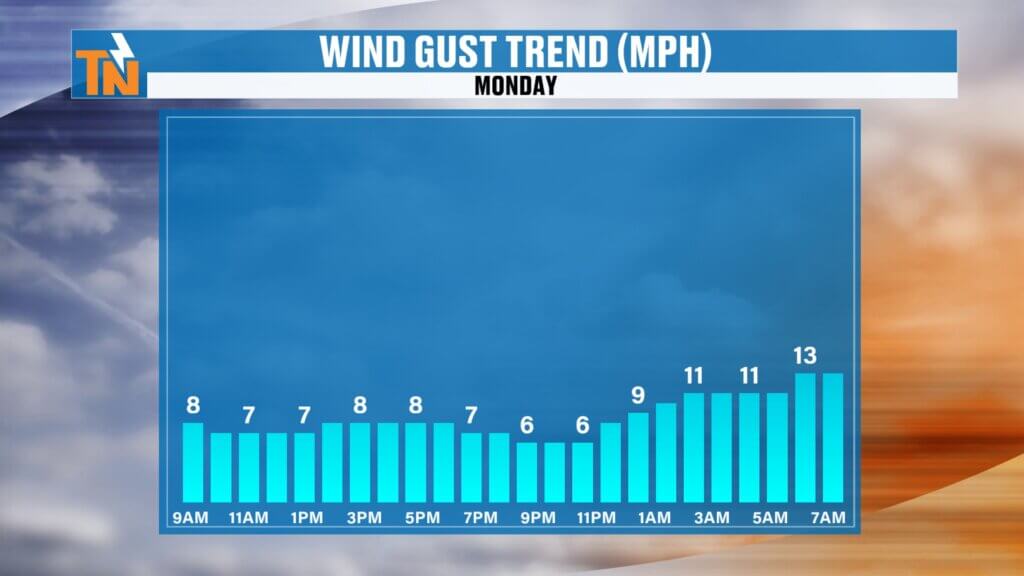
Winds will remain fairly light before storms arrive, allowing temperatures to climb into the low and middle 80s this afternoon. That’s right around average or slightly above average for early June.
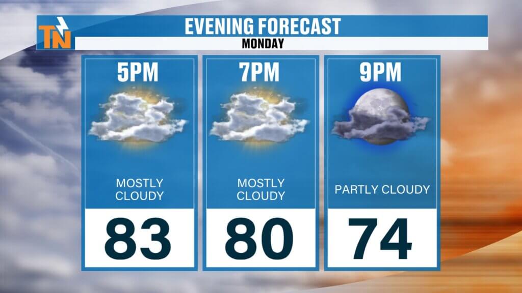
Even this evening, temperatures will remain in the lower 80s before cooler air arrives behind the storms.
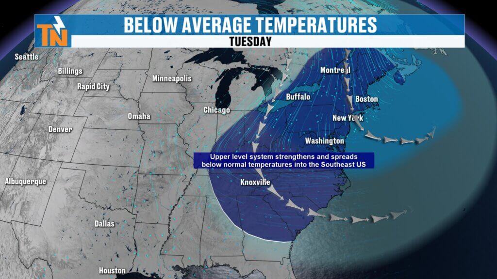
Big Weather Change Arrives Tuesday
Once today’s system exits, a trough of low pressure will settle into the eastern United States and completely change our weather pattern.
Tuesday through Friday will feature:
- Lower humidity
- Cooler temperatures
- Comfortable mornings
- Plenty of sunshine
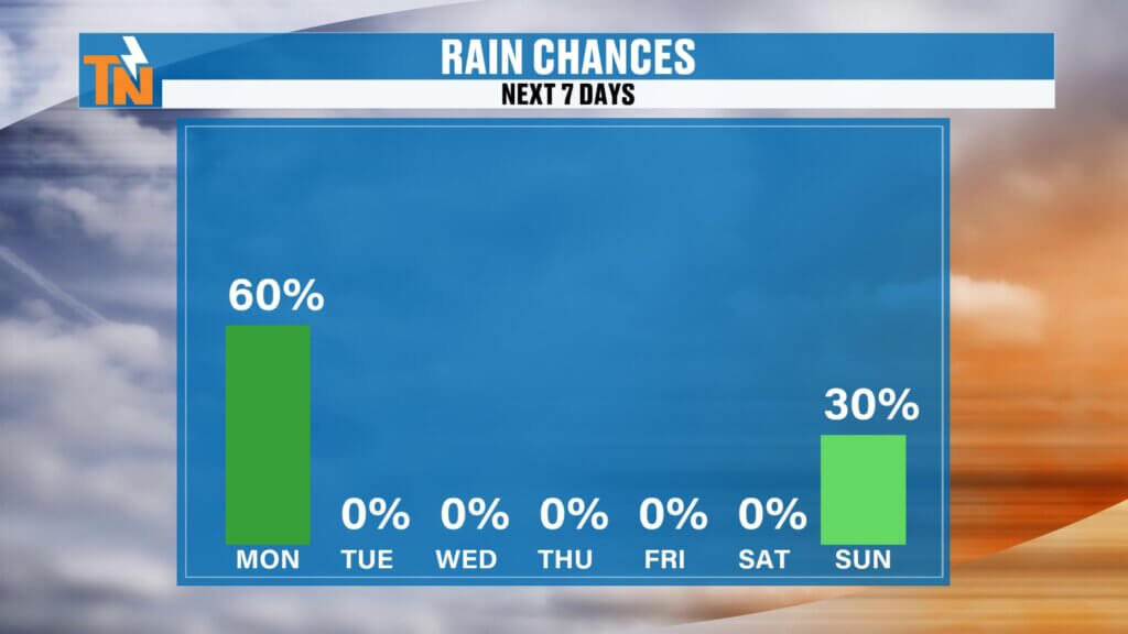
- Very limited rain chances
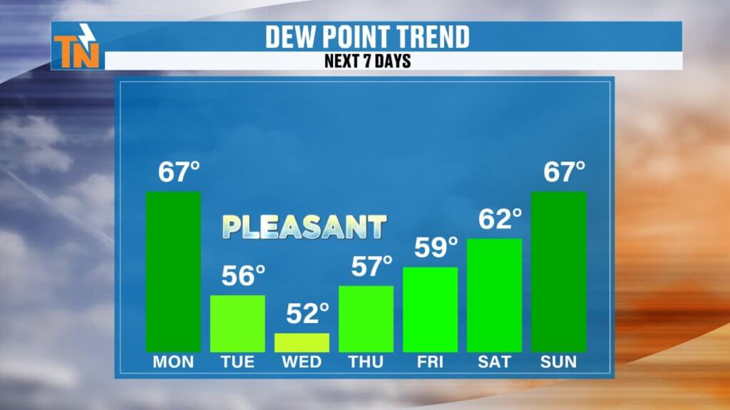
The moisture currently fueling showers and storms will be pushed out of the region, bringing some of the most pleasant weather we’ve seen in weeks.
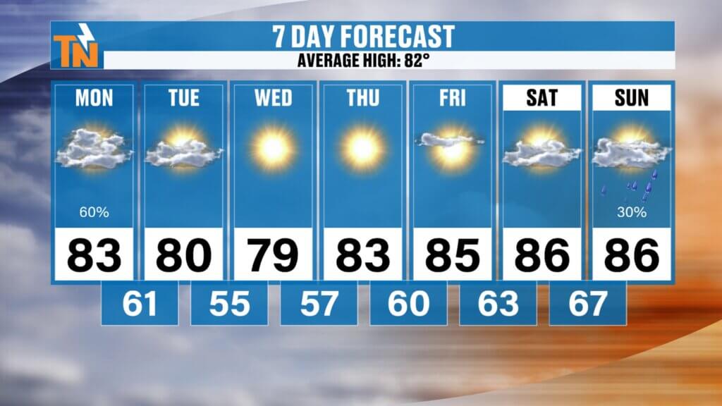
7-Day Forecast Highlights
- Monday: Strong storms possible, highs in the low to mid 80s
- Tuesday: Sunny, less humid, upper 70s
- Wednesday: Pleasant and dry
- Thursday: Comfortable with below-average temperatures
- Friday: Warming begins
- Saturday: Mid to upper 80s with a slight rain chance
- Sunday: Warm and more humid with isolated storm chances
Looking Ahead
While this week’s cooler stretch won’t last forever, it should provide several days of outstanding weather before summer heat begins building back into the region next weekend.
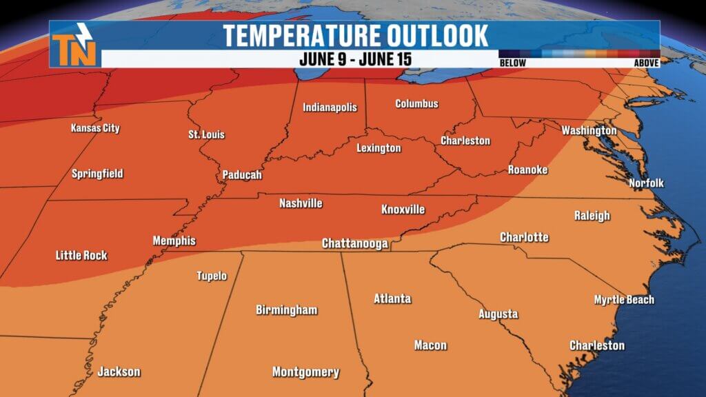
Long-range trends continue to suggest above-average temperatures returning through the middle part of June.
For today, keep an eye on the radar and forecast updates. The exact track of this storm complex remains uncertain, and that will make all the difference in how active the weather becomes across East Tennessee this afternoon and evening.