Happy Tuesday, everybody. Sure hope you have a great day today. We’re starting the morning off with rain showers across East Tennessee, but the wet weather will not last all day. As this system moves on out, colder air is going to spill in behind it — so keep those winter coats handy. It has been a chilly stretch, and today continues that trend as temperatures fall through the afternoon.
Timing Out Today’s Rain & Temperature Drop
We’ve been talking about this setup for a couple of days, and the timing remains consistent.
-
Rain ends between 9 AM and 10 AM across most of East Tennessee.
-
A brief mix is possible on the northern Cumberland Plateau as colder air works in, though accumulation will be minimal to none.
-
The mountains of East Tennessee and western North Carolina are unlikely to see significant snowfall with this system due to weaker northwesterly flow.
Rainfall totals from this system will range from 0.25″ to around 0.50″, and many areas already picked up a healthy amount of rain overnight.
Adjusted Snowfall Forecast
Confidence remains extremely low for widespread snowfall. However:
-
Northern Plateau: A few flakes possible, maybe a quick dusting in isolated areas.
-
Valley locations: No accumulation expected.
-
Smokies: Only a low-end flurry chance; not a true northwest-flow setup this time.
Morning Warmth Gives Way to Afternoon Chill
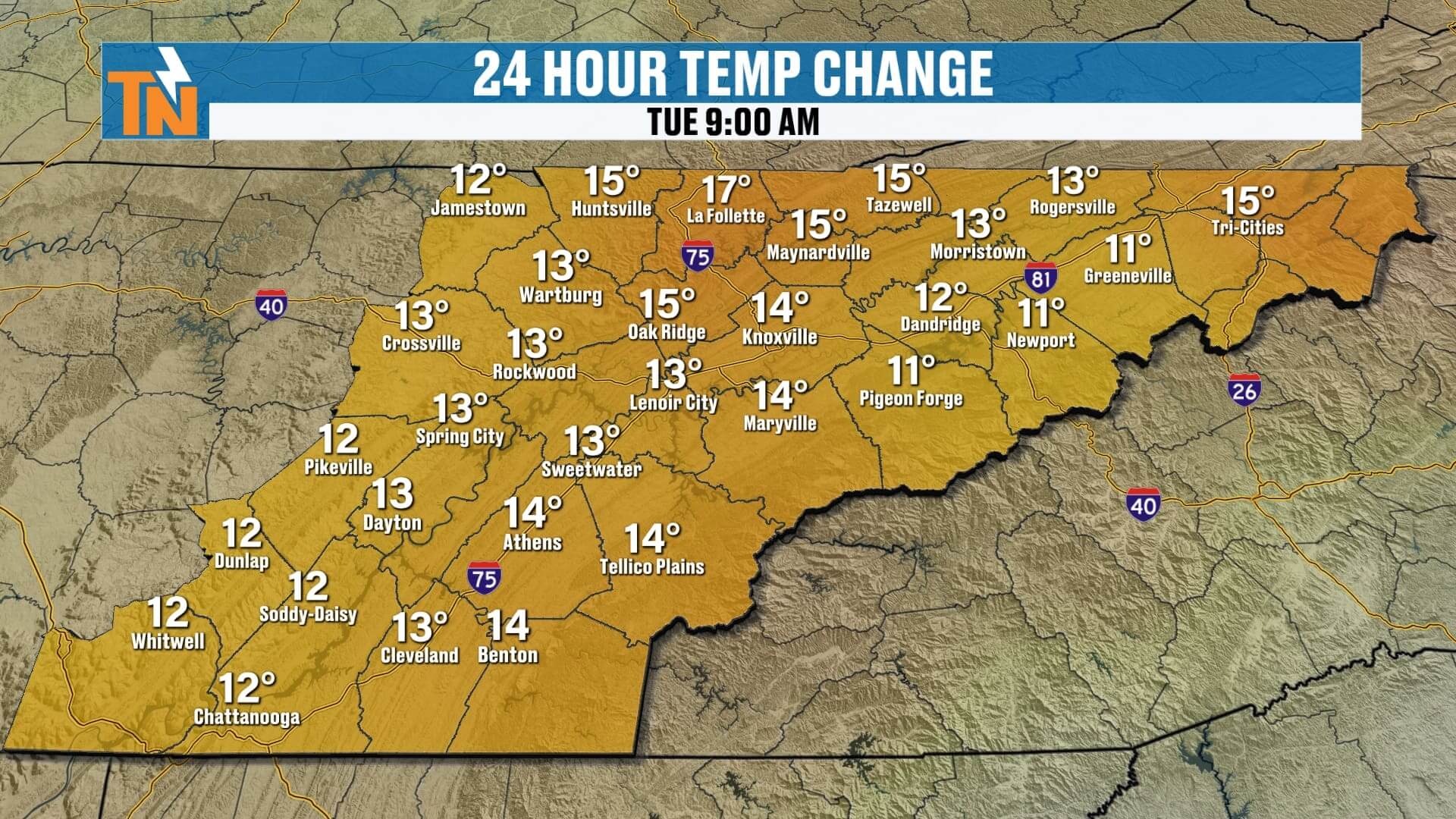
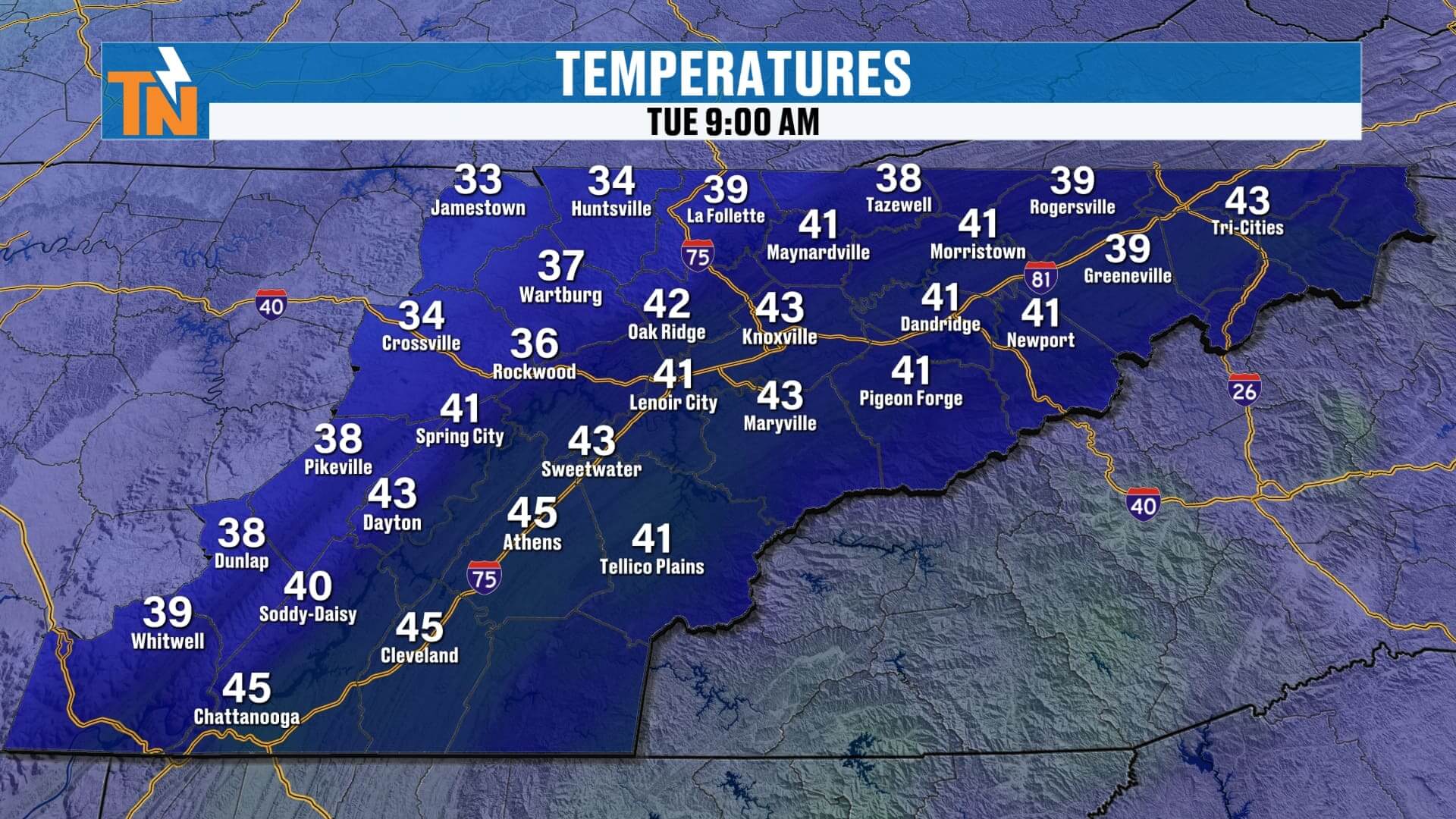
It is noticeably warmer this morning — 10 to nearly 20 degrees warmer than Monday morning — with temperatures starting in the 40s. But don’t get too comfortable!
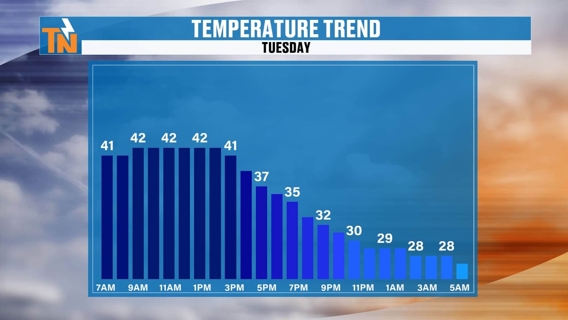
Here’s how temperatures trend today:
-
Steady through late morning
-
Begin falling after Noon–3 PM
-
Upper 30s by the evening commute
-
Mid to upper 20s overnight
So yes — winter returns quickly tonight into Wednesday morning.
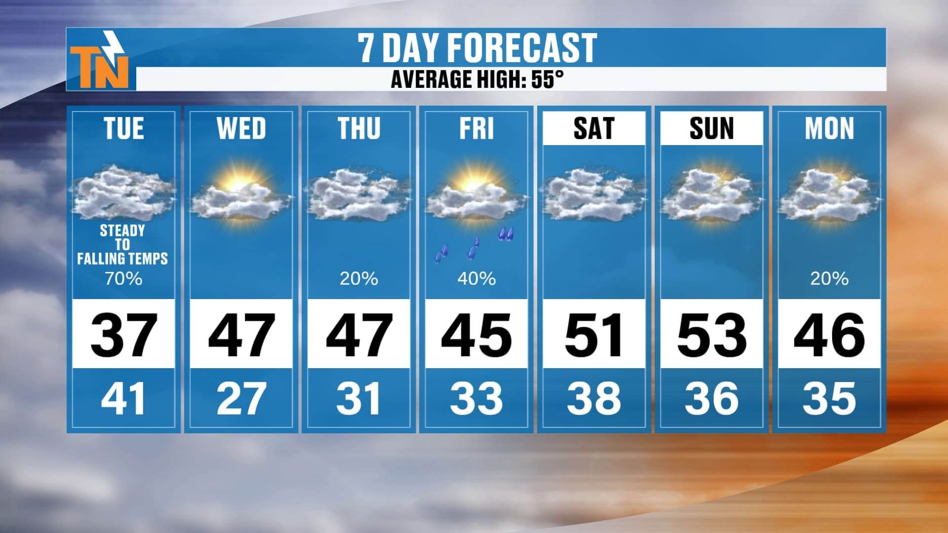
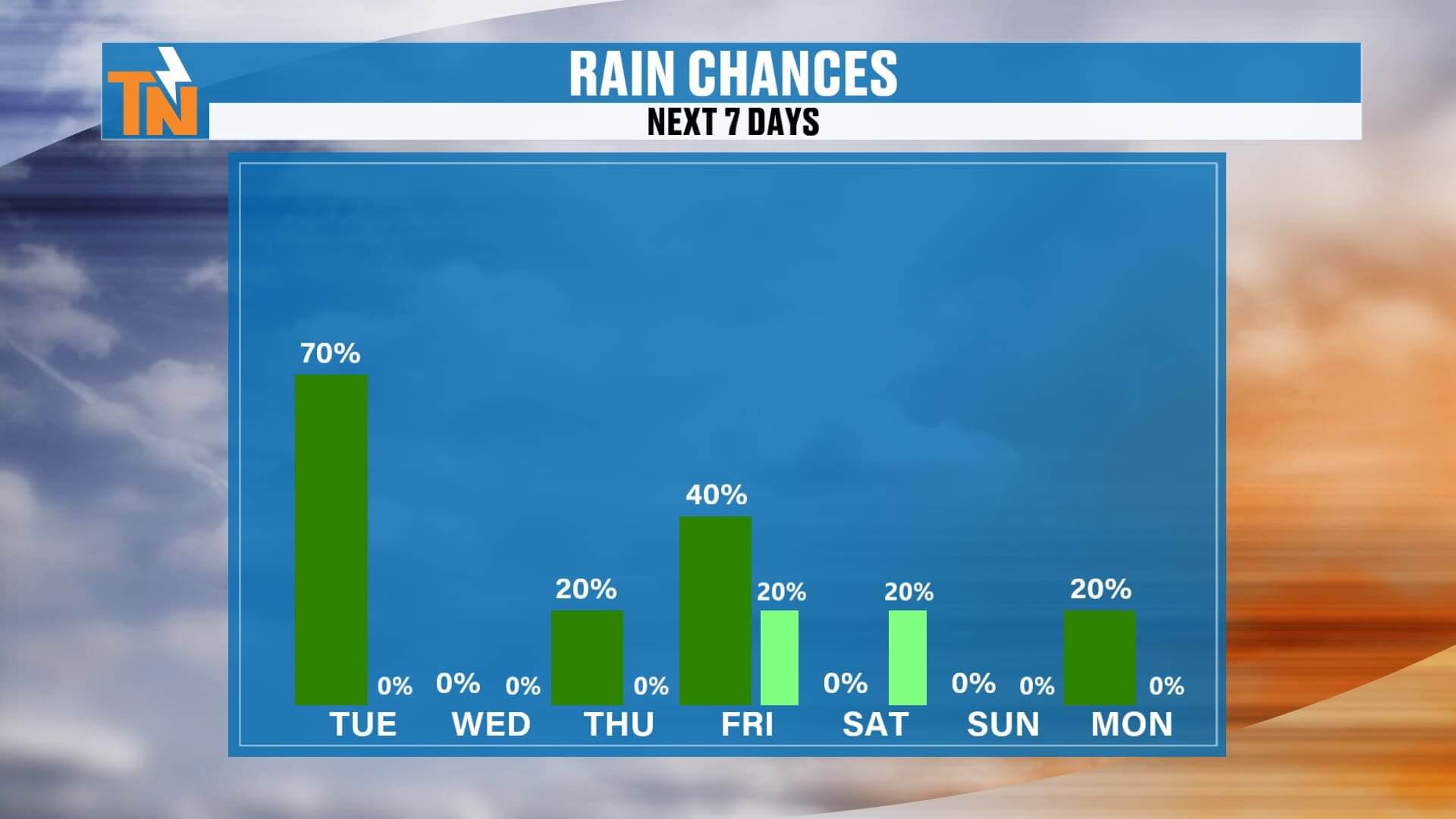
7 Day Forecast Breakdown
Here’s how it all plays out:
-
Tuesday: Steady to falling temperatures. Official “high” is misleading because it occurs early—actual afternoon temps fall into the 30s.
-
Wednesday: Cold start at 27°, afternoon near 47°, sunny and seasonally cool.
-
Thursday: Another day in the upper 40s with increasing clouds.
-
Late Thursday into Friday: A weak system brings light rain. Not a big rain maker at all.
-
Saturday & Sunday: Dry, quiet, cool, and pleasant for late November.
-
Monday: Another small wave may bring scattered showers. Still uncertain; will fine-tune in the days ahead.
Temperatures remain on the cooler side of average through the week, with brief warmups and additional small disturbances to watch.
Stay Connected & Track Every Update
If you want the easiest way to stay on top of the changing weather pattern:
-
Download the East Tennessee Weather App
-
Check the interactive radar
-
Watch the daypart forecasts
-
See the full 7-day outlook
-
And catch Witcher’s One Minute Weather anytime
If you’re watching on the 24/7 weather channel, simply scan the QR code in the bottom-right corner to download the app instantly on iPhone or Android.
Have a great Tuesday! Stay dry early, bundle up later — it’s going to be a chilly one.