
Good morning, East Tennessee!
Happy Thursday, and thanks for checking in with your local forecast from the eastTNweather team. I sure hope you’re having a great start to your day. We’re waking up to some clouds across the Plateau this morning—along with a few spotty light showers—but overall, it’s going to shape up to be another beautiful day across the Tennessee Valley, the Smoky Mountains, and the Cumberland Plateau.
Morning Setup: Clouds and a Few Plateau Showers
-
A batch of mid-level clouds is hanging around early this morning, with light showers mainly over the Plateau.
-
Most of this will shift south by mid-morning, leaving behind brighter skies for the rest of us.
-
Temperatures are starting in the upper 50s and low 60s—a comfortable, mild start for early September.
Ridge of High Pressure Takes Control
At the big-picture level, we’ve got an Omega block high pressure system building across the southern and southwestern U.S. That ridge is gradually expanding into East Tennessee, and it’s going to be the dominant weather feature through the weekend.
What does that mean for us?
-
Dry conditions across East Tennessee, with rain chances essentially at zero.
-
Abundant sunshine today and in the days ahead.
-
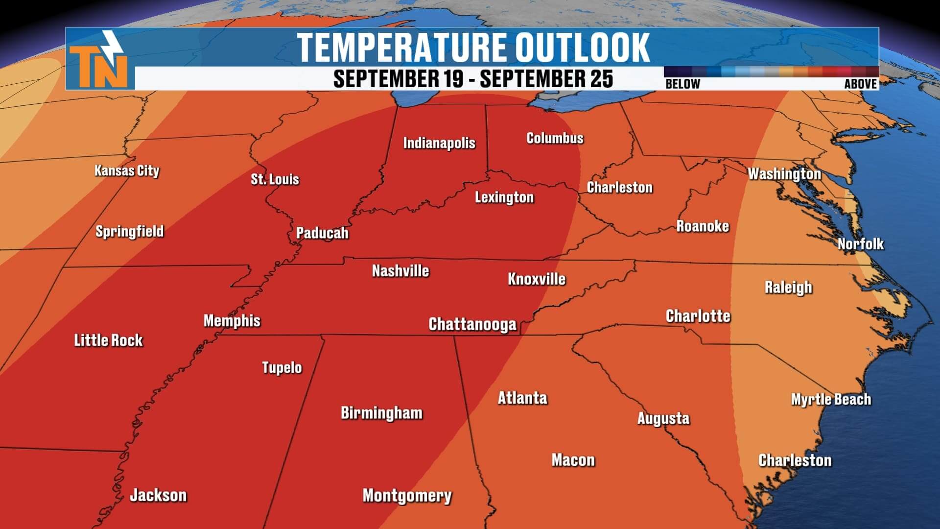
A warming trend with highs climbing steadily into the upper 80s and near 90° as we head into the weekend.
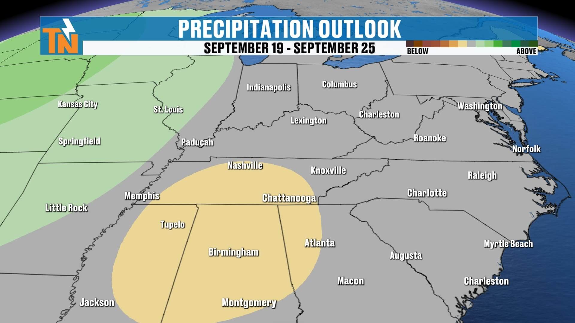
This ridge pattern looks stubborn, so the dry weather may stick around well beyond the 7-day forecast—possibly through the next two weeks.
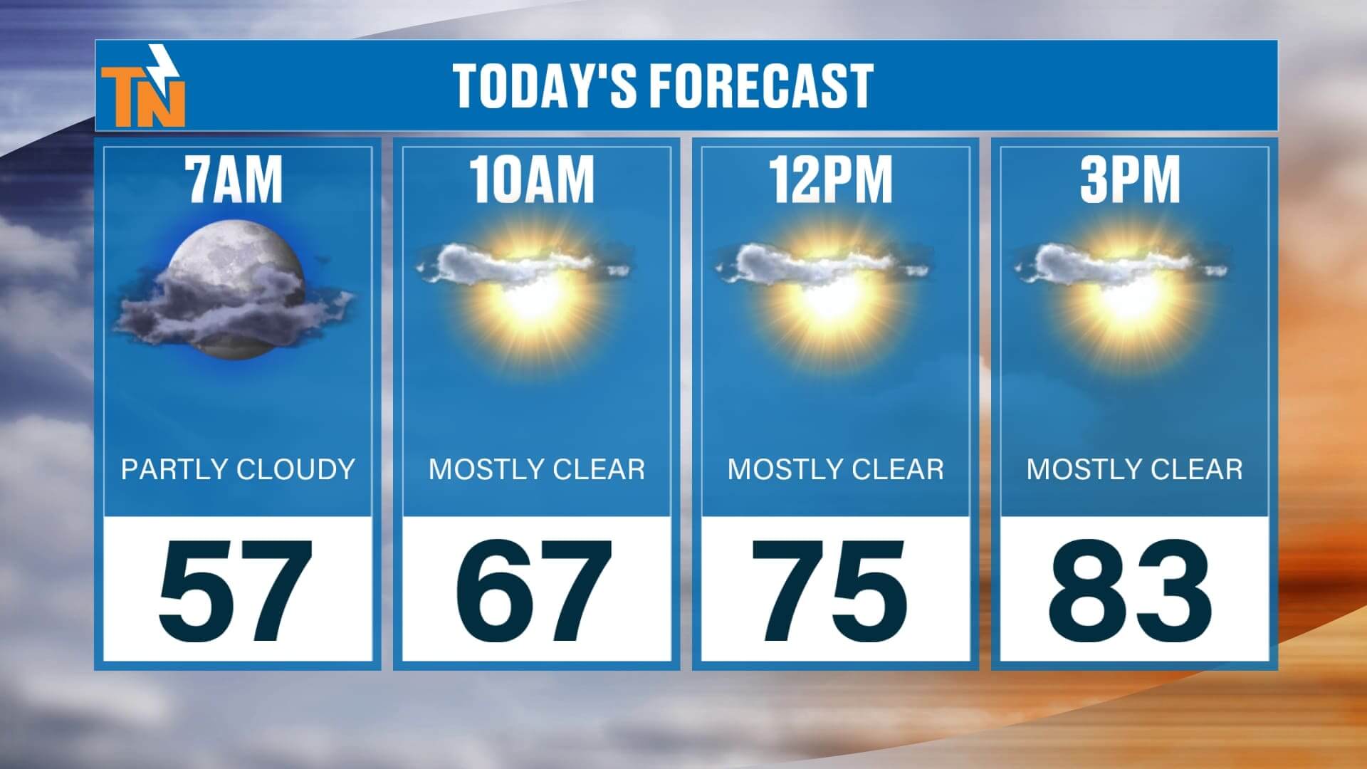
Today’s Forecast: Bright Skies and Comfortable Air
-
Morning: Clouds hang around, especially south and west, but skies brighten quickly.
-
Afternoon: Sunshine dominates with a few fair-weather cumulus clouds drifting overhead.
-
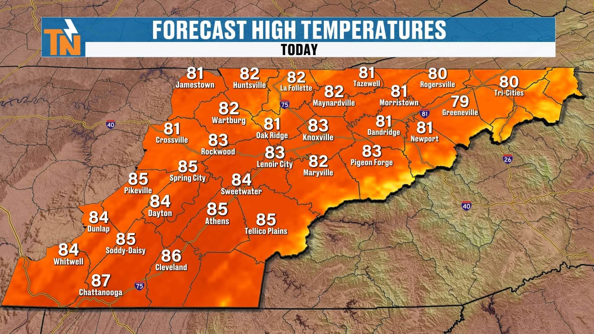
Temperatures:
-
Mid 70s by lunchtime
-
Low to mid 80s for most of the Valley by mid-afternoon
-
Upper 80s possible in the Southern Valley (Athens, Sweetwater, Madisonville)
-
Evening Plans: Still warm but comfortable—temperatures ease into the upper 70s by 6 PM and the upper 60s by 10 PM.
Extended Outlook: Dry, Warm, and Football Ready!
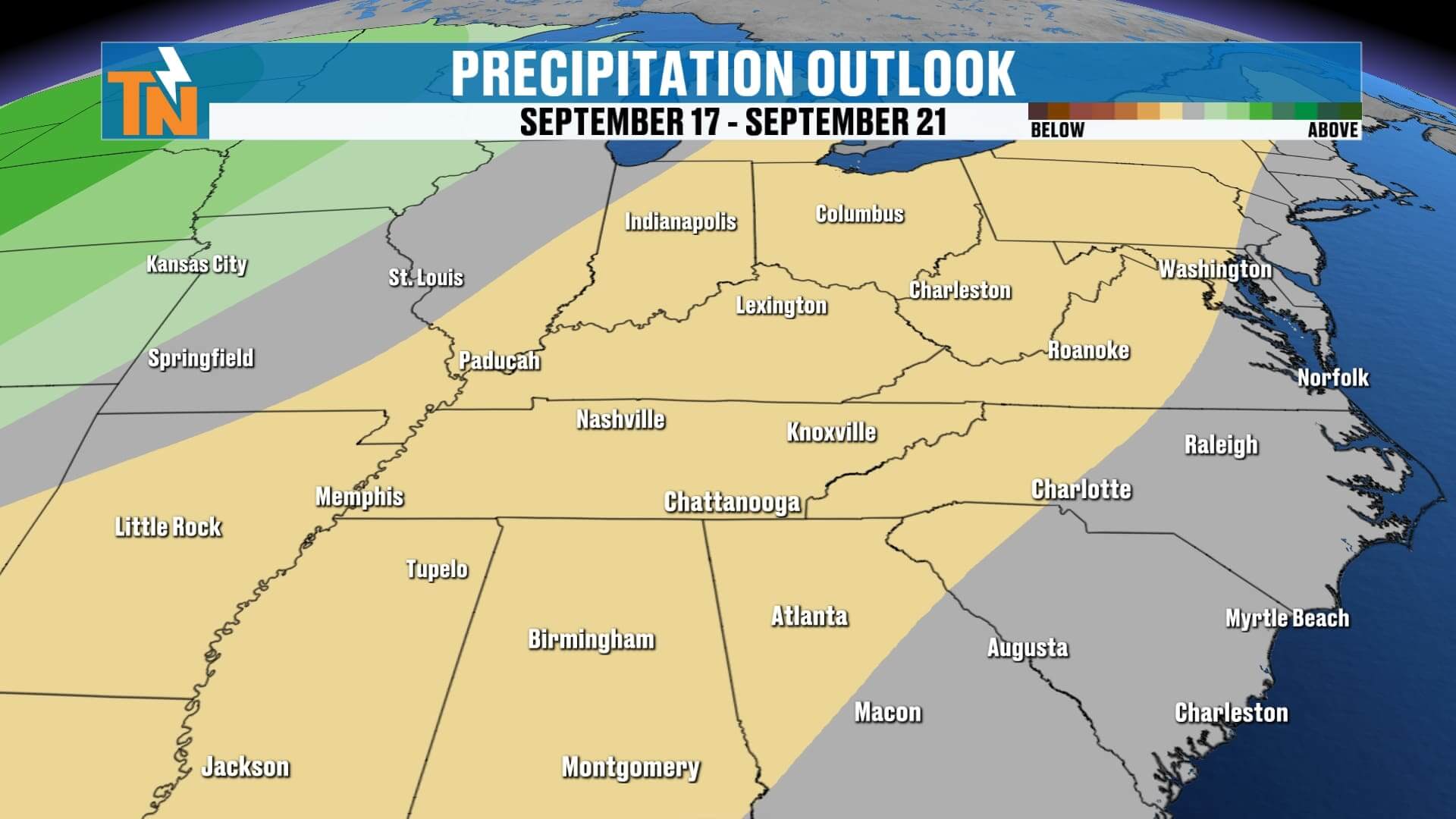
The Weather Prediction Center agrees with our forecast—very little rainfall expected across East Tennessee over the next week. In fact, many of us may stay completely rain-free through mid-September.
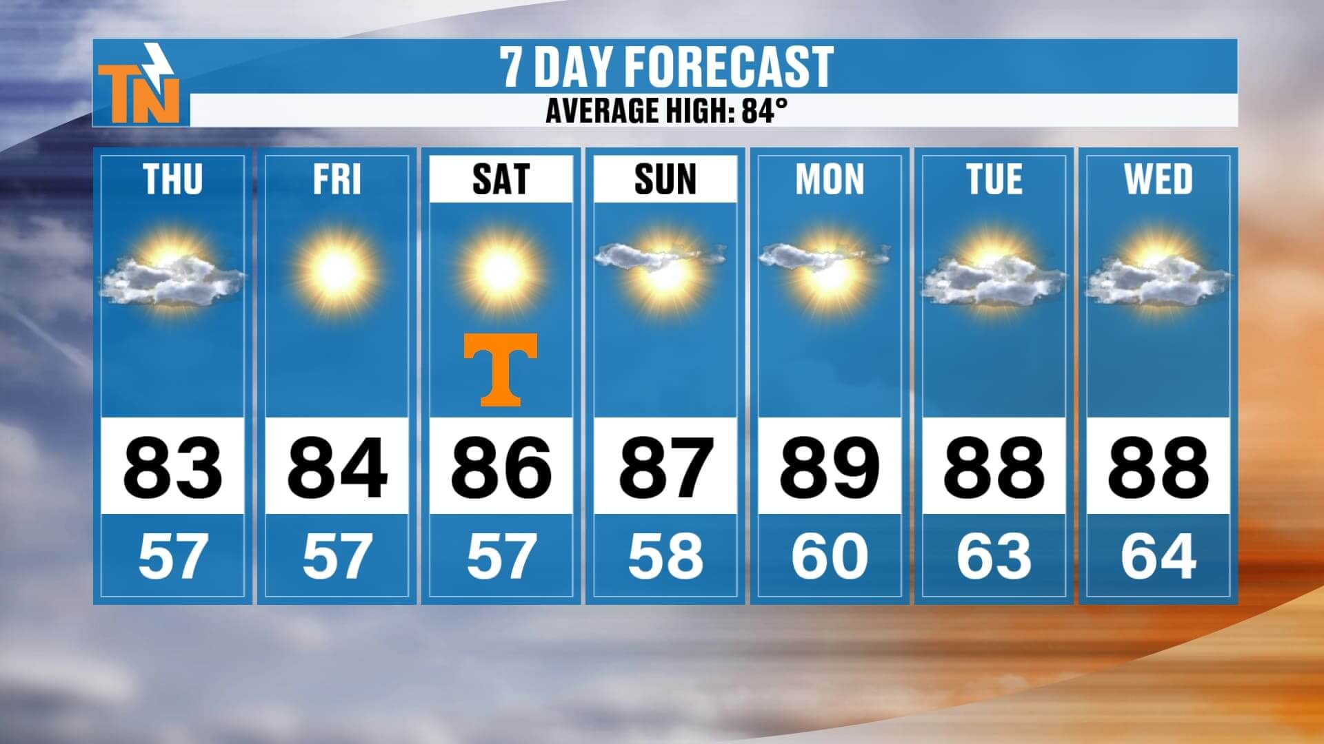
Here’s the temperature trend:
-
Friday: Highs mid to upper 80s
-
Saturday: Upper 80s, hot for game day
-
Sunday–Tuesday: Upper 80s to near 90°, well above average for early September
-
Overnight Lows: Staying mild, mainly in the 60s
Saturday’s UT Football Forecast: Hot & Sunny
All eyes are on Neyland Stadium this Saturday for Tennessee’s home game, and the weather couldn’t look better—though it will be toasty for tailgating and kickoff.
-
Morning Tailgates: 59° at sunrise, warming quickly
-
Noon: 80° under sunny skies
-
Kickoff (3:30 PM): 87°, hot and dry
-
Fourth Quarter: Low 80s, still mild but more comfortable
So, pack your sunscreen, sunglasses, and water bottles—it’s going to feel more like mid-summer than early fall.
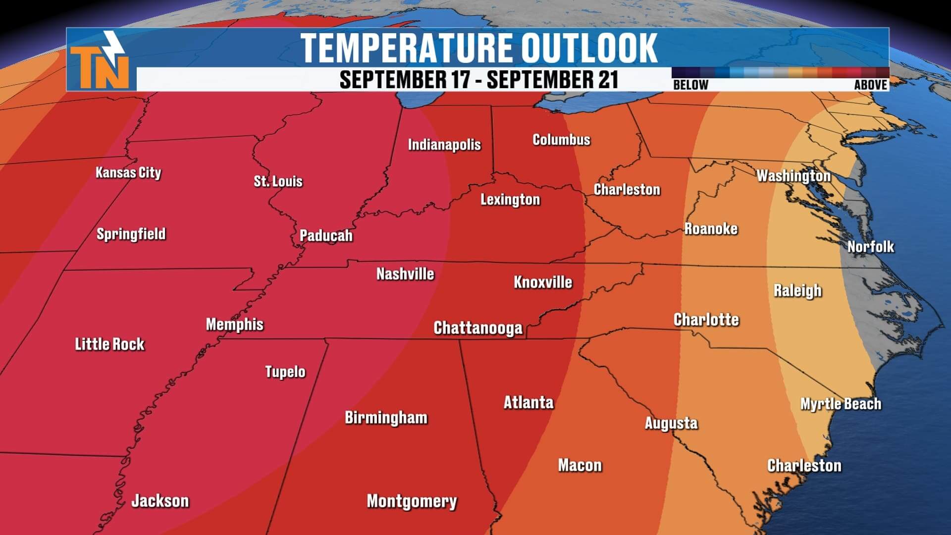
Looking Beyond the 7-Day Foreacst
While the first part of September has trended below average, this warm, dry stretch could flip that script. Long-range guidance hints at a warmer-than-average pattern sticking with us through the middle and later parts of September.
If you’ve been enjoying those crisp, fall-like mornings we had last week, you may have to wait a bit longer for another cool-down.
Weather Headlines
-
☁️ Thursday Morning: Clouds and a few light Plateau showers
-
️ Afternoon: Sunshine returns, highs in the 80s
-
️ Warming Trend: Mid to upper 80s Friday, near 90° by the weekend
-
Saturday Football: Hot and sunny, 87° at kickoff, low 80s by game’s end
-
Dry Pattern: Rain chances near zero for at least the next week, possibly two
ABOVE AND BEYOND THE 7 DAY FORECAST
Final Word
It’s another beautiful day across East Tennessee with sunshine returning and a warming trend setting up for the weekend. High pressure is in control, and that means dry skies and above-average temperatures as we roll into mid-September. Saturday’s UT football game looks picture-perfect—just hot—so plan for summer-like heat during the tailgate and kickoff.
Don’t forget, you can stay ahead of the forecast with the eastTNweather app. From interactive radar to push alerts and live updates, it’s your go-to source for Knoxville, the Plateau, the Smokies, and all of East Tennessee.
Have a great Thursday, and I’ll see you back later today with more updates!