
Good morning, East Tennessee!
Happy Tuesday. I hope you had a fantastic Labor Day weekend. Thanks for checking in with your morning weather update from the eastTNweather team. As we step into this short work week, the big picture pattern across the country hasn’t changed much—and that means we’re lining up for a couple of cold fronts, more showers, and eventually another shot of fall-like air.
The Big Picture: Ridge West, Trough East
We’re still locked into a trough-ridge setup across the U.S.:
-
High pressure ridge building across the Four Corners and Southwest, shifting slowly northward.
-
Trough lingering across the eastern U.S., keeping us unsettled here in Tennessee.
That trough is the reason we’ll see two cold fronts slide through the region this week. Both will bring rain chances and eventually deliver another cool-down as we close out the week and head into the weekend.
This Morning: Clouds & Spotty Showers
East Tennessee woke up to 50s and 60s this morning—comfortable, but running a little warmer than Labor Day Monday.
-
Clouds: A blanket of mid- to high-level clouds is overhead.
-
Showers: A few light showers already developed across the mountain counties and parts of the Cumberland Plateau.
Expect some of this activity to linger through the morning hours, tapering toward lunch.
Today’s Forecast: Scattered Showers, Mild Temps
Futurecast shows spotty showers through midday, then gradually shifting toward the Plateau and Kentucky border during the early afternoon. By the evening commute (5–6 PM), most of the area should be mostly dry.
-
Highs: Upper 70s to low 80s, keeping us about 5–10° below normal.
-
Evening: Comfortable and mild, perfect for late summer outdoor plans.
Rainfall today won’t add up to much—just enough to dampen a few spots while most of us stay dry.


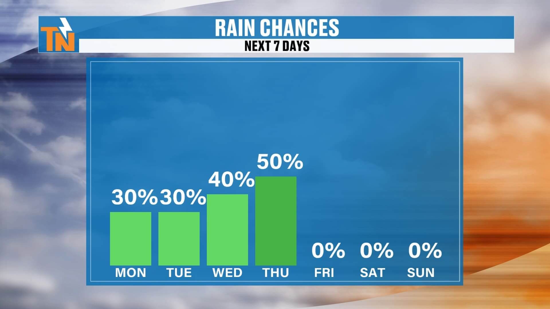
Midweek Into Thursday: Rain Chances Ramp Up
-
Wednesday: A few scattered showers and thunderstorms pop up during the day, nothing widespread.
-
Thursday: Cold Front #1 sweeps through, bringing increased humidity, warmer temps, and a higher likelihood of storms. By late Thursday, most of East Tennessee should see at least some measurable rain.
Friday Into The Weekend: Cold Front #2 & UT Football Forecast
Behind Thursday’s front, rain slides south and east by Friday. But here’s where things get interesting:
-
Cold Front #2: Arrives Friday night into Saturday, delivering another shot of dry, fall-like air.
-
Saturday: Models are hinting at a few showers lingering early, so I’ve added a 30% chance for rain. Most of the day should trend drier.
-
UT Football Game (Saturday 3:30 PM vs ETSU): Forecast looks favorable overall, but we’ll need to watch for leftover showers around kickoff.
By Saturday night into Sunday, dry high pressure builds back in.
7-Day Forecast at a Glance
-
Tuesday: 78–82°, scattered showers, mainly morning/midday
-
Wednesday: 80–83°, isolated showers/storms, humidity rising
-
Thursday: 81–84°, scattered to widespread storms with Cold Front #1
-
Friday: 80°, showers taper off, humidity drops slowly
-
Saturday: 30% chance morning rain with Cold Front #2, then drier for UT football
-
Sunday: 77–80°, sunshine, low humidity, crisp morning lows
-
Monday–Tuesday: Quiet, dry, highs upper 70s, lows in the 50s
Weather Headlines
-
️ Today: Mix of clouds, spotty showers, highs in the 70s–80s
-
️ Thursday: Cold Front #1 brings widespread showers & storms
-
Saturday: UT football kickoff mostly dry, but lingering showers possible early
-
️ Weekend: Cold Front #2 brings fall-like air with sunshine and cooler mornings
-
Next Week: Below-average temps continue with crisp early September mornings

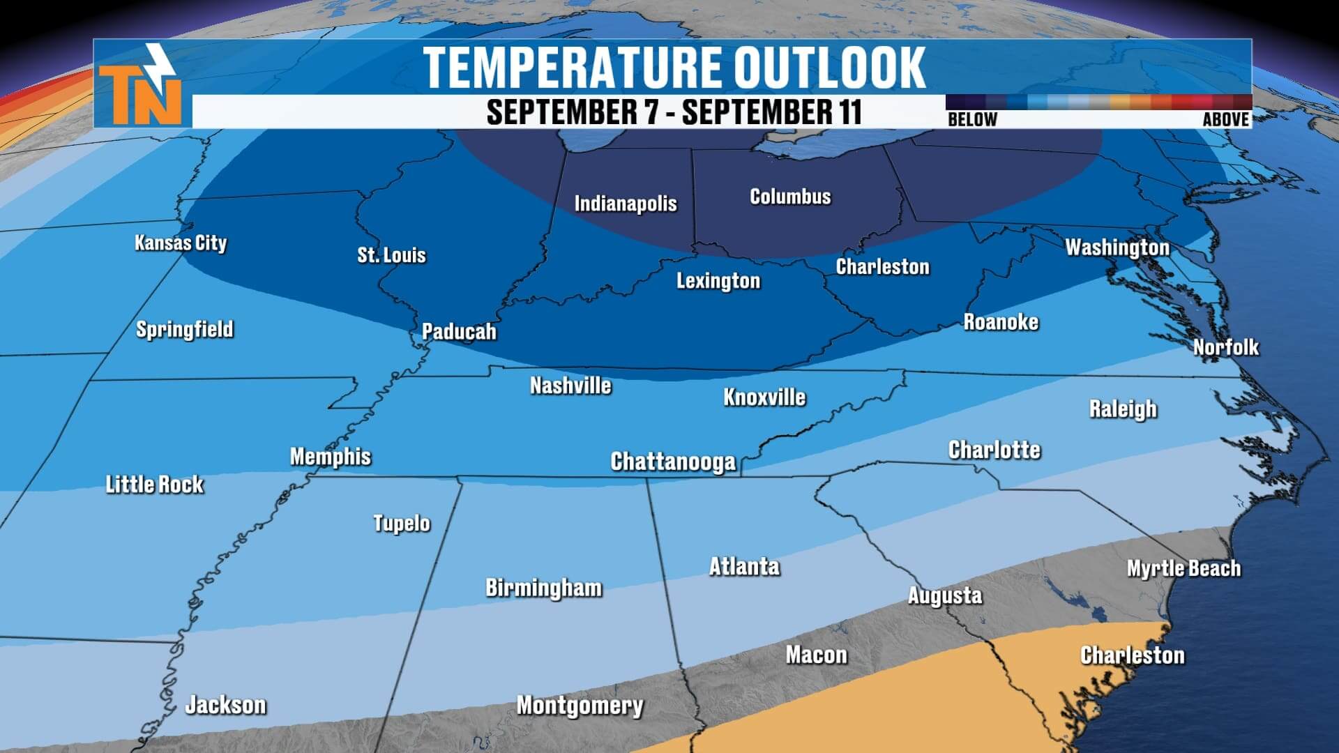
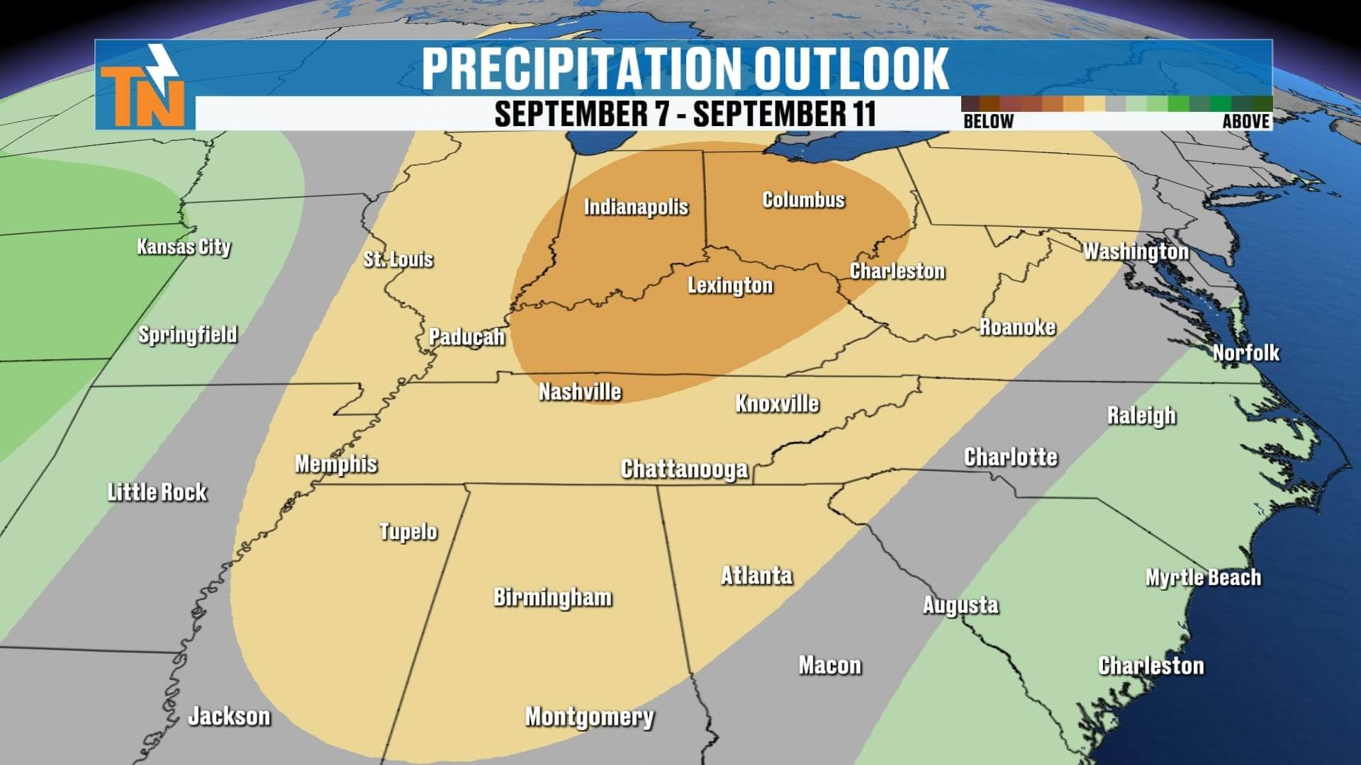
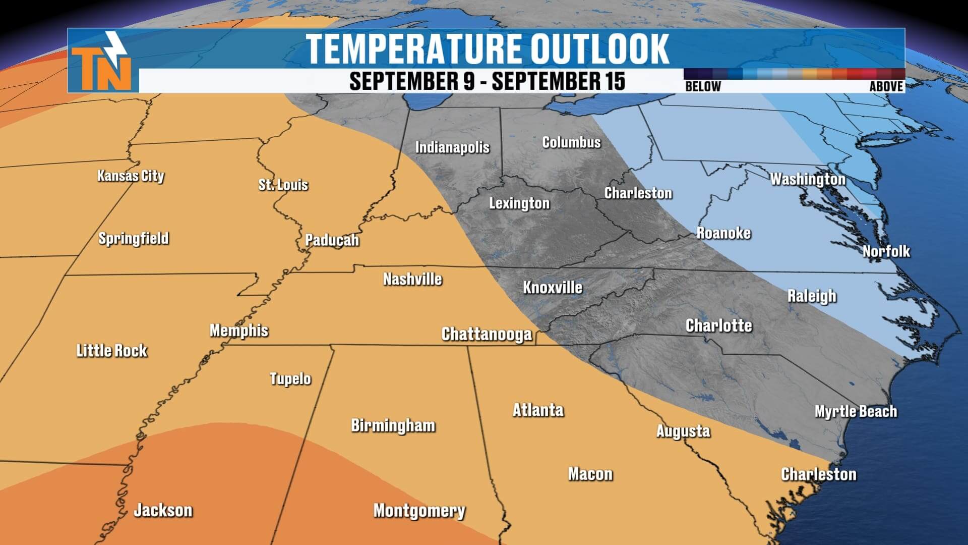
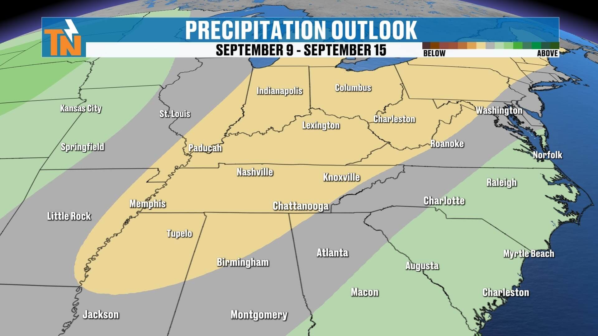
ABOVE AND BEYOND THE 7 DAY FORECAST
Final Word
Today’s showers are scattered and light, but rain chances ramp up midweek and peak on Thursday as Cold Front #1sweeps through. Then Cold Front #2 arrives Friday into Saturday, reinforcing the cool-down and giving us another stretch of refreshing, fall-like weather just in time for the weekend. If you’re headed to Neyland for the UT vs. ETSU home opener, conditions look mostly dry and comfortable by kickoff.
Don’t forget, you can track rain in real time with the eastTNweather app. From interactive radar to lightning alerts, it’s your best way to stay ahead of storms across Knoxville, the Plateau, and the Smokies.
Enjoy your Tuesday, East Tennessee, and I’ll keep you updated as we track both cold fronts this week!