
Good morning and Happy Tuesday.
Thanks for checking in. We’ve got another warm and breezy day ahead, but there are some subtle changes underway that will lead to a wetter pattern—especially by the weekend.
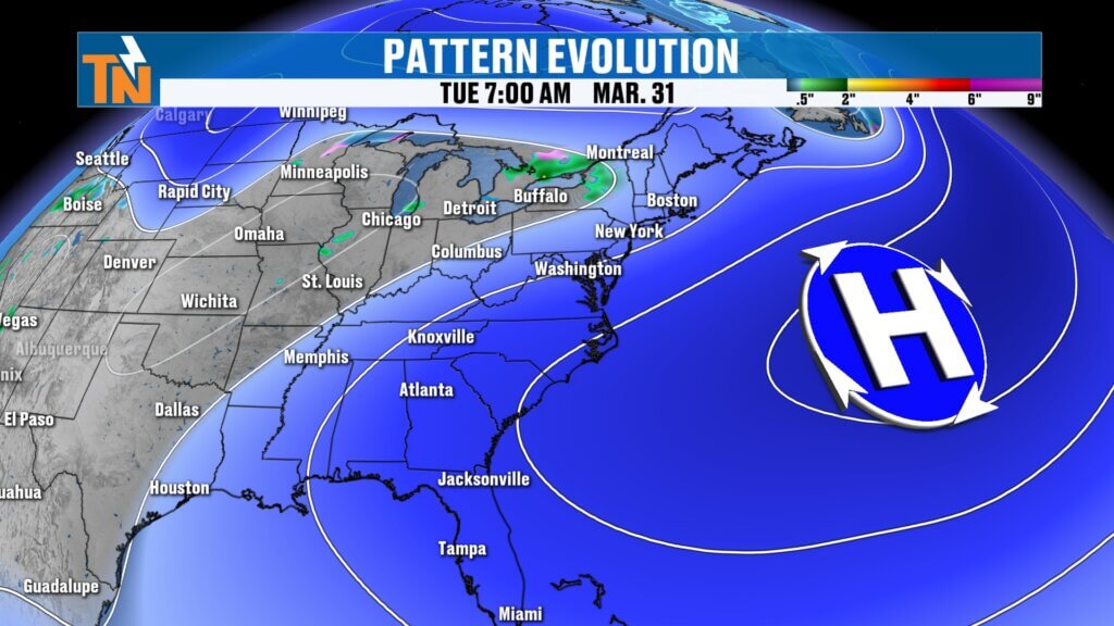
Big Picture: Warm Southerly Flow in Control
The overall setup is driving our current stretch of warm weather.
- High pressure anchored along the Southeast coast
- East Tennessee on the western side of that system
- Southerly winds pulling in warmer, slightly more humid air
This pattern keeps temperatures above average and sets the stage for increasing rain chances later this week.
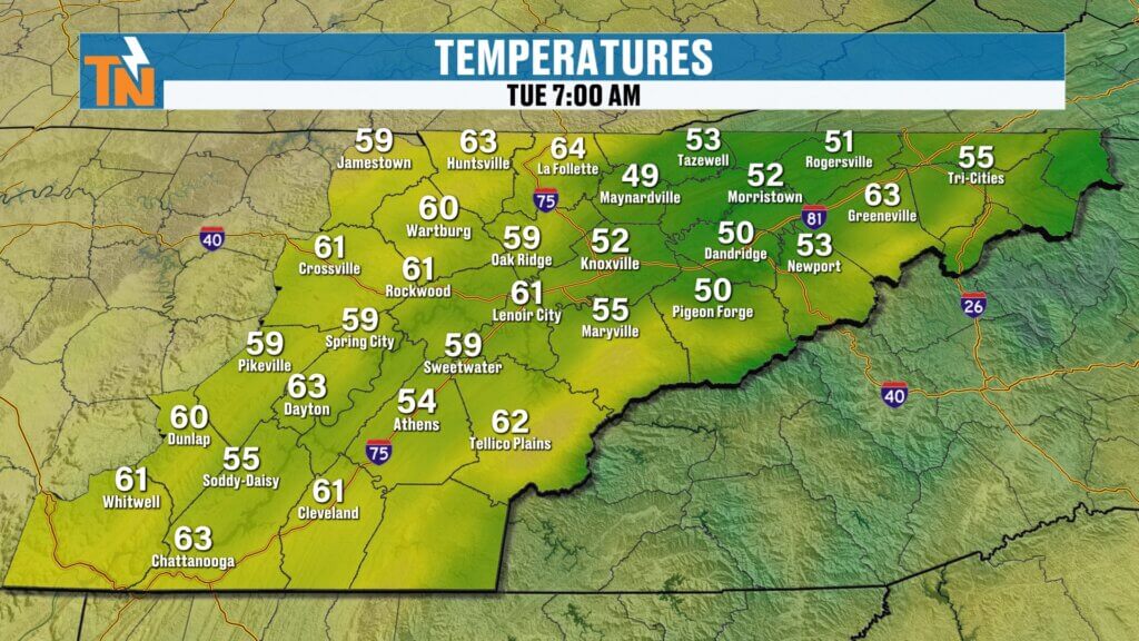
Mild Morning Start Across the Region
It’s another comfortable start to the day.
- Morning temperatures in the 50s and 60s
- Mild and pleasant early conditions
- No chill compared to last week’s colder mornings
A sign that spring is fully settling in.
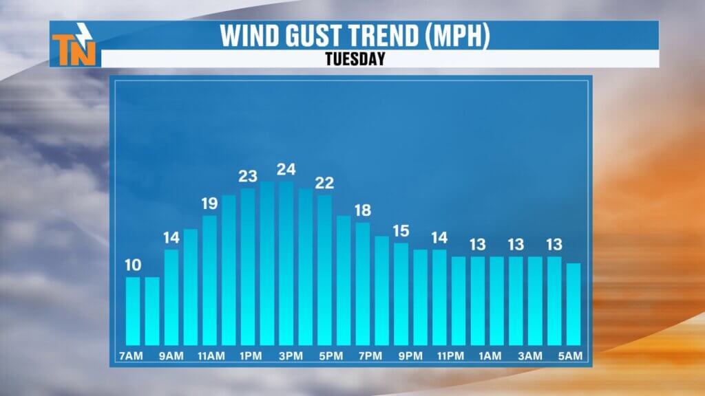
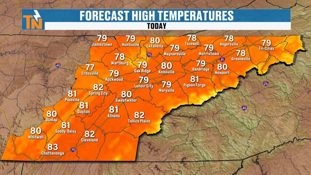
Breezy and Warm This Afternoon
Winds and warmth will be noticeable again today.
- Winds increasing through the afternoon
- Gusts around 20 to 25 mph
- Highs climbing into the upper 70s to low 80s
The breeze will ease a bit after sunset, leading to a very pleasant evening.
Evening Outlook: Great Conditions Continue
If you’ve got plans tonight, the weather cooperates.
- Around 81° for the evening commute
- Upper 70s during dinner hours
- Low 70s by bedtime
Warm, comfortable, and quiet overall.
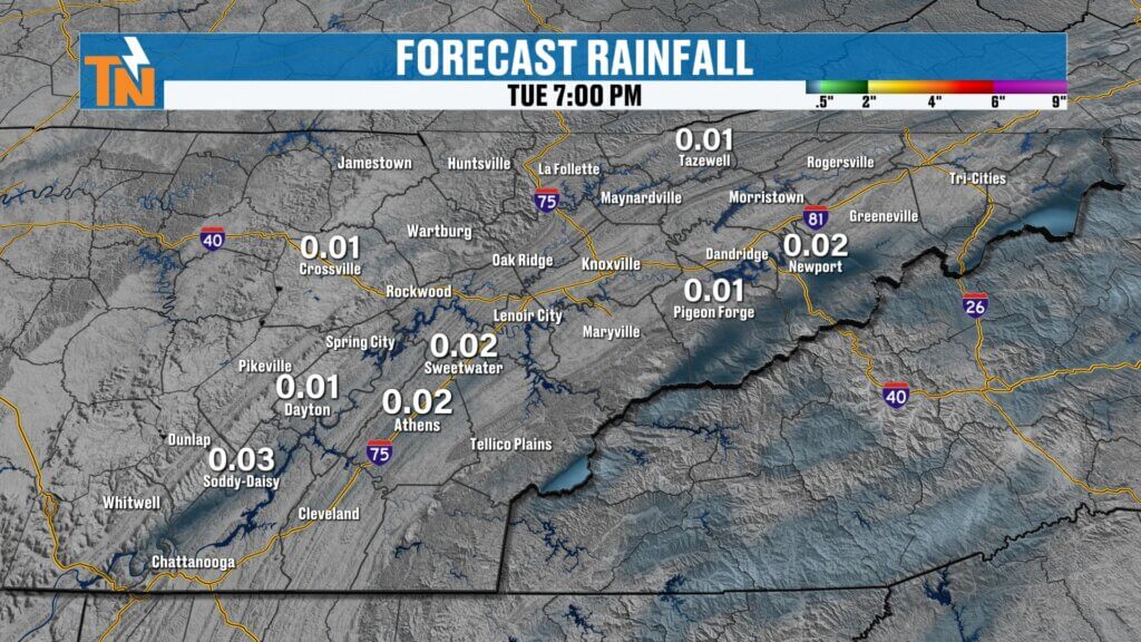
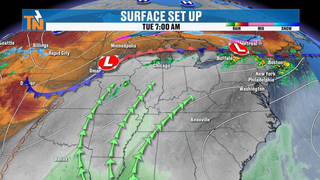
Isolated Pop-Up Showers Possible
While most areas stay dry, a few isolated showers or storms can’t be ruled out.
- Best chances in the higher terrain (plateau and mountains)
- Driven by daytime heating and added moisture
- Very limited coverage in the valley
Most locations won’t see rain, but don’t be surprised by a quick pop-up shower.
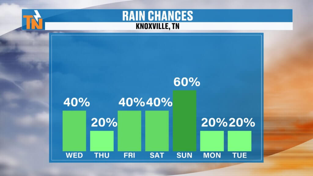
Midweek Through Saturday: Limited Rain, Continued Warmth
The pattern stays fairly quiet through the end of the workweek.
- Daily chances (20–40%) for isolated showers or storms
- Better chances remain in the mountains
- Warm and breezy conditions continue
Most of the heavier rain stays north and west of East Tennessee.forecast continues to evolve.
Easter Weekend Outlook: Increasing Confidence in Rain
Attention now turns to the weekend system.
- Saturday: Warm with a few scattered storms
- Sunday: Higher confidence in widespread rain
There is growing concern for a soggy Easter Sunday.
Sunday Timing: Watching for Morning Rain
Early indications suggest:
- Rain likely during sunrise services
- Showers may linger into the first half of the day
- Potential clearing later in the afternoon
Timing will continue to be refined, so check back for updates.
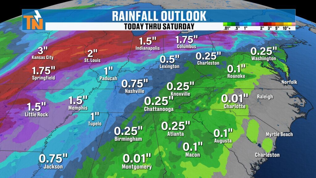
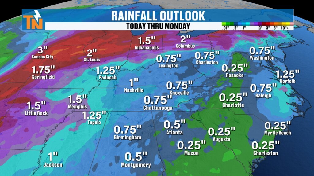
Rainfall Outlook: Helpful but Trending Lower
Rainfall expectations have adjusted slightly.
- Minimal totals through Saturday
- Around 0.75 to 1 inch possible Sunday
- Still beneficial for ongoing drought conditions
While totals have come down a bit, this is still helpful rain.
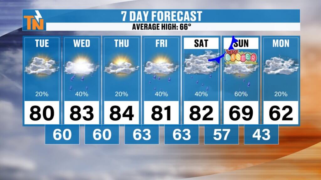
Temperature Trend
Warm weather continues before a slight cooldown.
- Low to mid 80s through Friday
- Around 82° Saturday
- Cooling back to seasonal levels Sunday into next week
Final Thoughts
Another warm and breezy day is ahead with only a slight chance for isolated showers. The bigger story is the increasing likelihood of rain by Easter Sunday, which could impact early plans.
Have a great Tuesday, and be sure to check back in as we fine-tune that weekend forecast.