
Good morning and Happy Wednesday.
Thanks for checking in. We’re stepping into a more summer-like pattern with warmth, humidity, and just enough energy in the atmosphere to spark a few afternoon storms..
Summer-Like Pattern Takes Hold
We’re seeing a big shift in the overall feel of the weather.
- Warm, moist air flowing in from the south
- Increasing humidity across the region
- More energy in the atmosphere for storm development
It’s starting to feel more like May than early April.
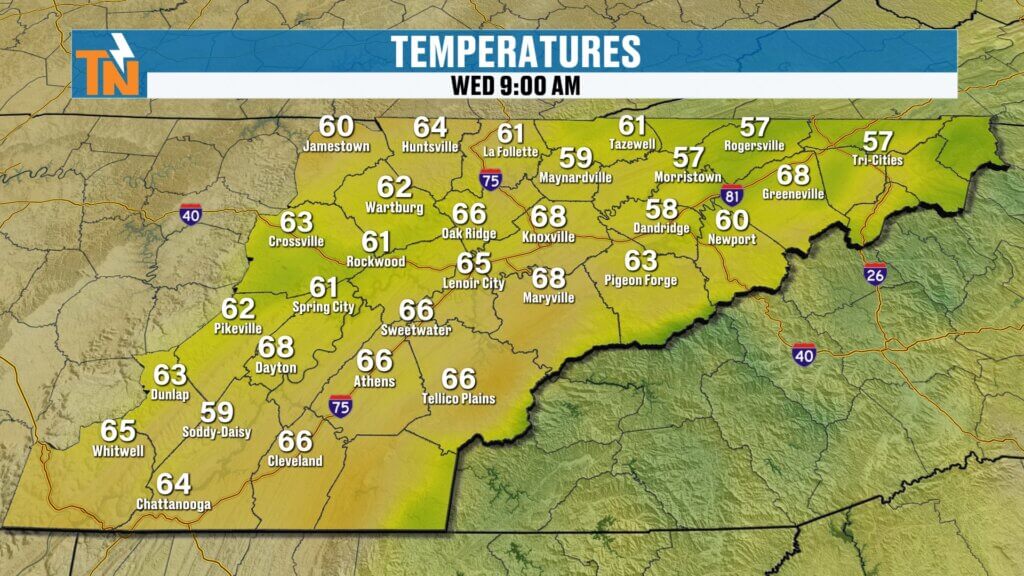
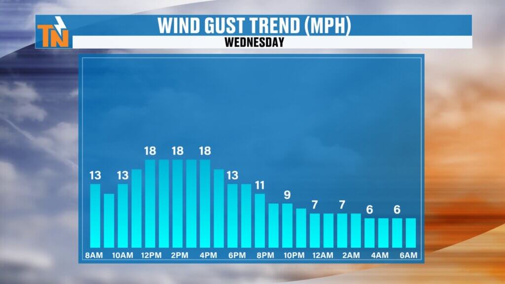
Mild and Breezy Start to the Day
The morning is off to a warm and comfortable start.
- Temperatures in the 50s and 60s
- Mild conditions right out the door
- Breezy winds continuing through the day
That breeze has been a constant and sticks around again today.
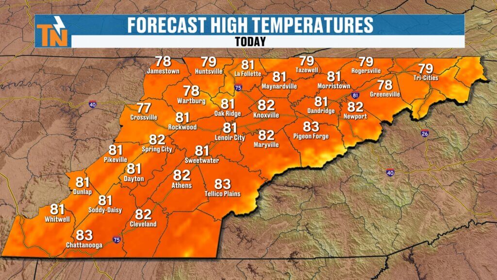
Afternoon Forecast: Warm with Isolated Storms
Expect another warm day with a few spotty storms.
- Highs in the upper 70s to low 80s
- Breezy at times
- 30–40% chance of showers and thunderstorms
Storms will be hit-or-miss, meaning:
Others stay completely dryweek.
Some areas get a quick downpour
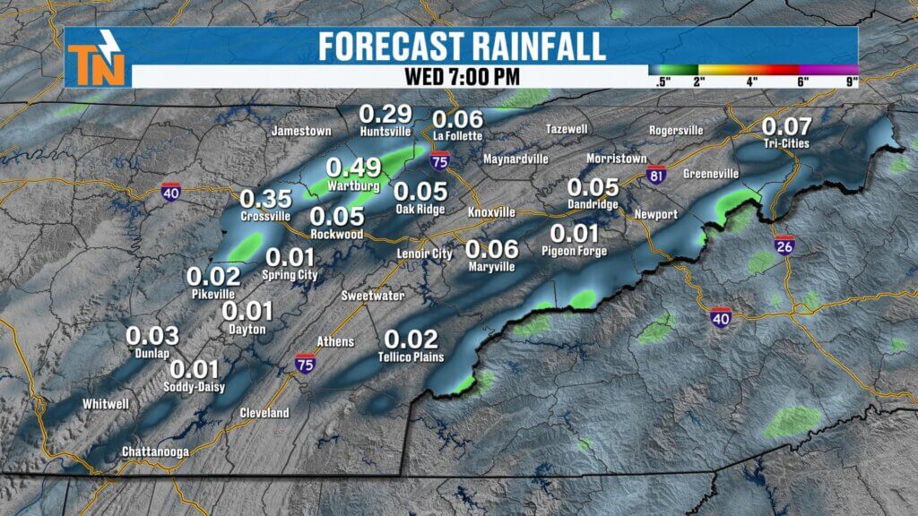
Where Storms Are Most Likely
Not everyone sees rain today.
- Best chances across the Cumberland Plateau and Smoky Mountains
- A few storms may drift into the valley
- Lightning possible with stronger cells
If you’ve got outdoor plans later today, especially after school or this evening, keep an eye on the sky.
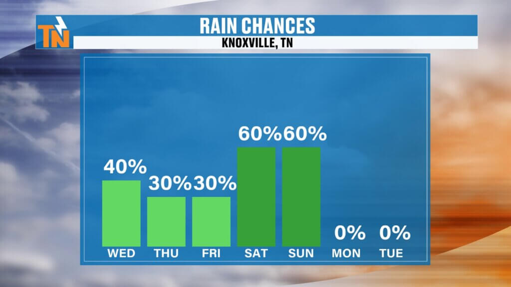
Through Friday: Continued Warm with Spotty Rain Chances
The pattern doesn’t change much through the end of the workweek.
- Daily chances for isolated showers and storms
- Warm and humid conditions continue
- No widespread or heavy rain expected yet
Weekend Cold Front: Timing Still Uncertain
Attention turns to the next bigger system.
- Cold front expected late Saturday into early Sunday
- Some models bring it in Saturday evening
- Others delay it until early Sunday morning
Timing is still being fine-tuned, so expect updates.
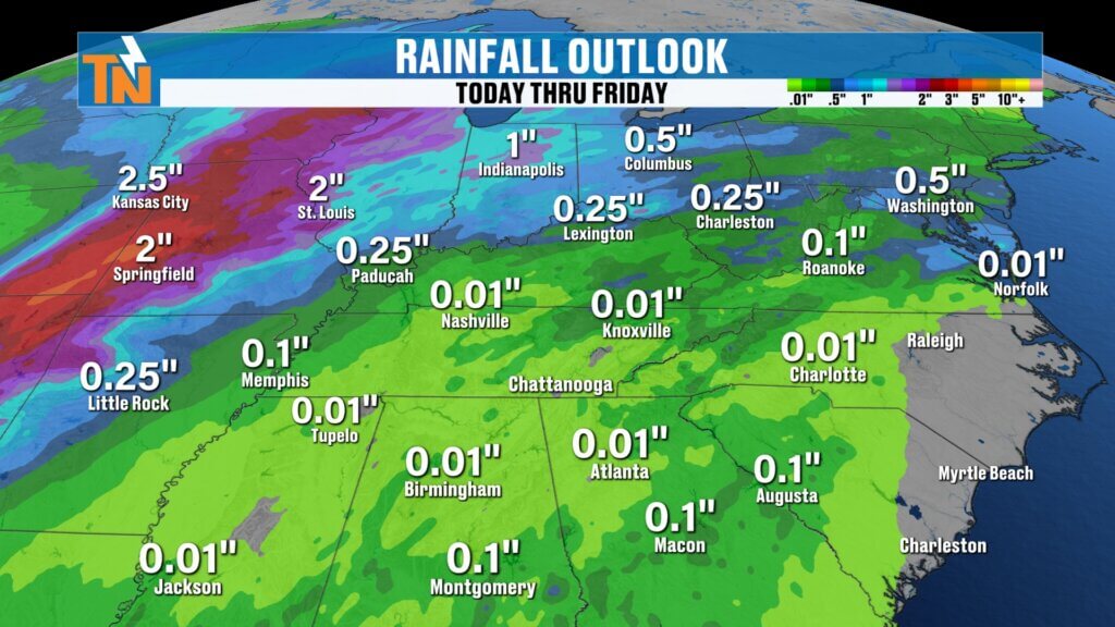
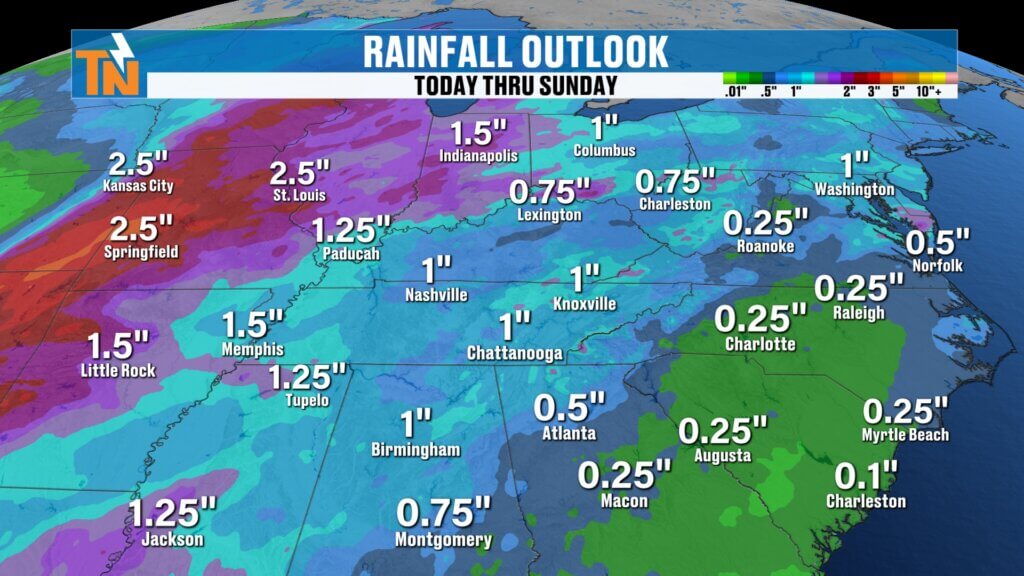
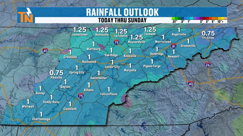
Rainfall Outlook: Much-Needed Rain Possible
This system could bring beneficial rainfall.
- Around 1 inch possible across the region
- Welcome relief for ongoing drought conditions
- Better coverage compared to midweek showers
Easter Sunday Outlook
Here’s the early look at Easter:
- Showers possible early Sunday morning
- Not expected to be an all-day washout
- Gradual clearing with sunshine later in the day
Still a few days out, but trends are improving for outdoor plans later Sunday.
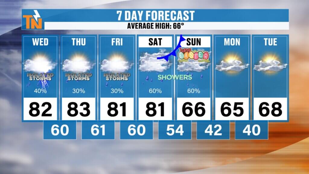
Temperature Trend
Warmth sticks around before a cooldown.
- Low 80s through Saturday
- Cooler Sunday with highs in the 60s
- Staying in the 60s into early next week
Final Thoughts
It’s another warm, breezy, and slightly more humid day with a chance for pop-up storms—mainly in the higher terrain. The bigger story is the weekend cold front, which could bring much-needed rain and impact early Easter plans.
Have a great Wednesday, enjoy the sunshine, and stay weather aware this afternoon.