
Good Morning, East Tennessee
Happy Friday, everybody! Thanks for checking in this morning.
If you’ve got outdoor plans today, enjoy the dry weather while it lasts because another wave of energy is set to bring increasing rain chances later this evening, overnight, and into the first half of Saturday. The good news? Sunday looks dry and pleasant to wrap up the weekend.
What’s Driving the Weekend Forecast?
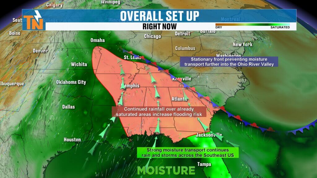
We’re watching a trough digging into the Northeast while moisture continues streaming north from the Gulf.
At the same time, a stationary front is draped across Tennessee, creating a dividing line between heavier rain to the south and lighter rainfall farther north. That boundary will wobble back and forth over East Tennessee through Saturday, helping spark rounds of showers and thunderstorms.
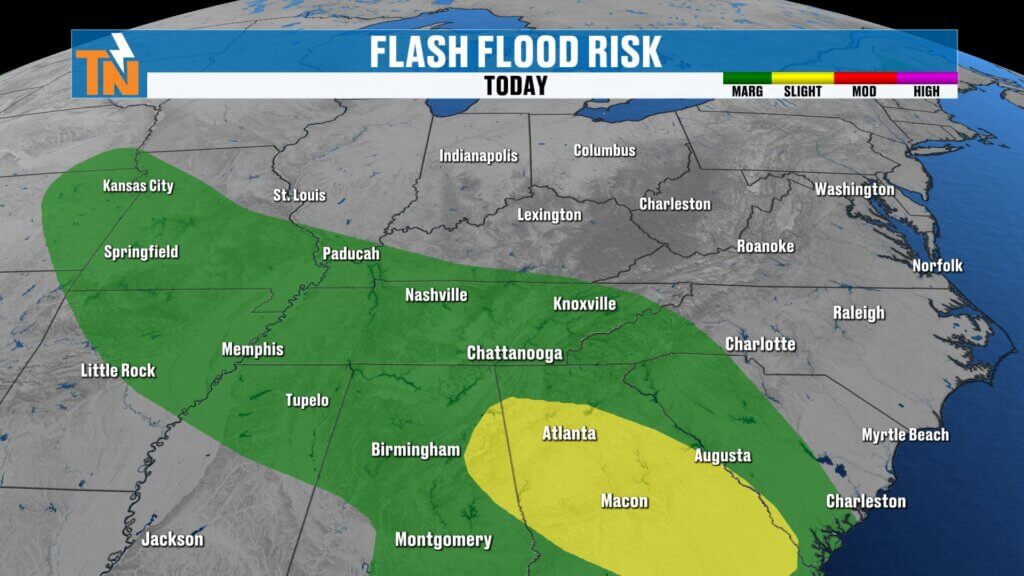
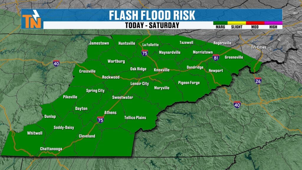
Because of the repeated rainfall potential, the Weather Prediction Center has placed East Tennessee under a Level 1 risk for localized flooding and flash flooding through Saturday morning.
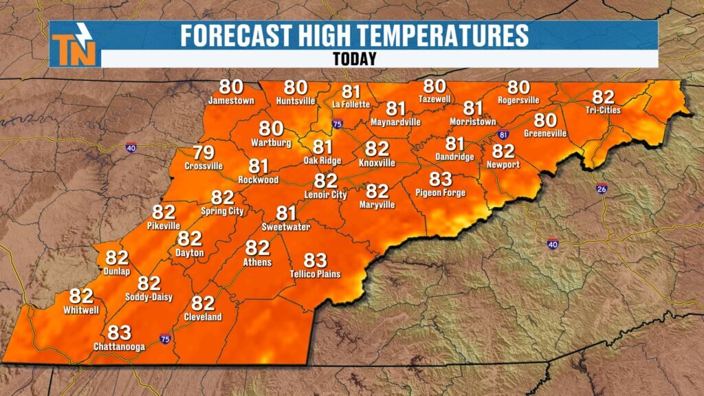

Today’s Temperatures: Warm and Toasty
We’re starting the morning in the:
- 60s across most locations
- A few lower 70s in the Southern Valley
Winds stay fairly light today, helping temperatures climb back into the low to mid-80s this afternoon.
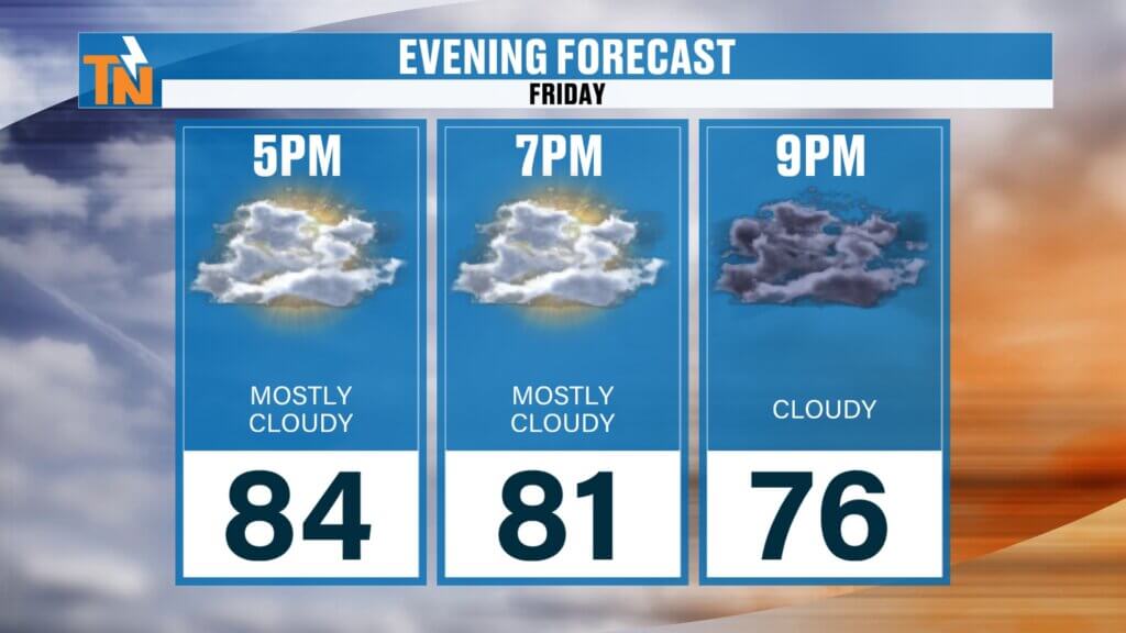
By this evening:
Increasing clouds and rain chances after sunset still happen quickly if heavier storms repeatedly move over the same location.
Around 81° by 7 p.m.
Today: Dry Start, Rain Later
The first half of Friday looks fantastic.
Timeline for today:
- Morning through lunchtime: Dry with high clouds and a beautiful sunrise
- Afternoon: Mostly dry and warm
- Evening into overnight: Showers increase from southwest to northeast
Rain should begin arriving sometime between roughly 5 p.m. and 9 p.m., then linger overnight into Saturday morning.
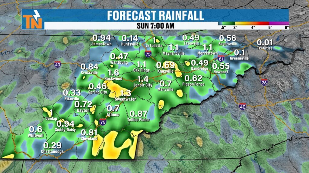
Saturday: Wet Start, Better Finish
Saturday won’t be a total washout, but expect periods of scattered showers for at least the first half of the day.
The wettest window appears to be:
- Friday evening through overnight
- Saturday morning into early afternoon
By Saturday night, rain should begin tapering off, setting the stage for a dry and pleasant Sunday — just in time for the final day of the month.
Flooding Concerns: Hit or Miss Heavy Rain
Rainfall will be scattered and uneven, but some locations could see good soaking rain.
Because storms may repeatedly move over the same areas, isolated flooding and flash flooding can’t be ruled out — especially where heavier downpours develop overnight into Saturday morning. Overall, temperatures stay pretty seasonal for late May and early June.
Looking Ahead: One More Rain Chance Monday
Rain fades out Sunday, but we’re not done just yet.
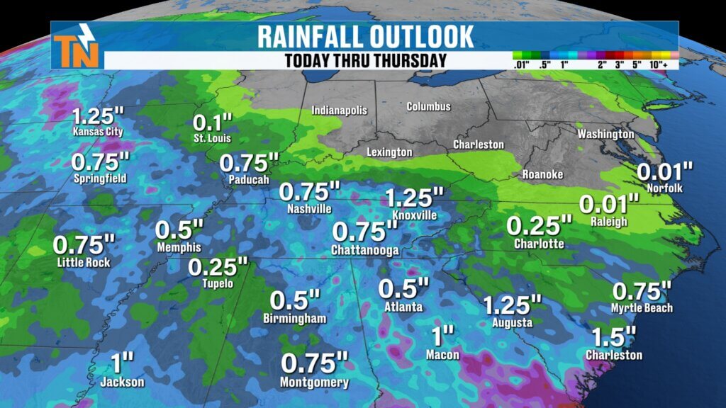
Another disturbance arrives Monday, bringing another round of scattered showers before drier weather settles in Tuesday through Thursday. That stretch next week is shaping up to be excellent pool weather and a nice start to June.
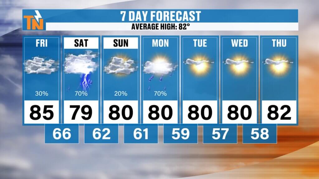
7-Day Forecast Snapshot
- Friday: Warm and mostly dry, rain late — mid 80s
- Saturday: Scattered showers, cooler — upper 70s
- Sunday: Dry and pleasant — low 80s
- Monday: Another chance for rain
- Tuesday–Thursday: Drier, sunnier, and warm — low 80s
Bottom line: Enjoy today, keep the umbrella handy tonight and Saturday, then get ready for a much nicer finish to the weekend.ing air moving into East Tennessee. Winds will be a touch breezier than yesterday, but nothing too significant.