
Good morning and Happy Thursday.
Thanks for checking in with your East Tennessee morning weather update. After a chilly stretch, we are now firmly in a warming pattern that will carry us through the end of the week and into a very spring-like weekend.
While temperatures are on the rise, we’ll also track a few weak disturbances and a light rain chance before a cold front arrives early next week.
Let’s break it all down.
Warming Trend Underway Across East Tennessee
Yesterday marked the beginning of our warming trend, even though it didn’t feel especially warm.
We topped out around 50 degrees, but that was a step in the right direction. Now, temperatures will continue climbing steadily through the next several days.
This warming is being driven by a strong ridge of high pressure out west that will gradually shift toward the Tennessee Valley.
Cool Morning, Milder Afternoon Ahead
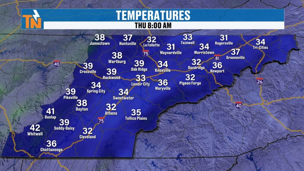
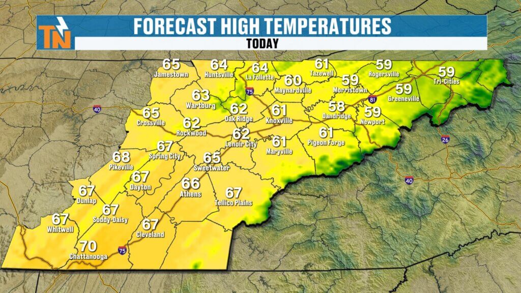
We’re starting off the day on the chilly side once again, with temperatures in the 30s across much of East Tennessee.
The difference today is how quickly we warm up.
Forecast highs this afternoon:
- Near 65 degrees across the Plateau
- Around 61 in Knoxville
- Upper 50s in the Tri-Cities
- Near 70 in Chattanooga
That puts us much closer to seasonal averages compared to earlier this week.
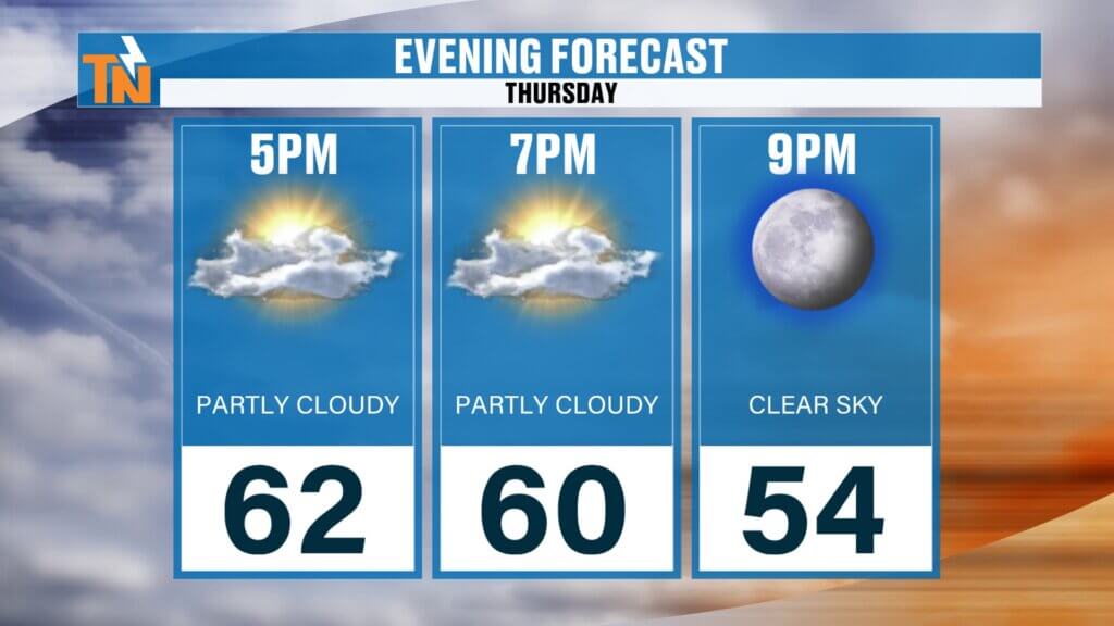
Clouds This Morning, More Sunshine Later
A weak disturbance moving through the northwesterly flow is bringing a few clouds early this morning.
As the day goes on:
- Clouds will gradually move out
- Sunshine will increase
- Expect a mix of sun and clouds overall
No significant precipitation is expected today.
Current Pattern: Northwest Flow with Weak Disturbances
Right now, we’re still dealing with a northwesterly flow pattern in the atmosphere. This setup is allowing a few weak disturbances to pass through the region.
One of those disturbances is moving through this morning, bringing:
- Some cloud cover early in the day
- No significant precipitation
Additional weak waves will move through:
- Friday
- Saturday
However, moisture is limited, so most of the activity will stay north and northwest of East Tennessee.
Mostly Dry Conditions with Minimal Rain Chances
While a few disturbances will pass through, rainfall chances remain very low.
The only timeframe to watch is:
- Saturday afternoon into Saturday evening
Even then, we’re only looking at:
- A couple of isolated showers
- Possibly a brief thunderstorm
Overall, the pattern remains mostly dry with no significant rainfall expected.
Strong Ridge to the West Driving the Warmup
A large ridge of high pressure across the western United States is playing a major role in our upcoming warmup.
This ridge has already brought extreme heat out west, with places like Arizona reaching near 100 degrees.
As this ridge shifts eastward:
- It will help push out the colder air
- Allow warmer temperatures to build into East Tennessee
Springlike Weekend with 70s and 80s
By the time we get to the weekend, temperatures will feel much more like spring.
Weekend Forecast
- Friday: highs in the 70s (about 10 degrees above average)
- Saturday: mid to upper 70s
- Sunday: upper 70s to near 80 degrees
It will be a fantastic stretch of weather for outdoor activities.

Temperature Trend Into Next Week
After the weekend warmup, temperatures will cool slightly but remain comfortable.
Temperature Outlook
- Monday: cooler after the front
- Tuesday and Wednesday: near seasonal averages
- Average high: around 62 degrees
No major cold air outbreaks are expected behind this system.
East Tennessee 7-Day Weather Outlook
- Thursday: Partly cloudy, highs in the low to mid 60s
- Friday: Sunny and warm, highs in the 70s
- Saturday: Warm with a slight chance of a shower, highs in the upper 70s
- Sunday: Very warm, highs near 80 with increasing clouds
- Sunday Night: Chance of light rain
- Monday: Cooler with decreasing clouds
- Tuesday: Seasonable temperatures continue
Final Thoughts
The overall weather pattern is shifting in a big way. After a stretch of colder weather, East Tennessee is heading into a much warmer and more springlike pattern.
Rain chances remain limited, with only a slight chance for a few showers this weekend and a weak system early next week.
Enjoy the sunshine and warmer temperatures ahead, and don’t forget you can always stay up to date with the latest forecast, radar, and alerts on the East Tennessee Weather app.
Have a great Thursday..