Good morning and happy Wednesday, everybody!
I sure hope you’re having a great start to your day. Before we dive into what’s shaping up to be another nice East Tennessee forecast, it wouldn’t be Wednesday without a quick good morning to Ed Up. Wait for it… there he is! Bam. Just like that, we’re sliding downhill toward the weekend, and that’s always a good feeling. The kids can get ready for school, Debbie can finally take her shower, and we can move right along with your Wednesday forecast. And if you’ve been missing Ed, don’t worry — he joins us every Wednesday right here on East Tennessee Weather.
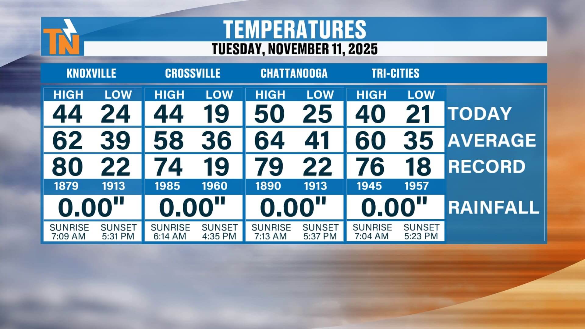
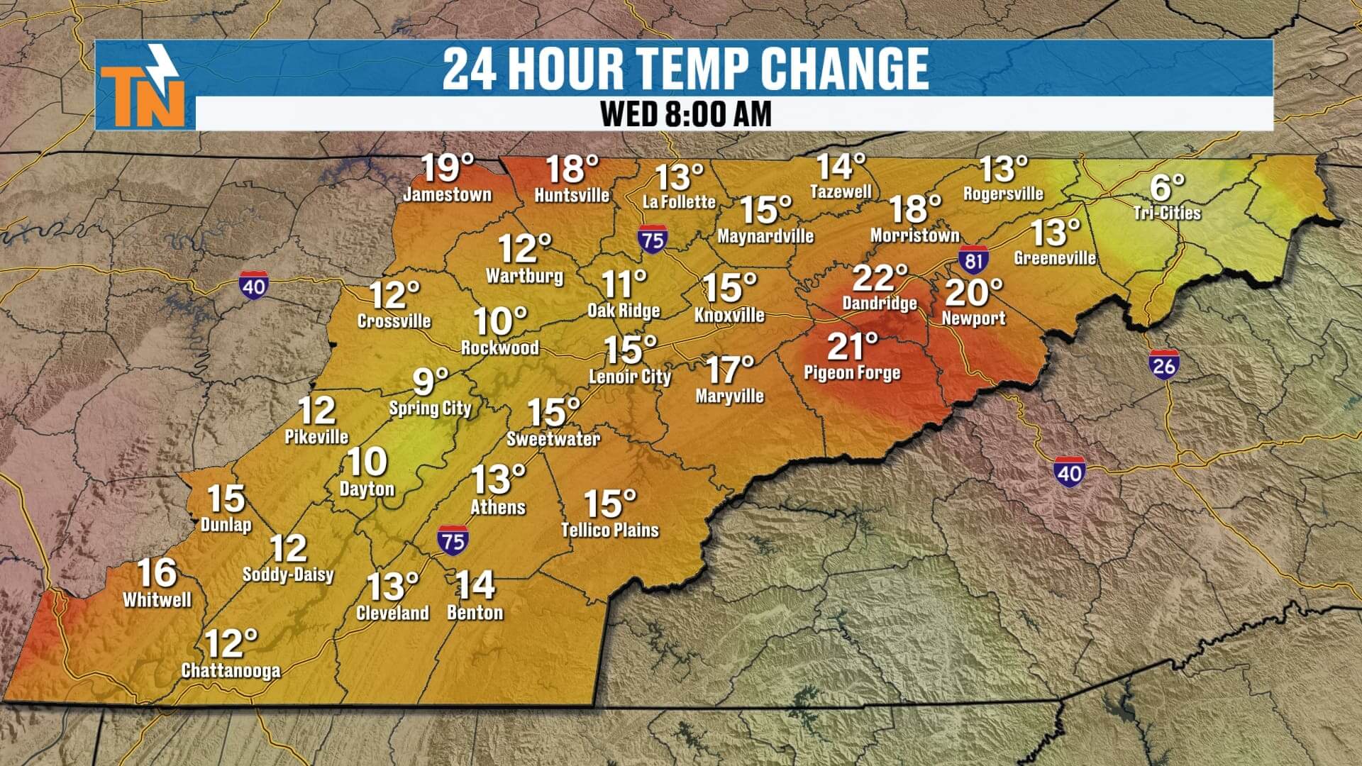
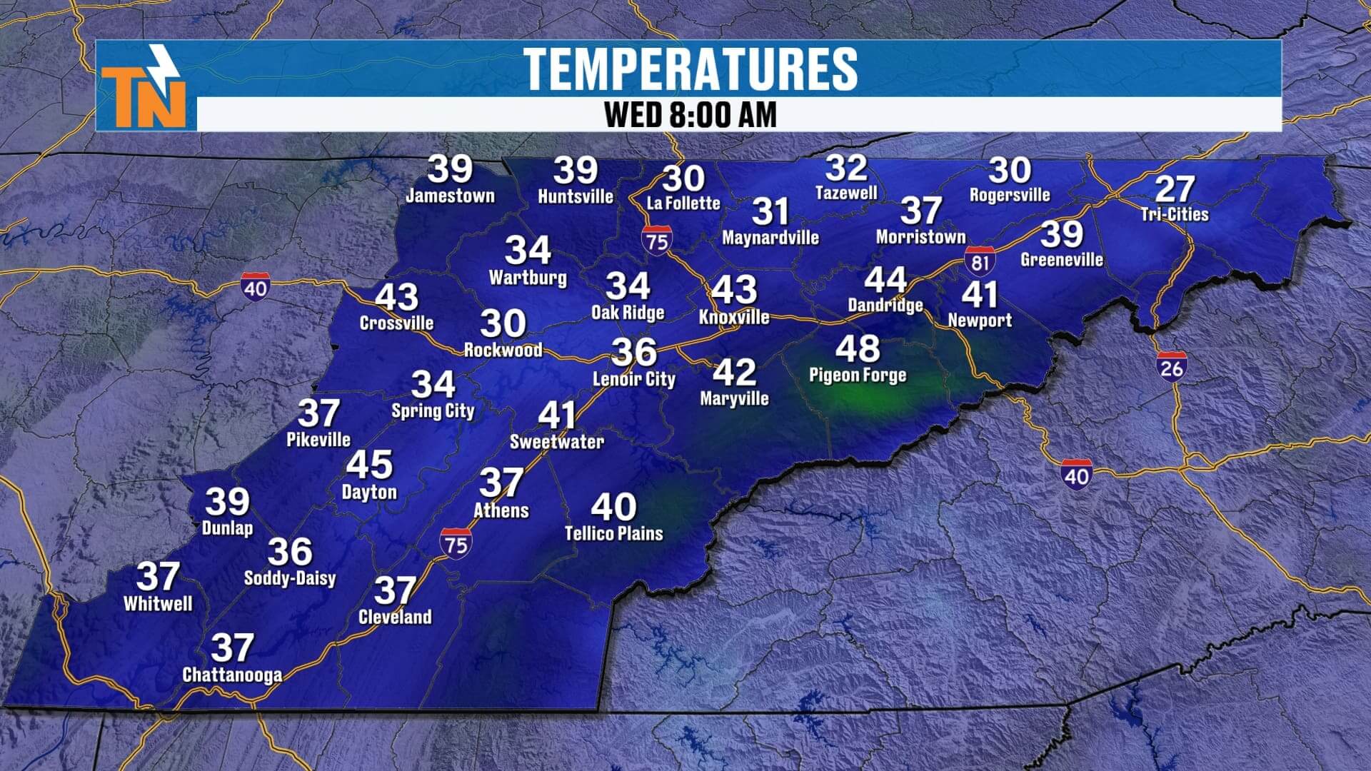
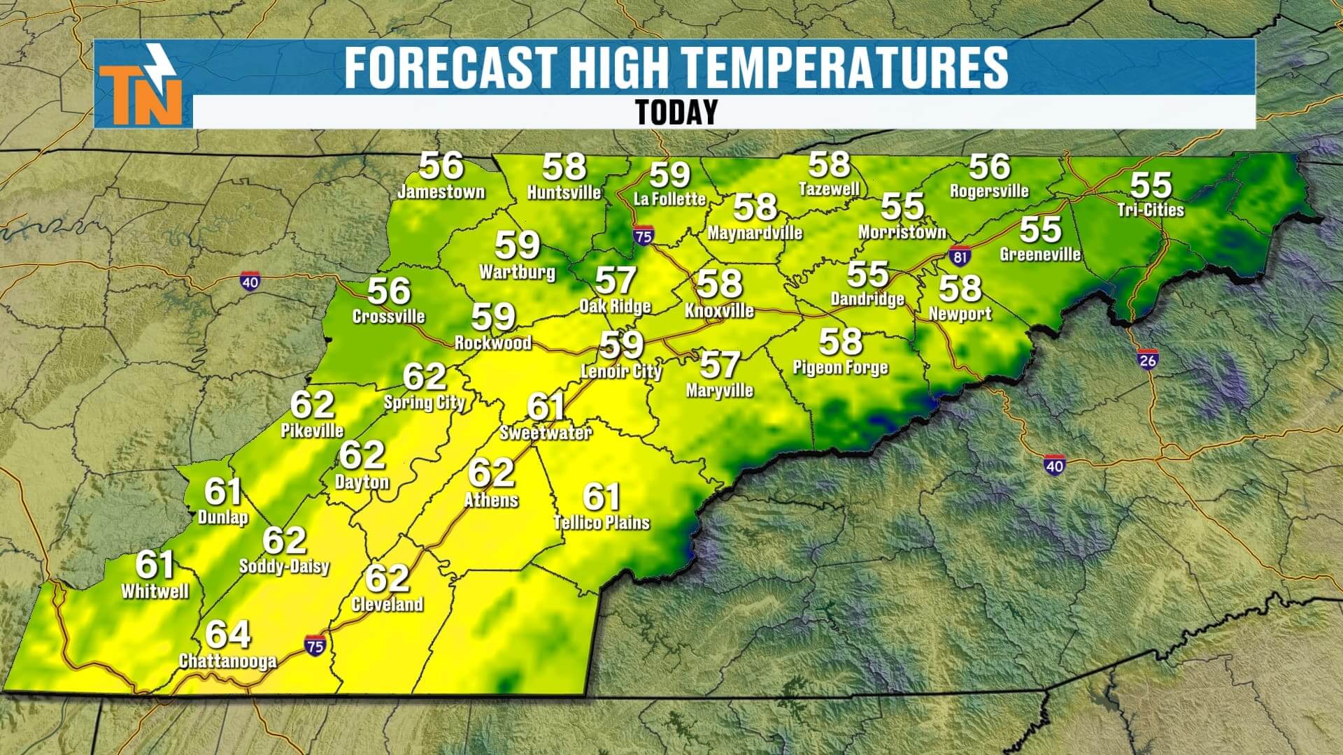
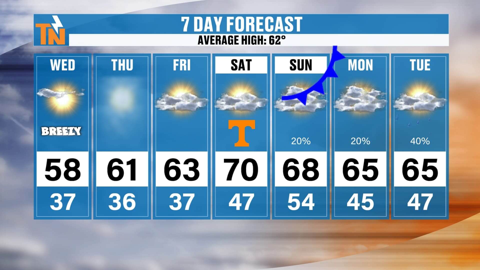
Now, let’s talk about this morning. Temperatures are running a good 10 to 20 degrees warmer than what we had yesterday morning. That means instead of waking up to the deep chill we’ve had lately, we’re starting off in the 30s and 40s — still crisp and cool, but certainly an improvement. As the sun climbs higher, we’ll see plenty of sunshine and a steady warming trend. This afternoon, highs will top out in the upper 50s to low 60s, a full step closer to those typical November averages.
It will be a bit breezy through the middle of the day with winds around 10 to 20 mph, but that breeze will gradually ease up later this afternoon. So, if you’ve got evening plans — maybe heading to a Wednesday night church service or just running errands after work — it’s going to be comfortable. Expect temperatures near 55 degrees at 6:00, dipping into the 40s by 10:00 tonight under mostly clear skies.
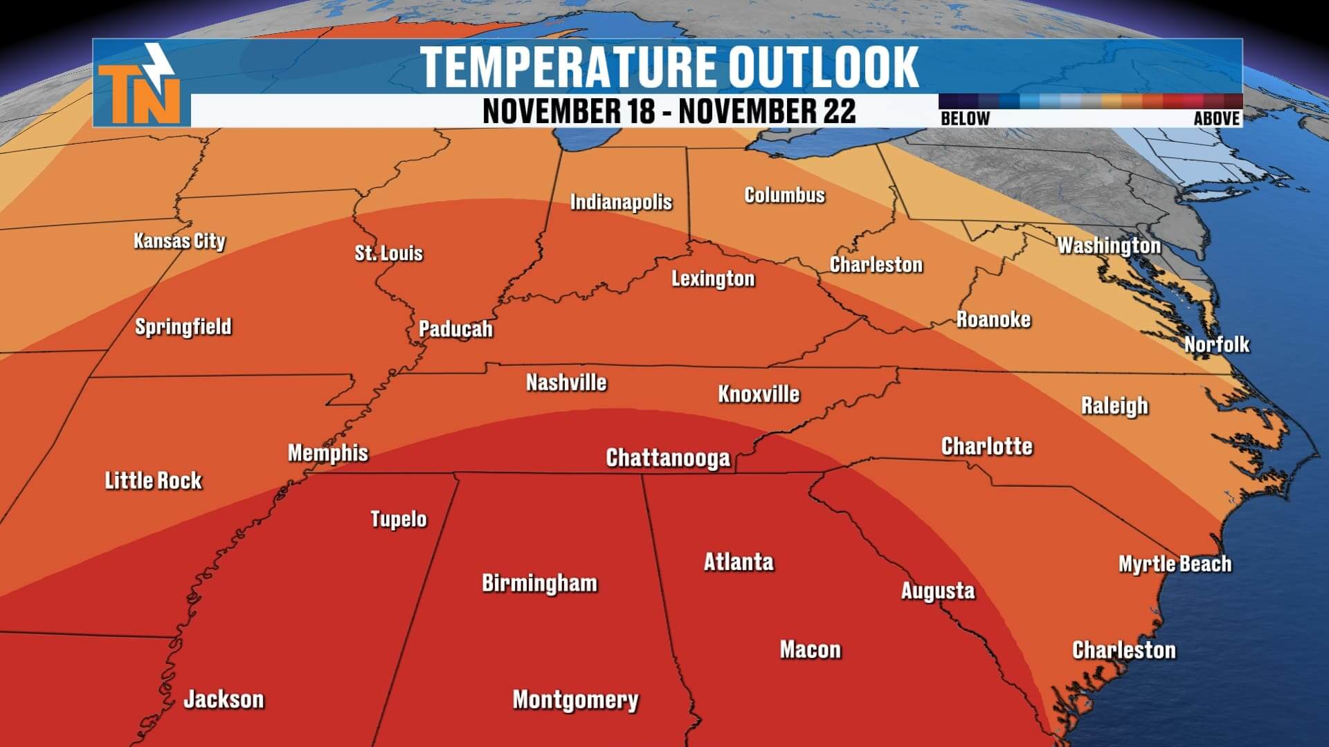
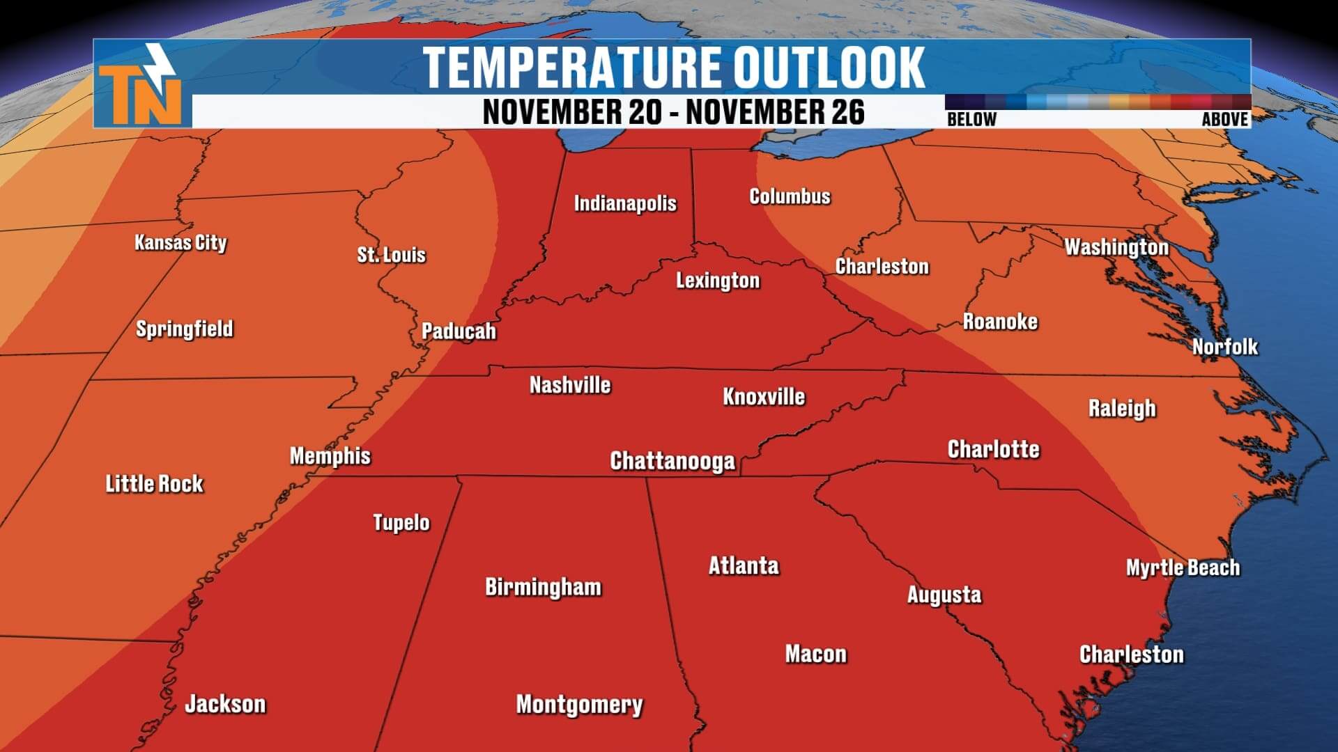
On the big picture, our trough of low pressure that brought us the cold, raw weather earlier this week is moving on out. In its place, a ridge of high pressure across the Southwest is starting to build in, and that’s going to be the driver behind a steady warm-up through the weekend. As that ridge strengthens, we’ll enjoy several days of sunshine and quiet weather before our next weather system moves in early next week.
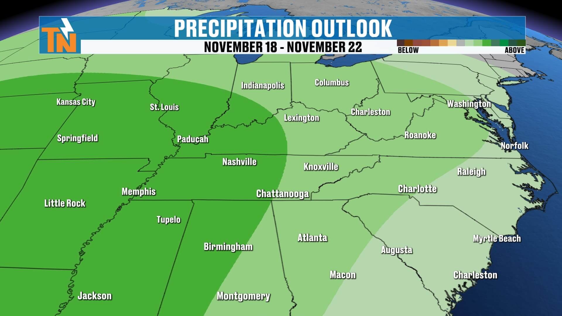
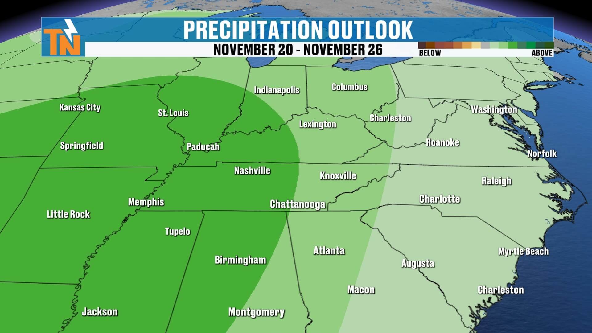
Looking down the road, there is a small piece of energy expected to dive southward by Sunday into Monday. That could bring a few light rain showers, but nothing significant — mostly just a few sprinkles and a slight uptick in the breeze. Beyond that, another system looks to arrive around Tuesday or Wednesday of next week that may finally deliver some measurable rainfall. The latest data from the Weather Prediction Center still only hints at about a quarter-inch of rain through the first half of next week, so it doesn’t appear to be a big soaker by any means.
In the meantime, it’s all about the warm-up. Temperatures will steadily climb from the upper 50s today to near 70 degrees by Saturday. That’s quite a turnaround from where we were just a few mornings ago with teens and 20s.
Speaking of the weekend, let’s talk football — because it’s another Neyland Stadium Saturday! Kickoff is set for 4:15 p.m., and the forecast looks nearly perfect. If you’re tailgating early, expect temperatures around 63 degrees by 11 a.m., warming to 67 by kickoff, and reaching close to 70 during the first half. By the time the game wraps up, temperatures will fall into the low 60s under partly cloudy skies. It’ll be a little breezy at times, but overall, it’s shaping up to be a fantastic football day in Knoxville.
As we head into Sunday, our next cold front arrives — but don’t worry, it’s a weak one. It’ll bring a few light rain showers and slightly cooler air, but temperatures will stay mild and pleasant through early next week.
So, to wrap it all up: we’ve got sunshine, warmer days, cool comfortable nights, and a great-looking weekend ahead. The pattern is finally shifting in our favor after that early taste of winter.
I’ll see you back here tonight at six o’clock with a full update on your weekend forecast and next week’s rain chances. Until then, enjoy your Wednesday — and don’t forget to check out Witcher’s One Minute Weather on the East Tennessee Weather app for quick updates throughout the day.