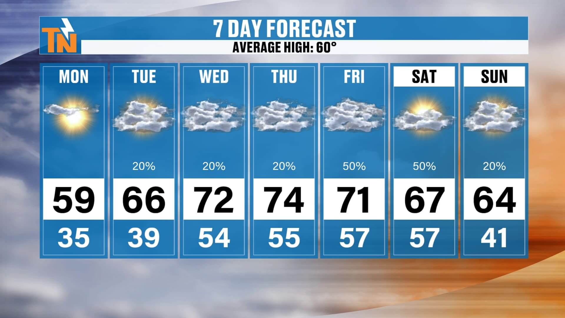
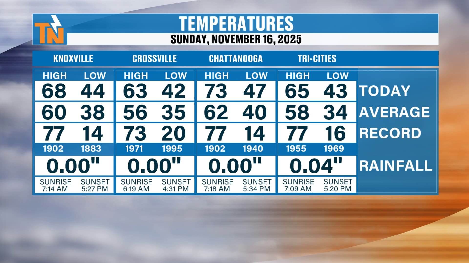
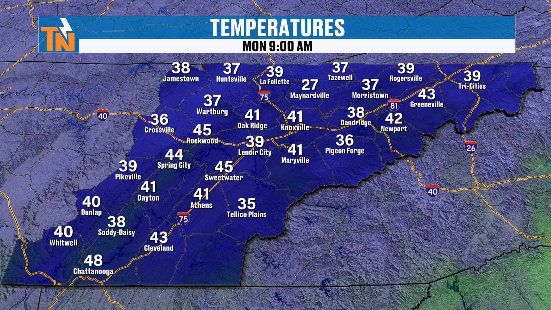
Good morning, and I hope you’ve had a great weeeknd. It really turned out to be a beautiful day across East Tennessee, but we’re rolling into a noticeably cooler start to the new week. Monday morning is going to feel crisp, with temperatures dropping into the 30s across much of the region. So make sure you grab the jacket before you head out the door — it’s going to be a chilly start.
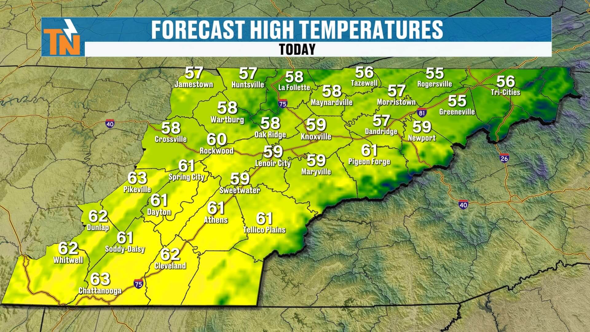
Even with sunshine returning, we won’t warm up a whole lot through the day. High temperatures will top out in the upper 50s, with a few pockets of low to mid 60s south of Interstate 40. In fact, Monday looks to be the coolest day we’ll see over the next seven days, because a warmer pattern is gearing up to take over.

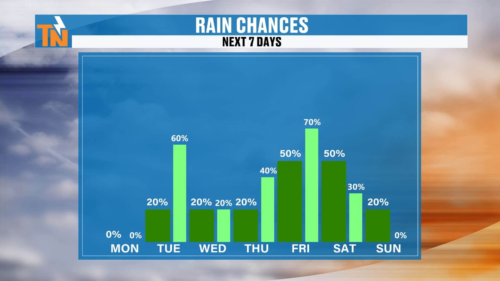
Rain Chances Increasing — But Not a Washout
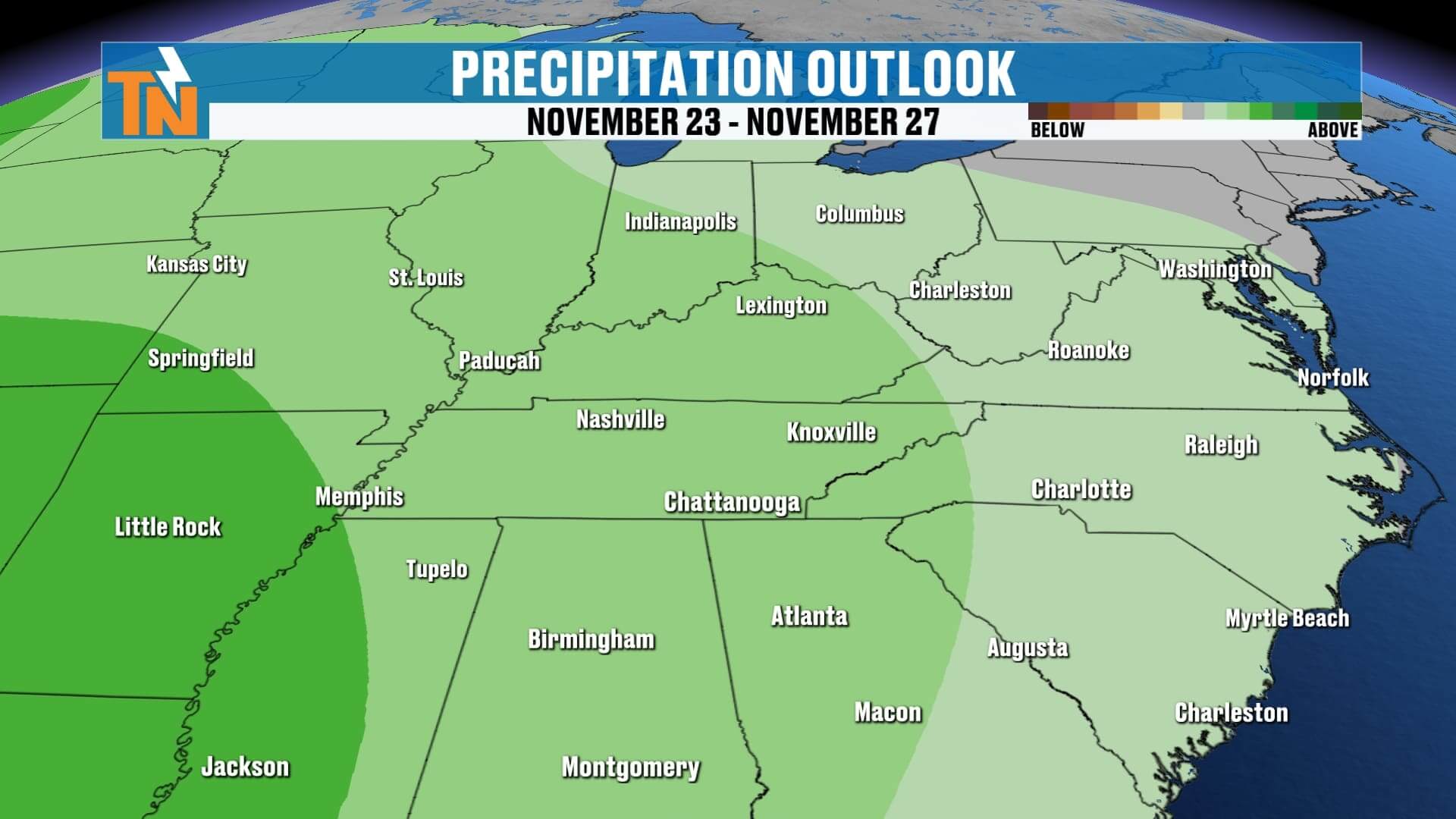
Rain chances do begin to ramp up a little this week, but the forecast looks more impressive on the models than what most of us will actually experience. High pressure builds in Monday, but by Tuesday, a weak wave in the atmosphere slides through. That could produce some light rain showers early Tuesday morning along with some passing clouds.
Another small wave may spin through Wednesday, keeping elevated rain chances around, but once again — not a washout. North of Interstate 40 has a slightly better chance of seeing measurable rain than areas to the south, with the true “bullseye” staying up across Kentucky and Ohio. That holds true through Wednesday.
More Waves Late Week
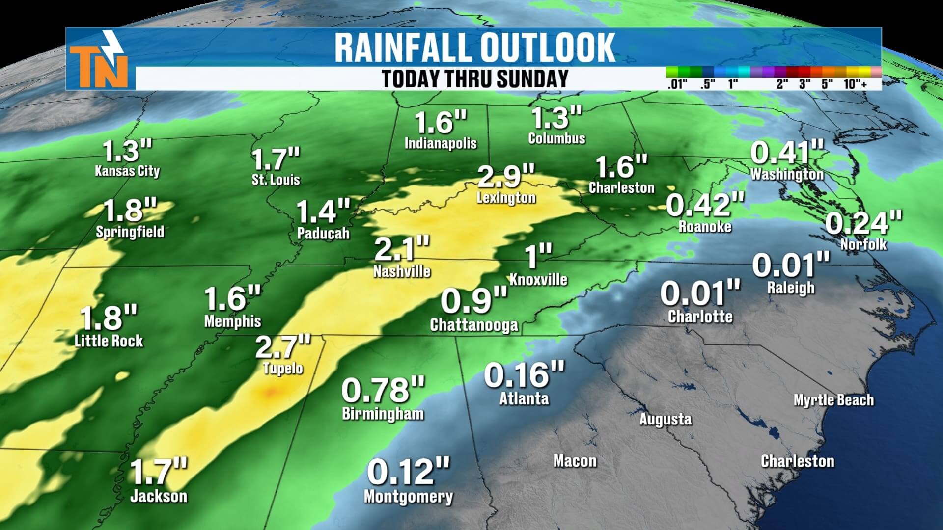
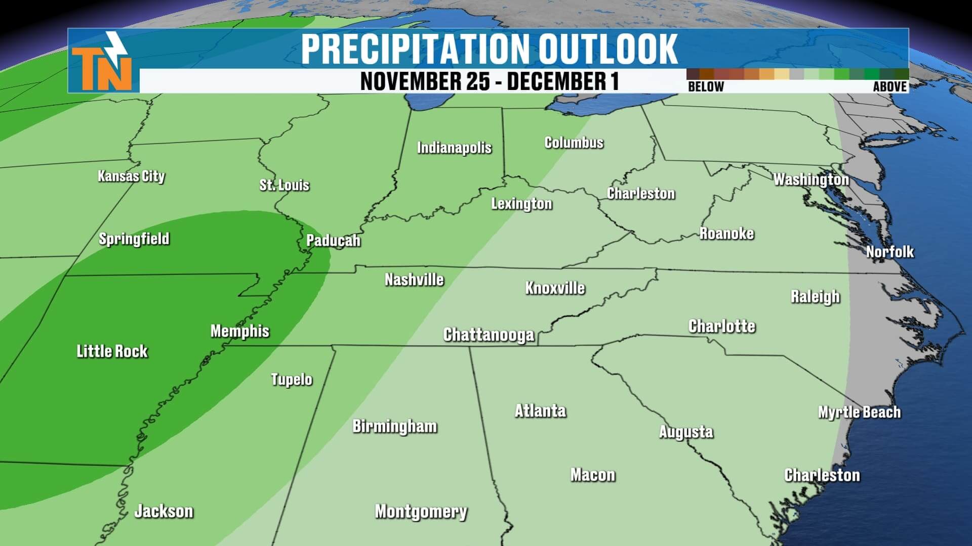
As we move into Wednesday night, Thursday, and Friday, additional waves of moisture will swing through. Clouds will be more noticeable through the second half of the week, and we may see a few spotty showers Thursday. The next meaningful cold front arrives Friday into Saturday, and that system looks more capable of producing widespread rain. Over the next seven days, total rainfall across East Tennessee could range from about a half inch to just over an inch, with heavier totals staying west of the Mississippi River.
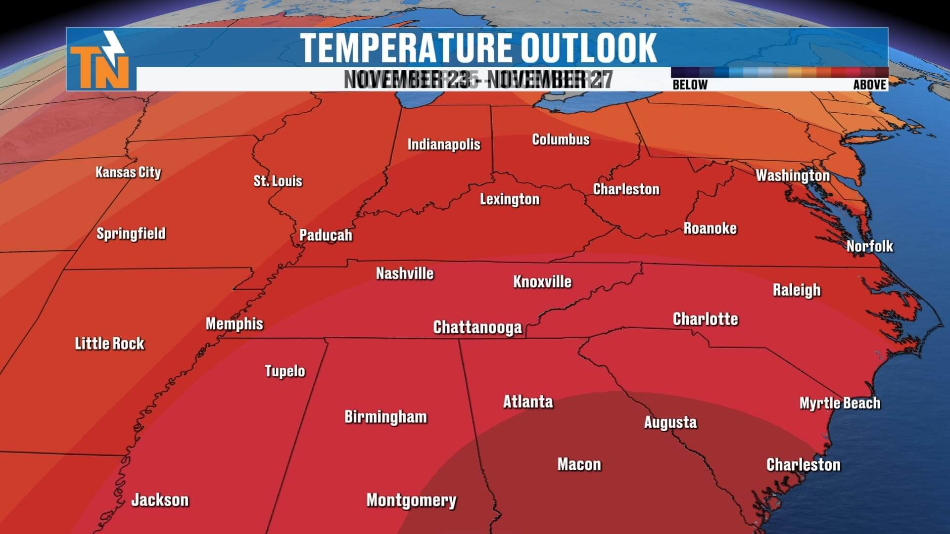
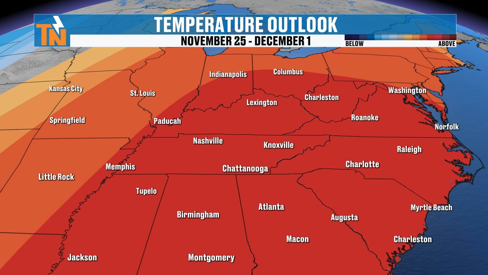
Temperatures Trending Warmer
Temperature-wise, this week looks fantastic — especially if you’re enjoying the stretch of mild November weather. After the cool 58-degree high on Monday, we climb right back into the 60s and 70s Tuesday through the weekend. Even with Friday and Saturday’s cold front, temperatures remain at or slightly above average.
And per the Climate Prediction Center, this warmer-than-normal pattern may hold on for at least another couple of weeks. So if you’re hoping for colder air, winter weather lovers may need to wait just a little longer.
Hope you have a great night, and thanks as always for checking in with your local forecast.