
Happy Saturday and thanks for checking in with your East Tennessee morning weather update. Today will start off quiet and mild, but storms are expected to develop later this afternoon and evening, and some of those storms could become briefly strong or severe.
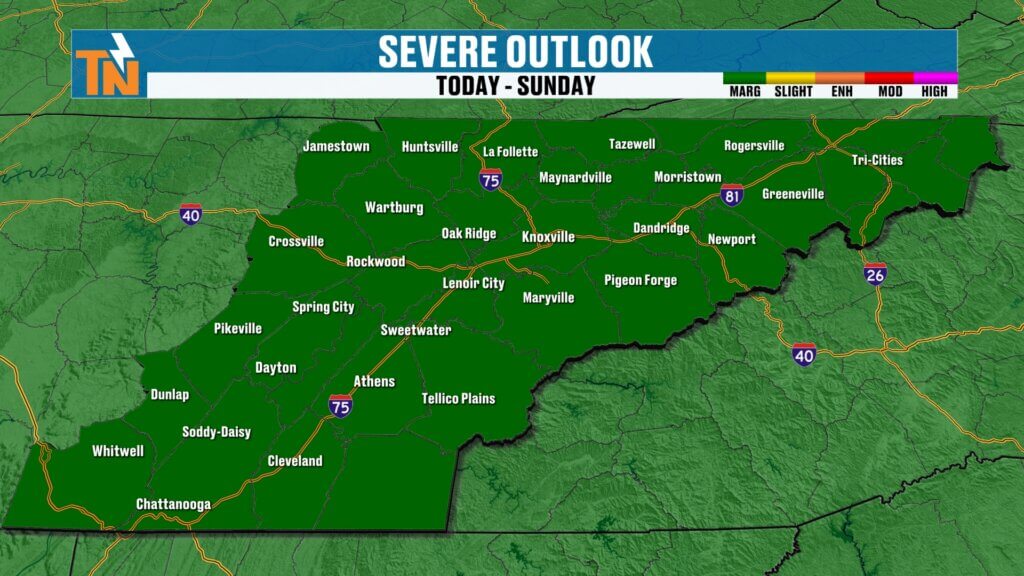
The entire state of Tennessee is currently under a Level 1 (Marginal) risk for severe weather, which means isolated storms could produce strong wind gusts, lightning, and heavy downpours. While widespread severe weather is not expected, it’s still important to stay weather aware as storms move through the region later today.
Let’s break down what to expect.

Storm Risk Across Tennessee Today
A developing weather system stretching from the Gulf Coast to the Ohio Valley is creating the setup for scattered thunderstorms this afternoon and evening. East Tennessee sits on the eastern edge of this system where storms may begin to weaken, but there is still enough instability and moisture in the atmosphere to support isolated strong storms.
The Storm Prediction Center has placed all of Tennessee under a Level 1 severe weather risk, including Knoxville, Chattanooga, the Tri-Cities, and surrounding communities.
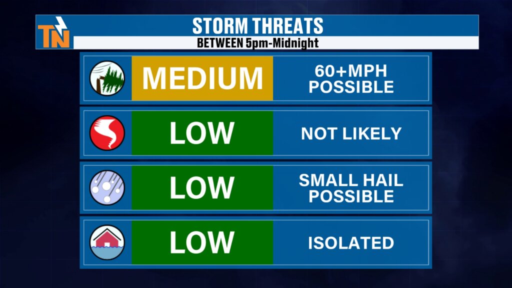
The biggest concern today will be isolated damaging wind gusts and lightning, with small hail also possible in stronger cells.
Timeline for Storm Development Today
The first half of the day will be relatively quiet before storms begin developing later this afternoon.
Morning through Noon
- Mostly dry conditions
- Increasing clouds
- Breezy and mild
Noon to 3 PM
- A few scattered showers and thunderstorms begin developing
3 PM to 5 PM
- Storm activity increases across parts of East Tennessee
- Some storms may briefly become strong, especially across the southern valley
Evening Hours
- Instability begins to decrease
- Storms gradually weaken as they move through the region
While the severe threat is not particularly high, anytime after about 3 PM today you’ll want to stay weather aware.
Main Weather Threats Today
The overall severe weather risk is considered low to moderate, but a few storms could produce brief impacts.
Possible hazards include:
- Strong wind gusts
- Frequent lightning
- Locally heavy rainfall
- Small hail
The tornado risk remains very low, and widespread flooding is not expected.
Breezy and Mild Conditions Ahead of the Storms
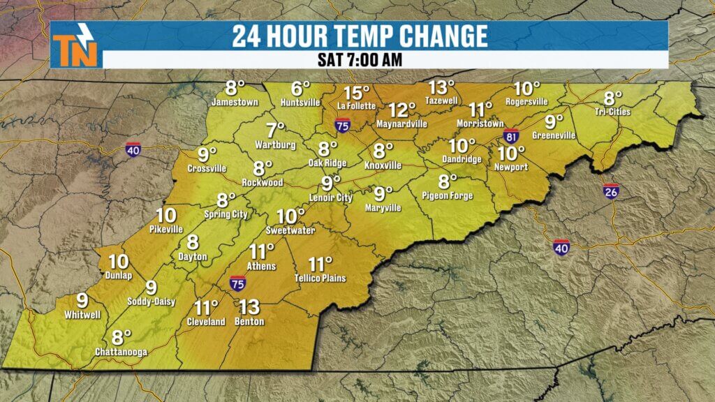
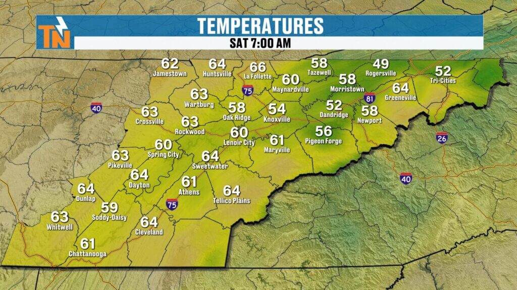
Before storms arrive, gusty winds will be noticeable throughout the morning and early afternoon. These winds are helping keep temperatures on the mild side this morning.
Many areas are starting the day with temperatures in the 50s and even low 60s, which is well above average for early March.
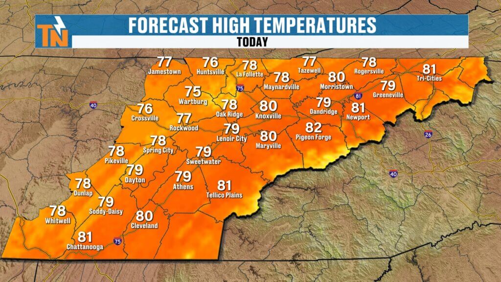
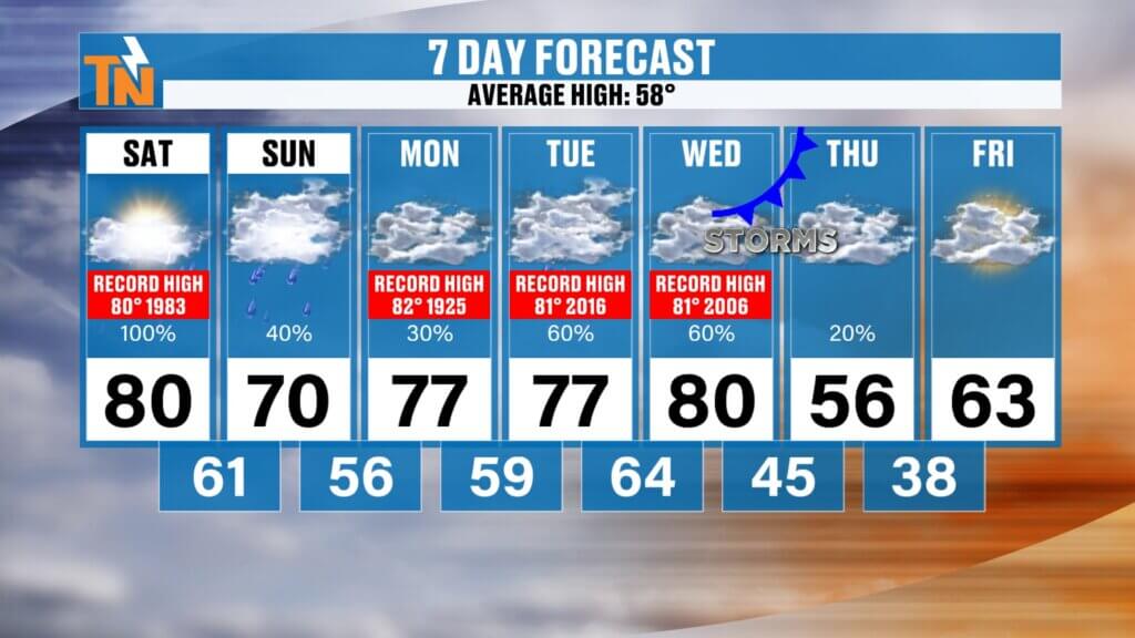
High temperatures this afternoon will approach near-record levels once again.
Forecast High Temperatures Today
- Knoxville: around 80° (record is 80°)
- Chattanooga: near 80°
- Tri-Cities: mid to upper 70s
- Crossville: mid-70s
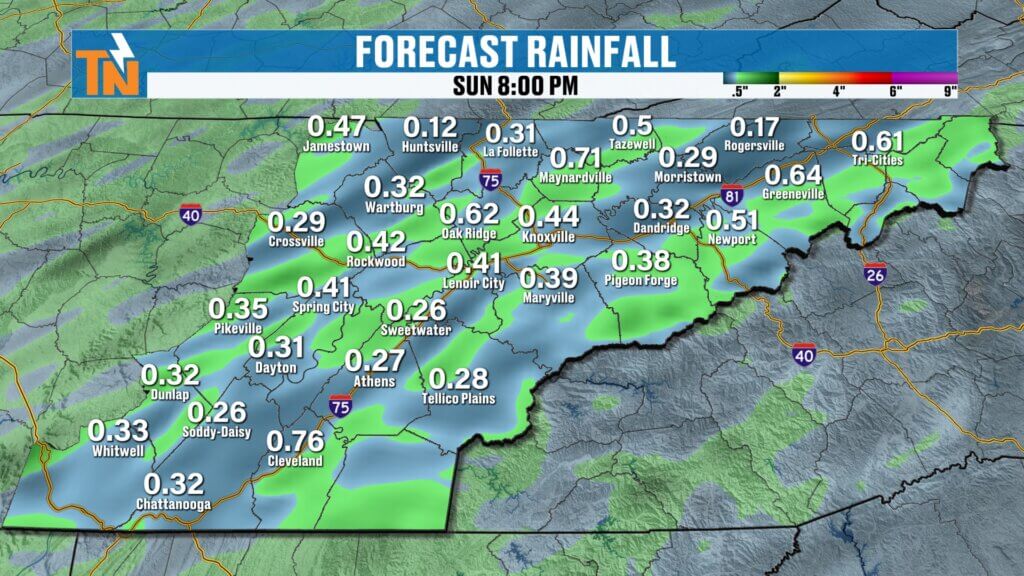
Rainfall Totals from Today’s Storms
Most locations will see between a quarter and a half inch of rain, although isolated areas could see slightly higher totals under heavier thunderstorms.
This rainfall will be beneficial and should not create widespread flooding concerns.
Sunday Forecast: Showers Early, Improving Late
Storms should gradually move out overnight, but a few lingering showers could still be around Sunday morning.
By Sunday afternoon, conditions will begin to improve.
Expect:
- Gradual clearing skies
- Some sunshine returning by the end of the day
- Slightly cooler temperatures around 70 degrees
No severe weather is expected Sunday.
Midweek Storm System to Watch
The weather pattern remains active as we head into next week. Another strong upper-level trough is expected to move toward the region late Wednesday into early Thursday.
This system could bring:
- Another round of showers and thunderstorms
- Increasing rain chances
- Potential for strong storms depending on timing
Forecast models suggest the strongest part of the system could arrive late Wednesday night into Thursday morning, but timing will continue to be refined over the next few days.
The Storm Prediction Center has already outlined severe weather potential in their Day 4 and Day 5 outlook, meaning this is a system worth watching closely.
Temperature Trend Through Next Week
Despite the storm chances, temperatures will remain well above average through much of next week before cooler air arrives behind the next cold front.
East Tennessee 7-Day Outlook
- Saturday: Near record warmth with afternoon storms
- Sunday: Cooler with lingering showers early
- Monday: Mild with scattered rain chances
- Tuesday: Warm and partly cloudy
- Wednesday: Increasing clouds, storms possible late
- Thursday: Cold front moves through with storms
- Friday: Cooler with temperatures closer to seasonal averages
For reference, the average high temperature this time of year is around 58 degrees, so temperatures in the 70s and near 80 are still running well above normal.
Stay Weather Aware Today
Since many people will be out running errands, attending ball games, or spending time outdoors this Saturday, it’s important to keep an eye on the weather later this afternoon.
The East Tennessee Weather App is a great tool for staying informed. It provides:
- Lightning notifications when storms are within 15 miles
- Real-time radar tracking
- Weather alerts and warnings
- Two-hour future radar to track storms moving toward your location
If you don’t already have the app, you can download it by searching East Tennessee Weather in your app store or by visiting easttnweather.com.
Thanks again for checking in this morning. Stay weather aware this afternoon, and have a great Saturday.