
Good morning and happy Monday!
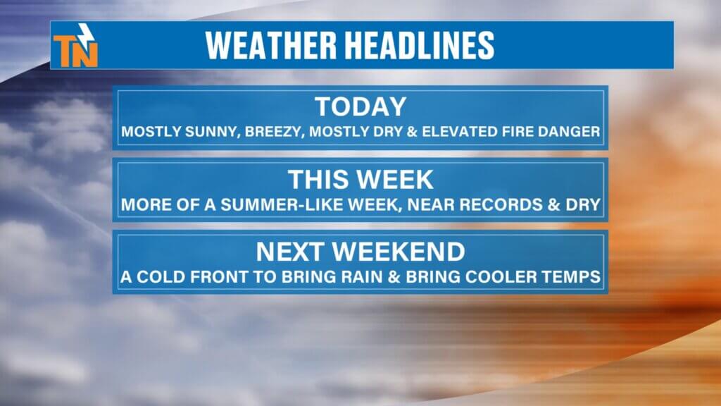
Thanks for checking in with your latest East Tennessee weather update. Another beautiful day is ahead, but there are a few key factors to keep in mind, including warm and gusty conditions, elevated fire danger, and only a slight chance for light rain. Overall, a summerlike weather pattern will dominate the region throughout the week.
Almanac Recap
Yesterday brought well above-average temperatures across the area.
This warmth sets the tone for the upcoming week, with temperatures continuing to run significantly above normal.This added moisture will help reduce fire danger compared to earlier this week.
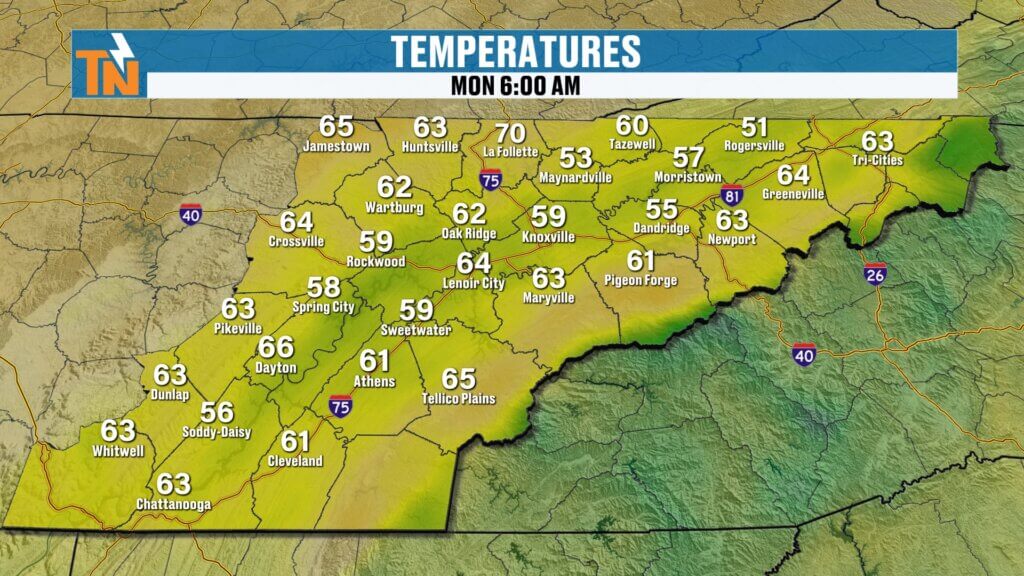
Knoxville reached a high of 85 degrees.
The average high for this time of year is around 70 degrees.

Weather Pattern Setup
High pressure remains firmly in control across the southeastern United States, keeping most of the moisture well to our west.
- Mostly sunny and dry conditions dominate.
- A strong southerly flow is helping to boost temperatures.
- Elevated fire danger persists due to dry conditions and gusty winds.
- A cold front is expected to arrive late Saturday into Sunday, bringing only minimal rainfall but a noticeable cool-down.
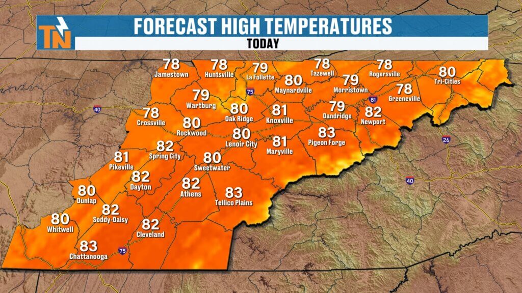
Today’s Forecast
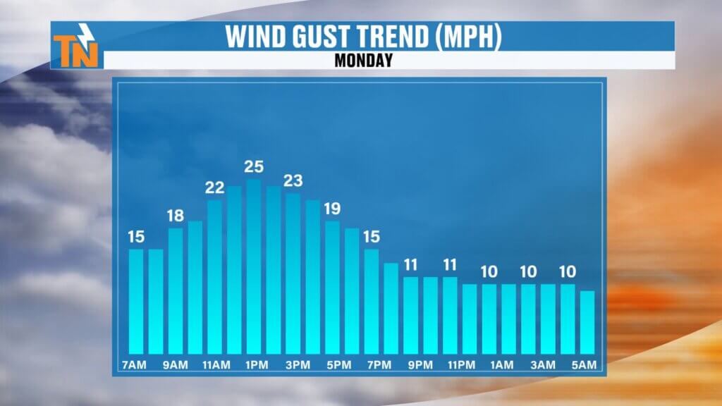
Expect another warm and breezy day across East Tennessee.
- Morning temperatures: 50s and 60s, running 10–20 degrees warmer than yesterday.
- Afternoon highs: Low to upper 80s.
- Sky conditions: Mostly sunny with a few additional clouds.
- Rain chances: A slight chance for isolated, light showers, mainly a nuisance and not beneficial for drought conditions.
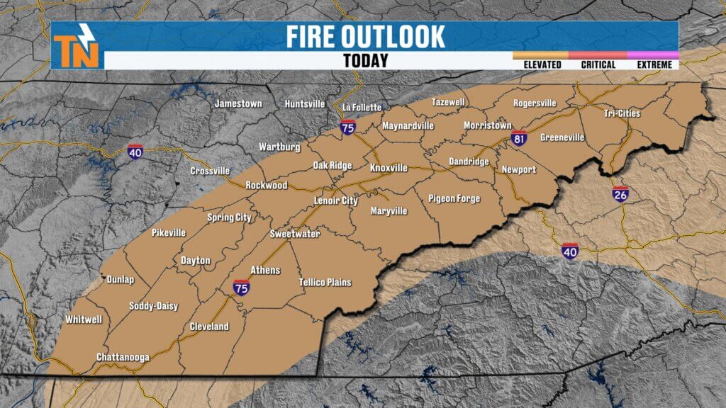
Elevated Fire Danger
Despite the slight increase in humidity, fire weather concerns remain.
- The Storm Prediction Center has highlighted a Level 1 elevated fire risk.
- Breezy southerly winds may help fires spread quickly.
- The greatest concern is across the central and southern valley, foothills, and mountain counties.
Residents should avoid outdoor burning and remain cautious with any activities that could spark a fire.
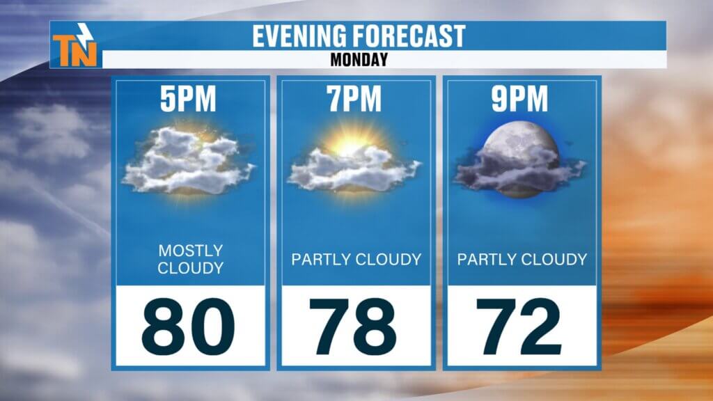
Evening Outlook
Conditions remain favorable for outdoor activities.
Mostly dry and warm, ideal for evening sports and events.
Temperatures around 78 degrees by 7 PM.
Breezy early, with winds gradually relaxing after sunset.
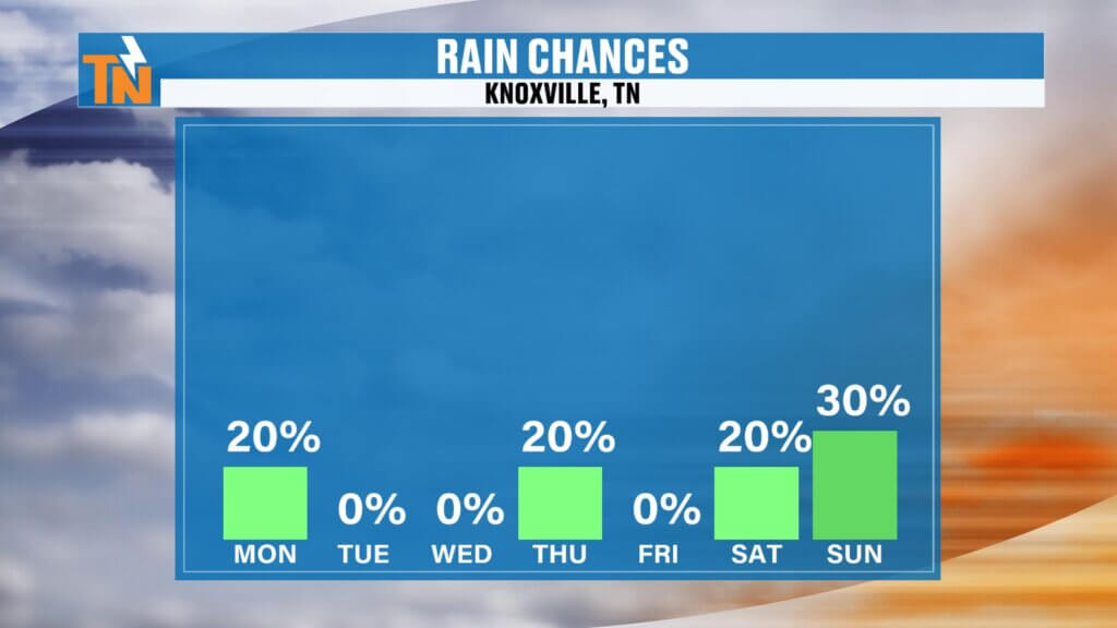
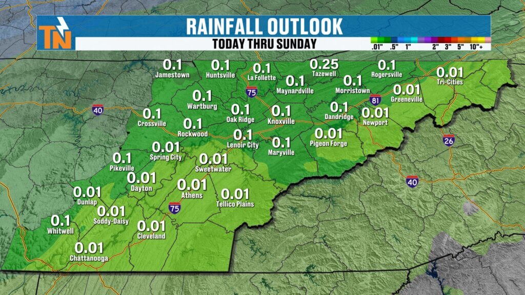
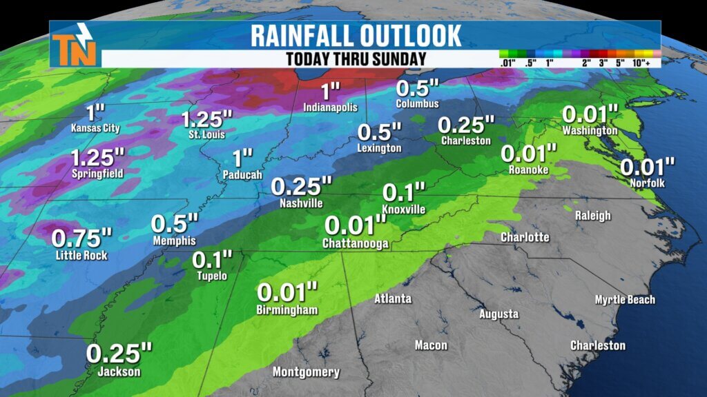
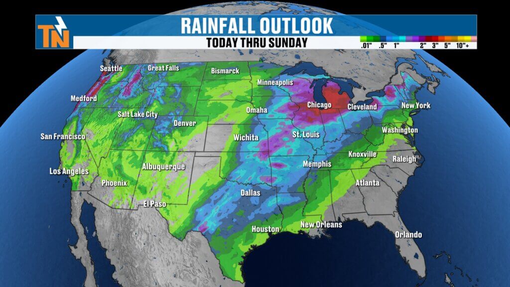
Rainfall Outlook
Rain chances remain very limited throughout the week.
The heaviest rain across the nation will remain from the Great Lakes to Texas, leaving the Southeast largely dry.Overall, excellent conditions for race weekend. Just keep a casual eye on Saturday afternoon.
Minimal precipitation expected through Friday.
A cold front arriving Saturday into Sunday may produce less than a tenth of an inch of rainfall.
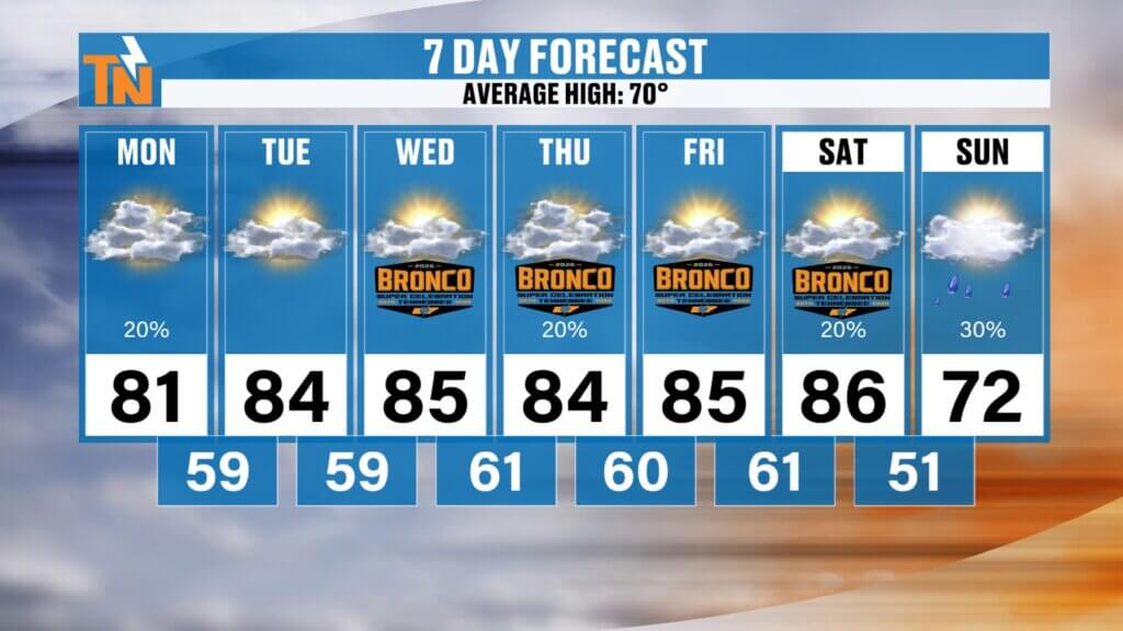
7-Day Temperature Trend
A prolonged stretch of summerlike warmth is expected before a modest cool-down.
Monday: Seasonable temperatures around 70 degrees.
Monday through Friday: Low to upper 80s.
Saturday: Around 86 degrees with a slight chance of light rain.
Sunday: Cooler, with highs near 72 degrees.
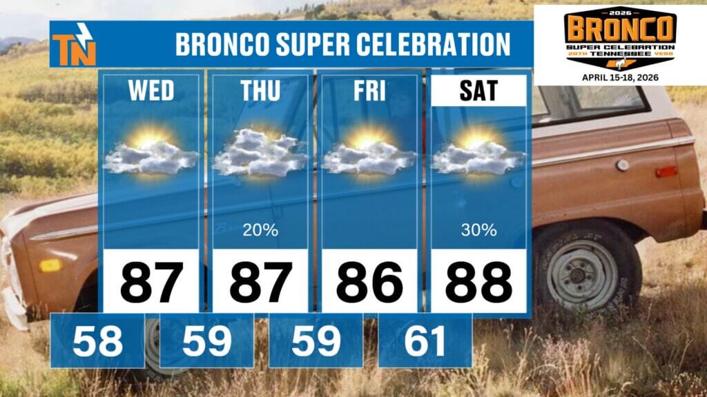
Local Event Spotlight: Bronco Super Celebration
The Broncos Super Celebration, marking the 20th anniversary of Bronco Fest in Townsend, Tennessee, runs from Wednesday through Saturday.
- Temperatures: Mid to upper 80s.
- Conditions: Warm, breezy, and mostly dry.
- Rain chances: Only a very slight possibility of isolated pop-up showers.
Overall, the weather looks excellent for attendees and outdoor festivities.
Final Thoughts
East Tennessee is settling into a prolonged stretch of warm, sunny weather with minimal rainfall. While the conditions are ideal for outdoor activities, the combination of warmth, wind, and dry fuels means elevated fire danger remains a concern. A weak cold front this weekend will bring only minor rainfall but will return temperatures closer to seasonal averages.
Have a fantastic Monday, and thanks for checking in. We’ll see you back here soon for the next update!