
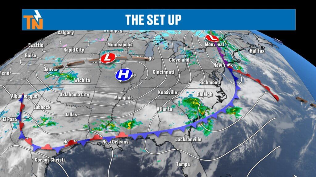
Big Picture Setup
Good morning and thanks for checking in.
We’re transitioning into a cooler and drier pattern today as high pressure builds in behind a departing system. There’s still a little leftover moisture early this morning, but drier air is quickly taking over.
That drier air will continue to settle in through the day, lowering humidity and giving us clearer skies and a cooler feel—especially later this evening.
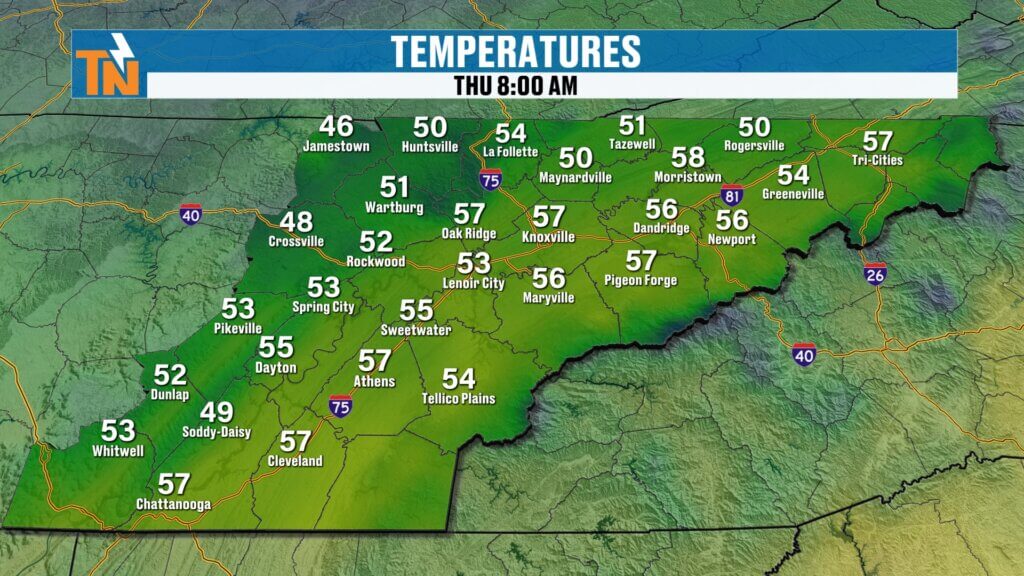
Morning Conditions
- Temperatures: 40s and 50s
- Light rain mainly across the southern valley early
- Cloud cover lingering to start the day
Overall, a cooler start compared to recent mornings, but not the coldest we’ll see this week.
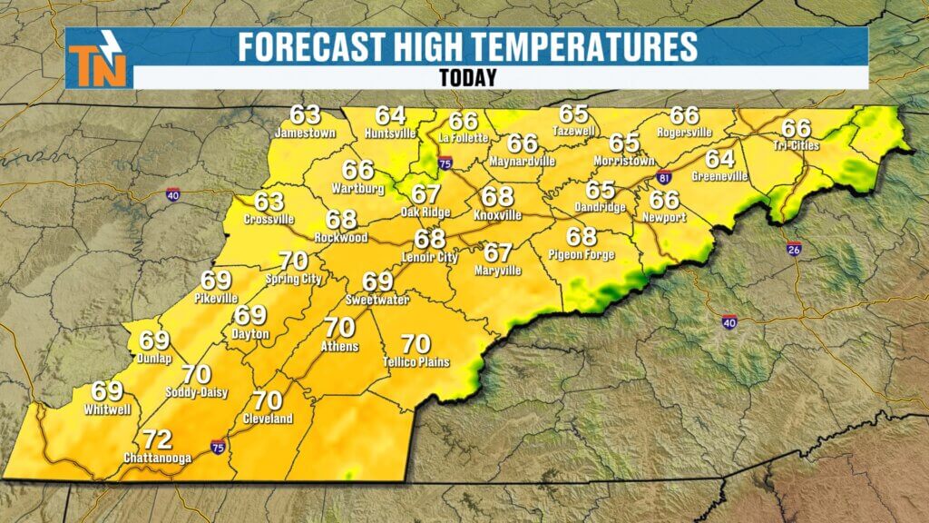
Today’s Forecast: Clearing and Cooler
As we move through the day:
- Clouds gradually clear out
- Sunshine returns by late morning into the afternoon
- Dry air moves in, dropping dew points into the 30s
High temperatures:
- Mid to upper 60s for most areas
- Low 70s possible in the southern valley (around Chattanooga)
Expect a comfortable, slightly cooler-than-average spring day.
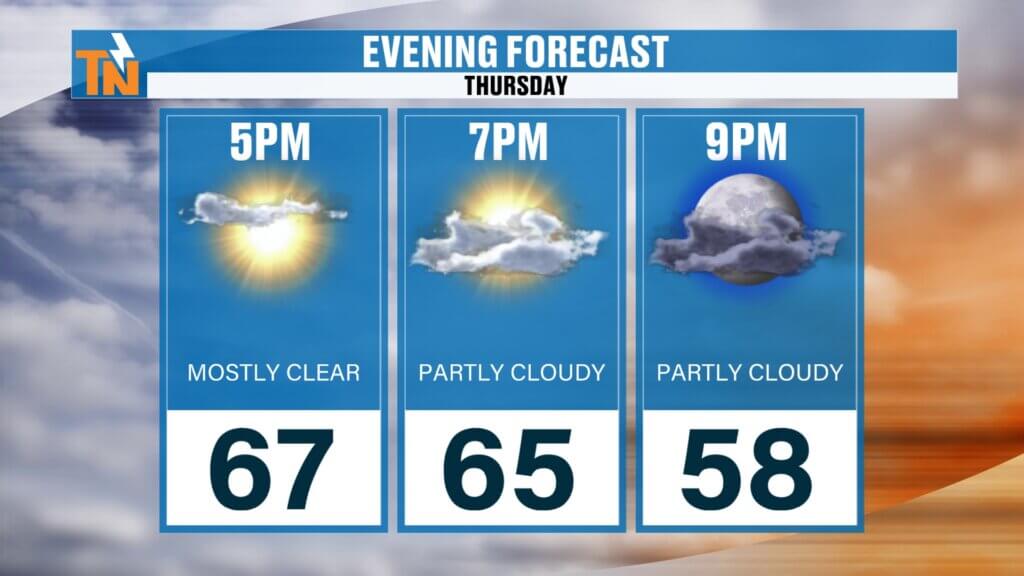
Evening Forecast
If you have plans tonight, conditions look great:
- Temperatures fall from the 60s into the upper 50s
- Clear skies and dry air
- A cooler feel after sunset
A perfect evening to be outside.
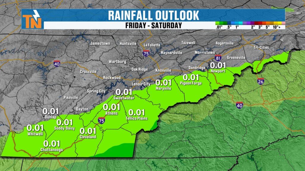
Weekend Rain Chances
Rain chances stay very limited through Friday, but things change slightly heading into the weekend.
Here’s the breakdown:
- Friday: Dry during the day
- Friday night into Saturday: Light rain develops
- Best chance: South of I-40 and along the foothills and mountains
This system comes in from the southwest and brings:
- Light, steady rain (not storms)
- No severe weather expected
Coverage won’t be widespread, but enough to notice—especially in southern areas.
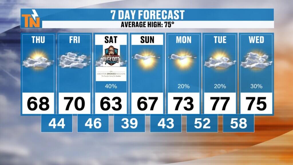
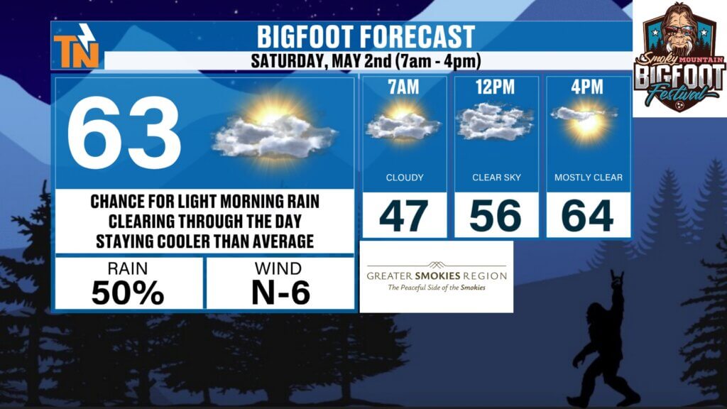
Weekend Outlook
Saturday:
- Cloudy with a 50% chance of light rain
- Cooler with highs in the 60s
Sunday:
Continued cool temperatures
Dry conditions return
Frost Potential
Cooler air deepens this weekend:
- Sunday morning: Potential for patchy frost
- Chilly start with temperatures dipping significantly
Something to keep in mind for sensitive plants.
Next Week: Dry Start, Then Rain Returns
Early next week:
- Monday and Tuesday: Dry conditions
Midweek:
- Tuesday through Thursday: Increasing rain chances
- Potential rainfall: 0.5″ to 1″
This will be beneficial as drought conditions continue across the region.
Temperature Trend
- Today and Friday: 60s to low 70s
- Weekend: Cooler with highs in the 60s
- Next week: Gradual warm-up back into the 70s
Overall trend: Cooler than average, especially through the weekend.
Event Highlights
Downtown Knoxville Event:
- PJ Parkinson’s Rise Up Party tonight
- Location: 5:30 Lounge
- Time: 6 PM to 9 PM
- Great cause supporting Parkinson’s awareness
Weekend Events:
- Bigfoot Festival in Townsend
- Cool and damp with light rain possible
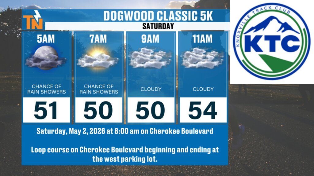
- Dogwood Classic 5K
- Mostly cloudy with only a slight chance of a sprinkle
Final Thoughts
Today brings a refreshing break with sunshine and cooler temperatures. The weekend stays on the cool side with some light rain possible, especially Saturday, followed by a chilly Sunday morning.
Enjoy the sunshine today—and don’t forget, cooler air and a bit of rain are right around the corner.Around 73° at 7 PM