
Wednesday Overview
Happy Wednesday! Thanks for checking in.
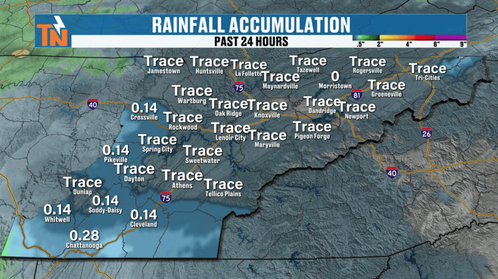
We didn’t see much severe weather or widespread rain overnight, but don’t completely let your guard down just yet. A cold front is moving through today, and while the severe threat is very limited, we could still see a few spotty showers and thunderstorms.
The bigger story? This front kicks off a cooler pattern heading into the weekend.
What Happened Overnight
- Limited rainfall across the region
- Minimal severe weather
- A few light showers and sprinkles early this morning
Overall, things stayed fairly quiet compared to expectations.
Today’s Setup: Cold Front Moving Through
As the cold front swings through East Tennessee:
- Winds shift from southwest to northwest
- A bit of instability develops this afternoon
- Spotty showers and storms may pop up
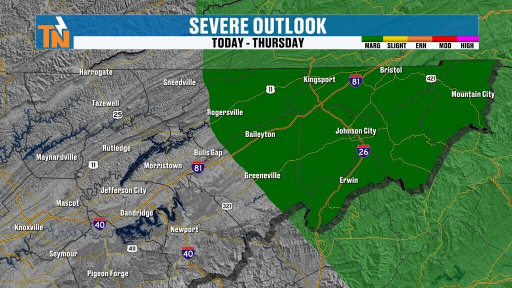
The Storm Prediction Center risk barely clips Upper East Tennessee, and overall severe potential is very low.
Wednesday Forecast: Hit-and-Miss Showers
Here’s what to expect today:
- Morning: A few light showers or sprinkles
- Afternoon: Isolated showers and thunderstorms possible
- Evening: Conditions improve and dry out
Any storms that do develop could bring:
- Brief gusty winds
- Small hail
- Quick downpours
Nothing widespread, but enough to keep an eye on the sky.
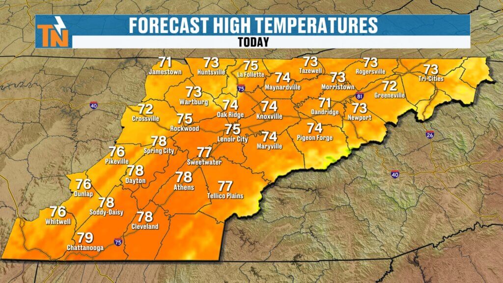
Temperatures and Wind
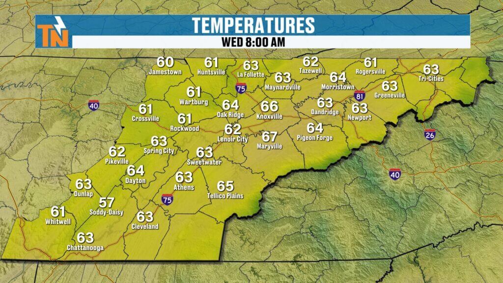
- Morning temps: Mainly 60s
- Afternoon highs: Mid 70s (right near average)
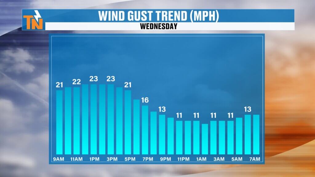
- Winds: Breezy, shifting northwest behind the front
By this evening:
Comfortable and gradually drying out
Around 73° at 7 PM
Late Week System: Limited Rain Potential
Another weak wave arrives late Friday into early Saturday:
- Best chance for light rain: South of I-40
- Mountain and foothill areas favored
- Light rain possible early Saturday morning
Most of this system stays to our south, so totals will be limited.
Weekend Forecast: Cooler but Improving
Saturday:
- Chance for light morning rain (mainly south)
- Gradual clearing through the day
- Cooler with highs in the mid 60s
Sunday:
- Dry and improving
- Slightly warmer with sunshine returning
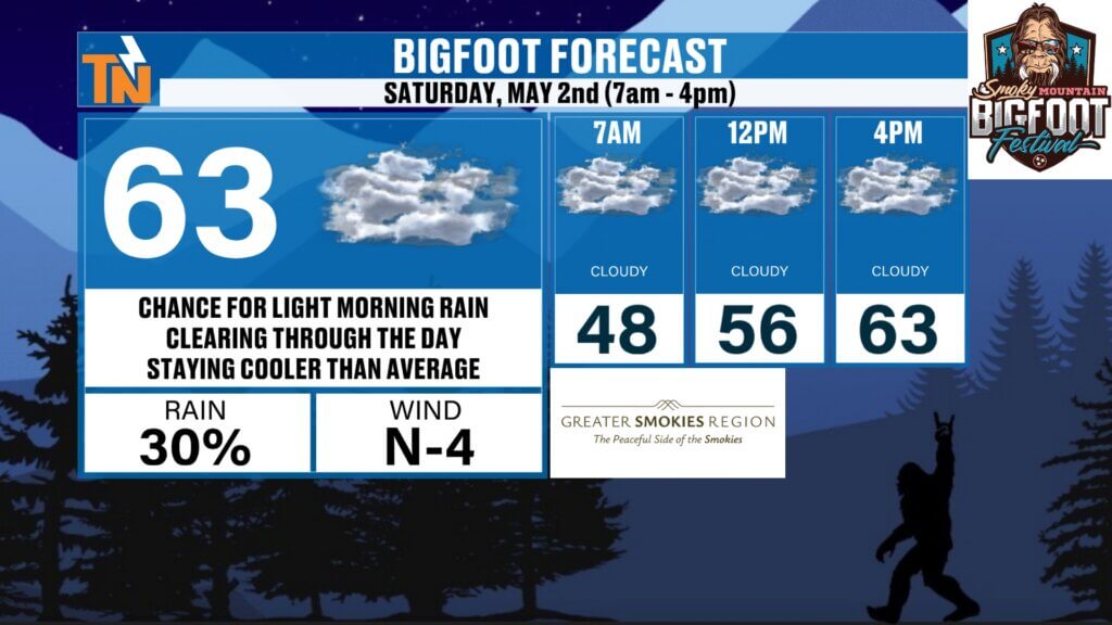
Bigfoot Festival Preview
If you’re heading to the Bigfoot Festival in Townsend:
- Expect cooler-than-average weather
- Highs in the mid 60s
- Small chance for light rain early, then improving conditions
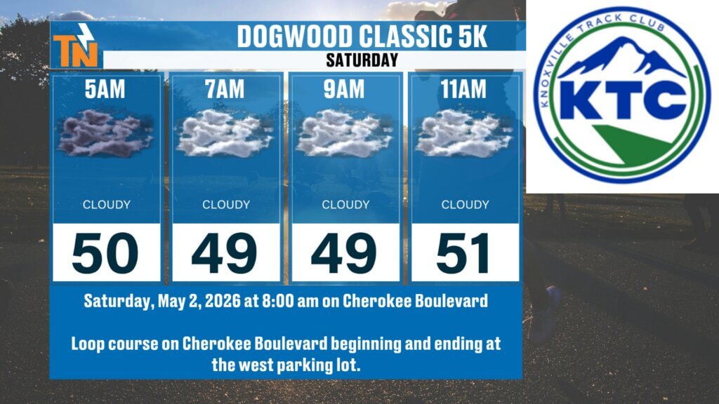
Dogwood Classic 5K Outlook
- Slight chance for early morning showers
- Most rain stays south of I-40
- Overall decent running conditions with cooler temps
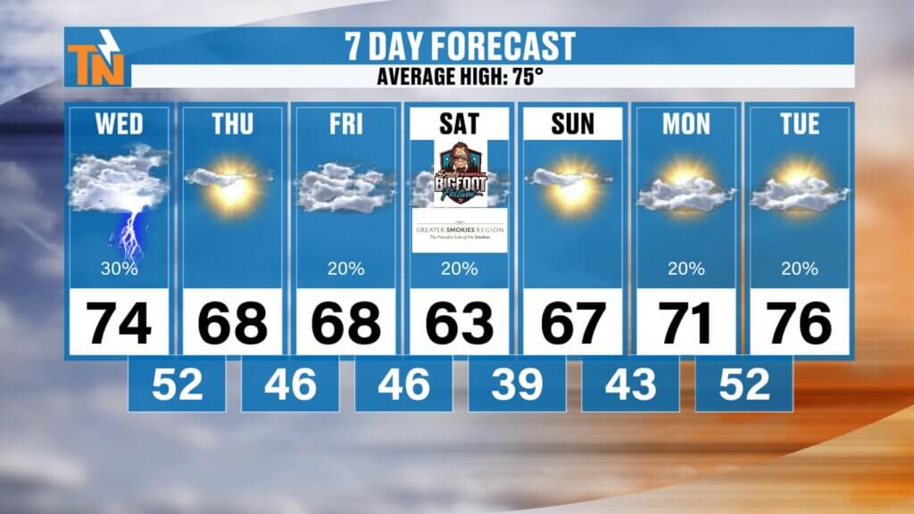
7-Day Temperature Trend
- Wednesday: Mid 70s
- Thursday–Friday: Upper 60s
- Saturday: Mid 60s
- Next week: Warming back into the low to mid 70s
Final Thoughts
Today brings a few spotty storms, but nothing widespread or severe. After that, we trend drier and cooler into the weekend with only a small chance for light rain.
Enjoy the more comfortable temperatures ahead, and keep an eye on the sky this afternoon just in case a quick shower pops up.
Have a great Wednesday!