
Big Picture Setup
Happy Saturday! Thanks for checking in.
The system we’ve been tracking all week is doing exactly what we hoped—most of the rain is staying to our south and southeast. That means East Tennessee avoids the bulk of the wet weather today, though we’ll still deal with clouds and a cooler feel.
Saturday Forecast: Cloudy Start, Slight Shower Chance Later
Today will be more about clouds than rain:
- Morning: Overcast skies with mid to high-level clouds
- Afternoon: Gradual clearing with a northwest flow developing
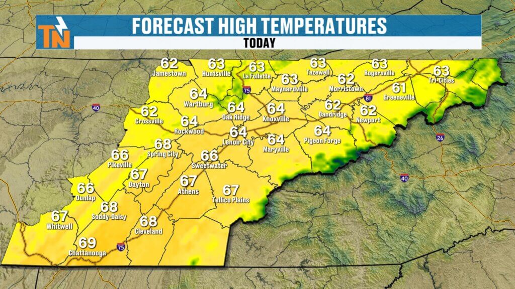
- Highs: Mid to upper 60s (cooler than average)
Rain chances:
- Dry through the morning
- A few isolated, light “instability” showers possible late afternoon into evening
- Any rain will be very light and spotty
This is not a washout by any means—just a small chance for a brief pop-up shower.
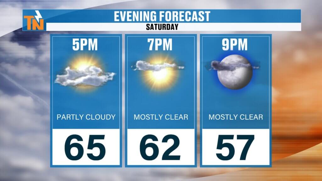
Evening Plans and Events
If you’re heading out around Townsend for the Bigfoot Festival or catching the Luke Combs concert tonight:
Overall: Good to go, just keep a light layer handy
Temperatures: Falling from the 60s into the 50s
Conditions: Mostly dry, just watch for a quick passing shower
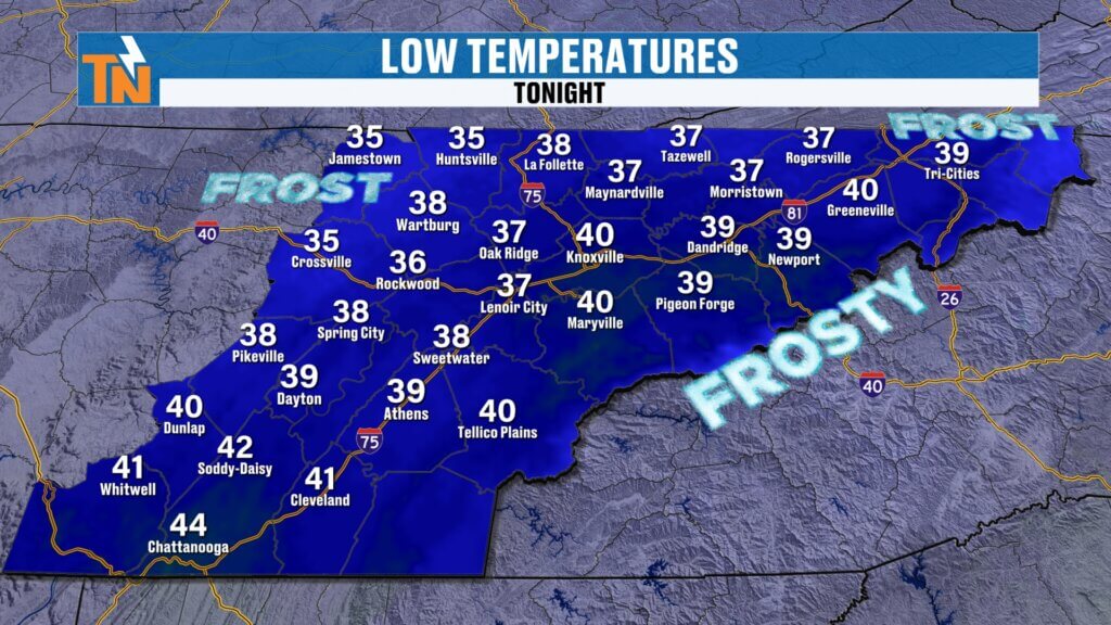
Overnight: Chilly with Frost Potential
Tonight will turn noticeably colder:
- Lows: 30s and 40s
- Frost possible:
- Cumberland Plateau
- Upper East Tennessee
- Higher elevations of the Smokies
If you’ve got sensitive plants, you may want to cover them.
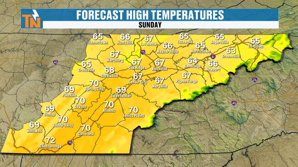
Sunday Forecast: Cool Start, Nice Finish
Sunday shapes up nicely:
- Morning: Cold start, possible patchy frost
- Afternoon: Sunshine returns
- Highs: Mid to upper 60s
A great day to be outside once we warm up.
Next Week: Warming Trend, Then a Wet Pattern
Looking ahead:
- Monday–Tuesday: Dry and warming into the 70s
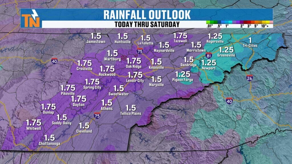
- Wednesday–Thursday: Stronger system arrives
Rain potential:
- Widespread rain midweek
- Totals: Around 1 to 1.5 inches possible
This will be a beneficial rain event for the ongoing drought.
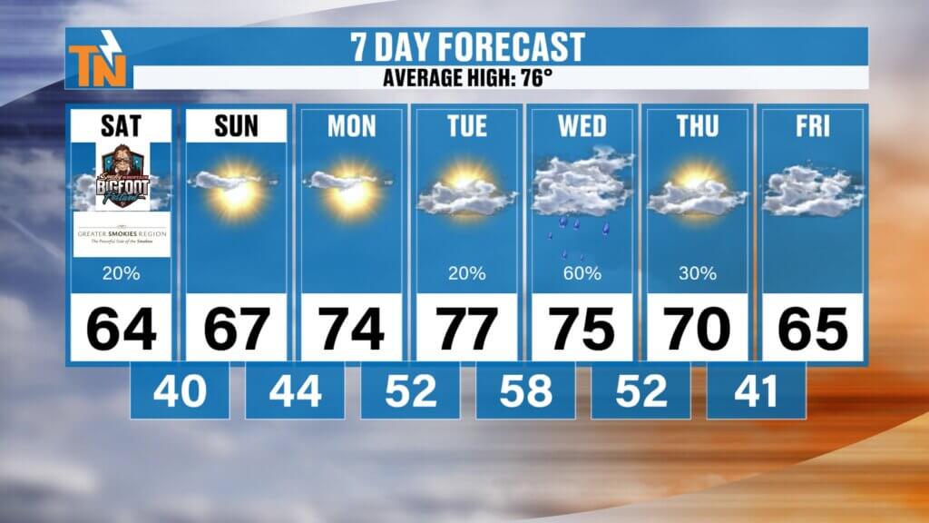
Temperature Trend
- Saturday: 60s (cooler than average)
- Sunday: 60s
- Early next week: 70s return
- Midweek: Cooler again with rain
Final Thoughts
The weekend forecast continues to trend in a favorable direction. Clouds will dominate early today, but rain stays limited and spotty at best. Cooler air settles in tonight with a frost risk, followed by a pleasant Sunday.
Enjoy your Saturday!