
Monday Overview
Happy Monday! Hope you had a great weekend.
After a stretch of cooler weather with highs in the 60s, we’re turning warmer today—and much wetter as we head through the week. A big pattern change is underway that will bring widespread rain and the potential for heavy totals across East Tennessee.

Big Picture Setup
Here’s what’s driving the change:
- Low pressure system off the West Coast
- Trough of low pressure to our north
- Strong subtropical jet stream feeding moisture into the region
All of this is combining to send a steady stream of moisture across much of the country, including the Tennessee Valley.
Bottom line: a wetter, more active pattern is setting up.
Monday Forecast: Breezy and Warmer
Today stays mostly dry, but you’ll notice the change:
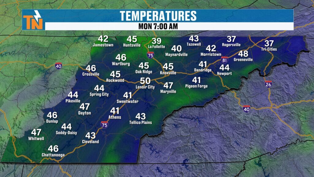
- Morning lows: 40s and 50s (a bit warmer than yesterday)
- Highs: Mid to upper 70s
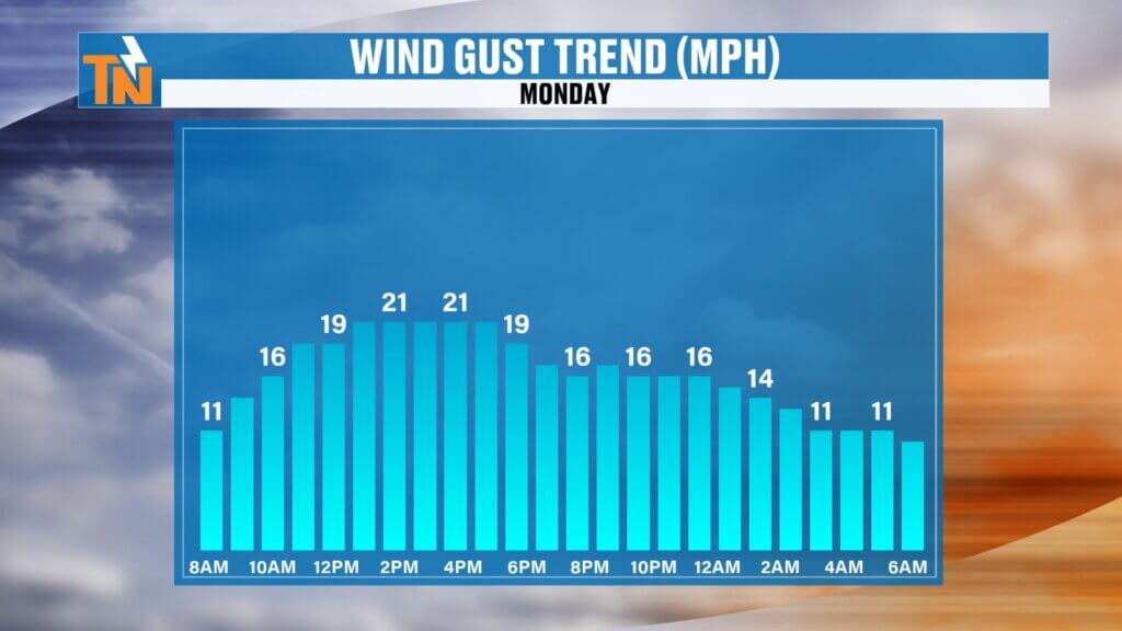
- Winds: South to southwest, gusting 20–25 mph
- Skies: Mostly sunny with a few clouds
A couple of light showers may brush parts of Upper East Tennessee early, but most areas stay dry.
By this evening, temperatures will still be mild, sitting near 75 degrees around 7:00 PM.

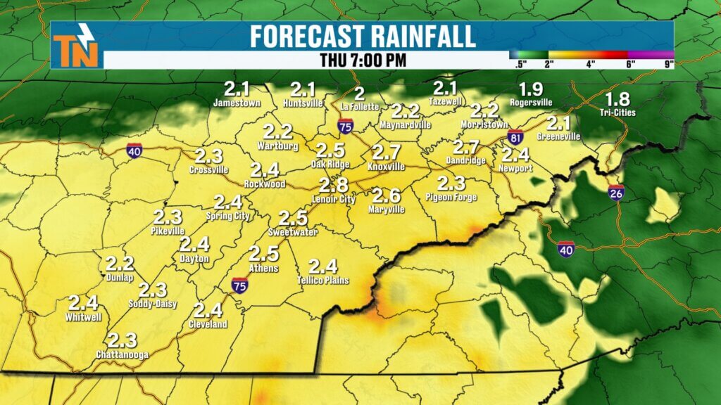
Rain Timeline: When the Pattern Turns Wet
Rain chances increase significantly after today:
- Tuesday: Still warm, increasing clouds
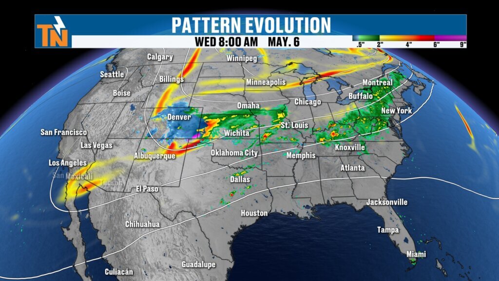
- Wednesday through Friday: Widespread rain develops
- Weekend: Additional scattered showers possible
This will not be a quick-moving system. Instead, it lingers—allowing rain to fall over a longer period.
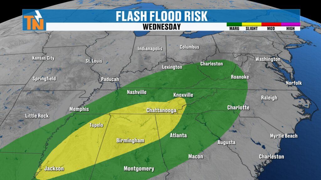
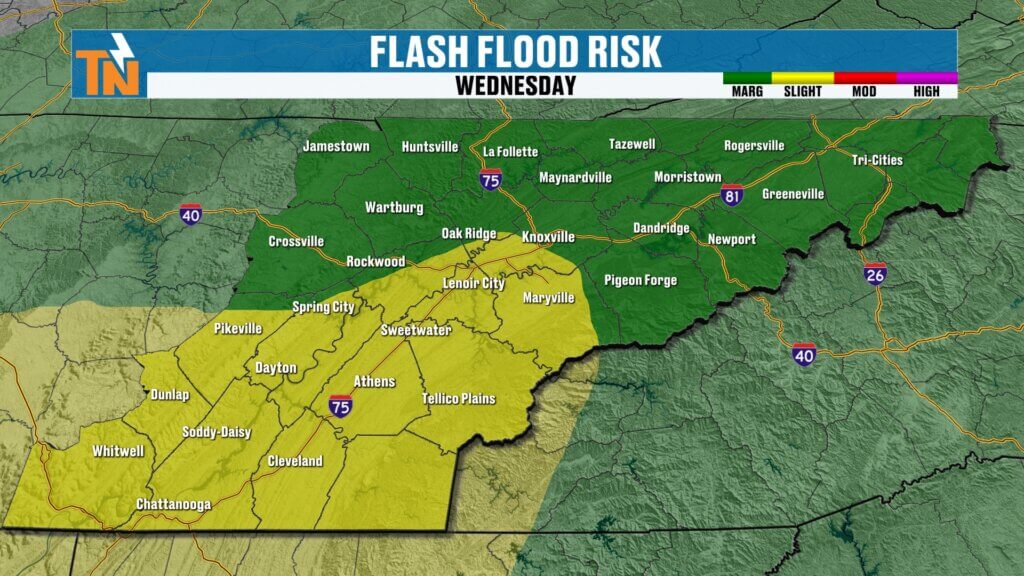
Heavy Rain and Flood Risk
This is the headline for the week.
The Weather Prediction Center has highlighted parts of the region for excessive rainfall, including a level 1 to level 2 risk for flooding.
Why this matters:
- Slow-moving boundary stalls over the region
- Multiple waves of low pressure ride along it
- Rain falls repeatedly over the same areas
Expected rainfall totals:
- 1 to 2 inches common
- Locally higher amounts possible
Given how dry it’s been, this rain will be beneficial—but if it falls too quickly, it could lead to localized flooding issues.
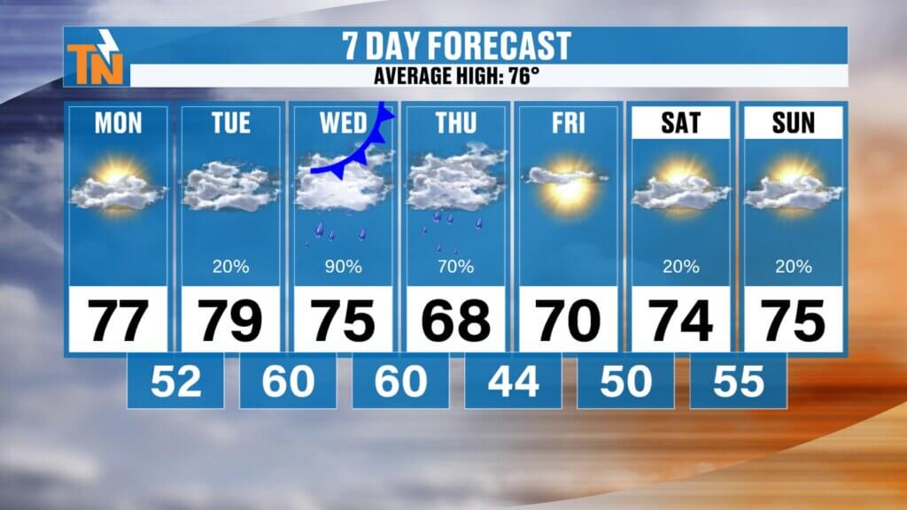
Temperature Trend
- Monday–Tuesday: Upper 70s
- Wednesday: Mid 70s
- Thursday–Friday: 60s to low 70s
- Weekend: Warming back up
Final Thoughts
Enjoy today’s dry and warm weather—it’s the calm before a much wetter stretch. A soaking rain is on the way, which we need, but it comes with the potential for heavy downpours and localized flooding.
Be sure to keep an eye on updates as we fine-tune rainfall totals and timing.
Have a great Monday!