
Happy Sunday, East Tennessee!
If you thought Saturday’s weather looked familiar, you’re right—today is shaping up to be very similar.
We’ll once again see scattered afternoon showers and thunderstorms developing, with the potential for locally heavy rainfall, gusty winds, frequent lightning, and a few isolated strong to severe storms. The good news is this won’t be an all-day rain event, so don’t cancel your outdoor plans. Just be sure to keep an eye on the radar and have a way to receive weather alerts.
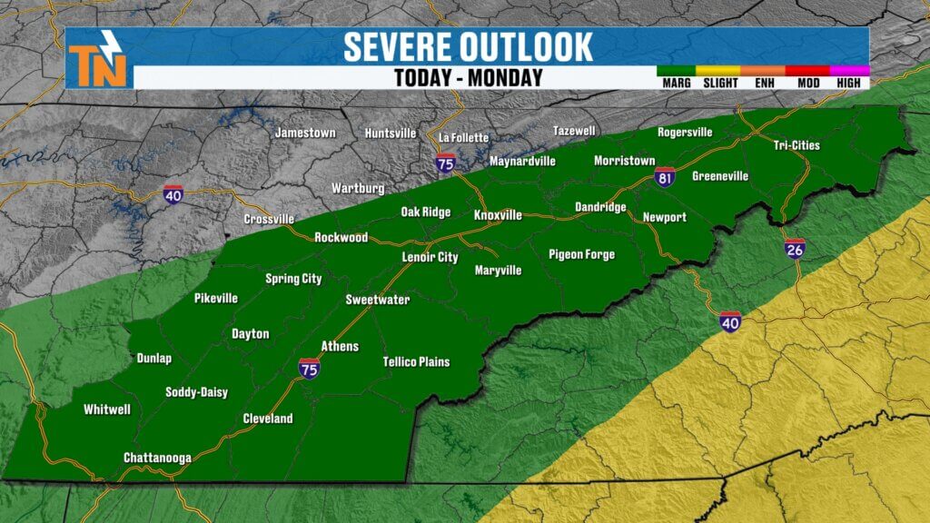
Sunday’s Setup Looks a Lot Like Saturday
Saturday brought scattered storms that rolled in from the north and northwest, dropping heavy rain across parts of East Tennessee while leaving other communities completely dry.
Today’s weather pattern will follow that same script.
The atmosphere remains loaded with moisture, and with another disturbance moving through, scattered storms will once again be capable of producing tropical-like downpours.
The greatest concern continues to be localized flooding in areas that have seen repeated rounds of heavy rain over the past week.
Morning Dry, Storms Develop This Afternoon
Most locations will enjoy a quiet start to the day.
A few isolated showers may begin developing late this morning, but the better chance for thunderstorms arrives during the afternoon.
Expect the greatest storm coverage between noon and early evening as storms develop and move from the northwest toward the southeast.
Much like yesterday, not everyone will see rain, but any storm that develops could quickly become heavy.
If you’re spending the day outdoors, heading to the lake, or attending a weekend event, don’t change your plans—just stay weather aware and check the radar periodically.
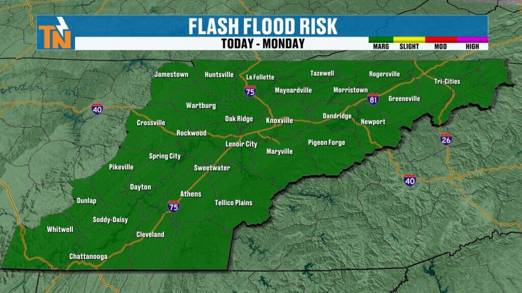
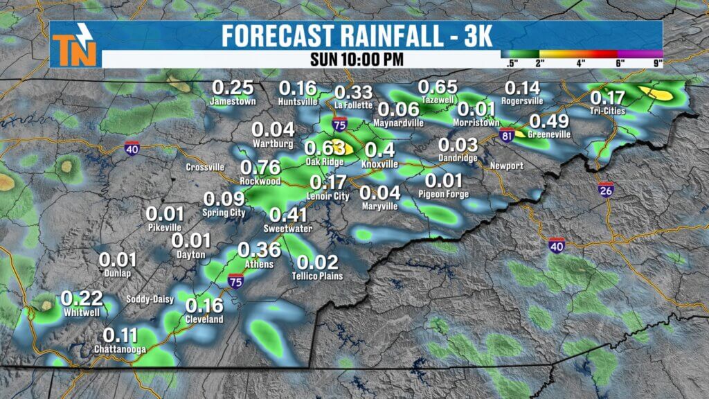
Heavy Rain and Flooding Remain Concerns
The atmosphere continues to contain an abundance of moisture, meaning thunderstorms will be very efficient rain producers.
Any stronger storm may bring:
- Tropical-like downpours
- Frequent lightning
- Gusty winds
- Localized flooding
- Isolated flash flooding
Communities that have already received several inches of rain over the past week remain the most vulnerable.
Remember, flooding can develop quickly when slow-moving storms repeatedly track across the same area.
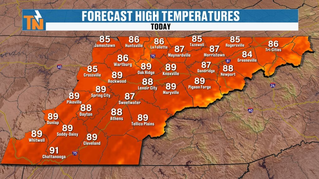
Temperatures Stay Seasonable
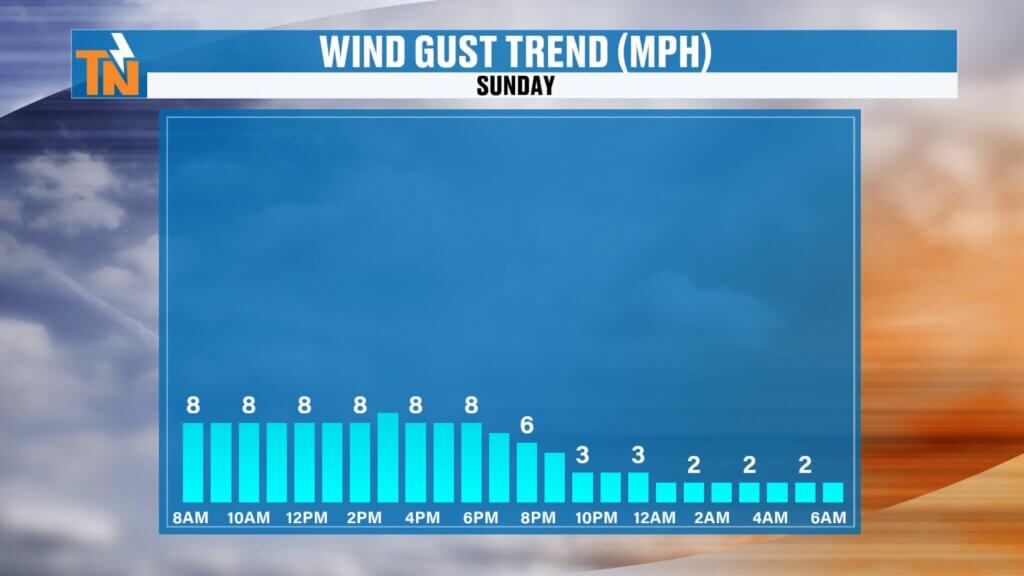
Morning temperatures begin in the 70s with light winds and plenty of humidity.
Afternoon highs climb into the upper 80s, which is right where we should be for late July.
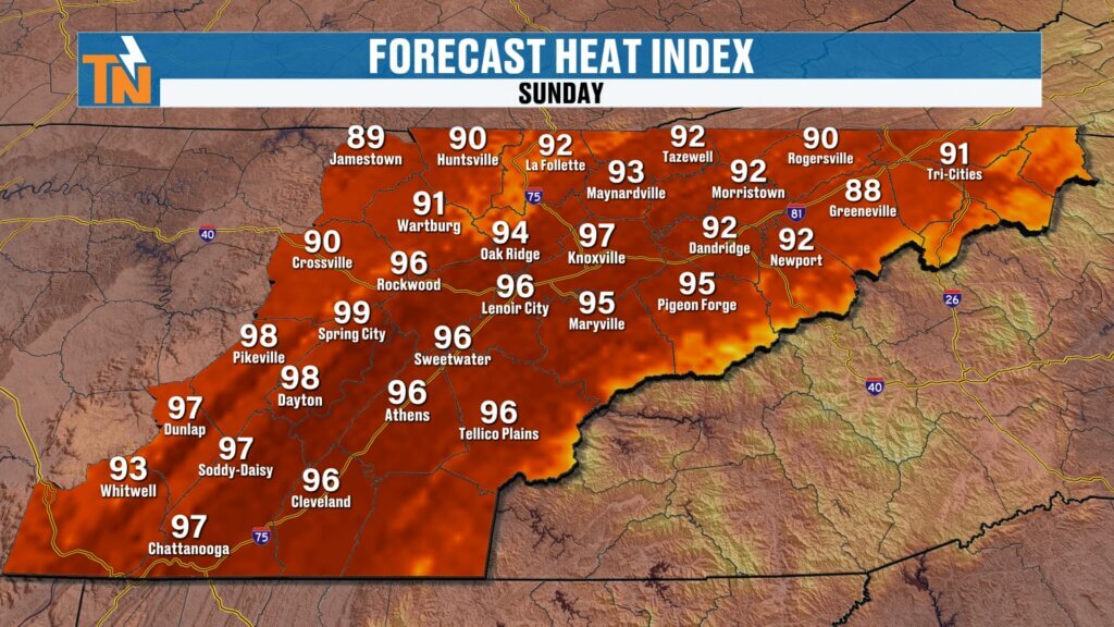
Heat index values will reach the middle and upper 90s, with the highest heat stress expected south of Interstate 40.
Storms begin winding down after sunset, leaving only a few isolated showers during the evening.
Another Stronger System Arrives Tuesday
Monday brings a slight break with fewer afternoon storms, but don’t get too comfortable.
Attention quickly turns to Tuesday and Wednesday, when our next weather system moves into the Tennessee Valley.
This system has the potential to produce:
- More widespread showers and thunderstorms
- Strong to severe storms
- Additional heavy rainfall
- Localized flooding
The Storm Prediction Center has already highlighted East Tennessee with a Level 1 and Level 2 risk for severe weather Tuesday into Wednesday.
Meanwhile, the Weather Prediction Center has introduced another Level 1 flood risk as additional heavy rain develops along the approaching cold front.
Midweek Cold Front Brings Welcome Relief
The good news is this active weather pattern won’t last forever.
A cold front pushes through Wednesday, bringing one final round of showers and thunderstorms before much drier air settles into the region.
By Thursday, you’ll notice a dramatic difference.
Expect:
- Lower humidity
- Cooler mornings
- Comfortable afternoons
- Plenty of sunshine
- Little to no chance of rain
After weeks of tropical humidity, Thursday is shaping up to be one of the nicest days we’ve experienced in quite some time.
Regional Outlook
Central Valley (Knoxville)
Highs remain in the upper 80s to near 90 through Wednesday before dropping into the middle 80s with much lower humidity Thursday and Friday.
Southern Valley (Chattanooga)
Warm and humid conditions continue through midweek before noticeably cooler and drier air arrives Thursday.
Cumberland Plateau
One of the biggest changes arrives here, with highs dropping into the upper 70s and lower 80s Thursday under much more comfortable conditions.
Northern Valley & Tri-Cities
This area may see some of the heaviest rainfall Tuesday into Wednesday before clearing skies and refreshing air arrive late in the week.
The Bottom Line
Today’s forecast looks very similar to Saturday:
- Dry start to the day
- Scattered afternoon thunderstorms
- Localized heavy rainfall
- Isolated strong storms
- Flooding concerns where repeated rain occurs
- Highs in the upper 80s with heat index values in the 90s
Looking ahead, Monday brings a brief lull before another stronger storm system arrives Tuesday and Wednesday. After that, a cold front delivers the most comfortable weather we’ve seen in weeks with lower humidity and sunshine returning Thursday and Friday.
If you’re heading outdoors today, keep the free eastTNweather app nearby. Interactive radar, lightning alerts, and push notifications will help you stay one step ahead of any storms that develop.
Have a great Sunday, stay weather aware, and thanks for making eastTNweather part of your day!