
August 2, 2026
By Meteorologist Mike Witcher | eastTNweather
Good Sunday morning, East Tennessee!
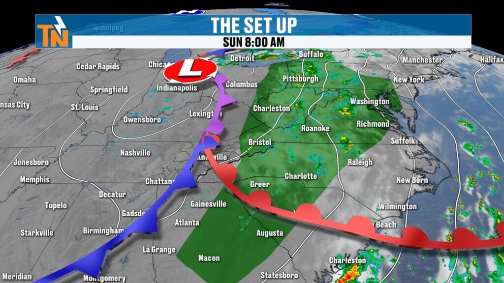
If you’ve been waiting for yesterday’s cold front to clear the area, you’ll have to wait just a little longer. The front is still sitting just to our west early this morning and is moving at a snail’s pace. That means we’ll continue to deal with scattered showers and thunderstorms today, although not everyone will see rain.
The good news? This is not an all-day washout, so don’t cancel your outdoor plans. Whether you’re heading to the lake, the pool, or enjoying the final weekend before school begins for some families, you’ll simply need to keep an eye on the radar.
Cold Front Still Slowly Moving Through
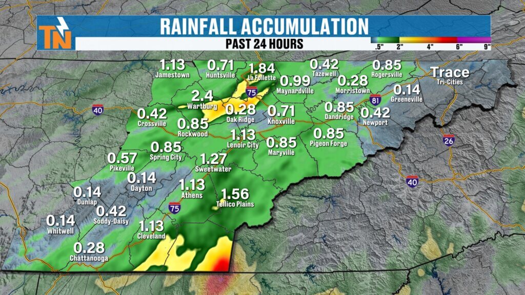
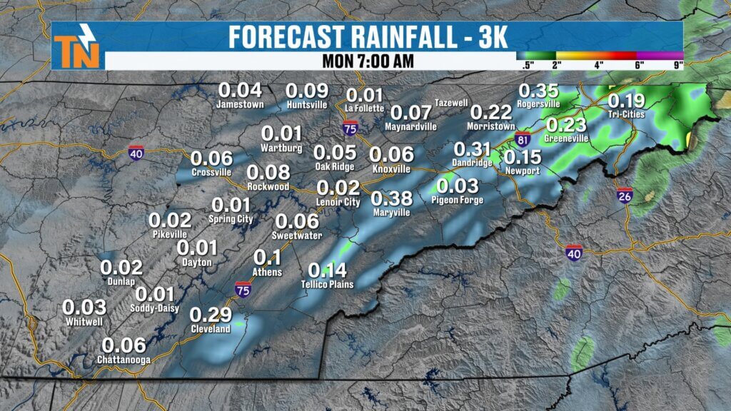
Yesterday brought pockets of heavy rainfall across portions of East Tennessee. Some communities picked up a healthy amount of rain, while others saw very little. A few stronger storms even knocked out power in parts of Blount County.
With saturated ground in some locations, the Weather Prediction Center continues a Level 1 (Marginal) Risk for localized flooding and flash flooding today. Fortunately, today’s greatest flood concern is focused over areas that missed much of yesterday’s rain.
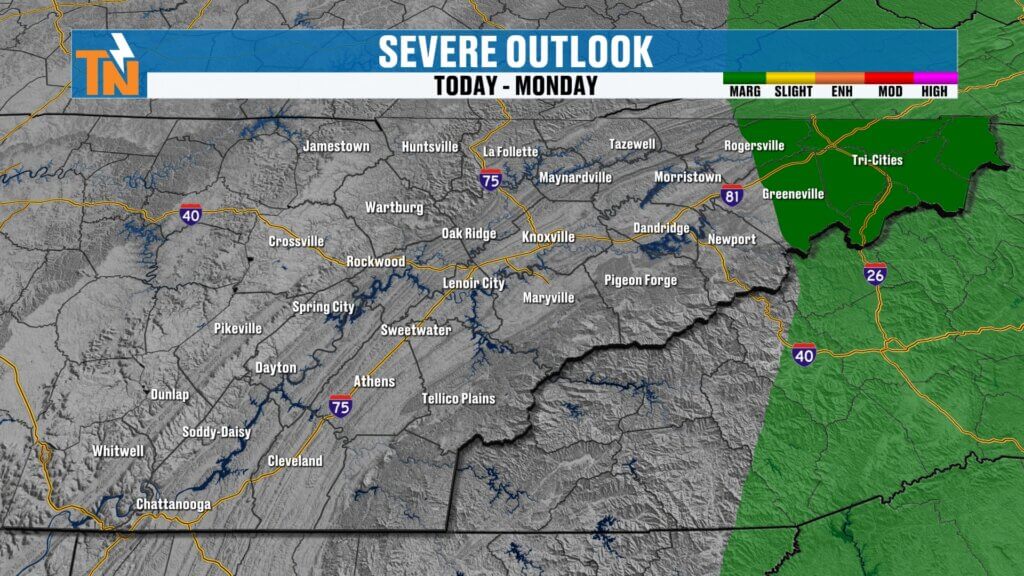
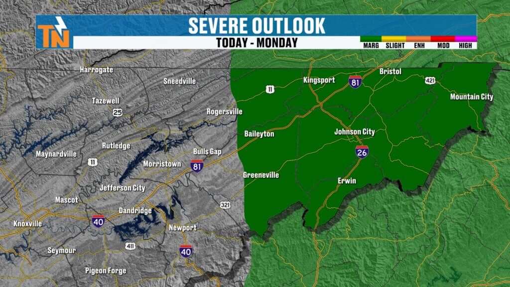
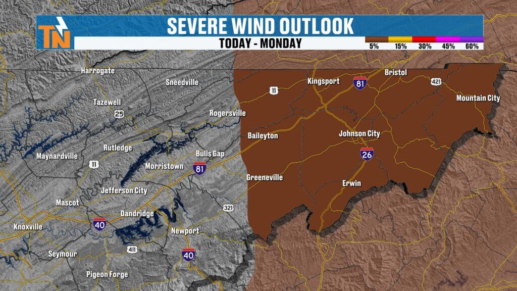
Meanwhile, the Storm Prediction Center has placed Upper East Tennessee under a Level 1 risk for isolated severe thunderstorms, with damaging wind remaining the primary concern. Widespread severe weather is not expected, but a few storms could briefly become strong this afternoon.
Today’s Forecast
Most of the morning will feature a mix of clouds and occasional sunshine with only a few isolated showers.
As daytime heating increases, scattered showers and thunderstorms will develop during the afternoon. Unlike yesterday, storms should move a little faster, helping to reduce the flooding threat somewhat.
If you’re spending time outdoors today:
- Don’t cancel your plans.
- Keep the EastTNWeather interactive radar nearby.
- Be prepared to head indoors if lightning approaches.
Temperatures begin the day in the 70s with muggy conditions already in place.
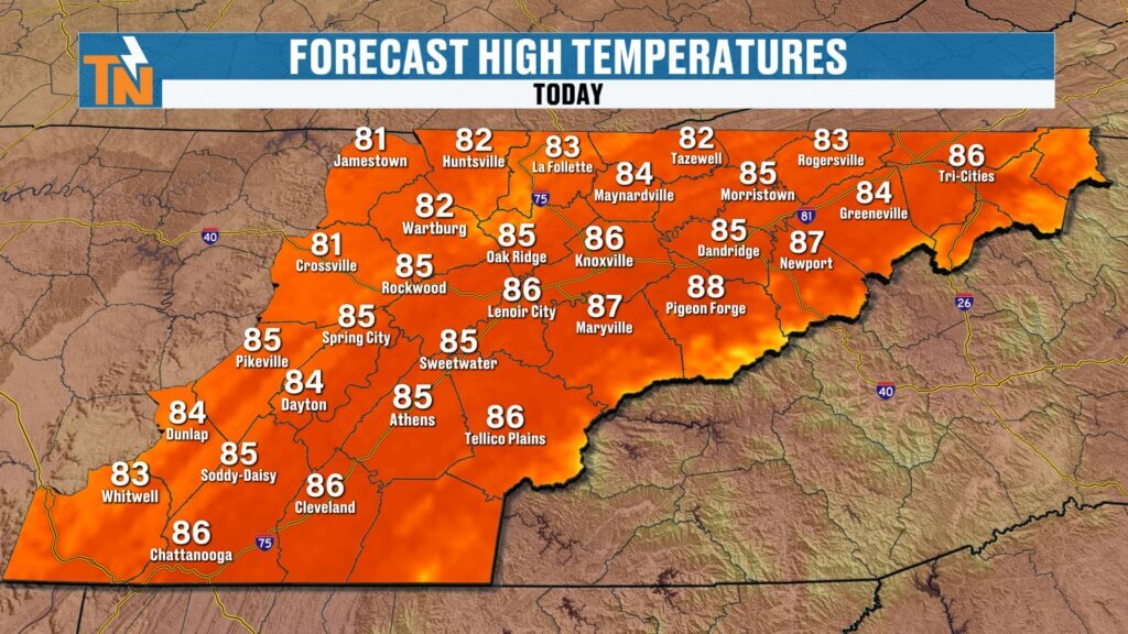
Afternoon highs will reach the mid to upper 80s, which is actually a bit below average thanks to increasing cloud cover. A light breeze will continue through the afternoon before temperatures settle back to around 81 degrees by 7 p.m.
A Cutoff Low Takes Over This Week
The bigger weather story develops over the next several days.
An upper-level trough diving into the Great Lakes will eventually pinch off into a cutoff low over the Tennessee Valley.
Meteorologists often joke that:
“A cutoff low is a weatherman’s woe—where it goes, nobody knows.”
That’s because cutoff lows become detached from the main jet stream and often wander slowly, making their exact track difficult to forecast.
One thing is becoming clearer, though.
This setup will likely change our normal summertime storm motion. Instead of storms arriving from the typical west or southwest, we could begin seeing storms developing over the mountains before drifting into the valleys from the east or southeast at times.
Daily Storm Chances Increase
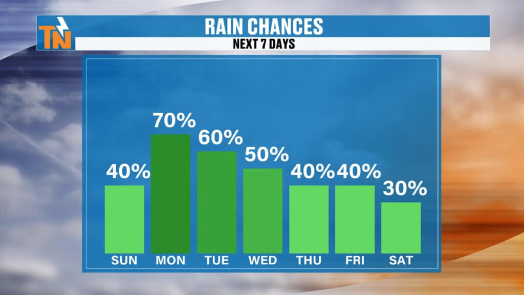
Rain chances gradually increase as the cutoff low settles nearby.
Expect:
- Sunday: Scattered afternoon showers and storms.
- Monday: More widespread afternoon development.
- Tuesday through Thursday: Daily scattered showers and thunderstorms, especially during the afternoon and evening.
The higher elevations of the mountains and Cumberland Plateau will once again have the best opportunity for rainfall, with storms then drifting into the surrounding valleys.
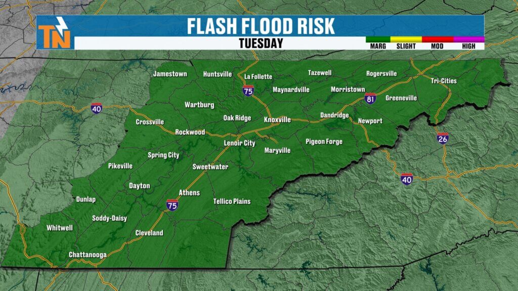
Flood Threat Returns Midweek
While Monday currently carries little flooding concern, the atmosphere quickly reloads with deep tropical moisture.
Beginning Tuesday, the Weather Prediction Center increases the excessive rainfall outlook each day through Thursday as repeated afternoon thunderstorms become capable of producing tropical-like downpours.
Localized flooding could once again become an issue where storms repeatedly move across the same communities.
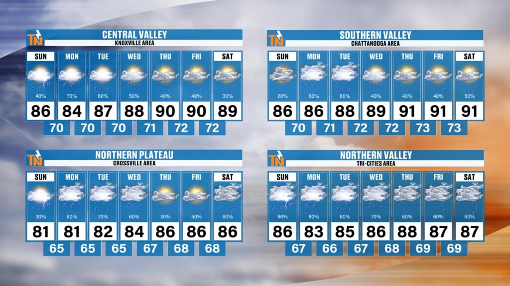
Looking Ahead
Temperatures remain seasonably warm through the week.
- Sunday & Monday: Mid 80s
- Tuesday & Wednesday: Upper 80s
- Thursday through Saturday: Low 90s return
As temperatures climb, humidity also increases. Dew points remain in the 60s and 70s, sending heat index values back into the upper 90s and lower 100s later this week.
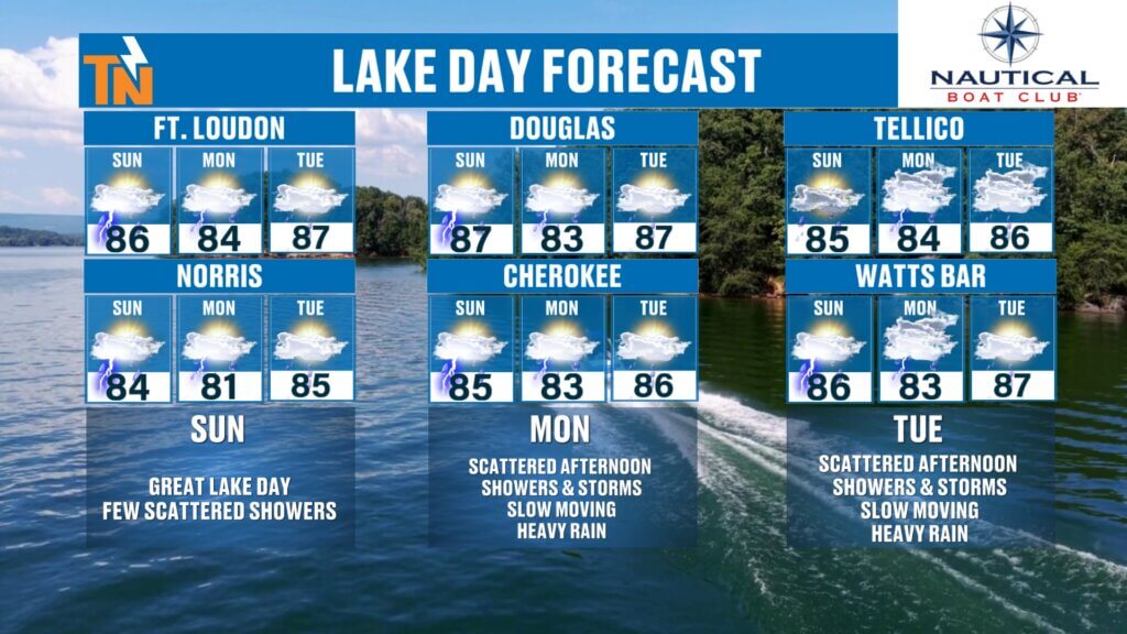
Lake Forecast
If you’re heading to one of East Tennessee’s lakes today, conditions are generally favorable.
Today’s weather won’t be perfect, but it certainly won’t be a washout either.
You’ll simply need to dodge a few afternoon showers and thunderstorms. Monday and Tuesday follow a similar pattern, with the greatest storm coverage expected during the afternoon hours.
Bottom Line
- The cold front is still moving slowly through East Tennessee.
- A few strong storms remain possible today, mainly across Upper East Tennessee.
- Localized flooding remains possible where heavy rain falls.
- An upper-level cutoff low settles in this week, bringing daily scattered afternoon thunderstorms.
- Heat and humidity gradually increase again later this week.
Be sure to keep the FREE EastTNWeather App handy for interactive radar, lightning alerts, watches, warnings, and live severe weather coverage whenever storms develop.
Have a wonderful Sunday, enjoy the rest of your weekend, and thanks for making eastTNweather part of your day.
High-Search SEO Keywords
East Tennessee weather, Knoxville weather, Sunday weather forecast, Upper East Tennessee storms, East Tennessee rain, Knoxville radar, flooding forecast Tennessee, East Tennessee thunderstorms, cutoff low weather, Tennessee weather blog, Mike Witcher, EastTNWeather, Tennessee lake forecast, Knoxville weather app
Hashtags
#EastTNWeather #TNwx #KnoxvilleWeather #SundayForecast #Thunderstorms #Flooding #WeatherUpdate #EastTennessee #LakeWeather #Storms #MikeWitcher #SummerWeather #StayWeatherAware