
Published: Friday, July 31, 2026
By Meteorologist Mike Witcher | eastTNweather
Good Friday morning, East Tennessee!
Enjoy today because it’s shaping up to be one of the best days we’ve had all week. Sunshine, low humidity, and comfortable temperatures will make for excellent weather whether you’re headed to work, spending time outside, or planning an evening event.
The weather pattern, however, begins to change this weekend as a slow-moving cold front approaches from the west. That front will bring increasing chances for showers and thunderstorms Saturday and Sunday, along with the potential for a few stronger storms, especially across the Cumberland Plateau.
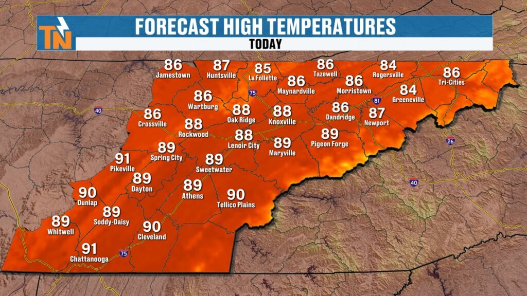
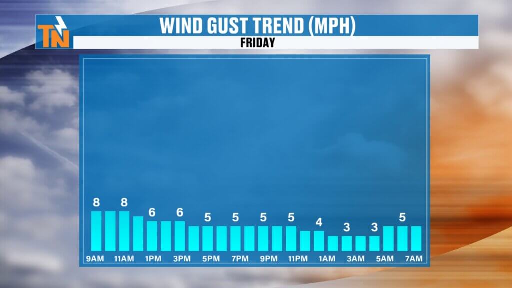
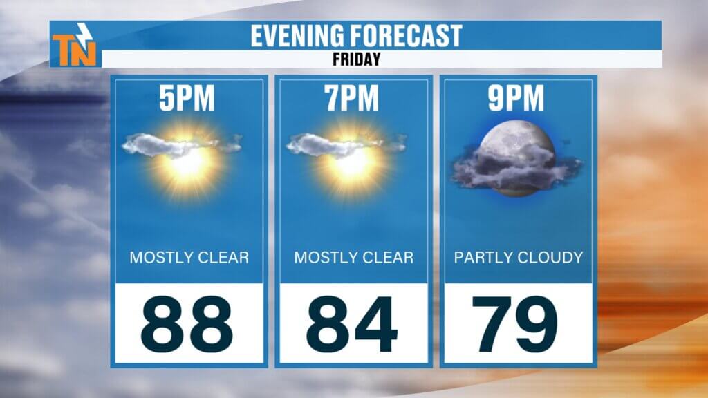
Friday: A Picture-Perfect Summer Day
High pressure remains in control across East Tennessee today, keeping skies mostly sunny and humidity levels pleasantly low.
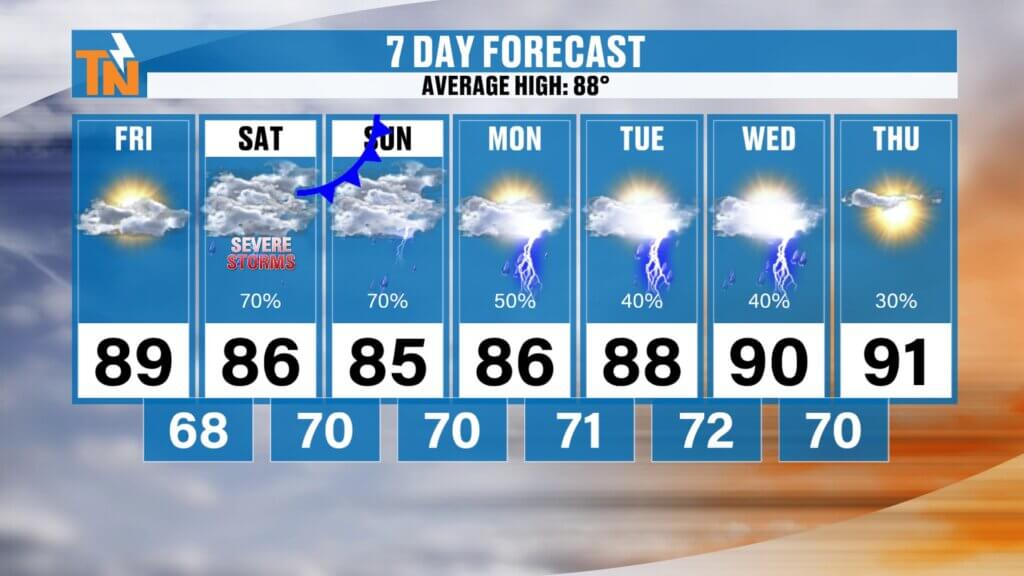
Afternoon temperatures will climb back to seasonal averages, reaching the upper 80s to near 90 degrees, but unlike earlier this week, it won’t feel oppressive outside. With lower dew points in place, heat index values will stay very close to the actual air temperature.
Winds remain light throughout the day, making it another excellent day to spend outdoors.
If you have plans this evening, conditions couldn’t be much better. Temperatures will still be around 84 degrees by 7:00 p.m., with comfortable humidity and dry weather continuing through the night.
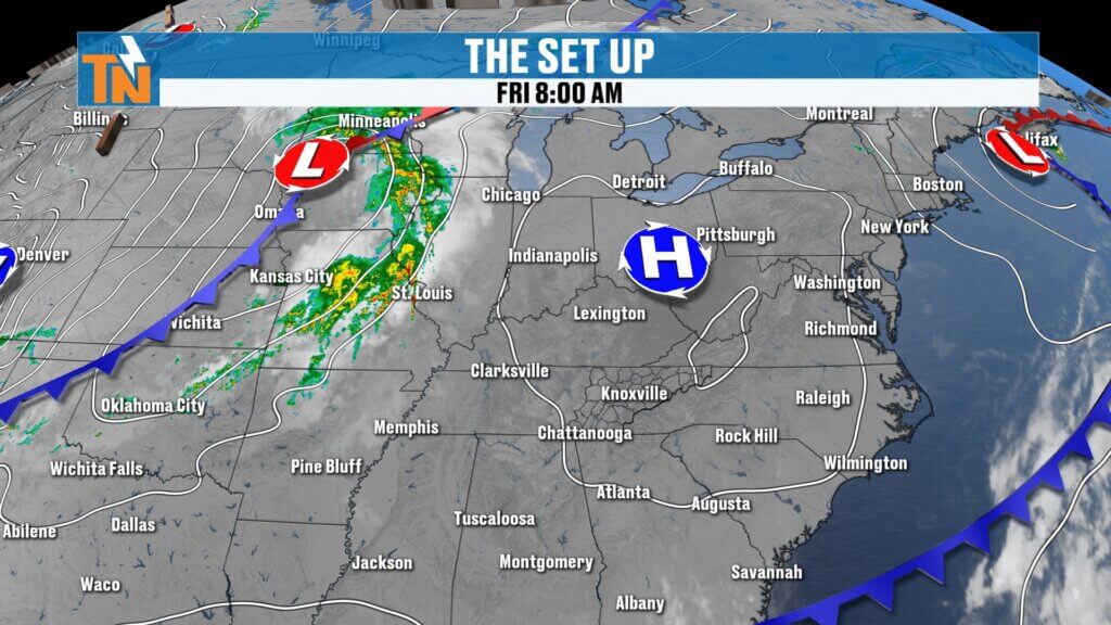
Cold Front Arrives Saturday
Changes begin early Saturday as a cold front slowly approaches from Middle Tennessee.
The Storm Prediction Center continues to highlight the Cumberland Plateau under a Level 2 (Slight) Risk for severe weather, while much of the rest of East Tennessee remains under a Level 1 (Marginal) Risk.
While the system is expected to weaken as it moves east, a few stronger thunderstorms could still develop, especially across the Plateau before reaching the Tennessee Valley.
Two Rounds of Rain Expected
Saturday currently looks to feature two separate rounds of showers and thunderstorms.
Round One develops during the late morning through early afternoon, bringing scattered showers and thunderstorms.
The second round arrives with the cold front itself during the evening, generally from around sunset through 10 p.m. to midnight.
Because these storms will arrive after peak daytime heating, the atmosphere will gradually lose instability. That should help limit the severe weather threat across much of East Tennessee, although a few storms could still produce:
- Gusty to damaging winds
- Frequent lightning
- Brief heavy downpours
- Small hail in isolated storms
Overall, widespread severe weather is not expected, but it’s certainly worth staying weather aware Saturday evening.
Sunday Remains Unsettled
The cold front moves east on Sunday, but enough moisture will linger behind it to keep scattered showers and thunderstorms in the forecast.
The good news is this won’t be an all-day washout.
There will be plenty of dry hours mixed in with the rain, so there’s no reason to cancel outdoor plans. Just keep an eye on the radar and be prepared to adjust around passing storms.
Flooding Risk Remains Low
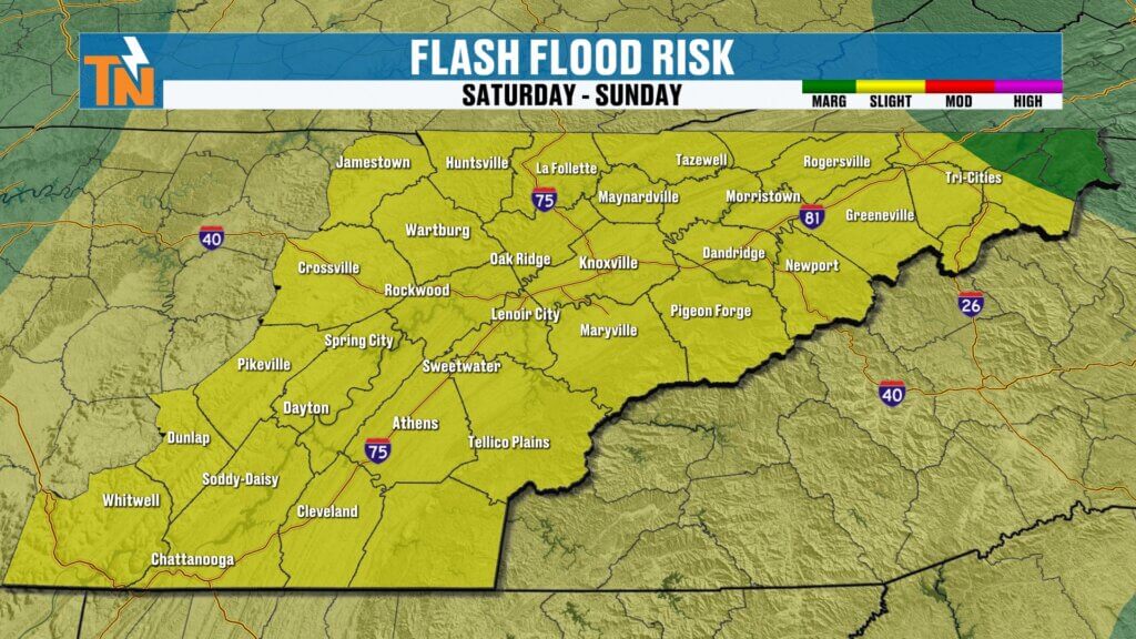
The Weather Prediction Center continues to include portions of East Tennessee in a Level 2 risk for excessive rainfall, mainly because the front will be moving slowly.
Most locations should receive between one-half inch and one inch of rainfall, although isolated areas could certainly pick up more beneath stronger thunderstorms.
Localized flooding is possible, particularly where heavier rain has fallen recently, but widespread flooding is not expected at this time.
Looking Ahead to Next Week
Once the weekend system exits, rain chances begin decreasing Monday before the familiar summertime pattern returns.
Temperatures remain in the mid 80s Monday, then gradually climb back into the upper 80s and lower 90s during the middle of next week.
Humidity also begins increasing again, sending heat index values back toward 100 degrees as we move deeper into next week.
Best Lake Day?
If you’re planning time on the water, today is easily the best day of the weekend.
Saturday and Sunday certainly aren’t washouts, but you’ll need to monitor developing thunderstorms and be prepared to head off the water quickly if lightning approaches.
Remember, lightning is often the first sign it’s time to seek shelter.
Bottom Line
- Friday: Sunny, warm, comfortable, and dry.
- Saturday: Two rounds of showers and thunderstorms with a few stronger storms possible, especially across the Cumberland Plateau.
- Sunday: Scattered showers and storms linger, but plenty of dry time remains.
- Next Week: Rain chances decrease before heat and humidity begin building once again.
As always, keep the FREE eastTNweather App handy for interactive radar, lightning alerts, watches, warnings, and live severe weather coverage if storms become stronger than expected.
Have a wonderful Friday and enjoy the beautiful weather while it’s here!
East Tennessee weather, Knoxville weather forecast, East Tennessee weekend weather, Cumberland Plateau storms, Tennessee severe weather, Knoxville radar, East Tennessee thunderstorms, cold front Tennessee, weekend forecast Knoxville, Mike Witcher, eastTNweather, East Tennessee weather app, Tennessee flooding, Knoxville weather blog
#EastTNWeather #TNwx #KnoxvilleWeather #WeekendWeather #ColdFront #Thunderstorms #SevereWeather #WeatherUpdate #Knoxville #CumberlandPlateau #MikeWitcher #EastTennessee #LakeWeather #StayWeatherAware