
Published: Friday, August 28, 2026
By Meteorologist Mike Witcher | eastTNweather
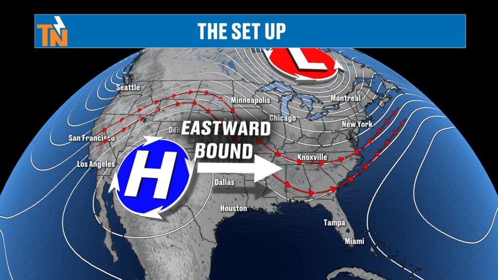
Happy Friday! East Tennessee is heading into a stretch of hotter, sunnier and mostly dry late-summer weather as a ridge of high pressure begins building into the region.
After Knoxville reached 90 degrees Thursday—above the late-August average of around 87—we’ll continue warming through the weekend and into next week. Rain chances, meanwhile, will become increasingly limited.
For those heading to Friday night high school football, the lakes or other outdoor events, the overall forecast is looking pretty good.
Mostly Dry Friday With Only a Few Isolated Storms
A cold front has slipped south of East Tennessee, but unlike some fronts we see this time of year, it hasn’t delivered a significant push of cooler or drier air.
Most of East Tennessee should remain dry today.
There is still a small chance for an isolated shower or thunderstorm, particularly across the mountains and Upper East Tennessee. A few storms could become stronger near the Tennessee/North Carolina border, but widespread severe weather is not expected.
Storm motion today will generally be from the north and northwest, meaning anything developing over the higher terrain may tend to move toward western North Carolina rather than deeper into the Tennessee Valley.
Bottom line: Most of us probably won’t see rain today.
Temperatures Climb Back Into the 90s
We’re starting Friday morning in the mid and upper 60s with some lower 70s around the region.
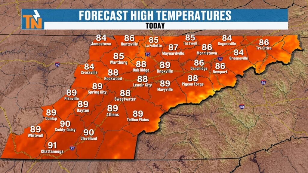
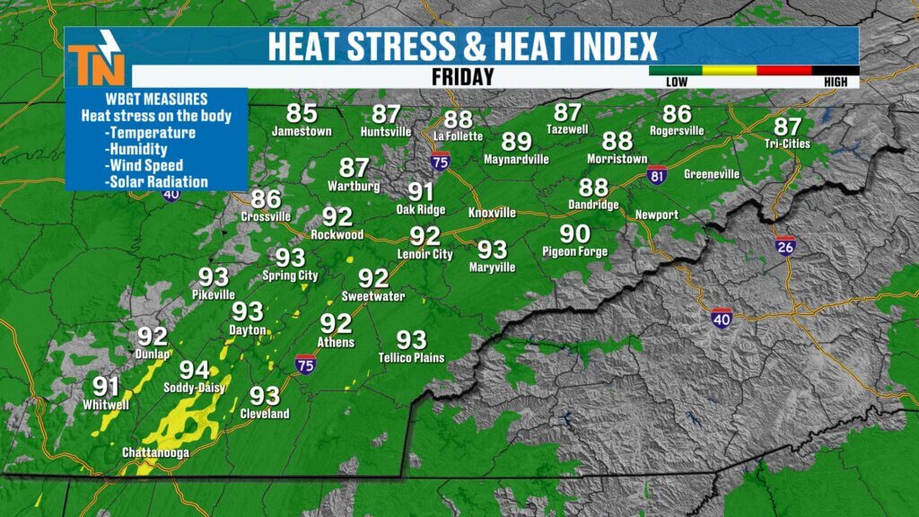
Afternoon temperatures will climb into the upper 80s and lower 90s, with heat index values generally reaching the lower and middle 90s.
That’s manageable for late August, but it’s the beginning of a warming trend that will become much more noticeable next week.
Great Weather for Friday Night Football
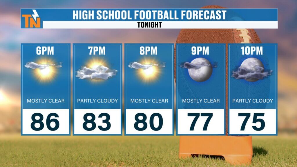
Friday night football is back, and the forecast couldn’t be much better.
Expect temperatures around:
- 6 PM: 86°
- 8 PM: 80°
- 10 PM: 75°
Most locations should remain dry through the evening.
And I get to have a little fun tonight! I’ve been invited to provide the game-day weather forecast at Powell High School as Powell takes on Farragut. If lightning becomes an issue, I’ll also be helping communicate any weather delays.
But right now, the weather looks pretty cooperative for kickoff.
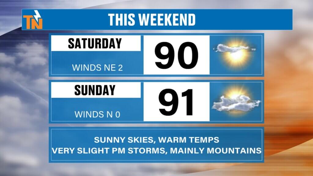
Hot, Sunny and Mostly Dry Weekend
If you’ve been waiting for a weekend without widespread afternoon thunderstorms, this may be the one.
Saturday and Sunday should feature plenty of sunshine with highs climbing into the lower 90s.
I still can’t completely rule out an isolated afternoon shower or storm—particularly around the mountains—but rain coverage should be very limited.
A subtle southeasterly flow this weekend could allow a storm developing over the mountains to drift toward portions of the Valley, but we’re talking about roughly a 20% chance at best for most locations.
So don’t cancel those outdoor plans.
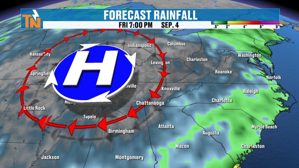
Heat Dome Takes Over Next Week
The bigger story develops next week.
Our trough across the eastern United States will gradually move away while the ridge currently centered across the Southwest expands eastward.
Think of this ridge as a big bubble of no trouble when it comes to widespread rainfall—but it also means increasing heat.
As the ridge strengthens, sinking air suppresses widespread thunderstorm development while allowing temperatures to climb.
Highs next week should routinely reach the low to middle 90s, with humidity pushing heat index values into the upper 90s and lower 100s.
By Wednesday and Thursday, portions of the Southern Valley—especially around Chattanooga—could see heat index values approaching 105 degrees.
That would put us close to Heat Advisory territory if current trends hold.
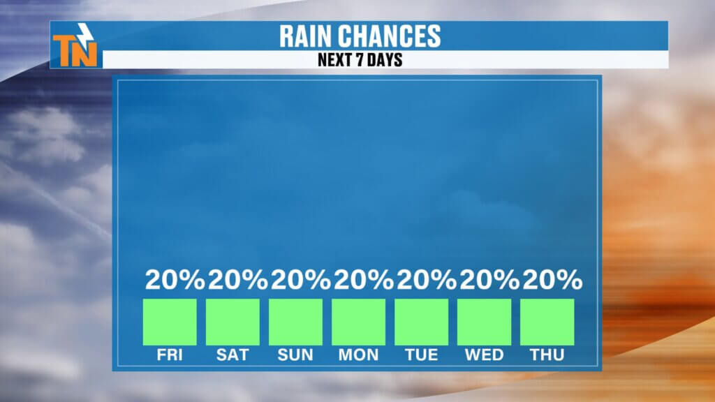
Rain Chances Stay Very Low
The strengthening ridge should also shut down most of our rain opportunities.
We’re not talking about a completely rain-free forecast. It’s still late summer, and enough heat and humidity could spark a stray afternoon thunderstorm.
But this isn’t the pattern we’ve dealt with for much of the summer when repeated disturbances produced widespread storms and locally heavy rainfall.
For most locations, rain chances will stay around 20% or lower, with the mountains having the best opportunity for an isolated afternoon storm.
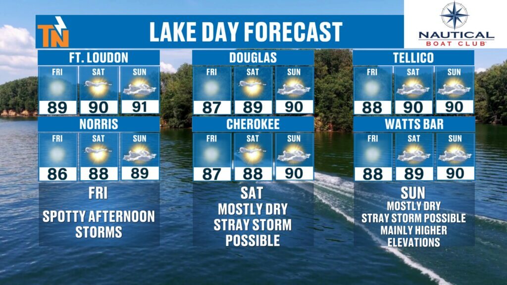
Excellent Boating Weather
If you’re trying to squeeze in some late-summer lake time, this is a good stretch to do it.
Friday, Saturday and Sunday all look favorable for boating across Norris, Fort Loudoun, Tellico, Douglas, Cherokee and Watts Bar.
Just remember that even with low rain chances, a single thunderstorm can quickly become dangerous on the water.
If you hear thunder or receive a lightning alert, it’s time to get off the lake and find shelter.
Tropical Storm Dolly Bears Watching
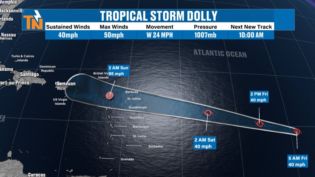
We’re also keeping an eye on Tropical Storm Dolly in the Atlantic.
Dolly is expected to weaken as it moves through the Lesser Antilles and toward the Greater Antilles. It poses no immediate threat to East Tennessee, but we’ll continue monitoring its progress—especially for anyone with late-summer travel plans toward the Caribbean.
Heat Could Continue Into Early September
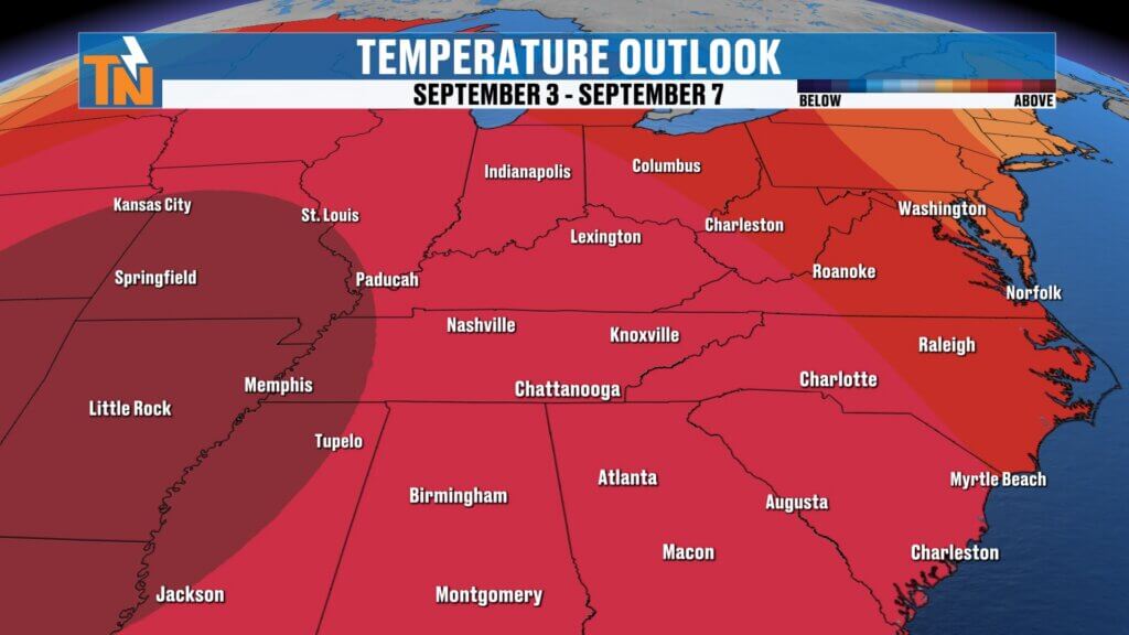
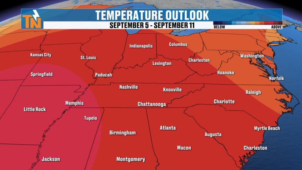
Looking beyond the seven-day forecast, the Climate Prediction Center continues to favor above-average temperatures into early September.
That’s worth noting because meteorological fall begins September 1, but Mother Nature doesn’t necessarily flip the switch to fall weather just because the calendar changes.
Rainfall also looks closer to average or potentially somewhat below average during this period.
In other words, late summer isn’t finished with us yet.
Bottom Line
Enjoy the weekend.
We’re looking at a mostly sunny, mostly dry and increasingly hot pattern across East Tennessee. Highs climb into the lower 90s this weekend before the heat becomes more noticeable next week.
Rain chances remain very low outside of an isolated mountain or afternoon thunderstorm, while heat index values could eventually climb above 100 degrees.
And if you’re heading to Friday night football or spending some time on the lake, the weather is looking pretty cooperative.
Keep the free eastTNweather app with you wherever you go. Turn on location services and notifications for weather alerts and lightning information, and use the interactive radar to see past, current and future radar out to two hours.
eastTNweather — Weather When You Want It.