
Published: Saturday, November 14, 2026 | By Meteorologist Mike Witcher | eastTNweather
Good morning, East Tennessee, and happy Saturday! I sure hope you had a great work week as we head into the weekend. Thanks for checking in with your morning weather update on this November 14th, 2026.
We’re talking about improving conditions and a gradual warming trend as we head into next week. A big warmup is on the way, a really nice little weather pattern, and we also picked up some fresh snow in the mountains.
So let me know in the comments below if you happened to see any of the first snowflakes of the 2026-2027 winter season yesterday. I’ve only seen photos and a few images here and there on social media, but that’s about all I’ve seen so far.
I’ll see what High on LeConte does on their daily blog, and how much snowfall they ended up with as we progress through the morning. Make sure you check out social media, because I’ll be posting more on that.
Yesterday's Almanac: Only the 40s and a Couple of Pockets of 50s
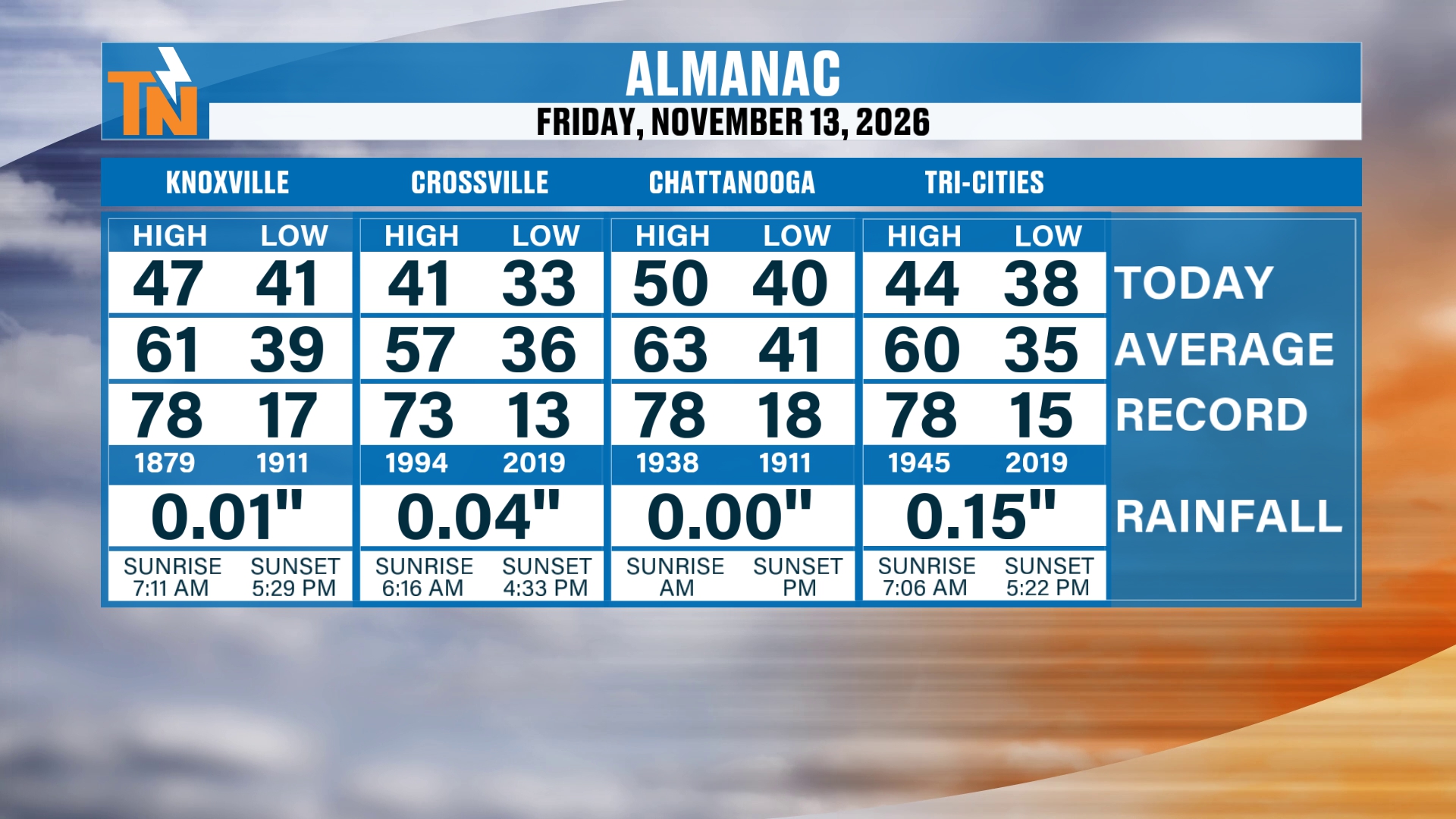
Let’s start you off with the almanac from yesterday. We only made it into the 40s, with a couple of pockets of 50s. We had 41 in Crossville, and McGhee Tyson Airport topped out at 47 degrees. Chattanooga reached 50, and the Tri-Cities made it to 44.
We’ve got some clearing skies this morning, so some nice weather is on the way. It’s some sunshine, but chilly sunshine, thanks to a trough that’s continuing to hang out with us.
This trough is going to continue to pull off to our north and northeast, and high pressure builds back in. And as the title says, a big old warmup is on the way as we progress through much of the week. So let’s walk through the details.
How Much Snow Fell in the Smokies?
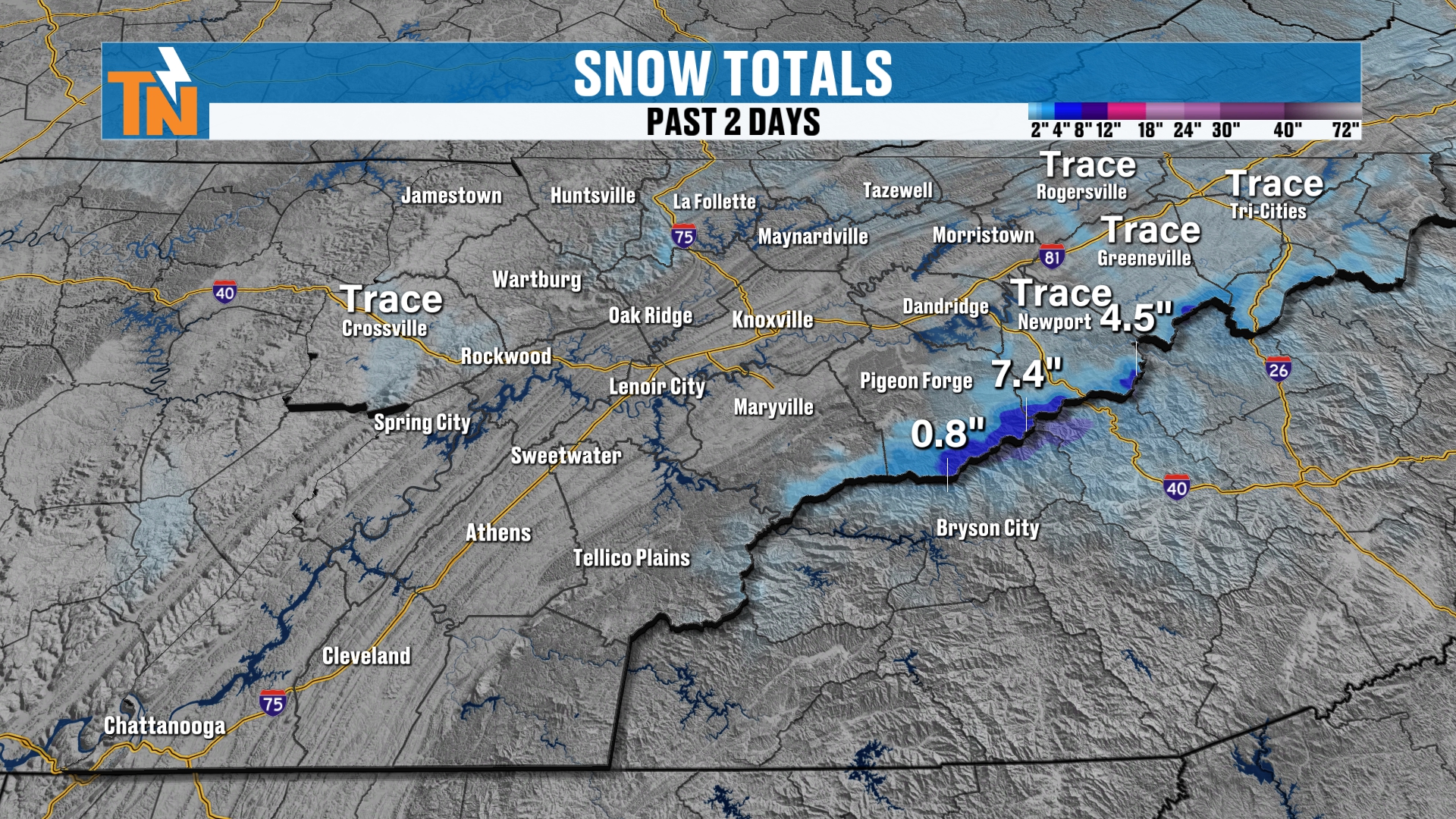
It was nice to see a little bit of snowfall around the area. This is the two-day snowfall from my in-house Baron model. It’s picking up on what we potentially saw, taken from Doppler-estimated radar. These are not official reports, by the way.
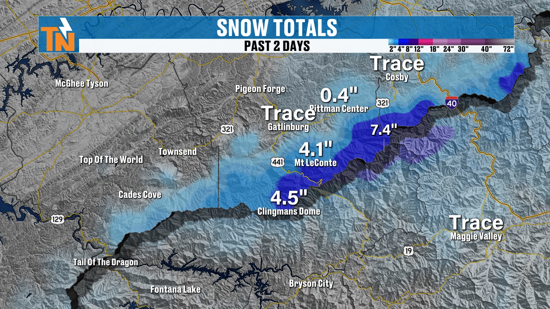
We saw a couple of snowflakes here and there up toward Cosby and Pittman Center. Mount LeConte picked up about 4 inches, Clingmans Dome about 4 and a half, and the highest peaks potentially saw upwards of 7 inches.
Again, I’ll keep you posted on social media, as High on LeConte will have the report this morning.
So it was a good, solid northwesterly upslope, or orographically lifted, snowstorm. We didn’t see a whole lot of activity in the lower elevations. And of course, we saw a little bit of rainfall last night for high school football as well.
A Few Clouds, Then Abundant Sunshine
We’ve got a few clouds hanging out with us as we get the day started. High pressure is building in from Canada, and it’s that ridge of high pressure that continues to bring us cooler, below-average weather.
There’s not a lot of precipitation left in the atmosphere. We’re kind of ringing it out across the highest peaks of the Smokies. Once those clouds move on out, we lose all of the moisture, the snow comes to an end, and abundant sunshine works its way back in.
So it’s really going to turn out to be a nice afternoon. Don’t forget the sunglasses today, because you’ll need those. But you’ll definitely need the winter coats, or at least the heavier jackets.
Morning Temperatures: No Hard Freeze This Morning
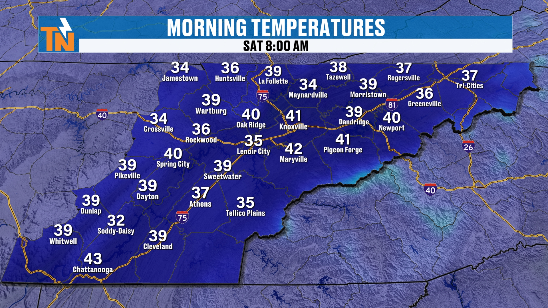
We’re starting off in the 30s this morning. So there’s no real hard freeze this morning, and we weren’t really looking at one. But tomorrow morning is going to be a different story. That’s going to be much colder.
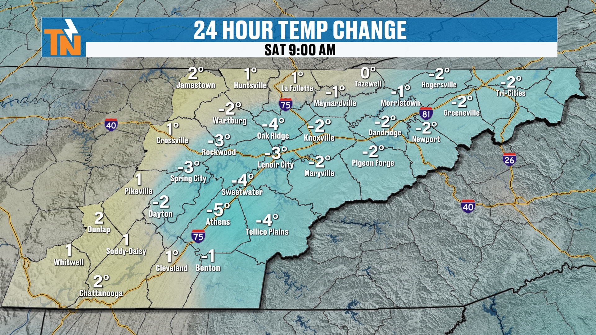
Temperatures are trending a bit colder in some locations than they were yesterday.
Today: Plenty of Sunshine, a Chilly Breeze
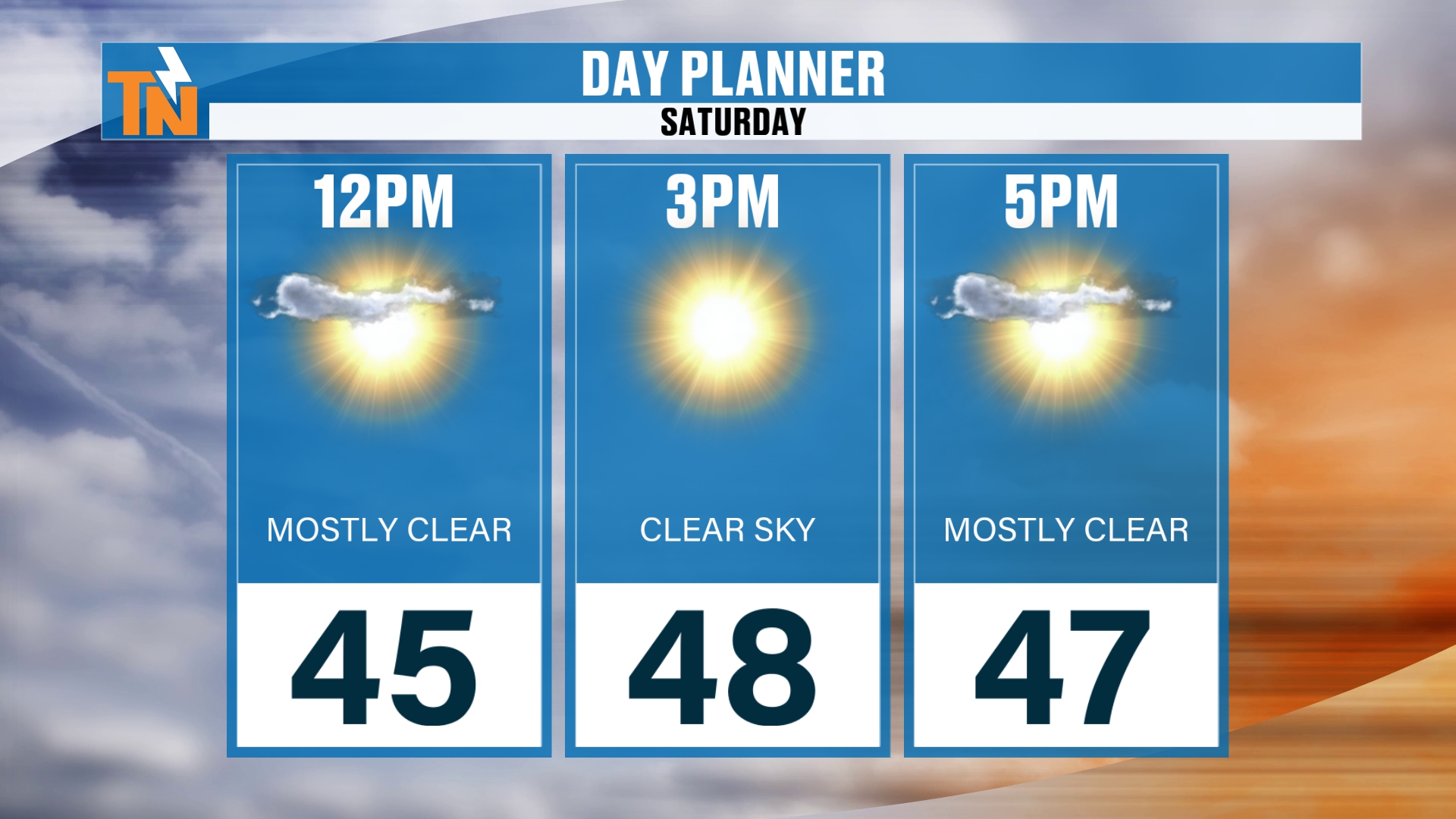
The general idea is plenty of sunshine. Temperatures climb into the mid 40s as we get into the lunch hour, with 45 at noon, 48 at 3 PM and 47 at 5 PM.
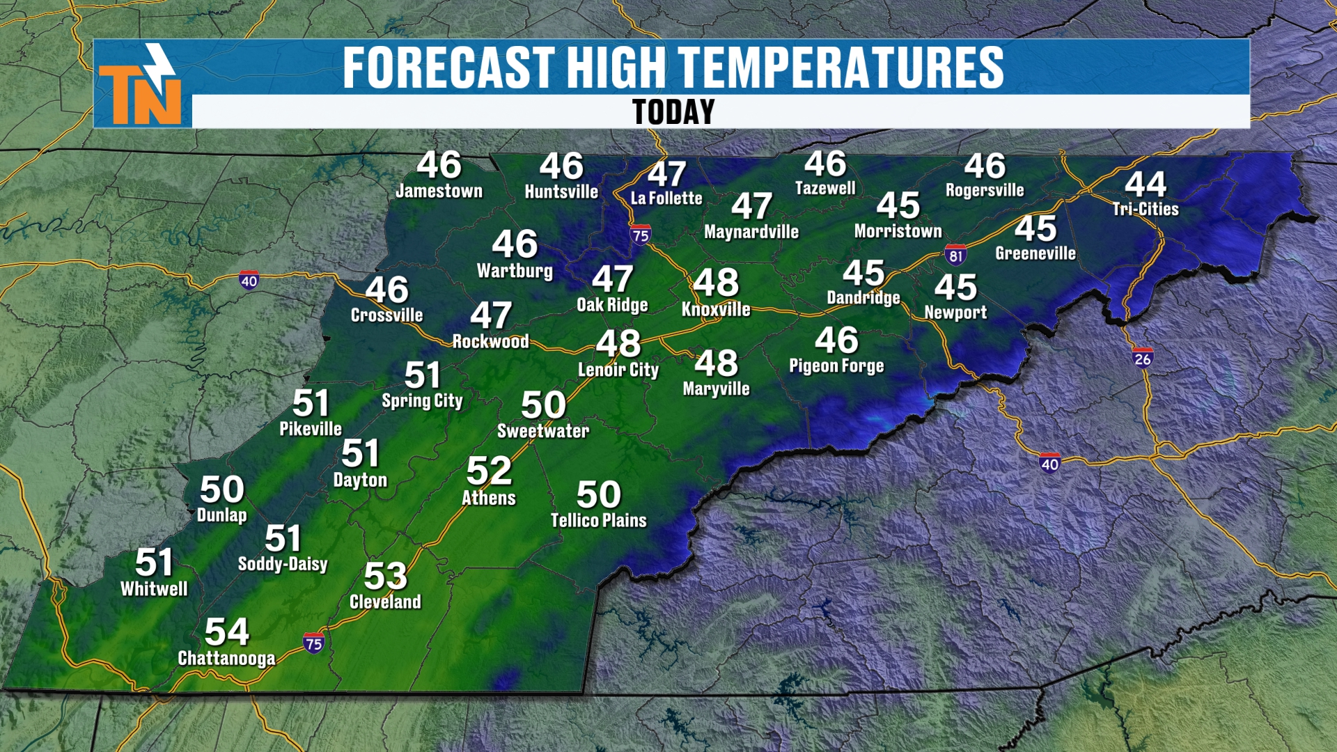
Our goal today is the mid to upper 40s. That’s similar to, or a little bit colder than, what we had yesterday.
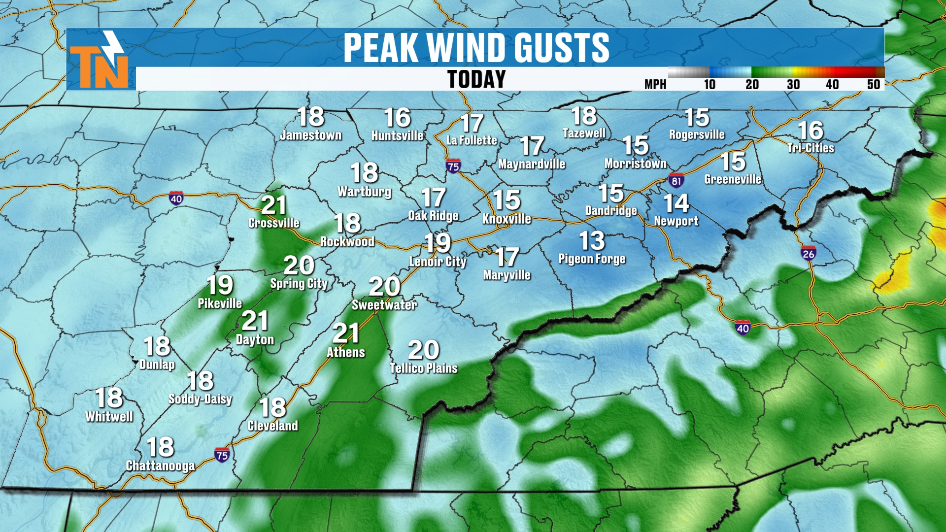
There’s also a bit of a breeze. Winds are going to be gusting in the lower elevations upwards of about 10 to 15 miles per hour, and that’s going to cut right through you.
It’s a little taste of old man winter. When you get that northwesterly wind and temperatures in the 40s, it makes it feel pretty chilly outside.
Evening Forecast: Cold but Sunny for the UT Game
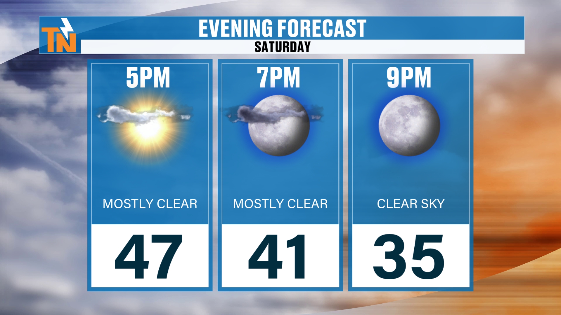
By 5 PM we’re hanging on to 47. We drop to about 41 by 7 PM and 35 by 9 PM.
So if you’re heading out to watch the UT football game somewhere, it is definitely going to be chilly, but sunny. Enjoy that!
Tonight: A Hard Freeze Is Likely
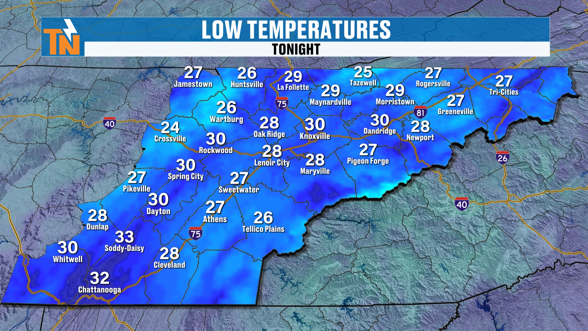
Now for low temperatures tonight. We have a better chance for a hard freeze along the Cumberland Plateau. We’re talking temperatures below 28 degrees for an extended amount of time, which means a hard freeze is looking likely in many locations.
We’re going to have clear skies and quite a bit of widespread frost developing early Sunday morning. So get the plants covered and bring in anything that doesn’t like the cold.
Sunday: Back Into the 50s
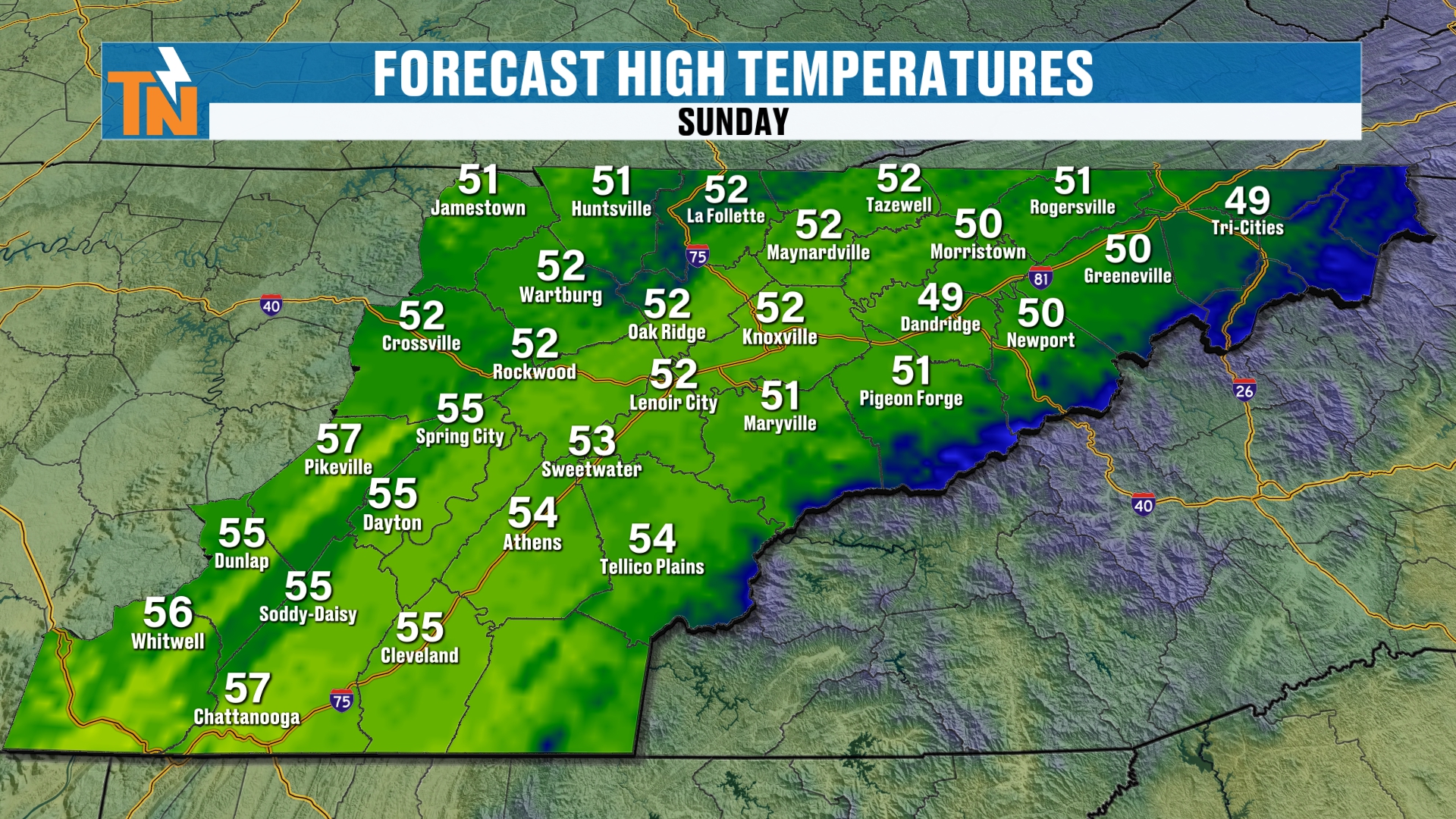
Sunday, we climb back into the 50s. So it’s a little bit warmer on Sunday, and that trend is going to continue for several more days.
There will be a little bit of a breeze during our Sunday afternoon as well.
The Big Picture: High Pressure in Control
When you look at your Futurecast model on the big picture, high pressure has been in control, coming in from Canada. That’s what’s bringing in the chillier weather as we progress through the rest of the weekend.
The clouds will clear on out, although they’re hanging strong across parts of the Great Lakes and the Northeast, and there’s even some lake-effect snow still flying across parts of the Great Lakes area.
So it’s high pressure all the way through Sunday evening. This is cold high pressure. But the atmosphere, as we just saw on Sunday, is going to modify a little bit and then continue to warm.
Why a Big Warmup Is on the Way
Like I said, a big old warmup is on the way, because our ridge of high pressure builds on in all the way up into the Great Lakes area. So temperatures will be trending above average as we progress through the rest of the week.
The 7-Day Forecast
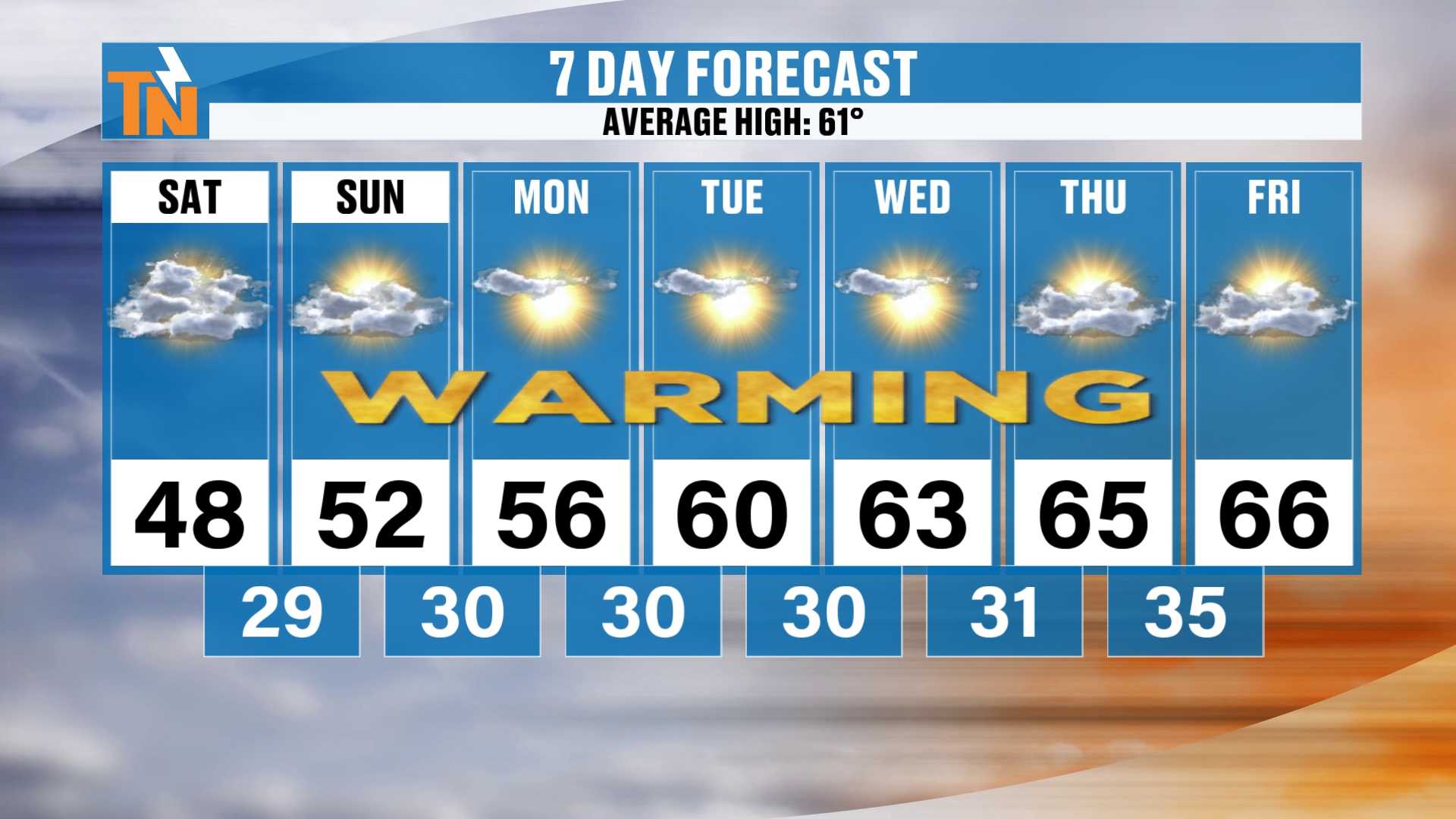
Here’s the 7-day forecast. Again, we’re trending warmer than average. The average high is now 61.
We start at 48 today and 52 on Sunday, then 56 on Monday, 60 on Tuesday, 63 on Wednesday, 65 on Thursday and 66 next Friday. We’re going to be in the mid to possibly upper 60s toward the end of next week, with sunshine, and quiet, dry weather.
Mornings stay chilly, with lows of 29 tonight, 30 on Sunday, Monday, Tuesday and Wednesday, 31 on Thursday and 35 next Friday.
So it’s a nice, solid 7-day stretch ahead of us. It starts off chilly, and then warms nicely. And we are going to stay dry this week. There are no chances for rain over the next 7 to 10 days or so.
Climate Prediction Center Outlooks: Above Average Temperatures
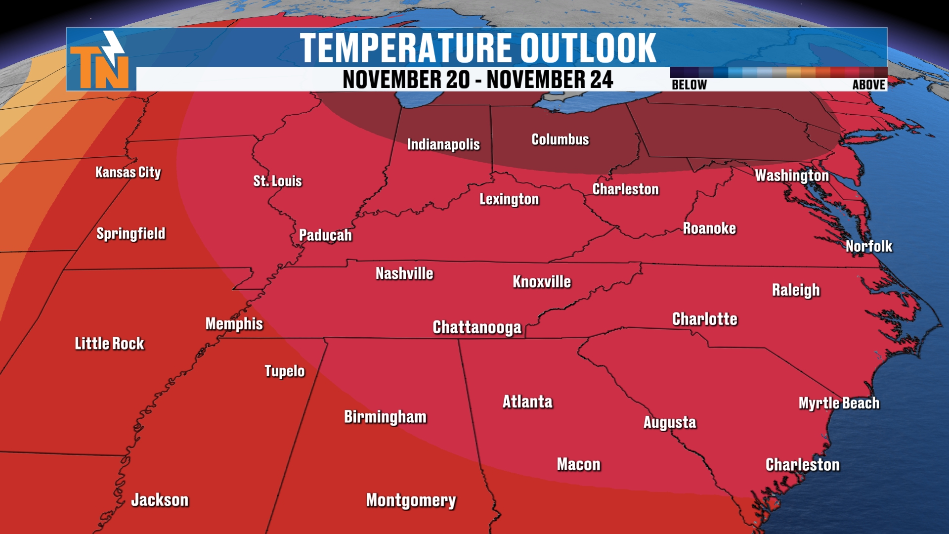
Your 6 to 10 day outlook from the Climate Prediction Center shows above-average temperatures, which is what I just showed you on the 7-day.
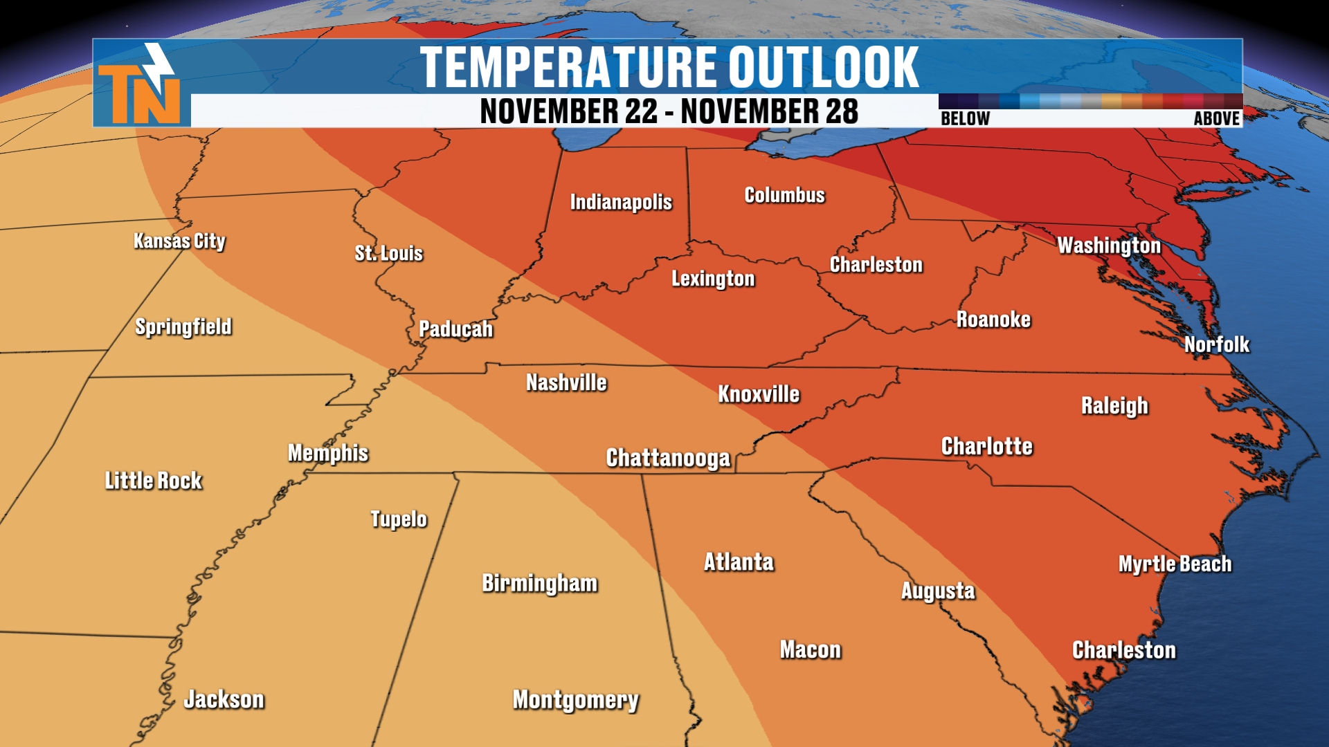
Looking out toward Thanksgiving week, the Climate Prediction Center also has us trending above average.
Your First Thanksgiving Week Outlook
Here’s where I want to be careful. Then, as we get into, say, Friday of next week, there’s some troughing that’s potentially going to head our way. That takes us into Thanksgiving week.
There’s the potential for Thanksgiving week to trend probably below average, and there are some signals of troughing taking shape as we get into that week. We’ll see how that all plays out, because if we start to get some troughing, then we’re going to see storms, and we potentially could have snowfall across the country.
It’s, of course, a busy travel week, so I’ll be highlighting that here in a couple of days. I’m really just trying to get an idea of what this troughing looks like. So make sure you check back in.
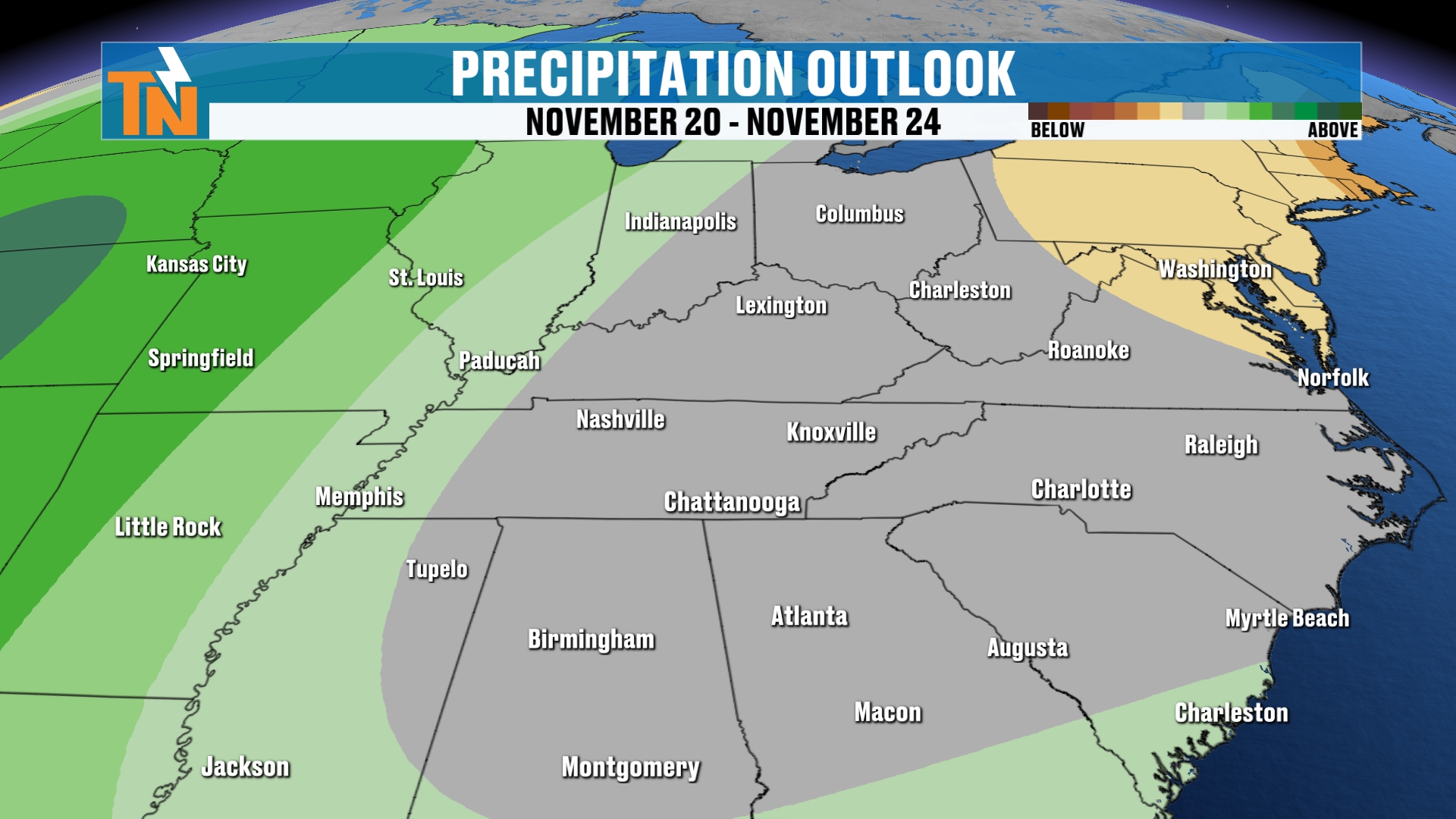
On the precipitation outlook, getting into Thanksgiving week, as I mentioned, there could potentially be some troughing that may elevate our rain, or at least our precipitation chances, around the region.
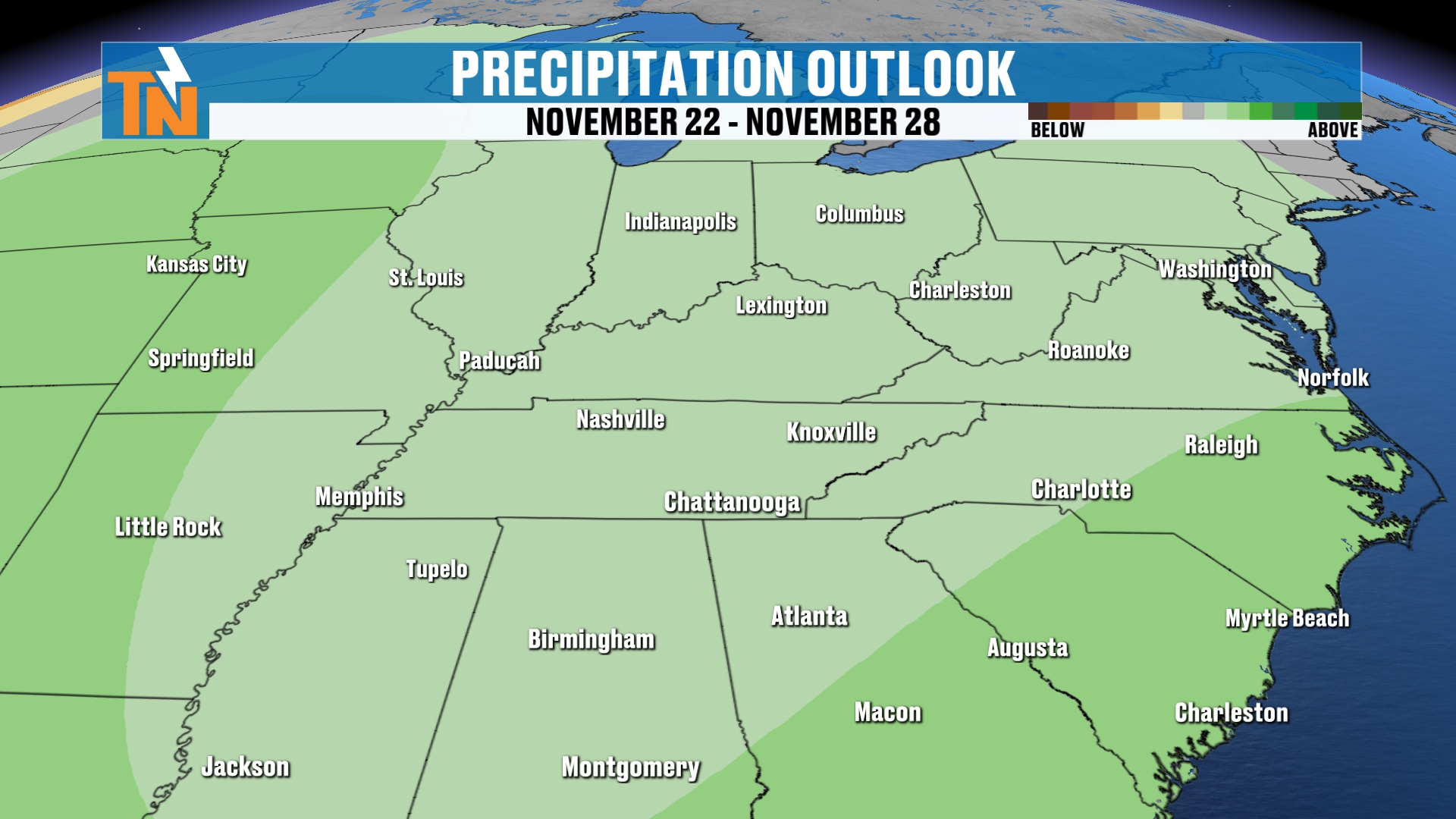
Although the Climate Prediction Center does have us trending above average, some of the model guidance and the ensembles are predicting below average, or at least a little bit more of a ripple in the atmosphere.
That’s what I’m talking about with Thanksgiving week. You can see our jet stream is going to be a little bit closer to us toward the end of Thanksgiving week. This is the GFS model, and it’s picking up on a much deeper trough.
Now, we’re a long way away, so I’ll be watching to see how this evolves over time. I do think we’re going to be average to maybe slightly below average during Thanksgiving week, with some more ripples in the atmosphere and the potential for a deeper trough to swing on in.
So make sure you check back in, and I’ll keep you posted right here on East Tennessee Weather.
Bottom Line
SATURDAY (TODAY): Mostly sunny and chilly, with a few clouds early and the last of the mountain snow ending. Mornings in the 30s. 45 at noon, 48 at 3 PM, 47 at 5 PM, a high in the mid to upper 40s, and a northwesterly breeze gusting 10 to 15 mph in the lower elevations. For the UT game: 41 at 7 PM and 35 by 9 PM, chilly but sunny.
SATURDAY NIGHT: Clear skies and widespread frost. A hard freeze is likely, especially on the Cumberland Plateau, with temperatures below 28 degrees for an extended time.
SUNDAY: Sunny, a little breezy in the afternoon, and back into the 50s with a high around 52.
MONDAY THROUGH WEDNESDAY: The big warmup, with highs of 56, 60 and 63 and sunshine. Chilly mornings near 30 and no chance for rain.
THURSDAY AND FRIDAY: Highs around 65 and 66, with mid to possibly upper 60s toward the end of the week, quiet and dry.
THANKSGIVING WEEK: Watching a deeper trough that could bring temperatures average to slightly below average, with more ripples in the atmosphere and a chance for storms and precipitation. It’s still a long way out, so I’ll update you in a couple of days.
The takeaway: the mountain snow is ending, a hard freeze is likely tonight, and then a big warmup takes us into the 60s next week. Keep an eye on Thanksgiving week.
For more daily updates, check out our Daily Forecast page.
Don’t forget to LIKE, SHARE and SUBSCRIBE to the YouTube channel and hit the bell at the top. It really helps grow the platform quite a bit. If you’re new here, welcome!
Make sure you download my free East Tennessee Weather app. You can scan the QR code or just go to your app store and search East Tennessee Weather. It’s all weather all the time, for your cell phones and tablets. I also have apps that run on Roku TV and Amazon Fire, so you can put them up on your smart TVs at home as well.
I’m Meteorologist Mike Witcher. Have a great Saturday! Grab the sunglasses and the jackets, because you’re going to need those. And if you’re watching the football game and you’re a UT fan, clearly I am. Go UT. Go Big Orange!
eastTNweather — Weather When You Want It.