
Published: Wednesday, November 18, 2026 | By Meteorologist Mike Witcher | eastTNweather
Good morning, East Tennessee, and I do appreciate you checking in with your morning weather update on this Wednesday, November 18th, 2026. It’s another frosty start to the day for some folks around town, but all in all, it’s a little bit warmer this morning than it was yesterday morning. And that trend is going to continue throughout the entire week and into the upcoming weekend, which looks like a dry weekend for East Tennessee.
We’ve got an area of low pressure spinning across the Carolina coastline and zipping its way up the eastern seaboard. As a little upper level wave forms a surface low, high pressure builds in for us. That’s going to bring us warmer temperatures by the end of the week and really into the upcoming weekend. A cold front swings through as we get into Sunday and Monday. Does that produce a little bit of rainfall? Potentially, but probably not a whole lot.
And then as we get into Thanksgiving week, it does appear that we are going to have a rather unsettled week across the country in the form of rain, sleet, snow and some travel troubles. I’m going to walk you through all of those details.
Yesterday's Almanac: Low to Mid 60s
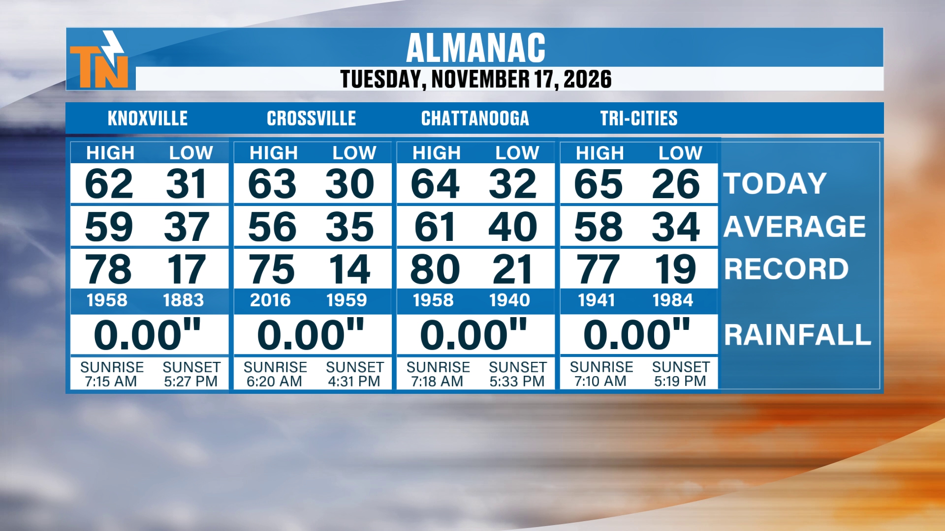
Let’s go ahead and start you off with the almanac from yesterday. We did top out in the low to mid 60s. That was a little bit warmer than the previous day, and right pretty much where we should be for this time of year. Of course, technically it’s a little bit above average, but all in all, not too terribly bad. Knoxville reached 62, Crossville 63, Chattanooga 64 and the Tri-Cities 65, and there was no rainfall anywhere.
The Big Pattern Across the Country
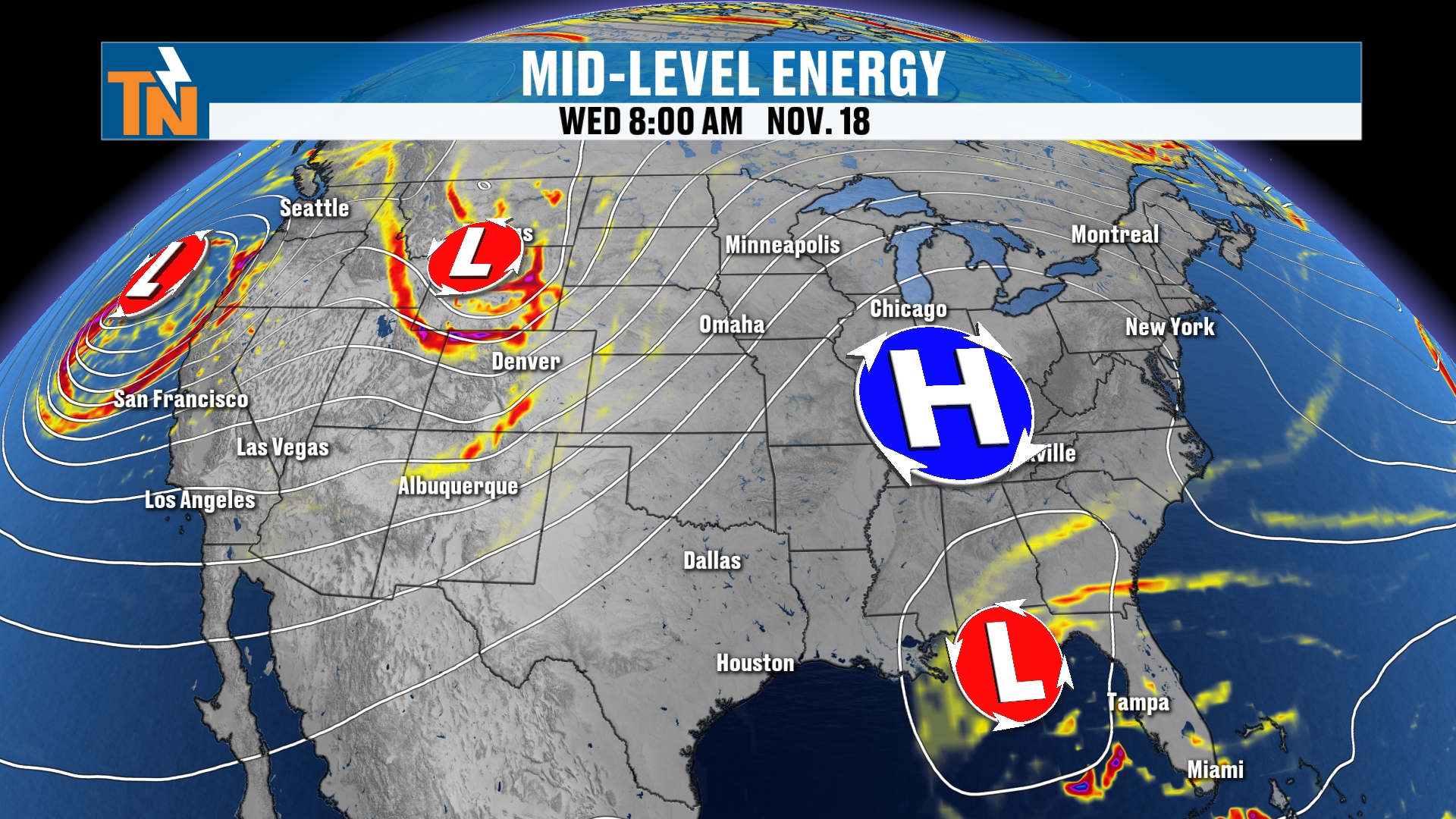
Here’s the big pattern across the country. We’ve got an area of low pressure swinging its way across the Pacific Northwest. That’s battering the coastal areas of the Pacific Northwest with rain, and heavy snow across the Cascades and the Sierra Nevada.
High pressure built in for our area, and that’s brought in some drier weather. You can see some brown show up around the area on the water vapor loop. That’s dry air.
And notice that kink over Florida. That’s another area of low pressure that’s going to form the surface low as we get into the upcoming weekend. So there’s the low pressures and the high pressures across the country. Again, high pressure is in control for us, and that’s leaving us quiet, sunny and dry.
Now, our satellite and radar. We have a couple of cold fronts off to our north and northwest, but for us right now, just high pressure is dominating. Cold front number one is going to kind of zip to our north. Our next cold front really doesn’t arrive until we get into Sunday.
But notice an area of precipitation down across parts of Florida. That’s going to continue to form into a low pressure system, a more organized low along the southeastern coastline, and it could possibly zip its way up the eastern seaboard.
Morning Temperatures: Frost and a Hard Freeze
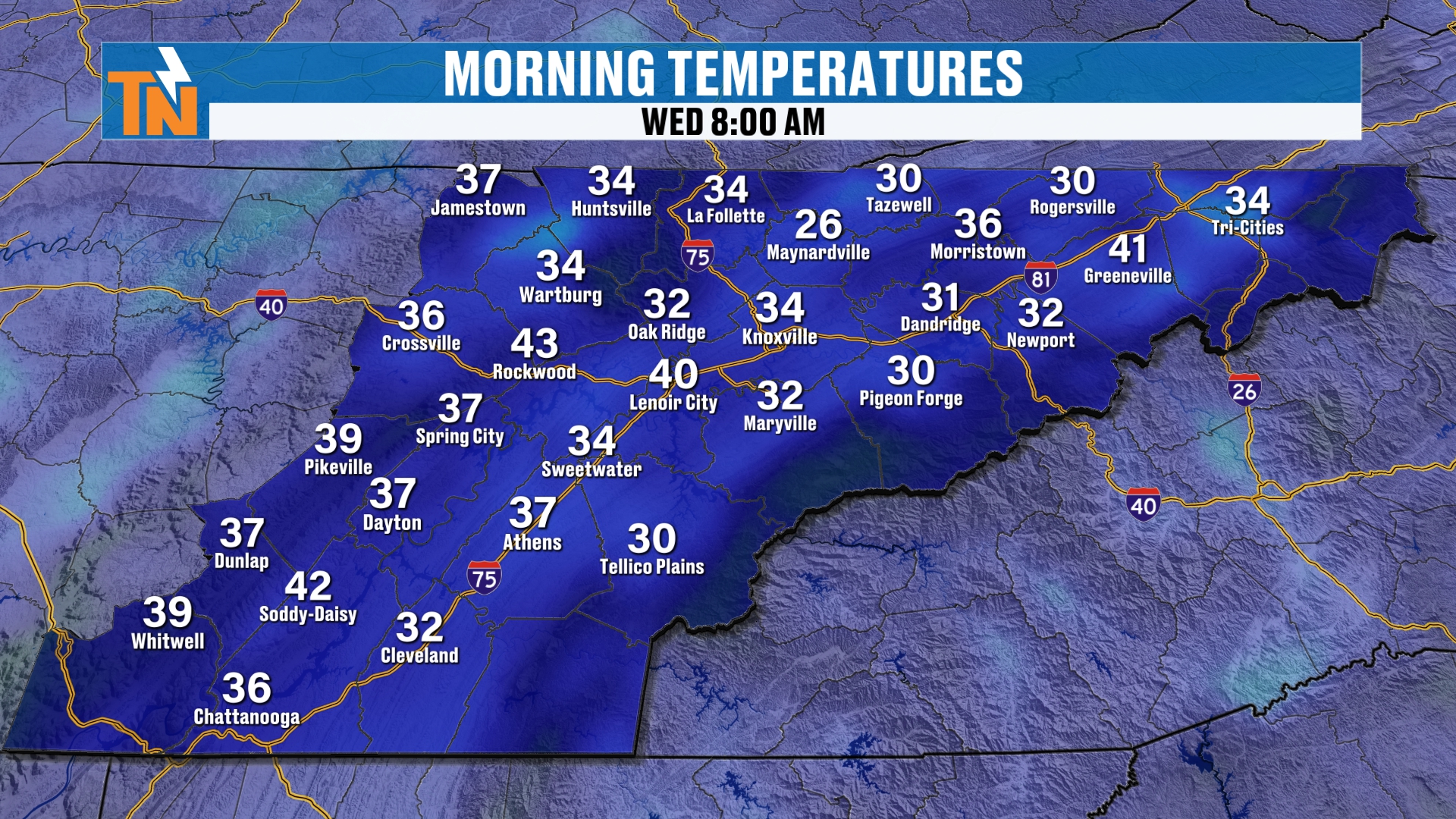
Out there this morning, it’s definitely another chilly start, with areas of frost and a hard freeze in some locations. I had 28 degrees in La Follette, 32 in Oak Ridge and 27 in Athens. In Townsend, it looks rather frosty. It’s not as foggy as it was yesterday morning, but it’s definitely a little bit on the frostier side, although yesterday morning was rather frosty around the area as well.
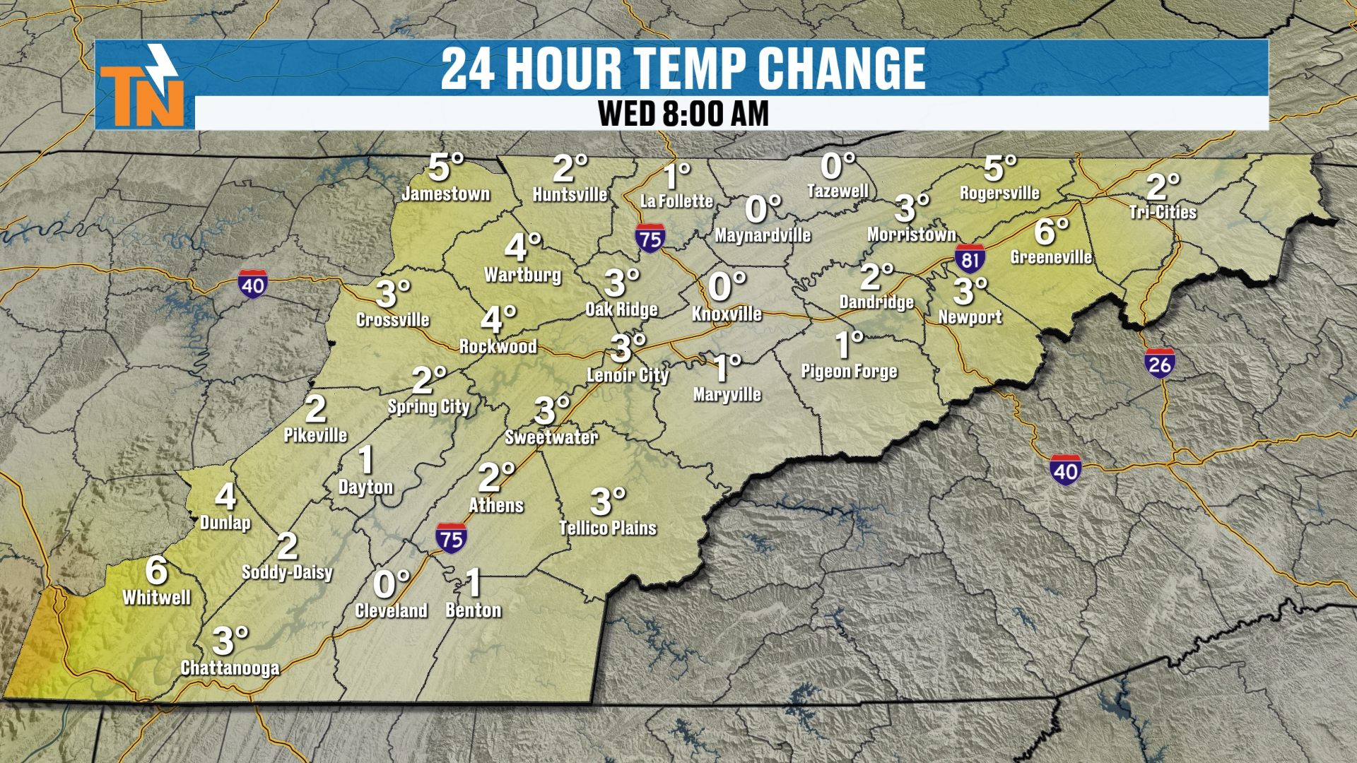
The good news is that, all in all, it’s a little warmer this morning than it was yesterday morning. Looking at the 24 hour change, most of us are a few degrees warmer than we were 24 hours ago, and that’s the trend that continues all week.
Today: Sunny, Warmer and a Light Breeze
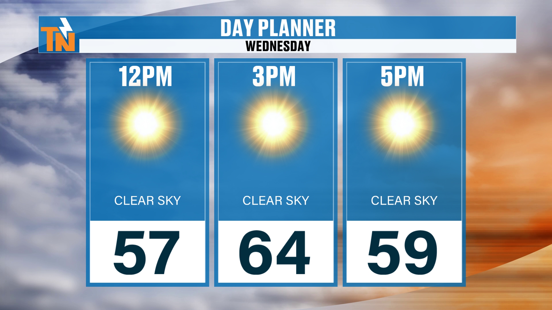
All right, here’s your day planner for today. We’re going to walk you through today, and then we’ll get to work with the big picture pattern: what’s in store for the weekend and for Thanksgiving week as well.
We’re at 57 by lunchtime. As the kids head home from school, we’re going to see those temperatures climb into the low to mid 60s. So again, a little bit warmer today than what we had yesterday.
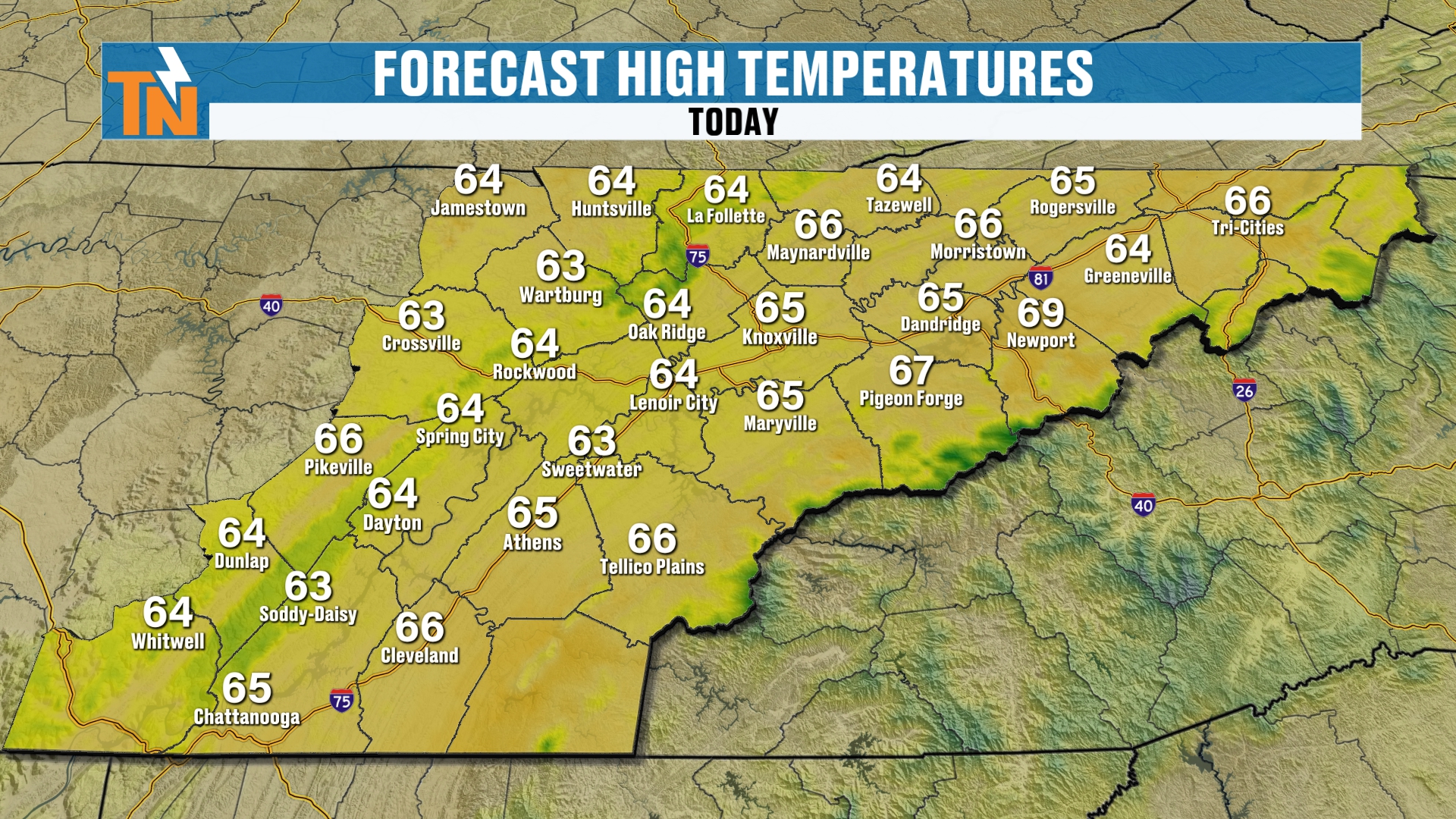
Highs this afternoon are mostly in the mid 60s across the area, with 65 in Knoxville and Chattanooga.
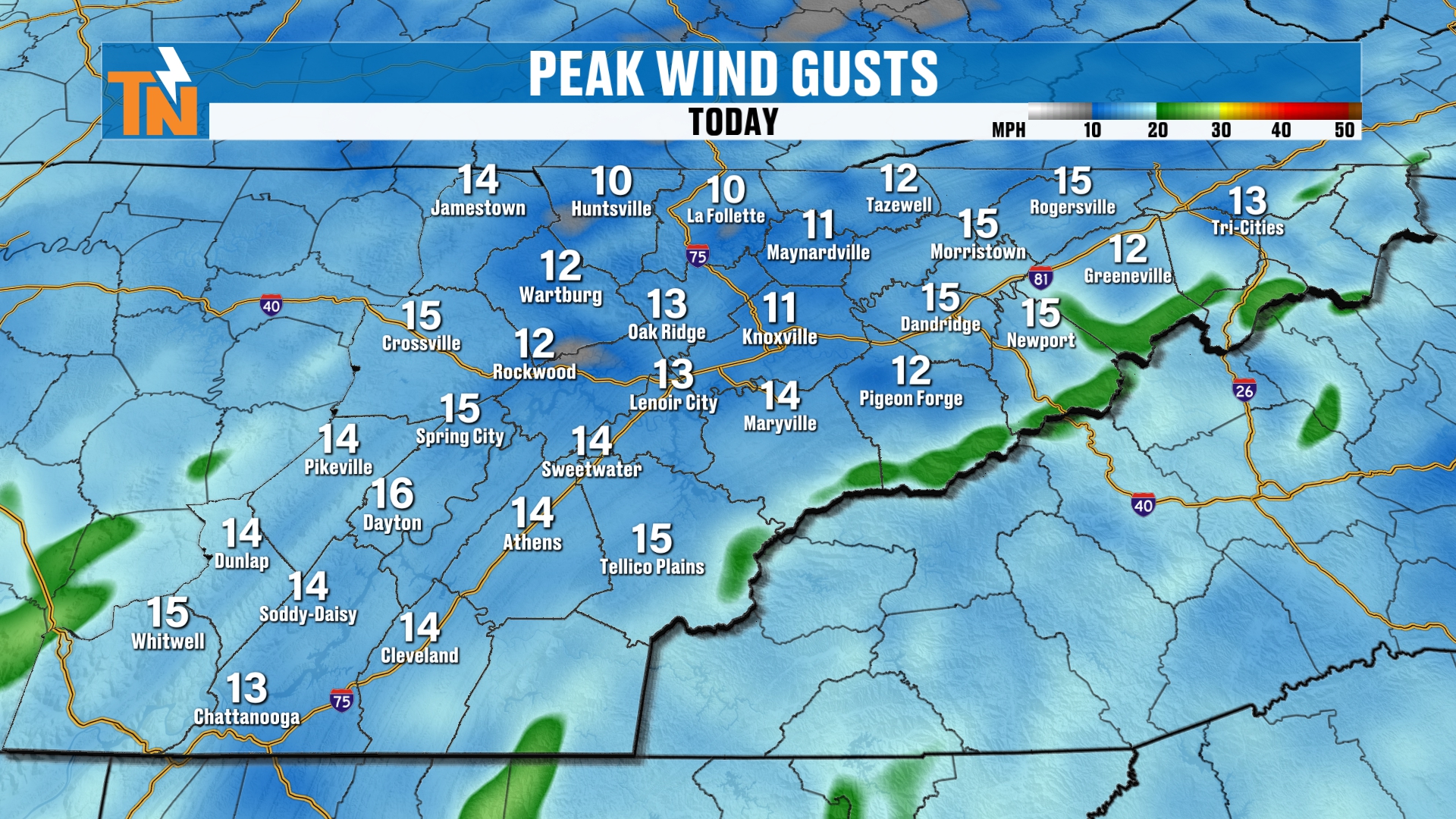
And not much of a breeze. We’re going to see a little bit of an afternoon wind coming in from the north and northeast, with gusts mostly in the 10 to 16 mile per hour range.
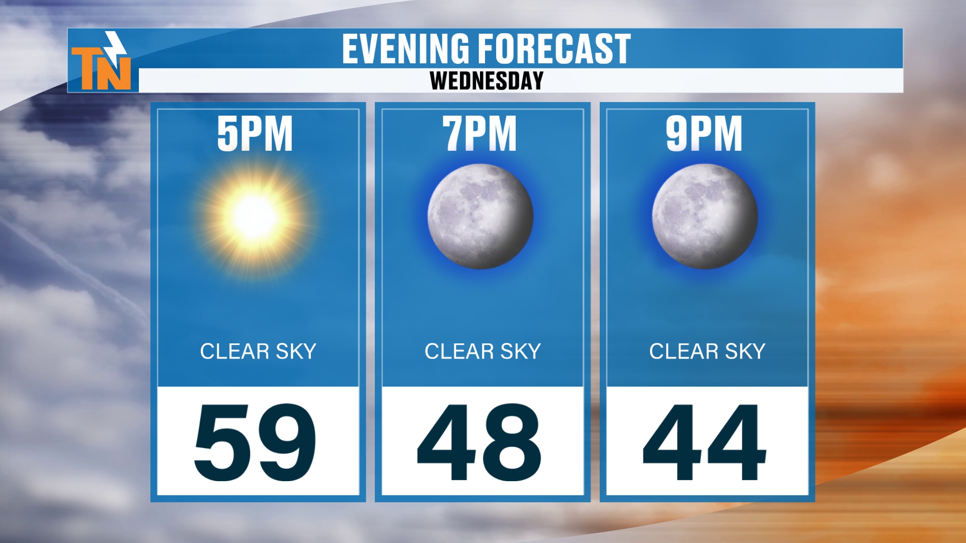
If you have evening plans here tonight, at 5:00 we’re at 59, dropping down to 48 by 7. Clear skies mean those temperatures fall fairly quickly once the sun goes down.
The Ridge Builds In: Dry Weekend Ahead
So here’s that ridge of high pressure dominating the weather pattern. We pick up our timeline here Wednesday, and I’m going to run you all the way through Friday. There’s a deeper trough out across the West Coast that’s being advertised. That’s going to be the storm system that really starts to set up a little bit more of an active weather pattern as we get into next week, which is Thanksgiving travel week.
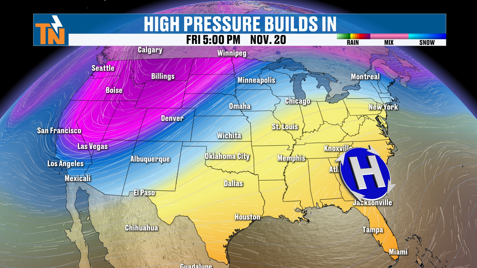
High pressure dominates all the way through Friday and really into the upcoming weekend. That’s what sets up our dry weekend.
The 7-Day Forecast: Nearly 10 Degrees Above Average
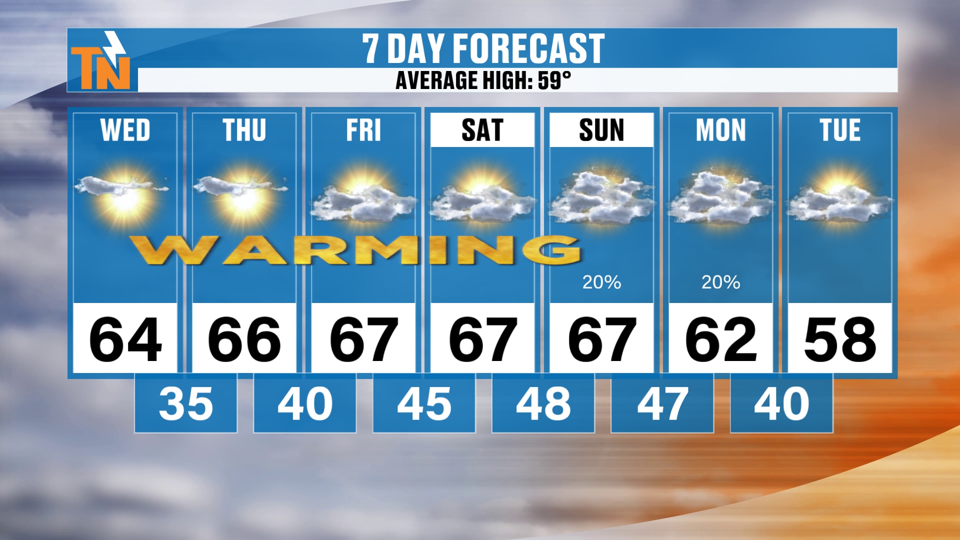
So here’s your 7-day. We’re going to be trending above average. The average high is 59, and we’re going to be in the mid to upper 60s, so nearly 10 degrees above average. Quiet, dry weather conditions.
As we get into the weekend, the clouds are going to be increasing, and that’s going to bring us a slight chance for maybe a couple of light showers late Sunday and into Monday. I’m not expecting a whole lot. Temperatures do drop back into the upper 50s, more average weather, behind that frontal boundary.
Rain Chances: A Dry Weekend, Then Little Rain Sunday and Monday
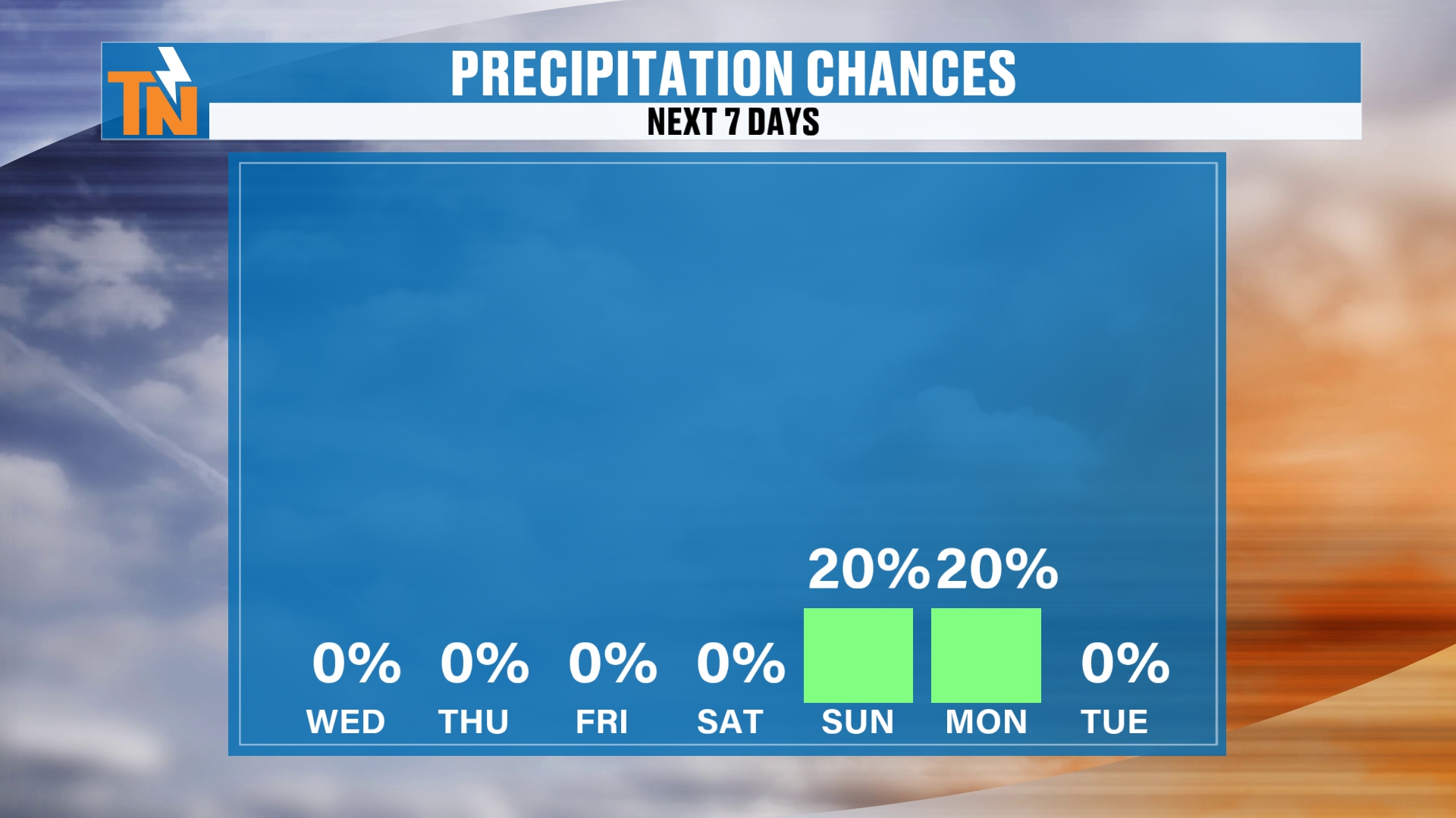
As we look ahead over the next seven days, what are our chances for rain? Well, just highlighting that, there’s that 20%, and that’s associated with the low across the coastal areas and the trough and the cold front coming through from the west and northwest.
You can see how these two systems are going to be converging into the southeastern U.S. Unfortunately, it just really doesn’t bring us a whole lot of rainfall. I think most of that activity is going to be along the coastal areas. Even the cold front is going to bring a little bit of rain across the Great Lakes area, but again, this is Sunday into Monday.
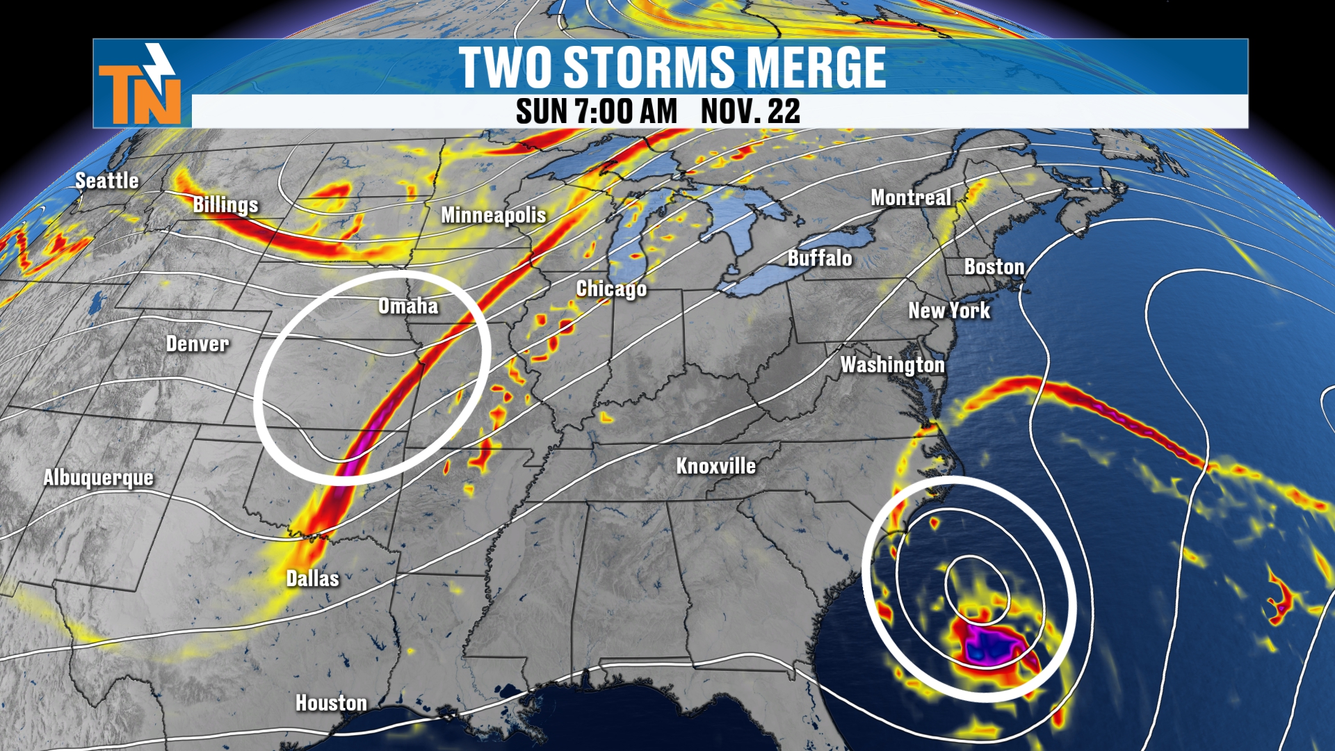
So we’re likely, and most models are indicating, that we’re going to stay dry all the way through Sunday evening. I’m not expecting any sort of rainfall really through the weekend. That’s the heart of the dry weekend forecast.
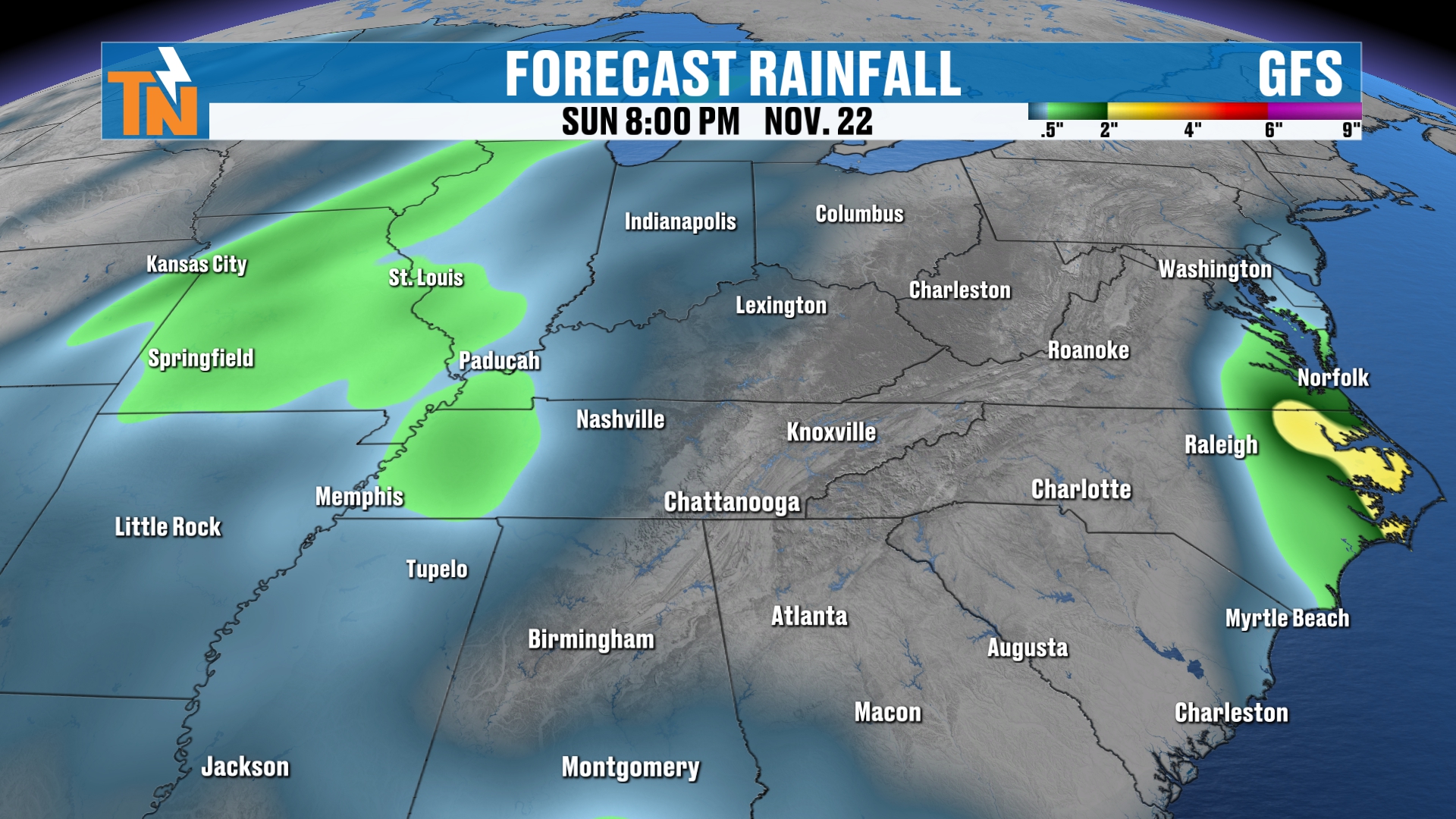
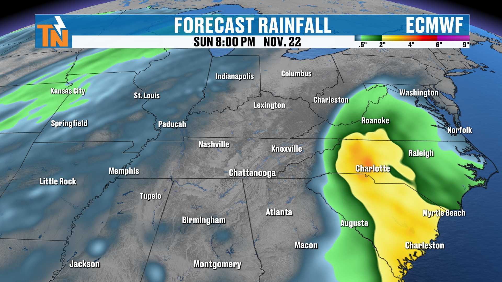
There’s the European model. The National Weather Service blend of models is picking up on a little bit of activity, too.
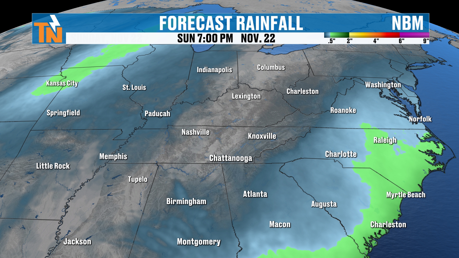
Actually, that takes us through Wednesday, so that wouldn’t technically be right through Sunday. We’re going to stay on the drier side.
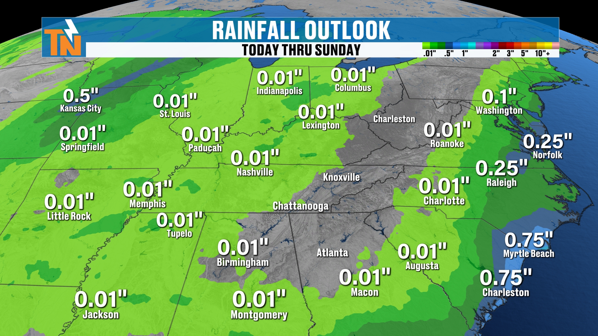
This takes us through Tuesday. So that’s picking up on our next wave of energy that’s going to start to head our way as we get into the middle part of next week. And all that energy is going to be zipping its way across the country.
Thanksgiving Week Travel: Unsettled Across the Country
Here’s your Thanksgiving week travel plans. Look at all of these disturbances and low pressures. And then towards the end of the week, Thanksgiving Day, Friday and into the weekend, when folks are traveling back home, look at what’s being advertised: a big old low pressure system.
Now, we’re more than a week away, so things are going to change for sure, but that’s what we’re going to be watching.
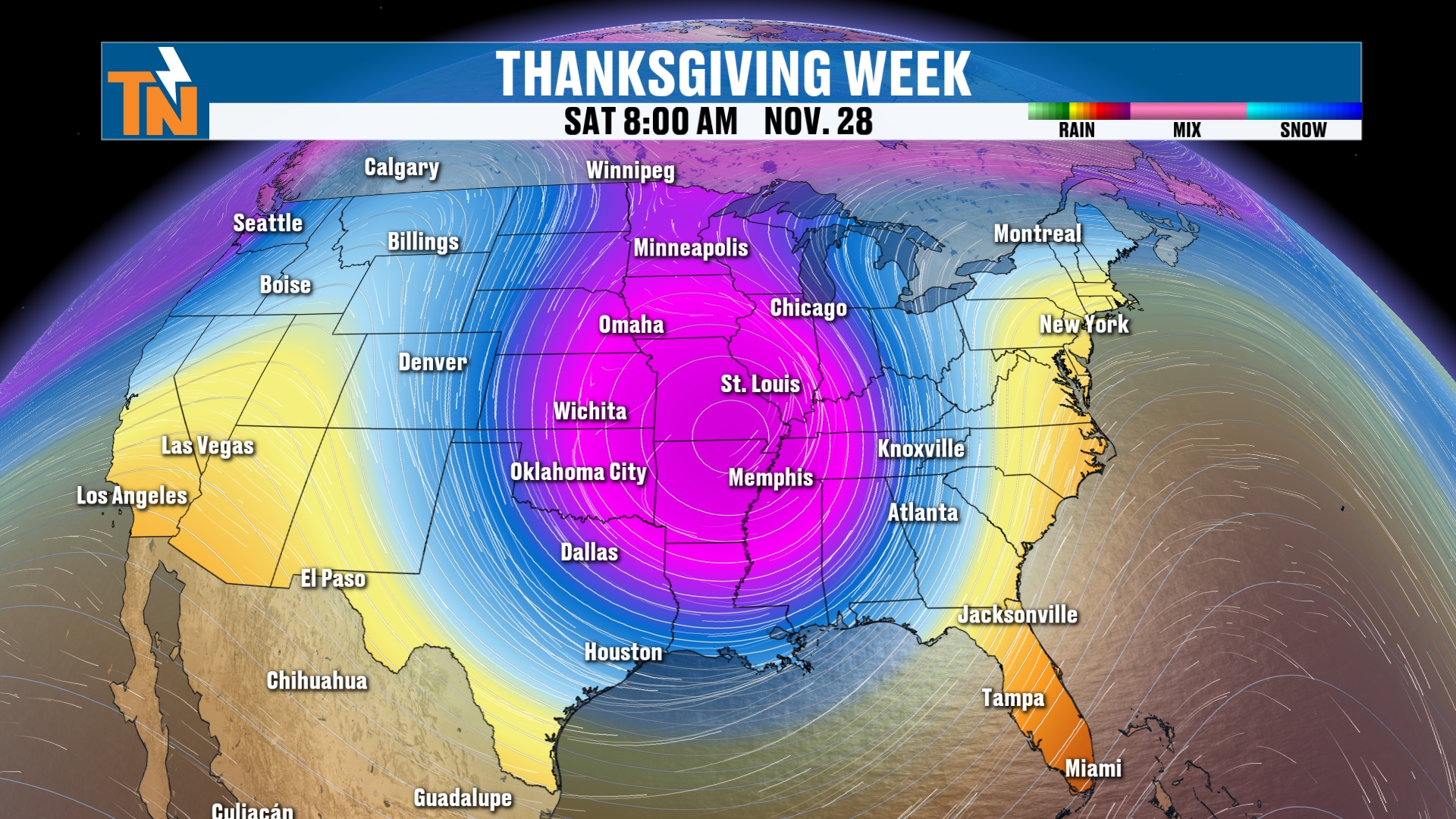
That’s going to bring a pocket of colder air and more unsettled weather.
At which point, I keep showing you this, and again, this is long range forecasting, so there is definitely no merit to this as of right now.
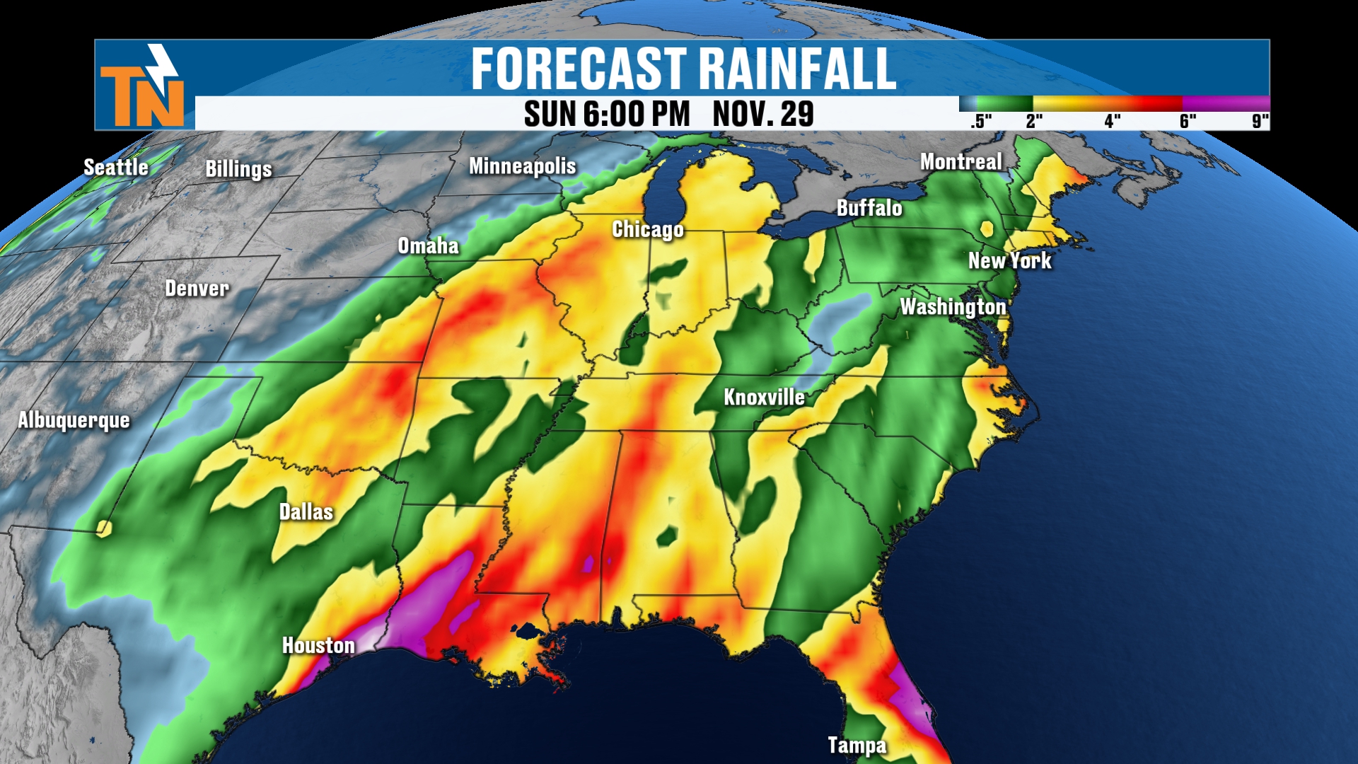
You can see some heavy rain across the coastal areas down in Florida from the storm system now. But look as we get into Thanksgiving week: we’re looking at some heavy rainfall possibly across the country. Again, this is being advertised across the eastern half of the U.S. The western half, it’s really going to be California, Washington and Oregon that get the heavy rain.
Snow Outlook: Plains, Midwest and Maybe the Mountains
Now, the snow from now through next Monday is going to be heaviest across parts of the Pacific Northwest and the intermountain West. Not much across the Great Lakes area, but that potentially could change.
Again, the models have still been picking up on that snowfall potential across parts of the Plains and into the Upper Midwest. That model forecast is still holding true, and you can see the forecast for snowfall across the Appalachian Mountains. Maybe we get a little bit of mountain snow around the area. That potentially is possible as we get into Thanksgiving week, and most of that is probably going to be towards the end of the week, when that bigger low pressure system and the bigger trough seems to be developing across the area.
So again, things are going to be fluctuating and changing, and I’m going to be modifying the forecast, but I’m just giving you a preview of what we potentially could expect around the area.
Take the App With You
If you travel for Thanksgiving, or for your job, or you just vacation a lot, take the app with you. Download my free East Tennessee Weather app. It travels anywhere in the country. The cool thing is you can put up to 10 cities into the app itself. Right there at the top, hit the icon, and then you can swipe the forecast. When you swipe the forecast, it changes the maps.
Not to mention, you’ll be notified in any inclement weather in up to 10 cities, even if you’re not there. So if you have kids or grandparents or parents that live somewhere and you want to keep an eye on them, it’s a great way to do that. A lot of folks who join have their kids go to UT here in Knoxville, and a lot of their parents follow them on campus through my East Tennessee Weather app. So go download it today. And don’t forget to download the apps for your smart TVs as well, for Roku and Amazon Fire, and right here on the YouTube channel.
Bottom Line
WEDNESDAY (TODAY): Another frosty start, with a hard freeze in some spots, then sunshine and a warmer afternoon. 57 at noon, low to mid 60s by 3 PM (a high around 64 to 65), and a light afternoon breeze from the north and northeast. 59 at 5 PM and 48 by 7 PM.
THURSDAY THROUGH SATURDAY: The warming trend continues under high pressure, with highs of 66, 67 and 67. Quiet, dry weather and a dry weekend start.
SUNDAY: Highs near 67. Clouds increase ahead of a cold front, with a slight chance, about 20%, for a couple of light showers late in the day. Most models keep us dry through Sunday evening.
MONDAY: A cold front sweeps through with a 20% chance of a few light showers and highs near 62. I’m not expecting a lot of rain.
TUESDAY: Back to more average weather behind the front, with a high near 58 and the next wave of energy approaching.
THANKSGIVING WEEK: An unsettled week across the country with rain, sleet, snow and travel troubles possible. A big low pressure system and a pocket of colder air show up near Thanksgiving Day through the weekend, with heavy rain across the eastern half of the U.S., snow across the Plains and Upper Midwest, and maybe some mountain snow in the Appalachians. It’s more than a week away, so expect changes.
The takeaway: enjoy a warm, dry stretch through the weekend, then keep checking back as we fine-tune your Thanksgiving week forecast.
For more daily updates, check out our Daily Forecast page. For longer-range outlooks, you can also check the Climate Prediction Center.
Don’t forget to LIKE, SHARE and SUBSCRIBE to the YouTube channel and hit the bell at the top. It really helps things out quite a bit.
I’m Meteorologist Mike Witcher. Have a great Wednesday! Thanks so much for tuning in, and I do appreciate it.
eastTNweather — Weather When You Want It.