
Published: Sunday, November 22, 2026 | By Meteorologist Mike Witcher | eastTNweather
Good morning, East Tennessee! Thanks for checking in with your morning weather update on this November 22nd, 2026. We are now officially heading into Thanksgiving week, and we’re starting to get more confidence that a Thanksgiving storm is going to develop and bring us a decent amount of rain.
The big question is which day that really happens. Is it Wednesday, or is it Thursday? That’s the day that brings us the better potential for rainfall, and I’m going to walk you through it. We’ll also talk about how cold it gets for Thanksgiving Day in the first weekend of the holiday season.
I’ll walk you through that all-important 7-day forecast, and then above and beyond the 7-day, I think we’re going to see a little more active weather patterns starting to set up shop as we round out the month and get into the first week of December. We’ll see how that all plays out, but either way you look at it, let’s get to work with the forecast.
Yesterday's Almanac: Another Warm Day
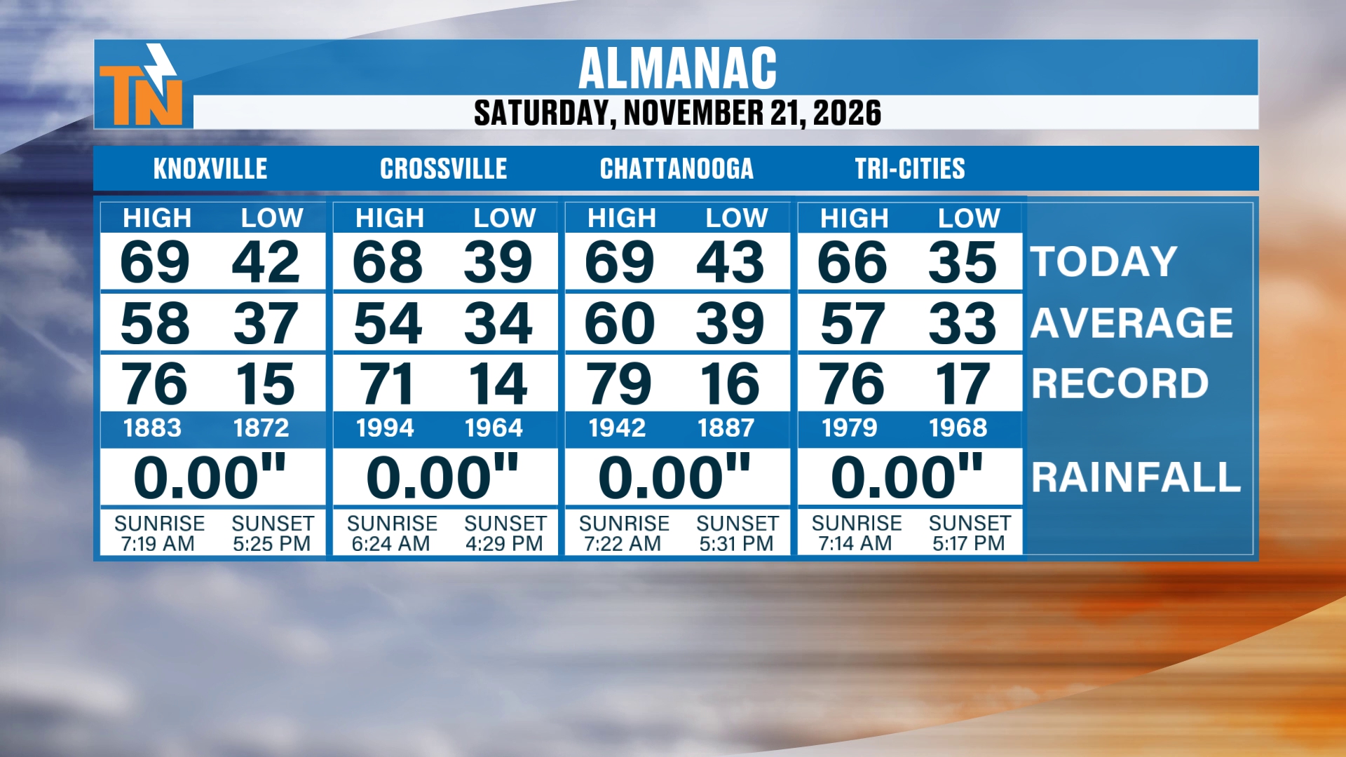
Let’s start you off with the Almanac from yesterday. It was another warm day. We made it into the upper 60s with a high of 69 degrees in Knoxville. The average high is 58, so that’s 11 degrees above average for this time of the year.
The Big Picture: High Pressure Departs and a Trough Heads Our Way
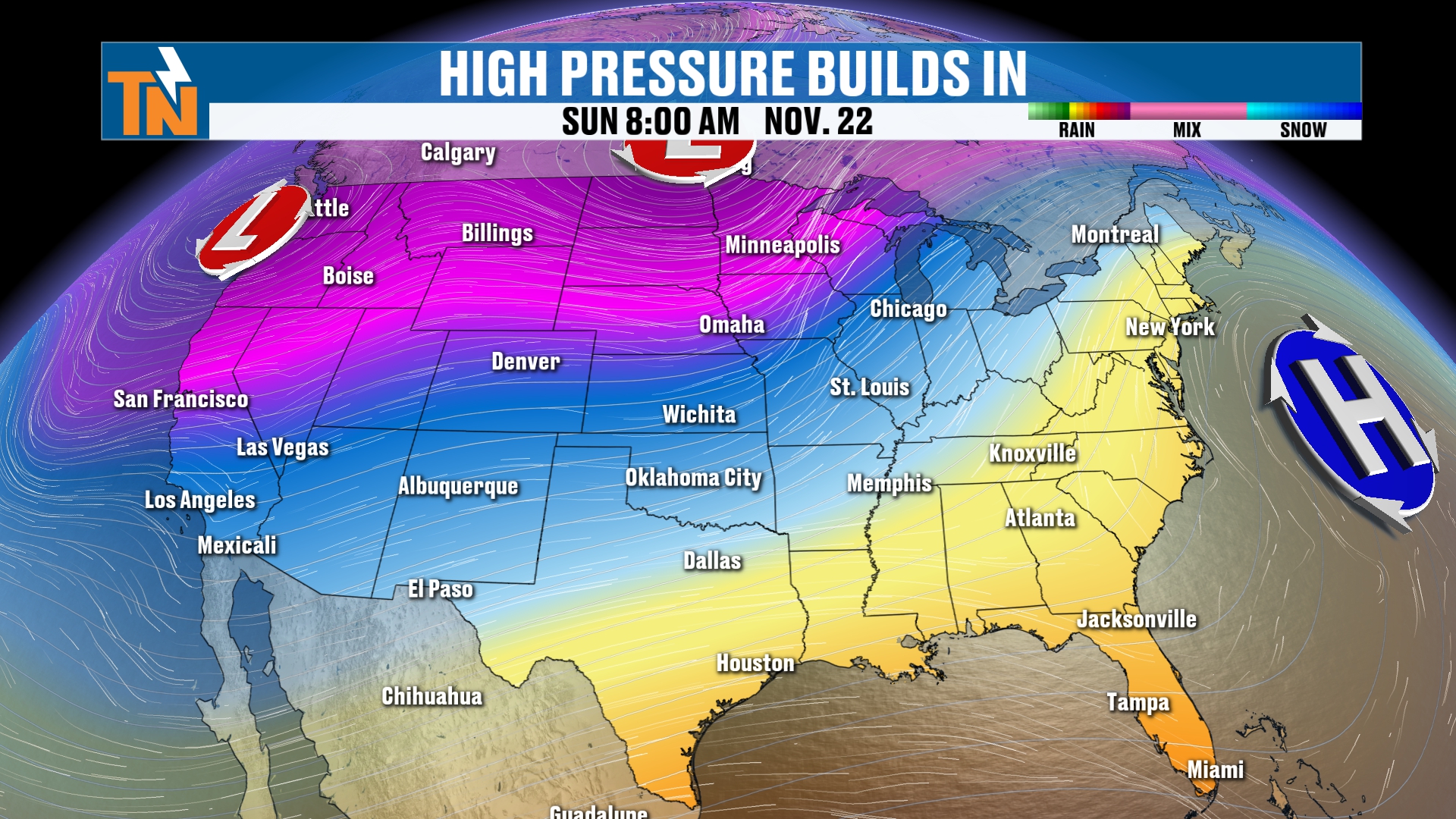
High pressure has kind of been scooting off to the Eastern Seaboard, breaking down as a trough of low pressure starts to head our way. That’s what’s going to usher in a cold front later on today.
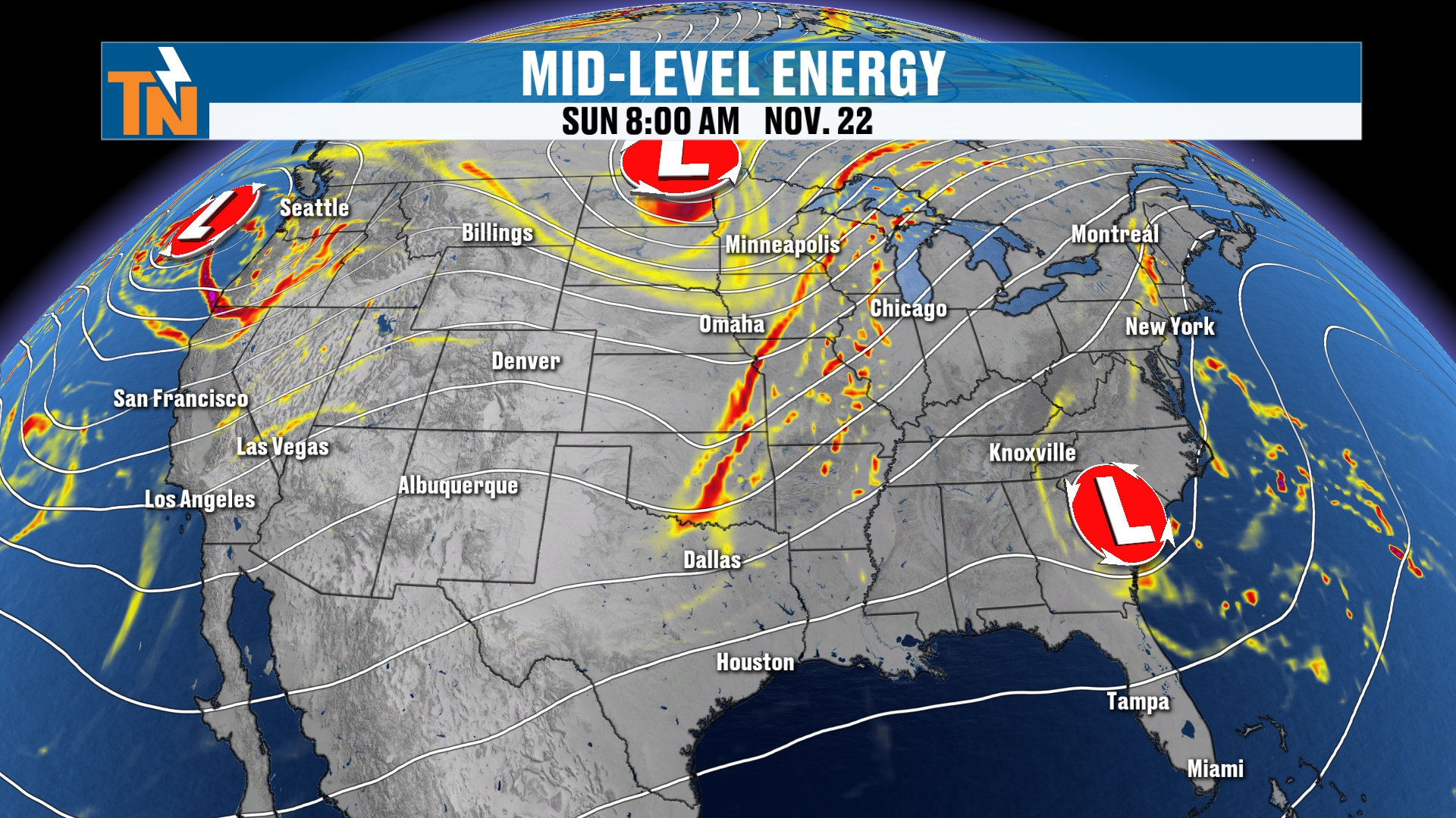
We’ve got a couple of things to talk about in the big picture. First, we have an area of low pressure in the mid-levels of the atmosphere down along the Southeastern coastline. That’s been bringing quite a bit of rainfall to that part of the country. It’s a coastal low, and that’s what’s bringing us the cloud coverage this morning. It’s also bringing a little bit of light rain around the area.
But there’s also a trough of low pressure back off to our west and northwest, and that’s going to push a cold front through the area. As this cold front comes through, it’s going to bring us another chance for some scattered light rain showers later on tonight into early tomorrow morning.
Short Term: A Few Nuisance Showers to Start the Day
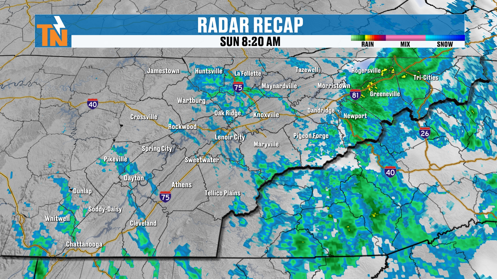
In the short term, we’re having to contend with a little bit of rainfall from that coastal low over in the Carolinas. It’s banked up against the mountains of East Tennessee and North Carolina, and kind of scooting over onto the Tennessee side. So we do have some more nuisance showers to get the morning started. But all in all, not too terribly bad.
Here’s a live look at Townsend, the peaceful side of the Smokies, and it’s mostly cloudy skies. I think that’s going to be the scenario for a good chunk of the day. We’ll probably see some sunshine before the cold front starts to slide our way later on this afternoon.
Futurecast: Scattered Showers Through the Day
All right, here’s your Futurecast model as we hit the day today. Let’s pick it up on those scattered light and nuisance showers throughout the day.
At lunchtime, some of us are going to have to contend with a little bit of rain. The majority of the rain is going to be across the I-81 corridor and the northern valley, banked up against the foothills and the mountains of East Tennessee and North Carolina.
But as we get into the 6 o’clock hour, most of that energy from the coastal low moves its way on out. Now we’re going to start to track our cold front. You can see it on the top left-hand side of your screen, with a little bit of rainfall starting to show up. That’s going to be after sundown tonight.
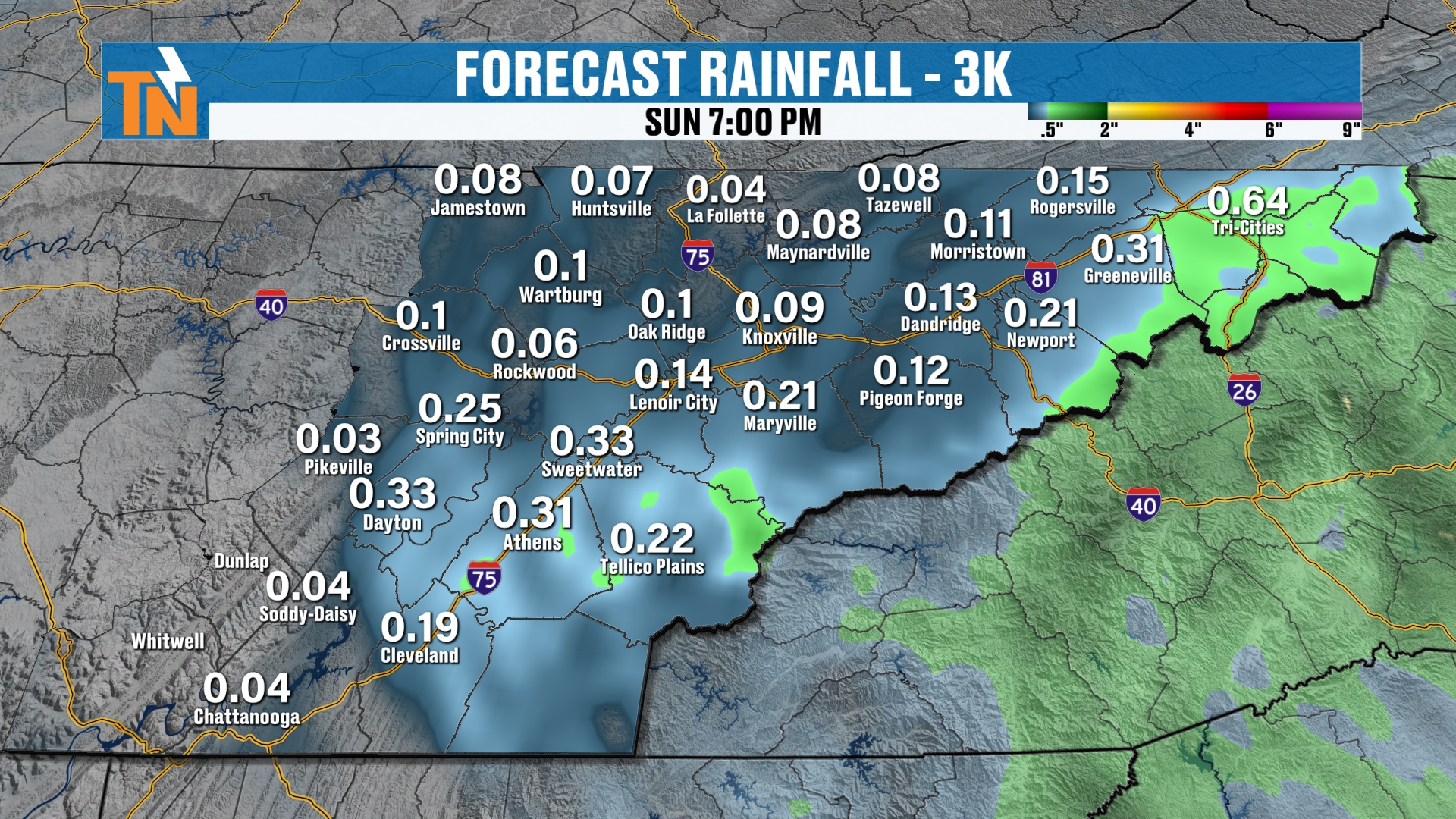
So just through 6 or 7 o’clock tonight, this is our rainfall potential. Most areas will get less than a tenth of an inch of rain. Most areas will get less than two-tenths, but there may be a couple of areas that get a little bit more rainfall, associated with some of those heavier showers this morning.
This Morning's Temperatures: About 15 Degrees Warmer
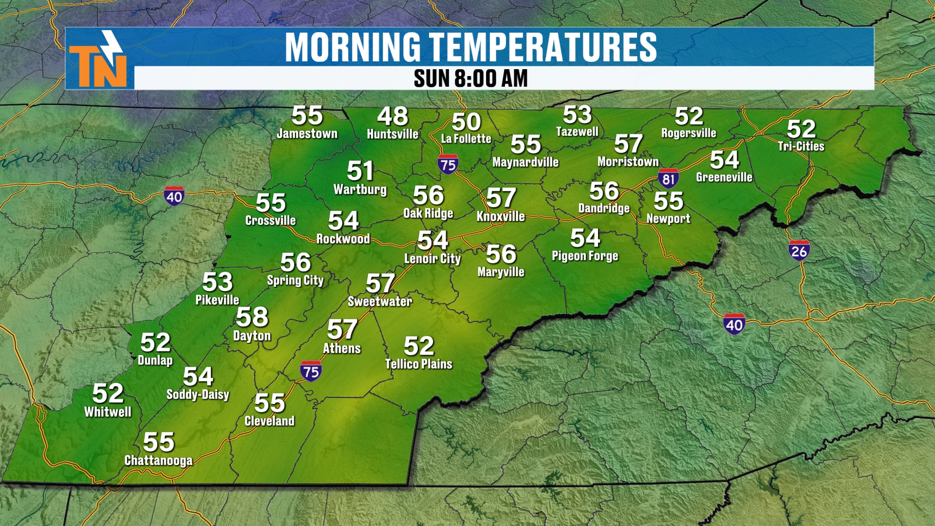
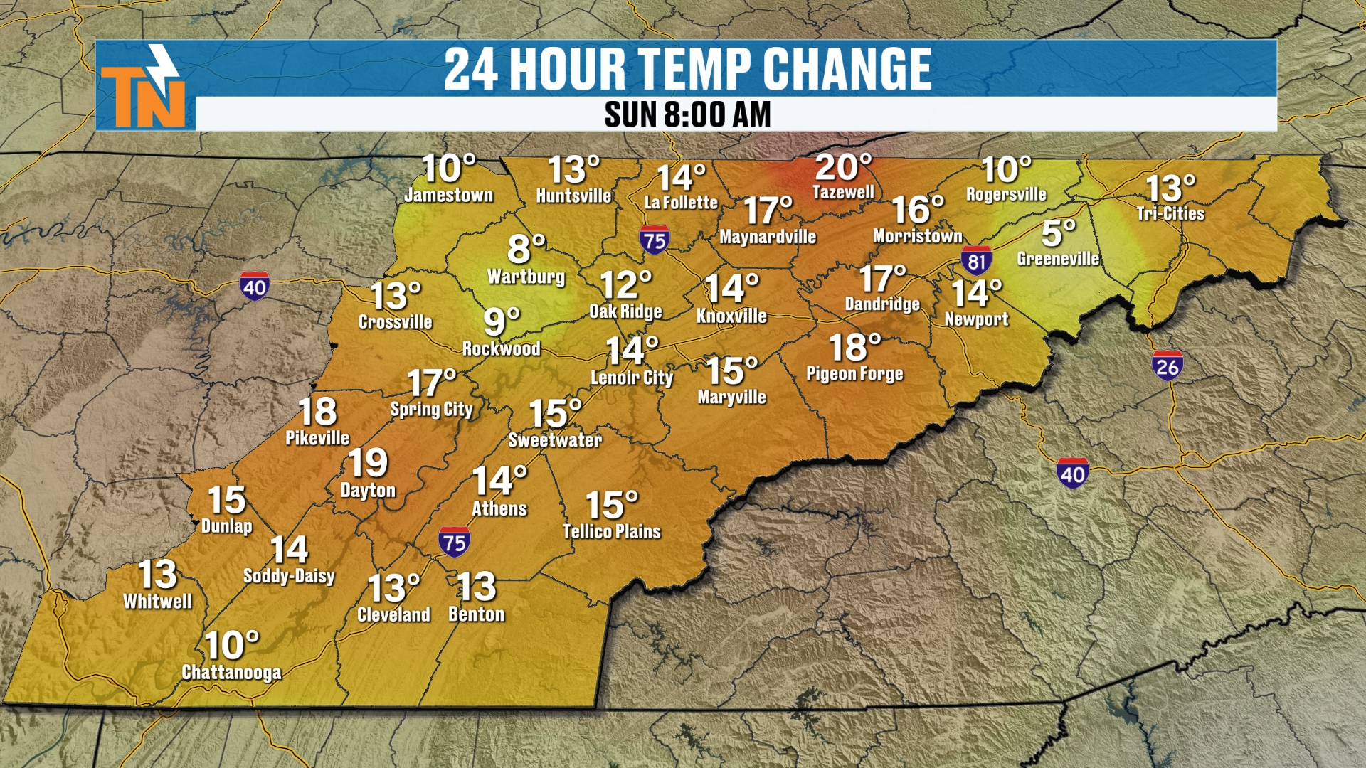
All right, our morning temperatures started off in the 50s. It’s a warmer start. We’re about 15 degrees warmer than what we were yesterday morning.
Today's Forecast: Low 60s by Lunch, Mid 60s This Afternoon
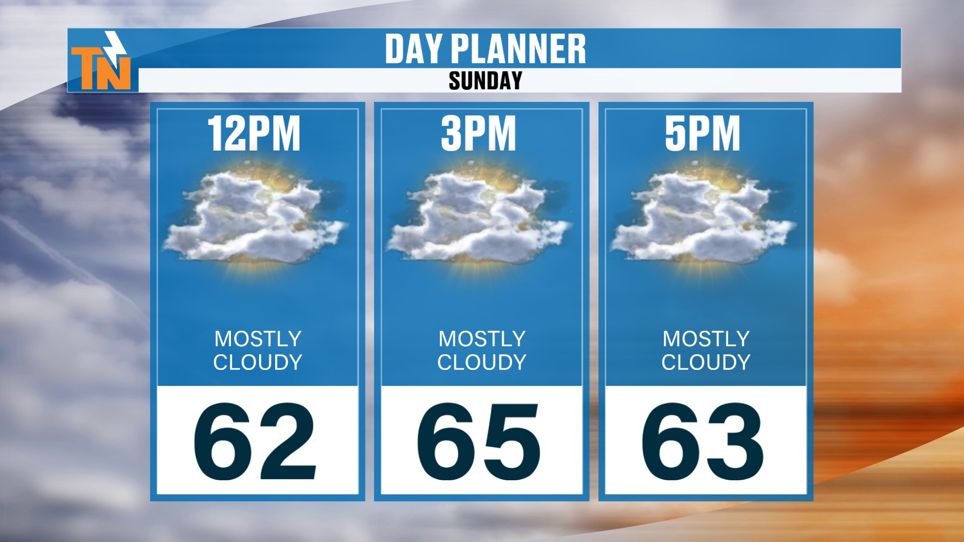
As we head through the day, we’re going to see temperatures climbing into the low 60s by lunchtime. For the forecast high, I still expect it to be in the mid 60s, even though we have the cloud coverage coming through.
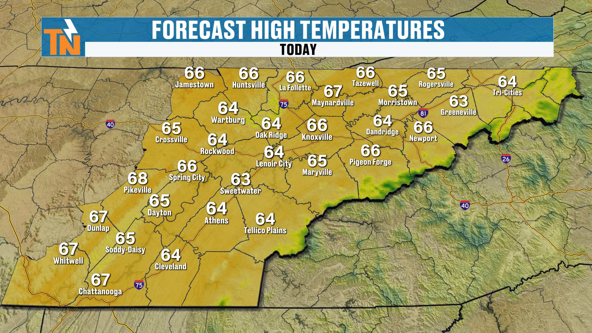
But the cold front that comes through tonight, that’s what’s going to drop our temperatures and start that process of a colder weather pattern here for Thanksgiving week.
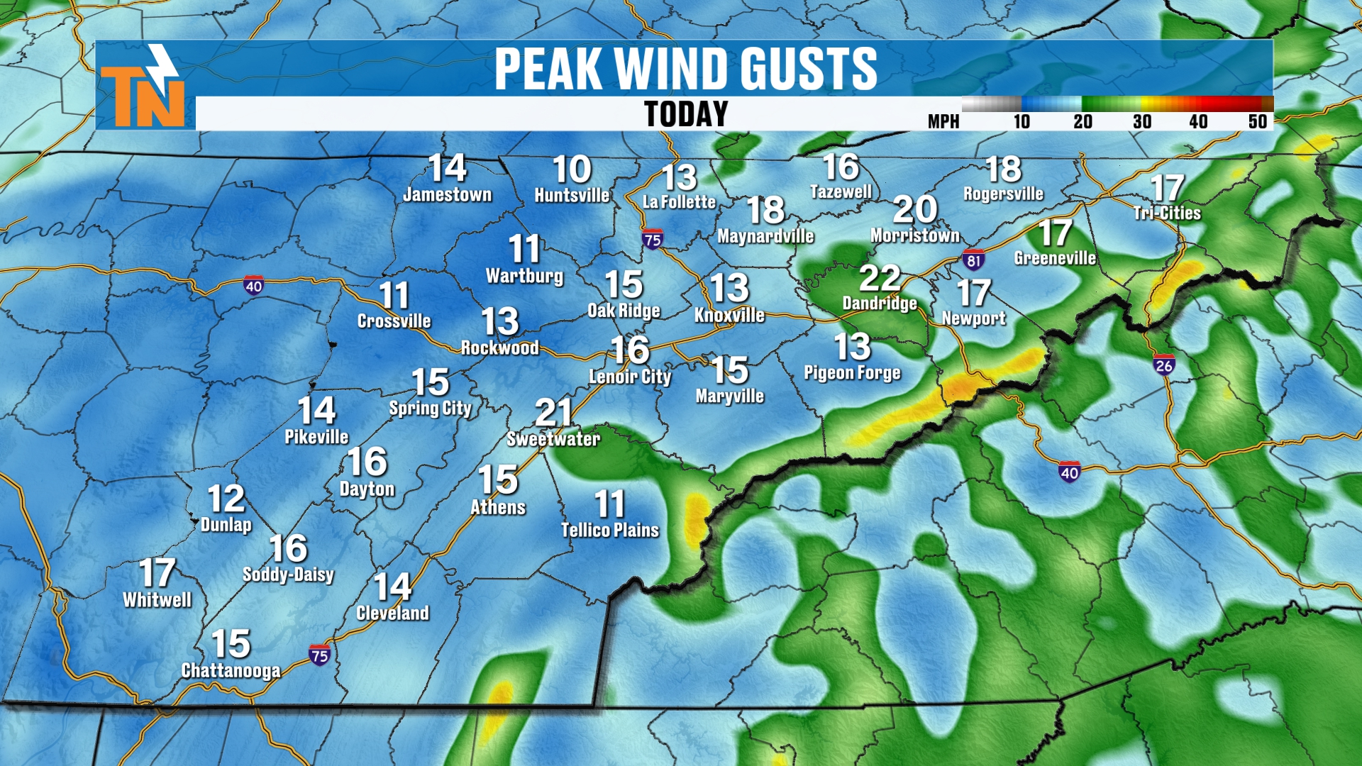
Hey, by the way, the winds are going to be a little bit stronger across the highest peaks of the Smokies, gusting to about 25 to 30 miles per hour. In the lower elevations, winds will be about 10 to 15 mile per hour wind gusts. So not really much of a wind, just a little bit of a breeze from time to time.
Tonight's Cold Front: Moisture Starved
All right, let’s pick up our Futurecast on the big picture, because as we progress through time, you can see how this cold front is going to come through. It’s kind of moisture starved. It just doesn’t have a whole lot of moisture with it, so I don’t anticipate a whole lot of rainfall.
The skies will be mostly cloudy on Monday, and then becoming mostly sunny as we get into Monday night and Tuesday, before our next system starts to arrive.
Your 7-Day Forecast: Cooler, With the Thanksgiving Storm on the Horizon
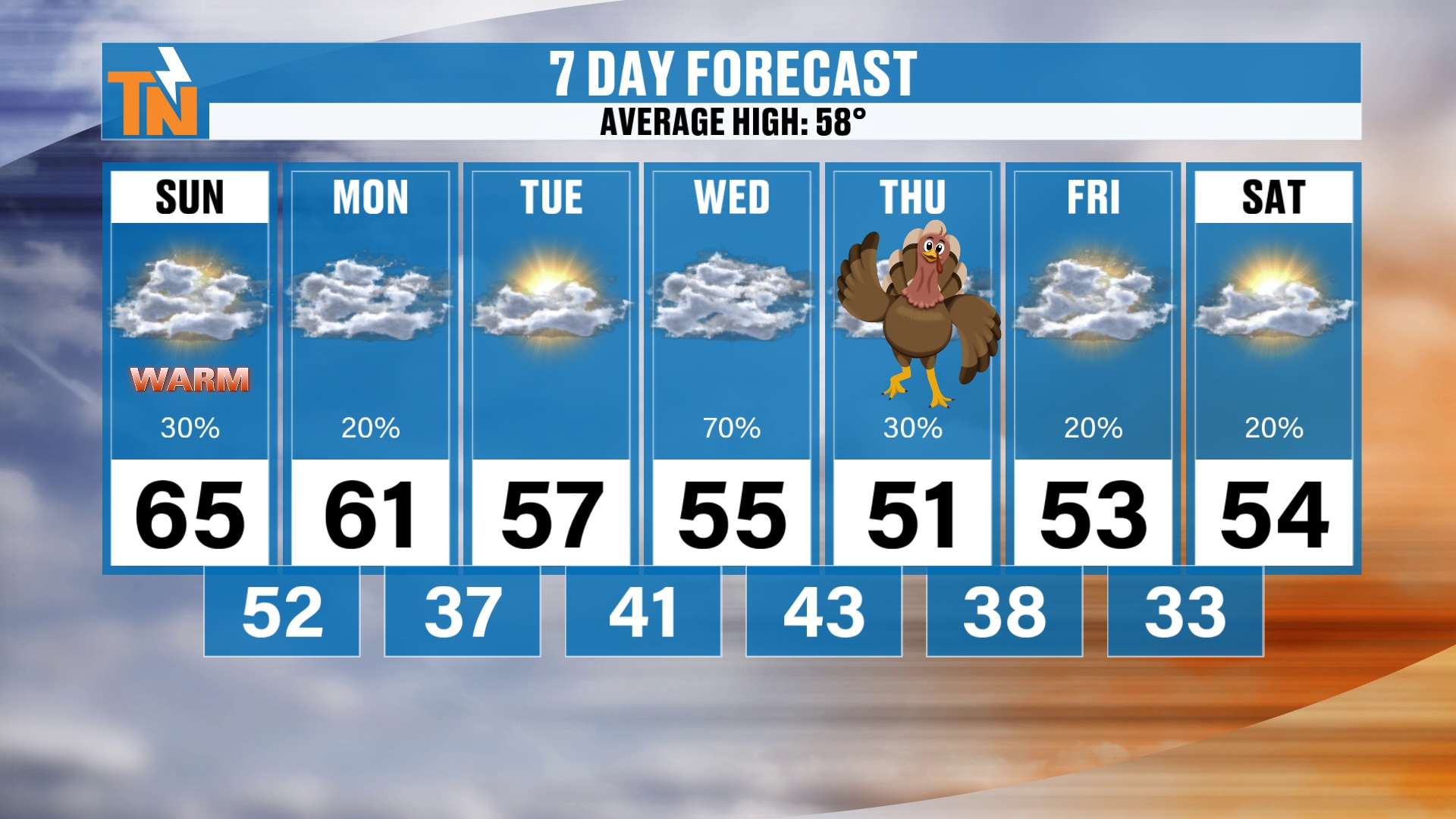
So here’s your 7-day. It’s going to be warmer today at 65 again, and the average high is 58 for this time of the year. We’re closer to those seasonal averages Monday, Tuesday and Wednesday.
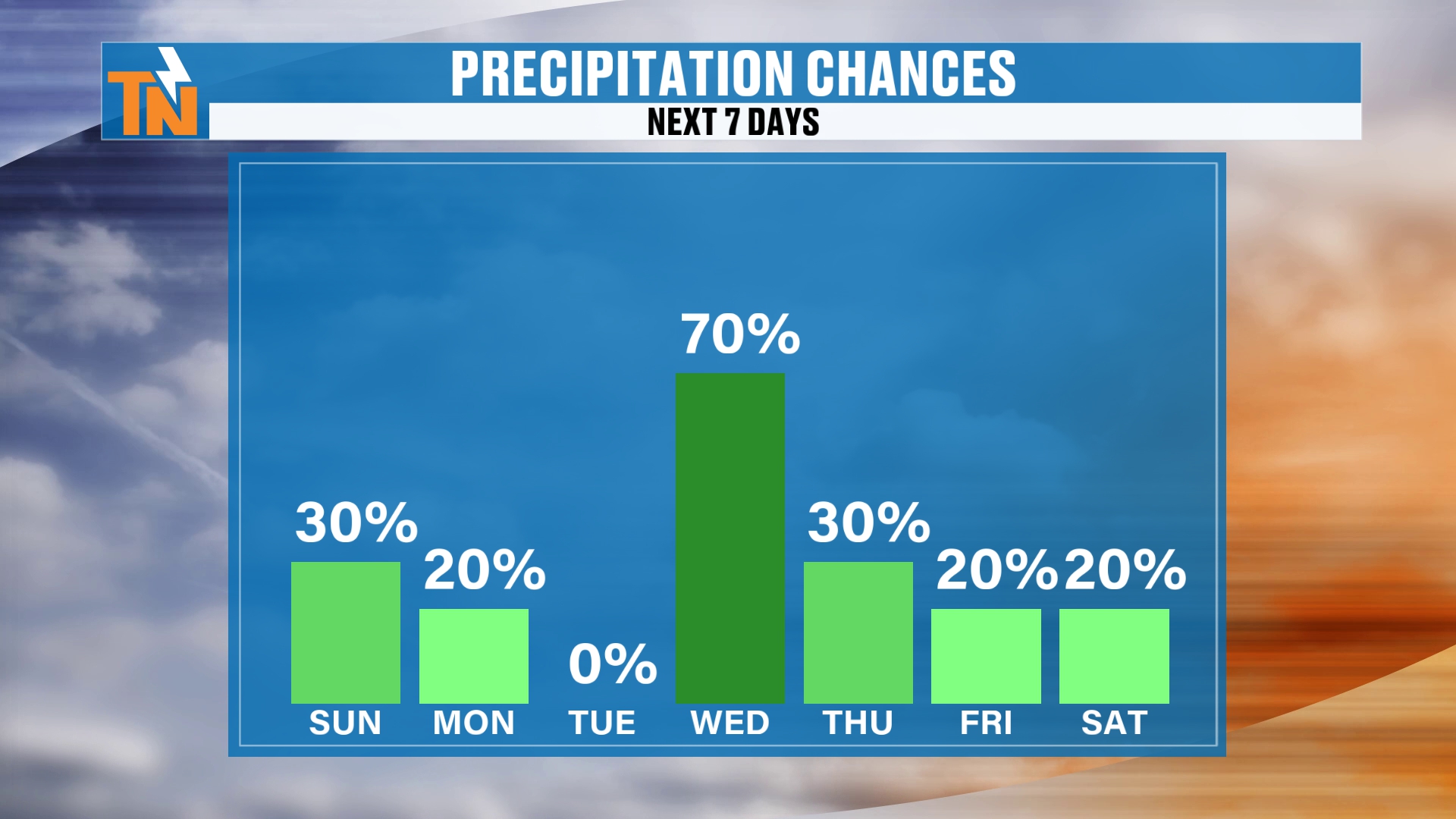
But on Wednesday, I bumped it up to a 70% chance of rain. On Thanksgiving Day, I’m hanging on to a 30% chance. Then we’ll hang on to about a 20% chance of rain on Friday and Saturday, with temperatures falling into the low to mid 50s and lows in the 30s and 40s. So some chillier weather there.
The Thanksgiving Storm: Wednesday or Thursday?
Let’s talk about that Wednesday-Thanksgiving Day storm system, as we highlight those chances for rain a little bit more. It’s associated with this big, deep trough. We’ve been talking about this for five or six days now, really highlighting Thanksgiving week, and things have started to come together. There’s a little more confidence in the forecast, as the European, the GFS and the high-resolution models are all picking up on this deep trough that’s going to develop and push through.
Then as we get into Sunday, there may be another trough that swings through, bringing us another potential for some rain showers.
So we know we’re going to cool off behind the system. I showed you that 7-day forecast with temperatures coming down into the 50s, so we know pockets of cooler air are going to settle into the area.
Futurecast: How the Thanksgiving Storm Could Play Out
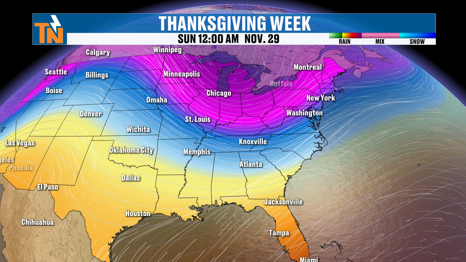
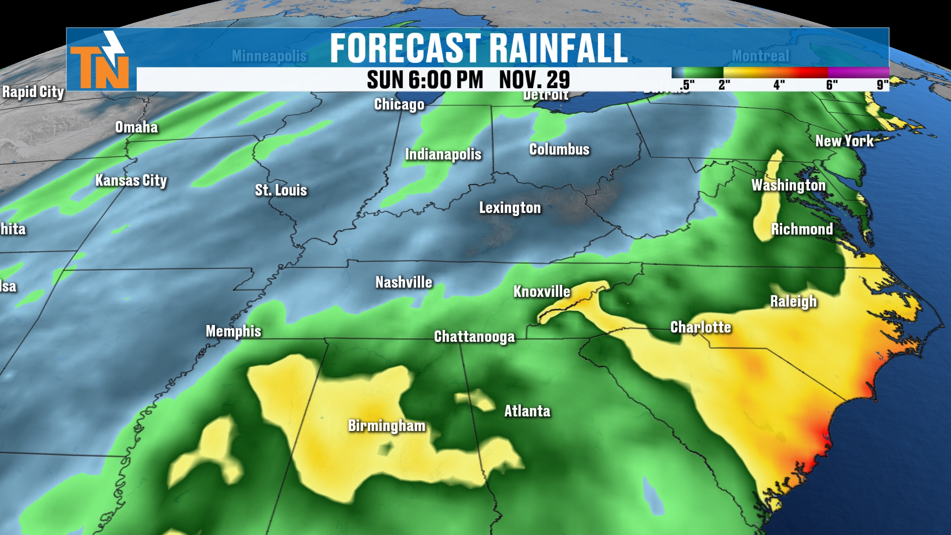
Let’s talk about the Futurecast model, because here’s that Thanksgiving storm system. It’s going to be a low pressure as that big, deep trough comes in. It’s going to form a surface low down along the coast somewhere and then shift its way northward. Wherever the timing, the intensity of the low and the location of the low really kind of depend on how much rainfall we get around town.
The 15-kilometer in-house model is picking up on the fact that we are going to get some decent rain, and most of that is probably going to be a late Wednesday event. So I think we’re going to start to see the rain showers increasing late Wednesday. On Thursday, Thanksgiving Day, we may start with some rain showers, and we potentially could pick up about half an inch of rain when all is said and done.
Snow Signals: Could the Mountains See Some Flakes?
Now, remember I was talking about the snow signals? I circled a couple of areas yesterday, saying this seems to be around the area where our models are picking up on snowfall as we progress through Thanksgiving week. I’m going to leave those circles on there, but you’ll notice the models are picking up on, well, still a little bit in some of those circles.
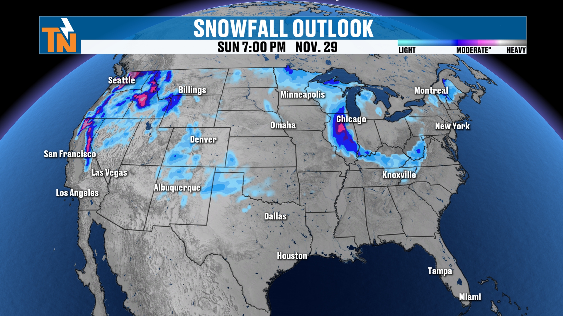
The model is going to flip-flop back and forth, but the point of the story is that somewhere across the upper Midwest and the Appalachian Mountains, we could potentially see some snow.
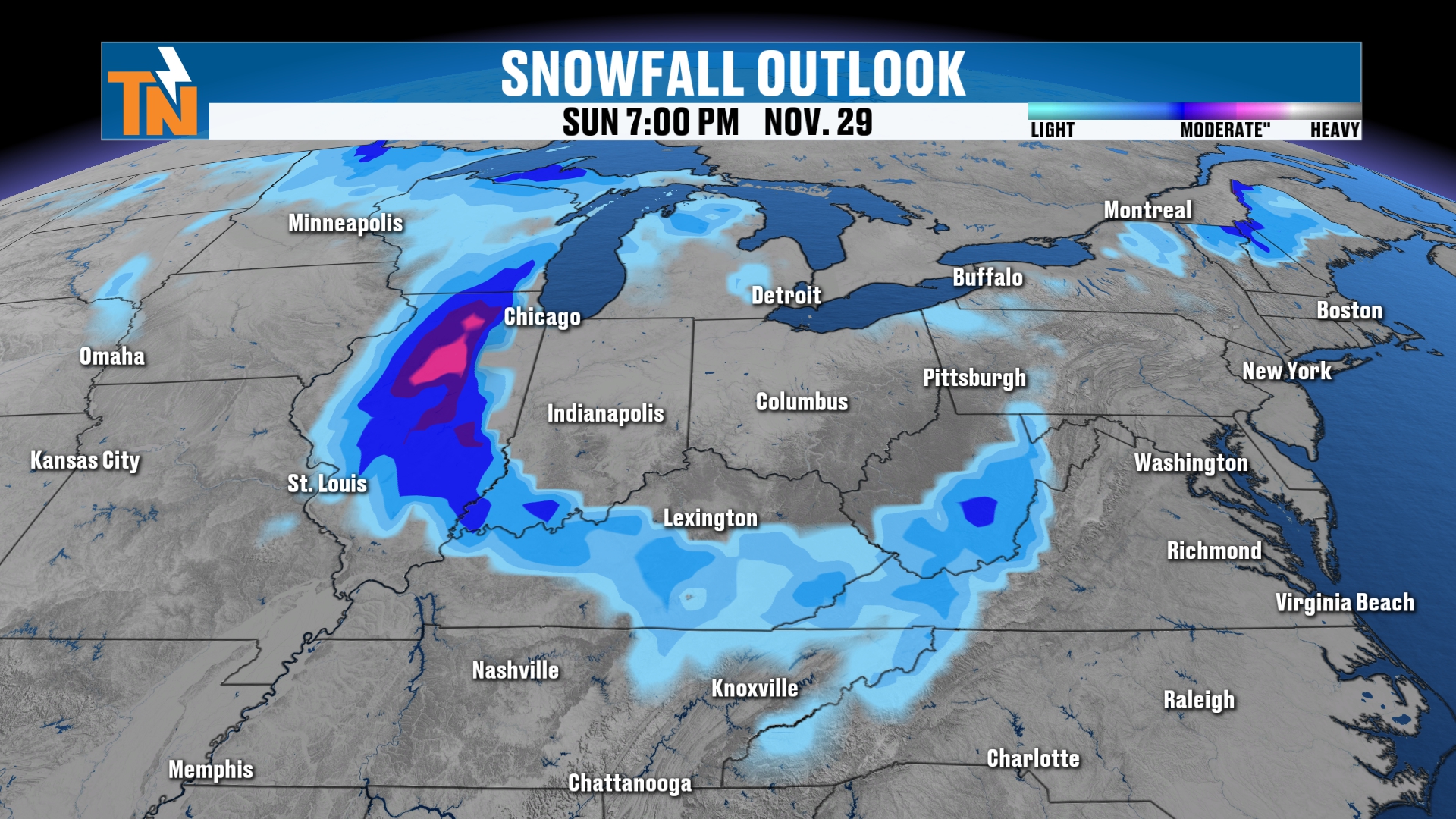
I think it’s going to be on the backside of this low pressure. Depending on the orientation and the track of the low, it really depends on whether it pulls in cold enough air behind it to produce some mountain snow showers here in East Tennessee. Of course, we’ll keep you posted on that.
Bottom Line
SUNDAY (TODAY): Mostly cloudy with some nuisance showers from the coastal low to get the morning started, mainly along the I-81 corridor and against the mountains. Morning temps in the 50s, about 15 degrees warmer than yesterday. 62 at noon, 65 at 3 PM, 63 at 5 PM, with highs in the mid 60s (66 in Knoxville). Breezy on the highest Smokies peaks with gusts of 25 to 30 mph and 10 to 15 mph in the lower elevations. The cold front arrives after sundown with scattered light showers, mostly less than a tenth to two-tenths of an inch.
MONDAY: Mostly cloudy with a few leftover light showers early, then becoming mostly sunny by Monday night. High near 61, with a 20% chance of rain.
TUESDAY: Mostly sunny and cooler, high near 57, back near seasonal averages, and dry before our next system arrives.
WEDNESDAY: The rain chance is bumped up to 70%, with rain increasing late in the day. High near 55.
THURSDAY (THANKSGIVING): A 30% chance of rain, possibly starting with some showers. High near 51 and potentially about half an inch of rain from the storm system.
FRIDAY AND SATURDAY: About a 20% chance of rain each day with highs of 53 and 54 and lows in the 30s and 40s.
NEXT SUNDAY: Possibly another trough swinging through with another chance for rain showers, plus a signal for some mountain snow behind the Thanksgiving storm.
The takeaway: we’re mild today, a cold front arrives tonight, and Thanksgiving week turns chillier and more November-like with the Thanksgiving storm bringing rain Wednesday into Thursday. Keep checking back.
For more daily updates, check out our Daily Forecast page. For longer-range outlooks, you can also check the Climate Prediction Center.
Thanksgiving week is right upon us, and I cannot believe it. Hopefully you’ve pulled your turkeys out and started to defrost them. Remember, you don’t want to forget to do that! Let me know in the comments: what’s good in your life this weekend? Are you excited for Thanksgiving week? Are you ready? Are you prepared? Do you have a bunch of family coming here, or are you traveling somewhere?
Don’t forget to LIKE, SHARE and SUBSCRIBE to the YouTube channel and hit the bell at the top. And don’t forget to download my free East Tennessee Weather app for your cell phones, tablets and your smart TVs on Roku and Amazon Fire, and right here on YouTube. Check out the 24-hour weather channel.
I’m Meteorologist Mike Witcher. Have a great Sunday!
eastTNweather — Weather When You Want It.